Unsettled Weather Returns Later This Week... But How much?
Overview
My friends...
After a nice warmup with temps slightly above seasonal norms, a cooler and more unsettled pattern is on tap beginning Thursday evening. There are two approaching troughs. The first one will usher in a showery pattern featuring convectively driven showers and snow at high elevations. Uncertainty remains around the second trough, however it seems likely to bring a more winter-like storm, with frontal dynamics and much colder temps.
Approaching Active Weather
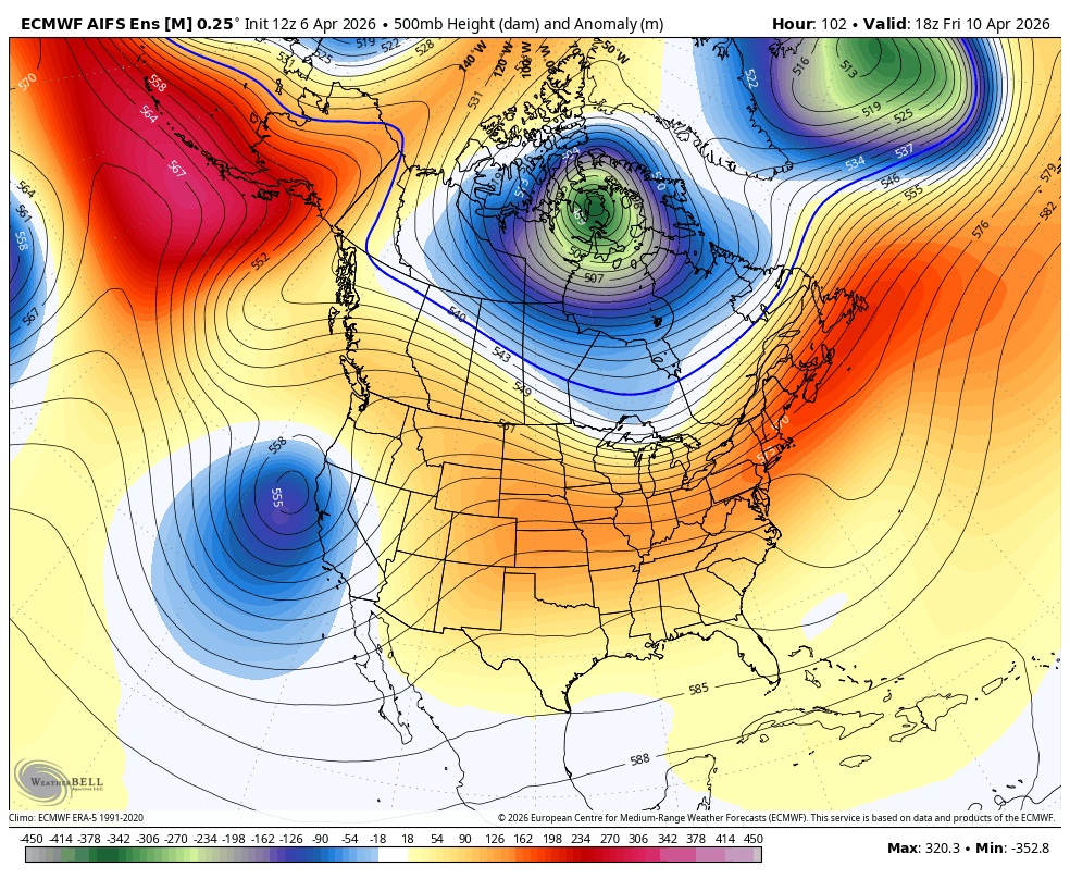
The models have latched onto a stormy period beginning later this week. The first impulse arrives roughly on Thursday evening, and is a relatively weak trough that should bring scattered convectively-driven showers. This storm will feel somewhat similar to the one we had last week, with scattered showers and highly variable precipitation on a localized scale. Right now, the bulk of the showers look like they'll set up west of the Sierra Crest, but some will spill over the crest.
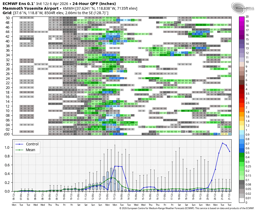
Scattered showers associated with this first wave will begin on Thursday and pick up through Saturday.
As of now, I'm expecting totals of 0.2-1" of liquid along the crest, with considerably less than that spilling over in most places. As mentioned, totals will vary quite widely, but localized areas along the crest could pick up around 5-9" of snow by Saturday evening, with other areas scoring less than that.
Snow levels will be roughly 8-9k on Friday and roughly 7-8k Saturday.
It's not over there, as model guidance is currently showing a stronger shortwave trough impacting California beginning Saturday night.
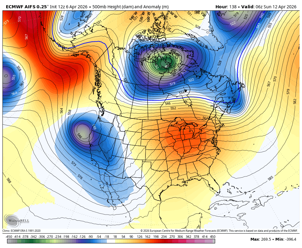
While uncertainty is high around this second system, it looks likely to bring much colder temps and lower snow levels than the first system, as well as stronger, more widespread precipitation resembling the frontal dynamics typical in a midwinter storm. This will lead to slightly more East Side spillover as well as less localized precipitation totals.
Models currently show a range of 0.4-1" of liquid equivalent, but it's too soon to say for this second system.
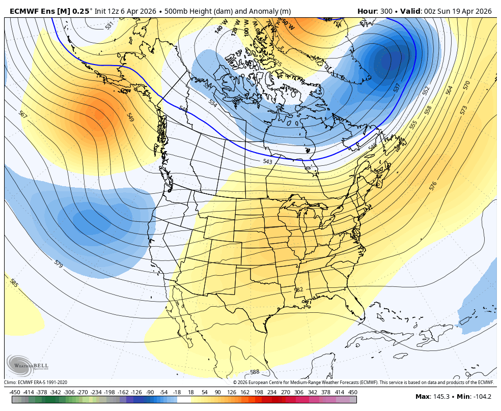
Longer Range
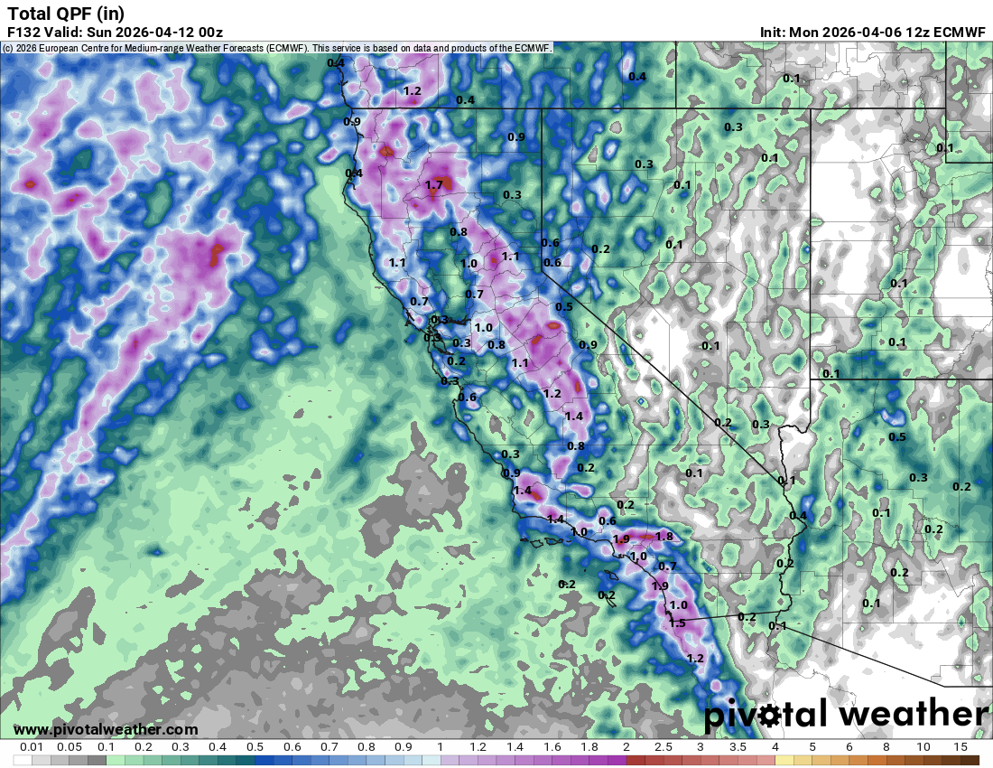
Taking a look at models, there are early indications that a troughing pattern may linger around the west coast into the third week of April, bringing more unsettled weather. Ensembles now show pretty decent positive precipitation anomalies for a 10 day period!
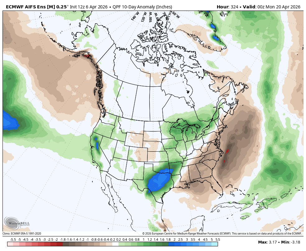
Ensembles now show slightly depressed heights hanging around more often than not, which could keep our unsettled weather going. TBD!
Taking a look at the meteogram for the Euro Ensemble, most members are fully bought into the twin storms this weekend, but they are split on whether we see more active weather in the longer range.