Winter's Revenge! Showers through Saturday, Winter Storm Saturday Night
Overview
My friends...
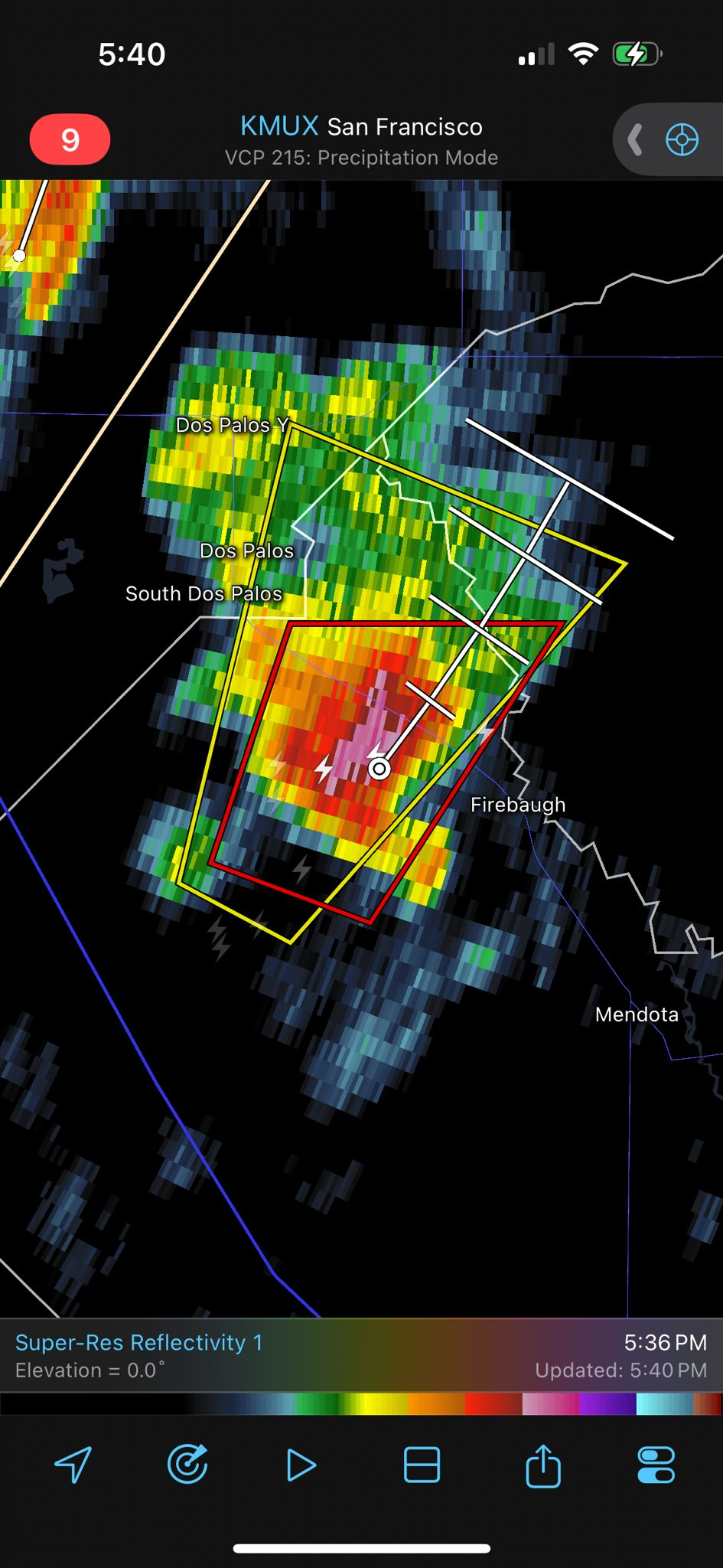
Yesterday's showers resulted in a tornado warning in the central valley, as well as several other strong thunderstorms. Some showers made their way into the Sierra, but mostly north of Mammoth. Today, showers will pick up across the state, including stronger showers in the Eastern Sierra region. Showers will lull tomorrow, but remain possible, while a stronger winter storm is set to impact the state Saturday night through Sunday.
Showers
Some strong thunderstorms spawned over the central valley yesterday, resulting in one tornado warning.
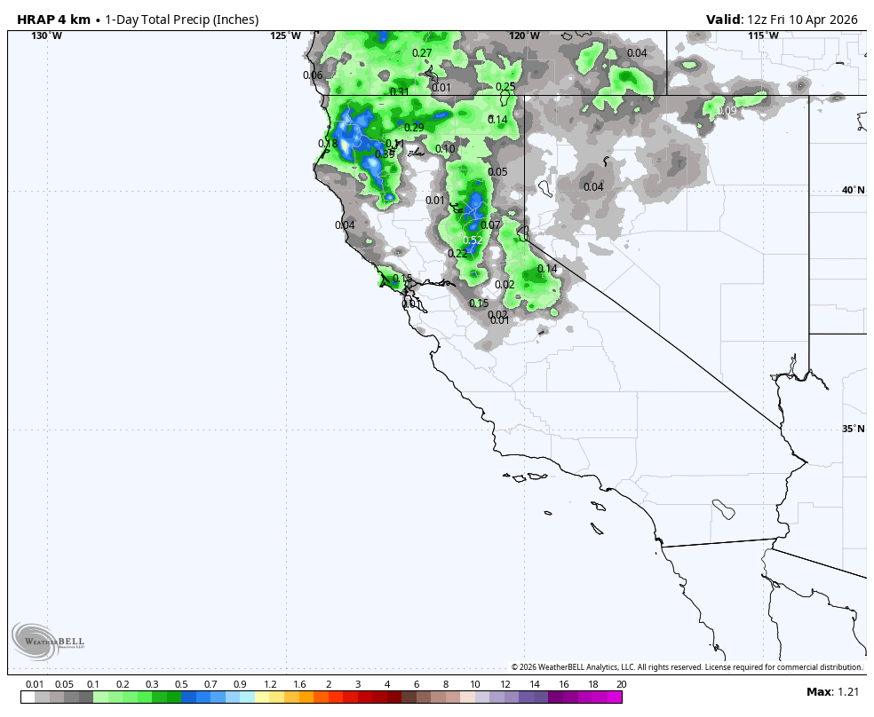
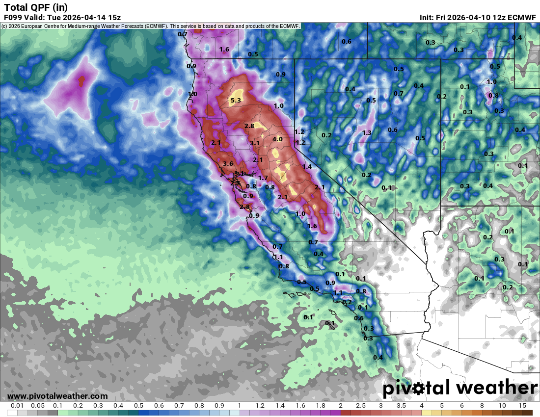
Some showers did make their way into the Sierra, but watching the radar showed that they were mostly training west of the crest between Bridgeport and Lee Vining. Here are the 24 hour precipitation totals:
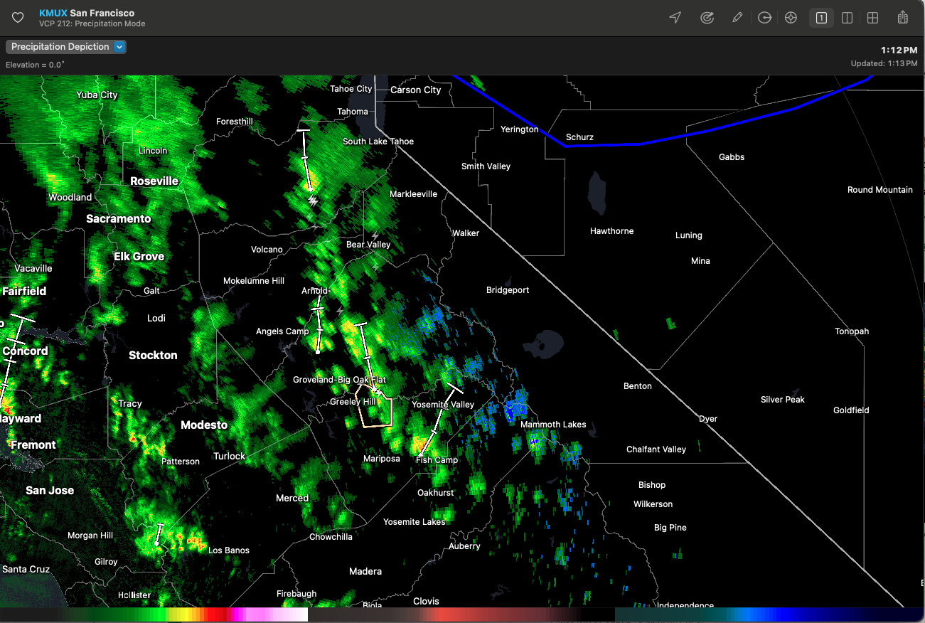
Stronger showers are beginning to pick up across the state, including a few snowflakes now starting to fly in Mammoth Lakes. These showers will peak in intensity later tonight, resulting in snow levels down below 8k, and accumulations up to 1-5". Wide variances in totals are likely, as individual cells line up over localized areas. Today will be a much more active day for thunderstorms, and the occasional tornado remains possible.
Showers will begin to lull overnight, but remain possible until a stronger trough merges with the weak, slow moving trough responsible for these showers.
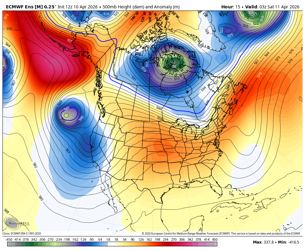
Winter Storm Saturday Night
On Saturday, a stronger trough from the Gulf of Alaska will merge with our weak upper level trough and bring in a winter storm to the state.
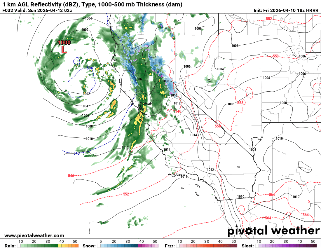
This trough and associated surface low will bring frontal dynamics typical of a mid-winter storm. This will cause a narrow cold frontal rainband, which will bring very heavy rainfall rates before briefly stalling over the Sierra Nevada and delivering 1-2"/hr snowfall rates overnight Saturday. As of now, hi-res guidance suggests that the main frontal passage over the Sierra will occur around 12-1am Sunday, and strong showers will last for several hours.
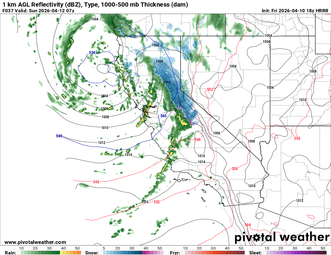
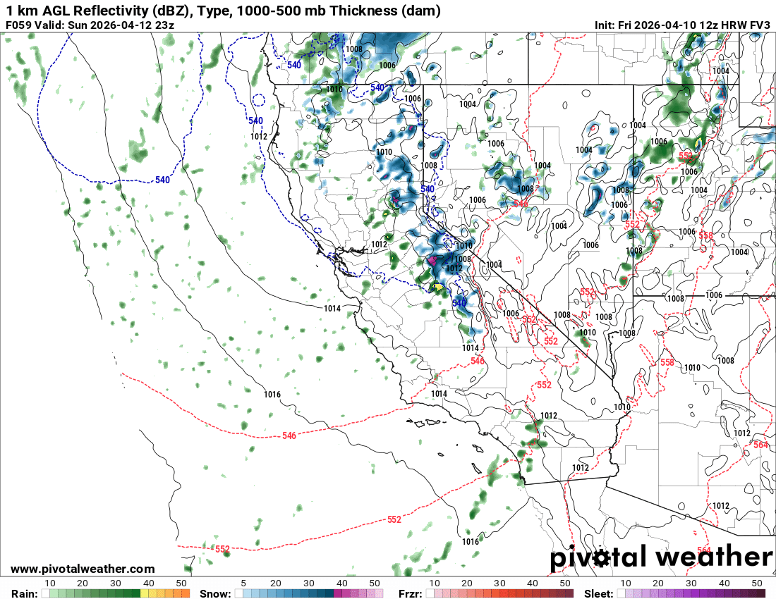
Showers will then diminish into the early morning hours, before picking back up as a second surge of moisture and convectively driven showers follow the front Sunday throughout the day.
Winds currently look very strong Saturday night, with gusts in excess of 70mph over ridgetops possible.
Snow levels will start around 7k, but lower to near 5k pretty quickly. They will then rise to around 6k during Sunday's post-frontal showers.
As of now, models suggest anywhere from 1.5-2.5" of additional liquid from this second wave. This should result in an additional 15-25" of snow for Mammoth Mountain and Sierra Crest areas thru Sunday, with totals decreasing southward. Parts of the 395 corridor may see between 2-10" of snow. Bishop Pass might see 10-17".
Longer Range
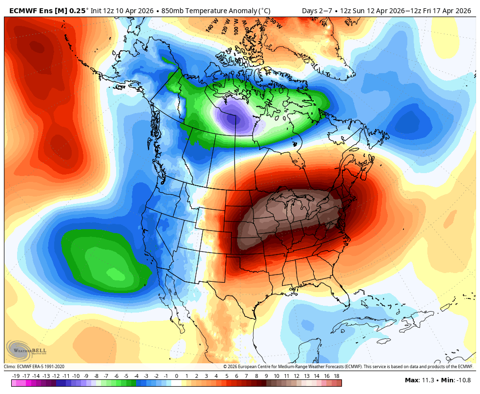
Longer range, models continue to tease at occasional showers making their way into California, but the signal is unconvincing. For now, we will have to get through this upcoming storm and continue to watch for something coherent to emerge. Nothing coming next week, though we should start out below seasonal norms, before rising to near seasonal temps by the end of the week.
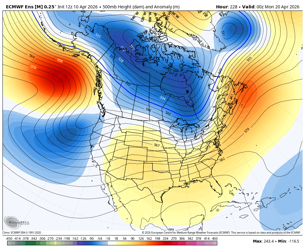
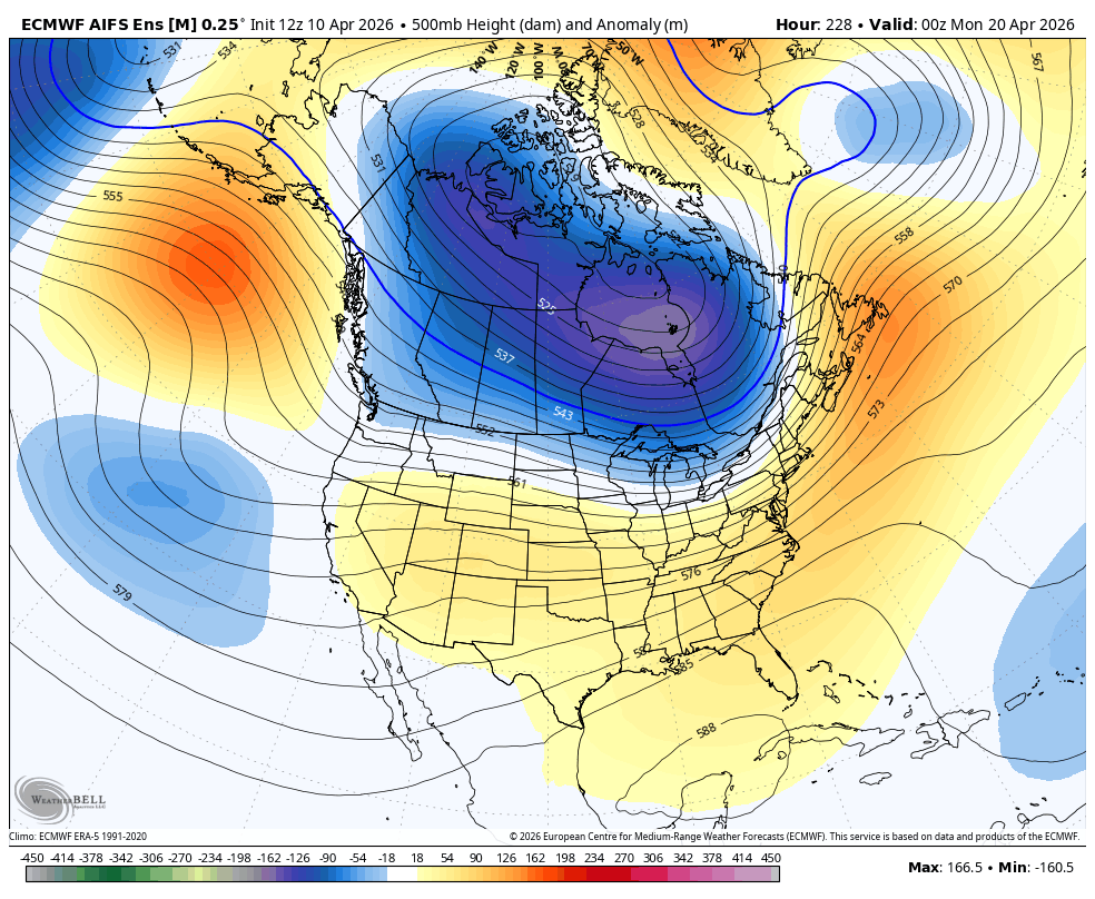
The ECMWF ensemble shows a storm window on Monday, April 20th, with a trough approaching the state, but the AI ensemble is not bought in with a much weaker trough.