A Proper Winter Storm!
Overview
My friends...
The models have backed off of the totals from our convectively-driven showers in exchange for a much stronger winter storm Saturday night. This storm will bring snow levels down below 5000' at times, as well as widespread precipitation totals and snowfall totals measuring in feet across much of the Sierra.
Longer range, models continue to hint at possible weak storms the week after. If only we had this pattern in the middle of winter!
A pair of storms...
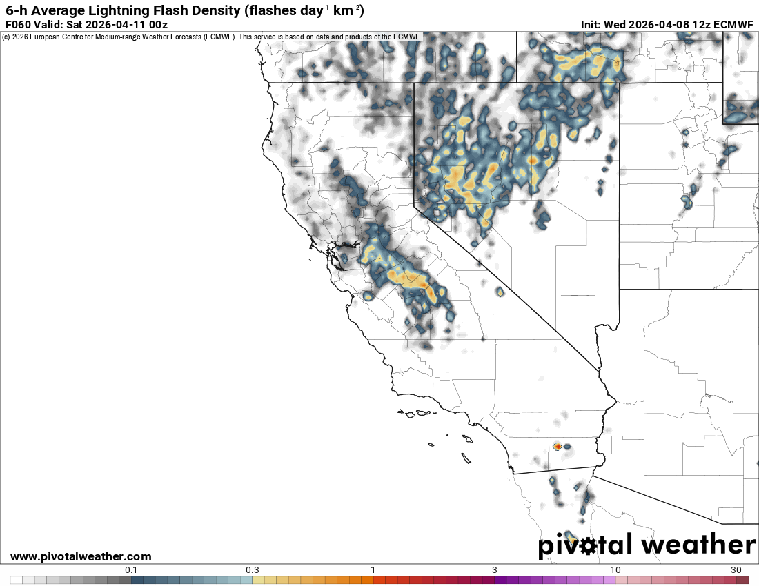
Two storms are currently set to imapct California. The first storm is a weak, slow-moving upper level trough that will bring several days of scattered showers and thunderstorms, mostly west of the Sierra Crest. These showers will begin to pick up in earnest Friday afternoon and last through Saturday afternoon.
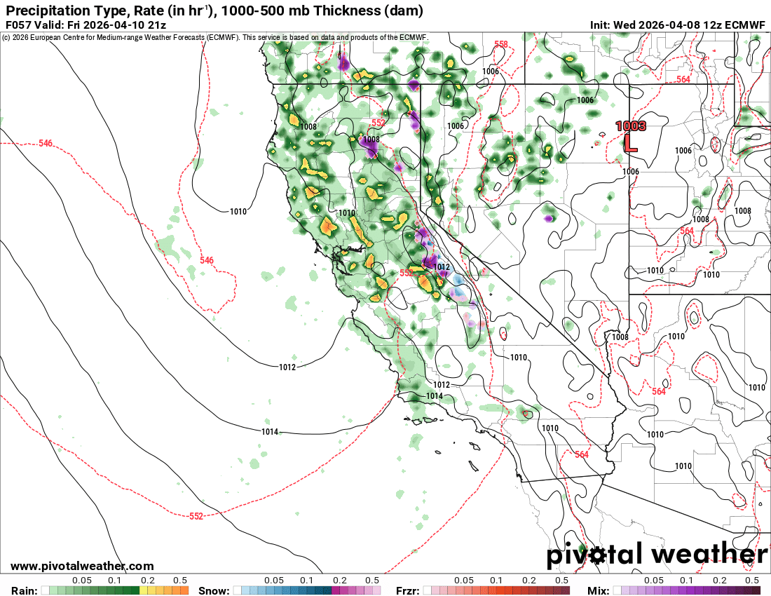
This storm has the potential to form some strong thunderstorms, with lightning likely, and the occasional tornado cannot be ruled out.
This storm will bring about 2-4" of snow to parts of the Sierra Crest, with considerably less precip east of that. Snow levels look around 8-9k.
On Saturday, the main event arrives, in the form of a proper winter-type storm with frontal dynamics and very heavy snowfall. This is a much stronger trough with an associated surface low. This storm will drag snow levels down below 5k at times, and looks likely to deliver over a foot of snow to most of the Sierra Nevada, with more expected northward, such as in Tahoe.
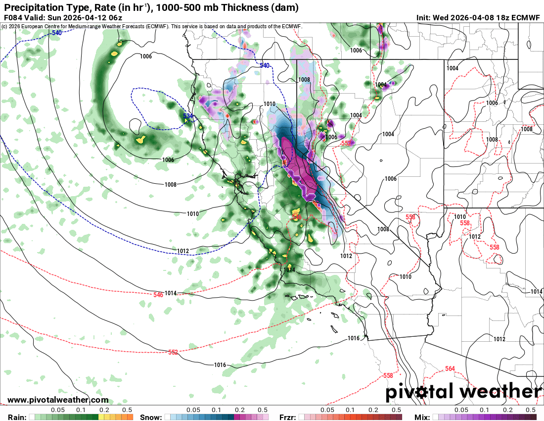
The main front will arrive Saturday night, and could briefly deliver snowfall rates of 1-2"/hr.
Models currently show 1.5-2.5" of liquid for the Sierra Crest, including Mammoth Mountain. With cold temps, I'm expecting 15-25" of additional snowfall from this second storm for the Sierra Crest and Mammoth Mountain, with 2-10" possible along parts of the 395 corridor. Expect totals to adjust when hi-res models are in range.
Showers will linger through early Monday morning, before clearing out for a colder week.
Longer range
Longer range, models show extended West Coast troughing into the following weekend, with more chances for storms.
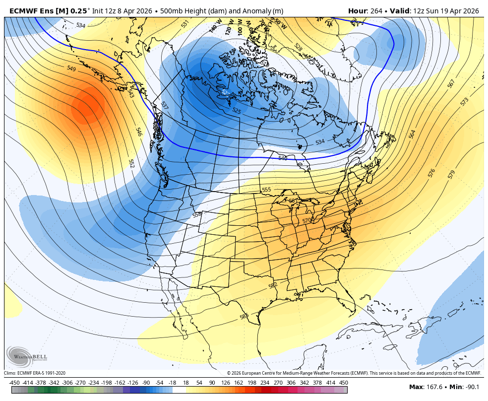
This -PNA pattern is favored for much colder temps and storm chances to continue. While not a lock, our chances of continued storms in the long range continue to look possible, but time will tell!