A Last April Hurrah?
Overview
My friends...
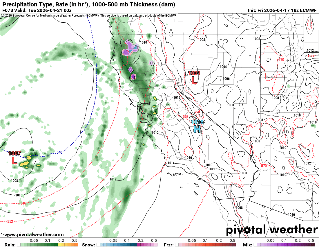
I am calling this our "Zombie Winter", in that it died completely in March but is back from the dead for April. Like a zombie, it is never really all there given our extensive snowpack loss the month prior. The models are honing in on a return to active weather for next week. Beginning on Monday, a relatively strong trough for the time of year will approach California, first bringing coastal showers before pushing inland far enough to deliver moderate snowfall to the Sierra Nevada on Tuesday with snow showers lasting through Wednesday. Models are mostly showing a cooler but drier pattern for the rest of April after that.
More April Pow!?
April is shaping up to be quite an active month for us, with another storm making landfall over California beginning next Monday.
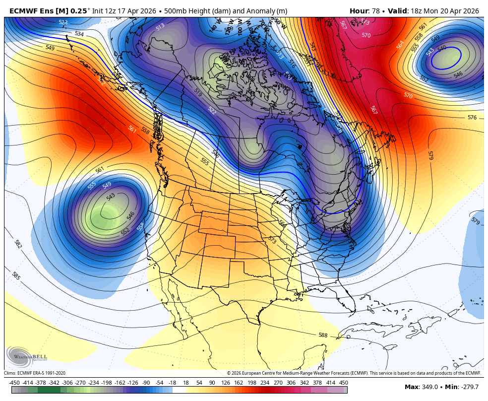
An unseasonably deep trough will form over the Pacific Ocean and push inland early next week. Starting on Monday, coastal showers will begin as the trough takes its time pushing towards the Sierra.
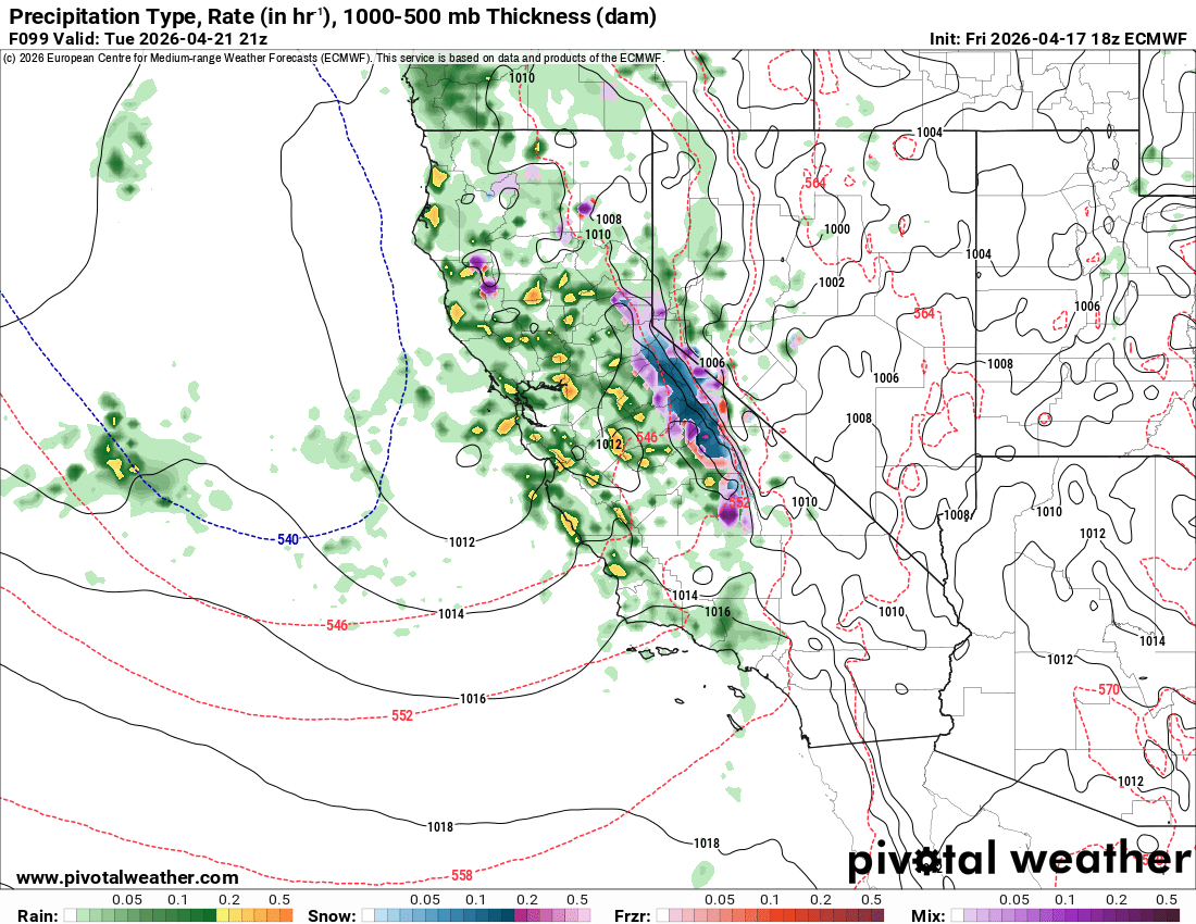
By Tuesday, the trough will push inland and result in moderate snowfall over the Sierra Nevada, with showers lasting through the day on Wednesday. There will be some thunderstorm activity over the Central Valley Tuesday afternoon as daytime heating picks up. Snowfall looks heaviest during the day on Tuesday. Convection will follow the main band of precipitation, and could lead to strong bursts of activity.
Models currently show a range of about 0.7-1.3" of liquid equivalent for the Mammoth area through next Wednesday. Snow levels will begin around 7,500' but lower to just over 6k'. Winds associated with this system currently don't look too strong, but can often end up overperforming here. Some models, like the Euro operational, show higher precipitation totals above 1.5" of liquid equivalent. We'll have to see about that!
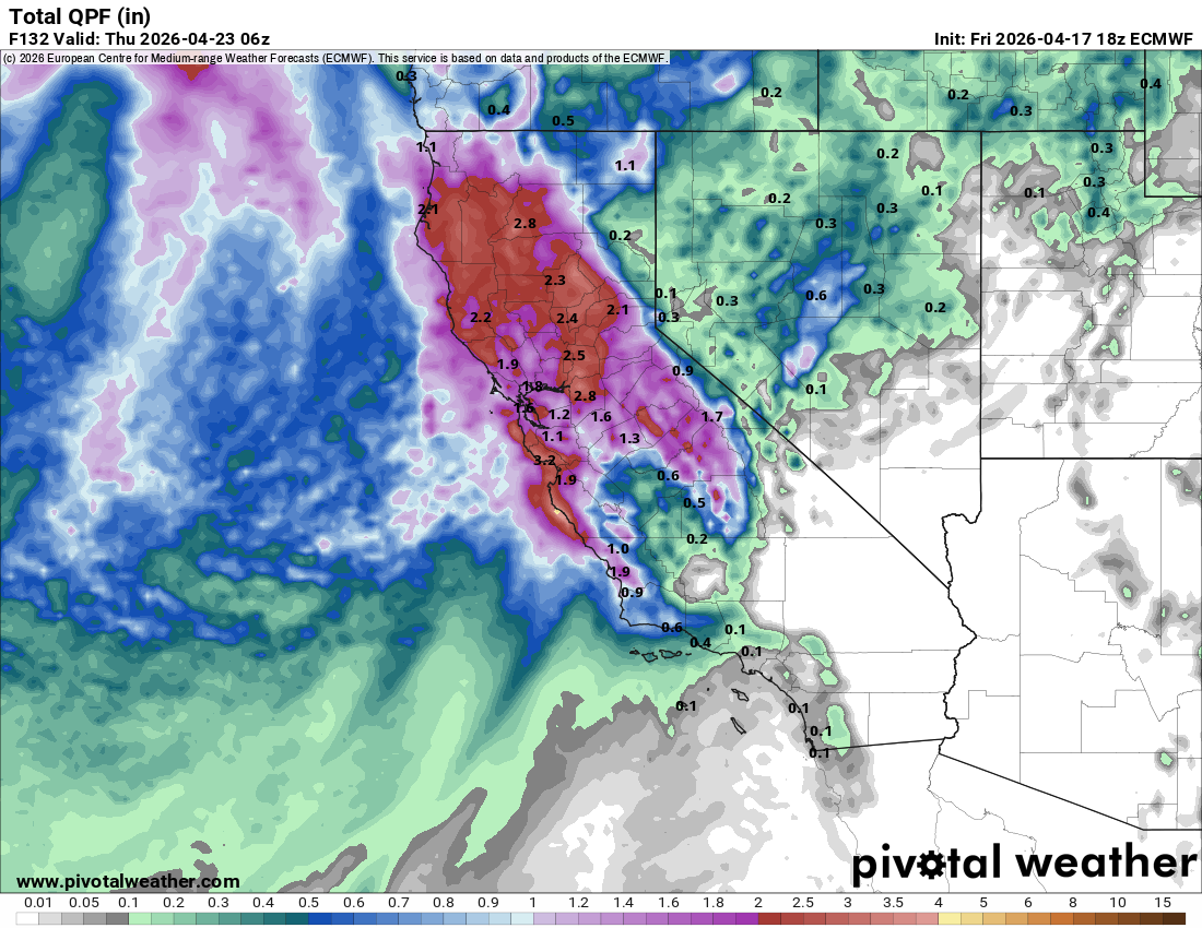
In total, I'm expecting about 7-12" of snowfall for the Sierra Crest near Mammoth, and about 0-5" along parts of the 395 corridor.
Longer range
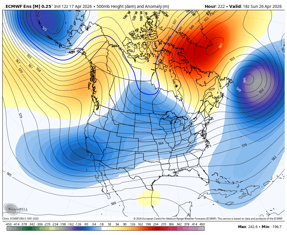
Longer range, models show a period of troughing undercutting the West Coast ridge, which could lead to a weak showery pattern and will keep temps down:
Models show this causing a whole week of below average temperatures:
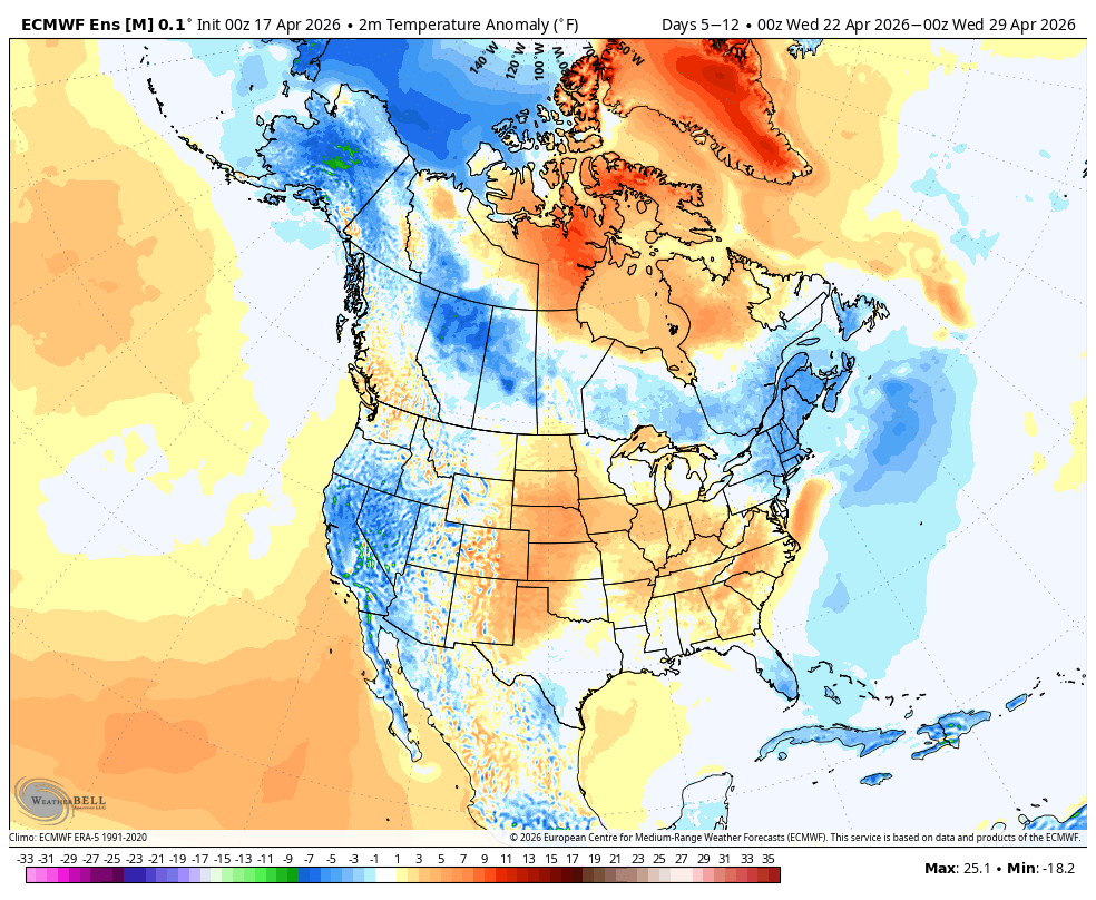
While it will be nice to stay a bit cooler, the placement of the ridge means we will stay mostly dry unless something changes. Either way, it's nice to have a stormy period that isn't immediately followed by a torch!