Awesome April! All Aboard the Train!
Overview
My friends...
Awesome April is happening, and I am jumping on the train. While it can't save us from our Malevolent March, it is a worthy consolation prize and should help preserve our skiing into May. Here's the summary:
A passing trough to our north this Thursday will keep us cooler as well as bring in strong winds and increasing cloud cover. There may be an occasional pop-up shower, but nothing much. Weak high pressure will then build in over the weekend, which will bring a slight warmup. By the beginning of next week, models are showing another winter storm impacting California, bringing more beneficial rain to CA and snow to the Sierra Nevada. Beyond that, it looks like we dry out for the remainder of next week, while the occasional storm chance remains through the end of the month.
Passing Trough
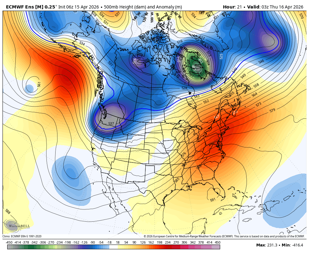
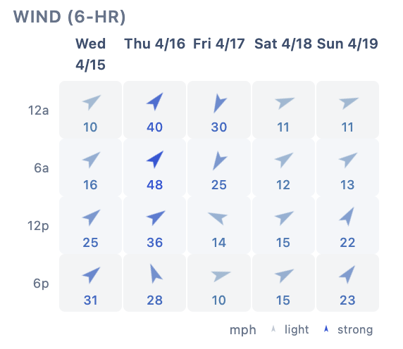
A trough is currently passing to our north, and will bring temperatures down with it tomorrow. Starting this evening, winds will be moderate to strong out of the Southwest through Thursday evening. By Friday, the winds turn North as the trough continues over the Great Basin. Here's a chart of 5 day winds for Mammoth Mountain:
Weak high pressure then builds in for a slight warmup and clear weather over the weekend.
4/20 Storm Window?
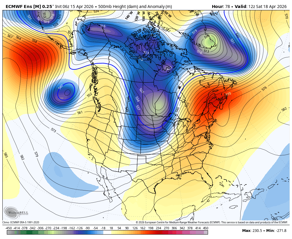
Models are showing another storm impacting us beginning next Monday. Yet another shortwave trough will undercut the Gulf of Alaska ridge, bringing more rain and snow to California.
While still too soon to discuss details around timing and precipitation amounts, this looks to be somewhere in the weak to moderate category, but should be a nice April refresh.
As you can see from the University of Utah snowfall plume for Mammoth Mountain, widely varied totals are still forecast by ensembles, but there is a signal there for a snowstorm, possibly one resulting in double digit accumulations. Too soon to say.
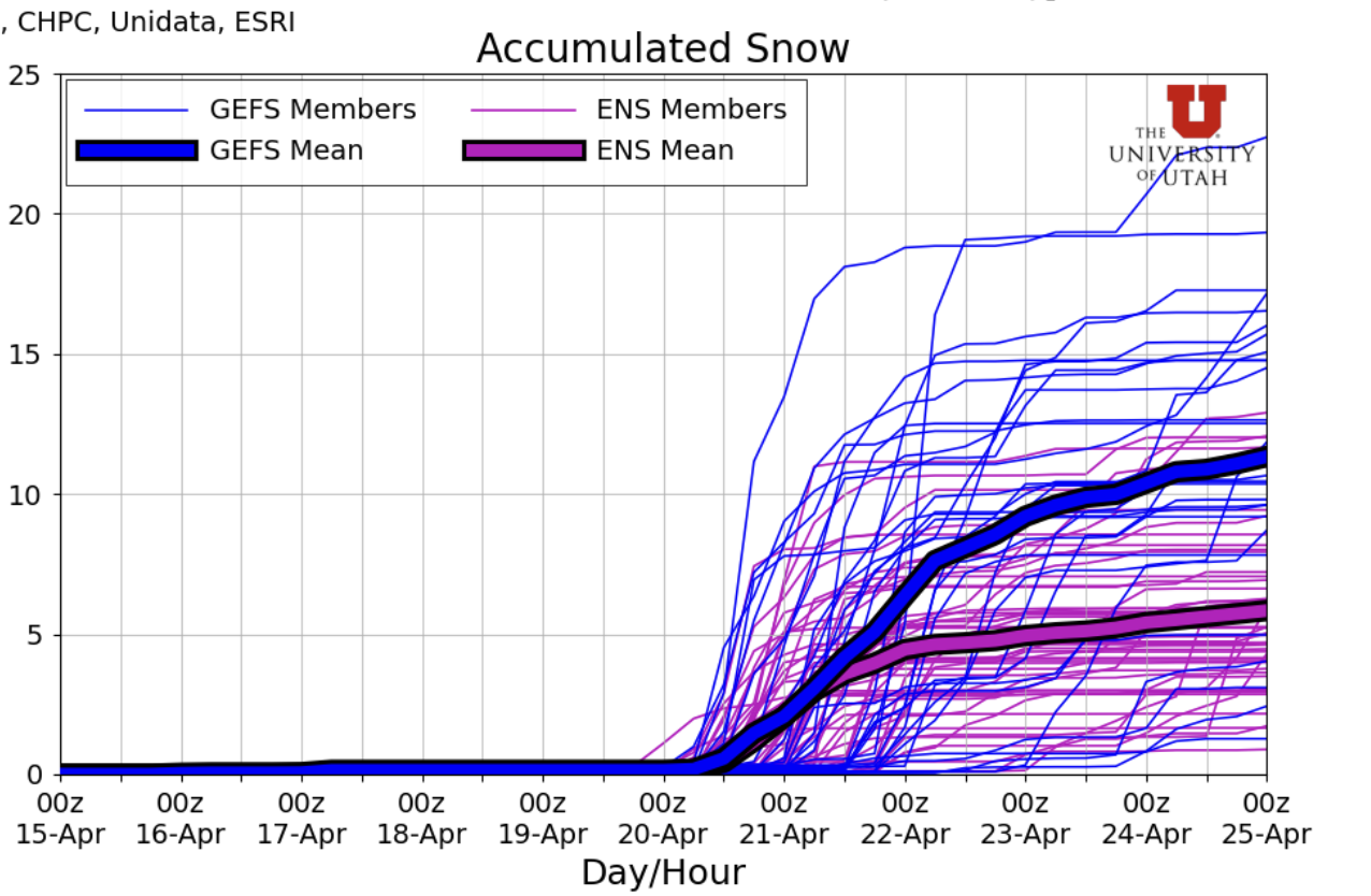
As of now, snow levels look around 6-7k'.
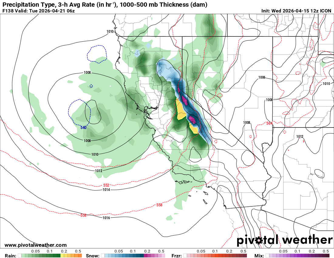
Some models, like the ICON and Euro AI, show a period of heavy snowfall occurring overnight Monday night, with showers lasting throughout the day on Tuesday. This looks like another storm with solid frontal dynamics and post-frontal convectively driven showers. These post-frontal convectively driven showers can result in highly varied totals depending on where bands of convection set up.
While this looks promising, it is still not a lock. A potential failure mode for this storm is the "out to sea" scenario, where the trough fails to push inland before disintegrating.
A few more days and we can begin to form a better picture of totals and timing.
Will Awesome April Continue?
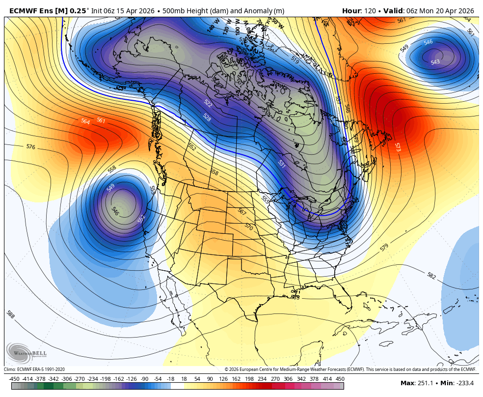
Longer range, high pressure will stay in the Gulf of Alaska, but appears to nudge slightly closer to California. This doesn't slam our storm door shut, but rather keeps it just slightly ajar.
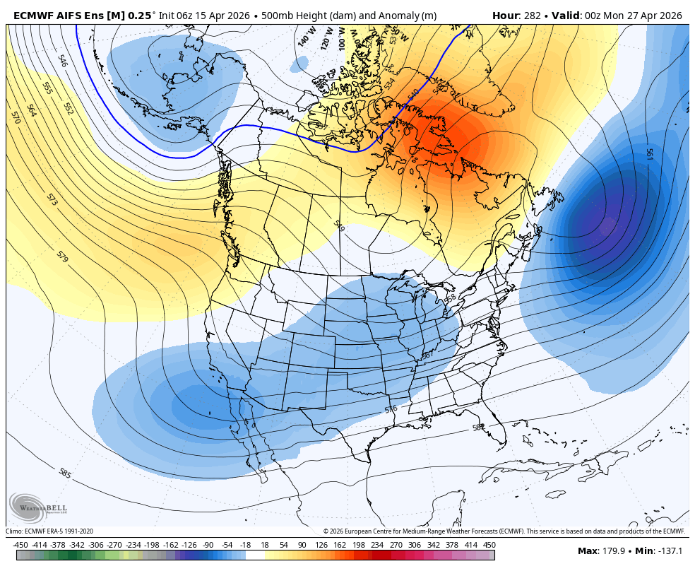
Also, notice that blue area near Southern California. This indicates a slight troughing pattern continuing to undercut the ridge in the Gulf of Alaska. This means we might continue to have an occasional chance at a weak shortwave trough approaching California. However, at 12 days out, this is a relatively uncertain and diffuse signal.
The final interesting piece of the equation for us is Super Typhoon Sinlaku in the Western Pacific. When typhoons recurve into the midlatitudes, an impressive amount of moisture and forcing energy can make its way to the west coast. This is hard to model, and is about two weeks downstream, but is a factor worth watching at the moment. If it phases properly with a West Coast trough, things could begin to get interesting, but this is speculative at best.
At the very least, it looks like we've got another storm window coming up with more chances through the end of the month!