Hot and Dry with Dustings Possible Next week...
Overview
My friends... Well first of all, welcome to the first blog post on this website...!!! :o
After very light rain to a couple tenths of an inch near elevations of 11k, very warm and dry conditions will prevail into the weekend. By early next week, a disintegrating storm will bring slight chances for a dusting up to a couple inches of snow above 7000 feet. After that, we will remain mostly dry and on the cooler side with the occasional shot at inside sliders thru the first week of March. Uncertainty is high into mid march, but a major polar vortex disruption is currently favored to shake up the pattern.
Warm Weather...
My friends, what a strange time these last few days have been. Ripping winds in excess of 120MPH across the mtn, combined with warm spitting drizzle up to 11k has left our mountains with wet isothermal snow and runnels as high as chair 3 on Mammoth! Cloudy skies overnight have prevented a refreeze from occuring.
Beginning tonight, clear skies may allow the snow to undergo a superficial refreeze, the first in several days, while overnight temps remain warm (37F).
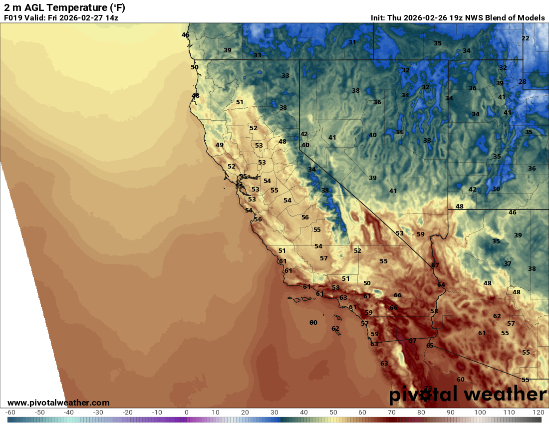
High temps in Bishop will crack 70F today thru Saturday!
Beginning tomorrow night, the first hard refreeze may be possible, as overnight lows dip below 30F.
However, by tomorrow, temps could reach as high at 57F in Mammoth Lakes, and will be in the high 40s across Mammoth mountain and above 9000 feet.
By Sunday, temps will come down to a more appropriate level. In town, temps will be roughly a low of 24 sunday night and a high of 42F on monday as storm chances increase into next week.
Next Week Storm?
My friends, a very unconvincing signal is there for a storm next week. A weak, disintegrating trough will slam into our high pressure, bringing chances at a dusting up to a few inches of snow to higher east side peaks. Temps will drop off rapidly enough for snow levels to be around 7k, but if we get any precipitation is still up in the air.
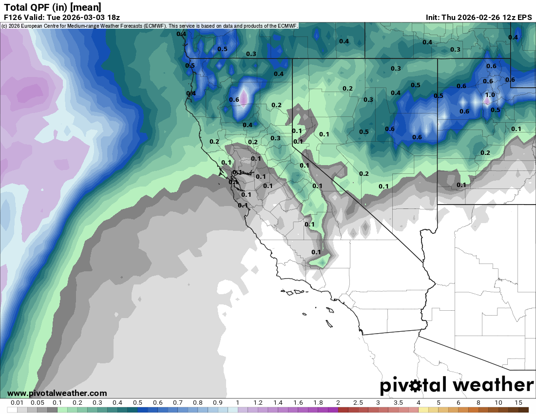 Ensemble average shows about 0.15" of precip for Mammoth, so not very much snow.
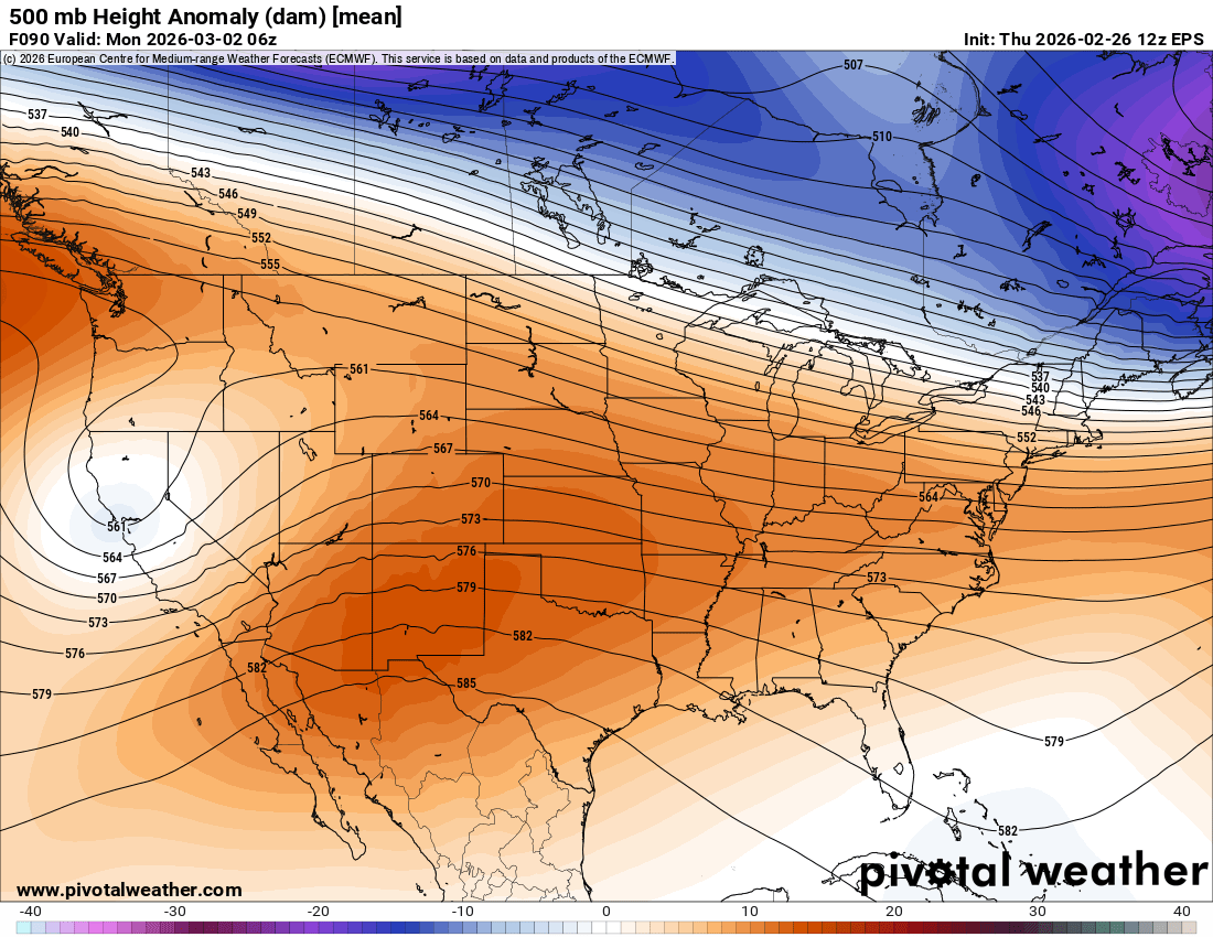 A very weak and anemic trough makes a go at California.
Longer Range
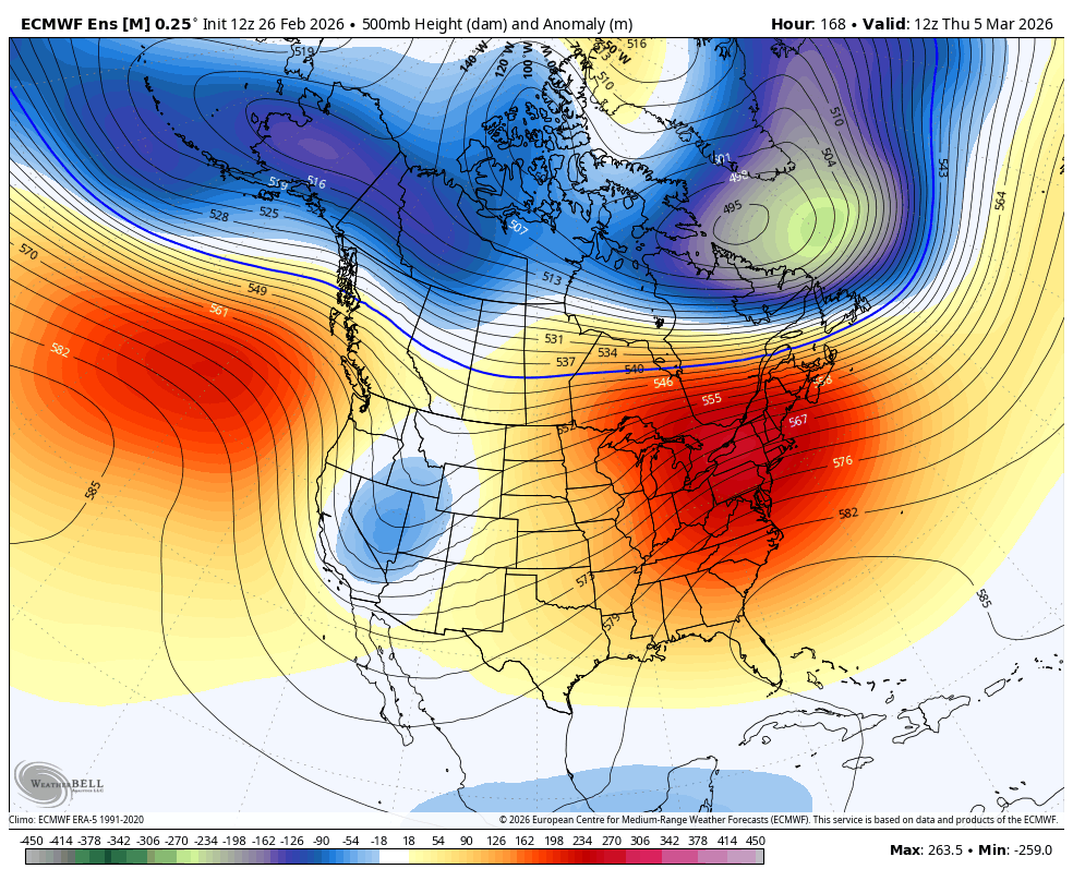
Longer range, some models are hinting at an inside slider type pattern, with troughs going up and over the big ridge in the gulf of alaska, and strengthening into the great basin.
This can be a good pattern for the interior west, which still badly needs snow, but unless the troughs move several hundred miles west, I don't expect us to get much out of this other than howling north wind... More on that later!
Sudden Stratospheric Warming Event (Polar Vortex Split?)
My friends... I mentioned a few days ago how Judah Cohen, author of the excellent aoblog, is now favoring for the polar vortex to split, resulting in a warmup out east and a cold trough in western Canada.
Polar Vortex signals originate from up in the stratosphere, and the effects of them are difficult for models to sniff out until they are right in from of them... We need to wait a bit longer, but this could shake up the pattern for us around mid month.
Tropical Forcing (MJO)
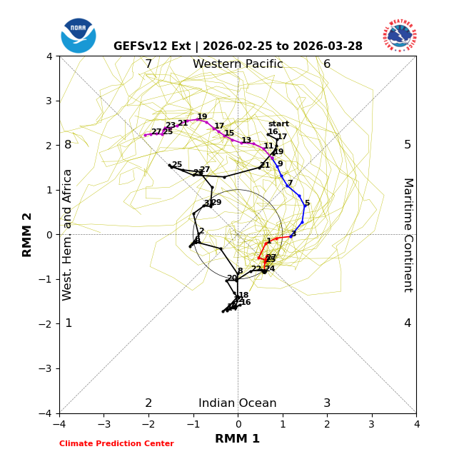
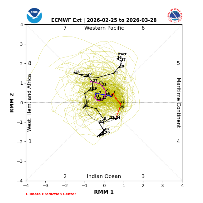
The progression of the Madden Julian Oscillation (MJO) is unclear in the coming weeks, with the GFS showing a very strong pulse into phase 7 at the same time as the polar vortex splits, while the euro is not sold on that idea, and keeps it lower amplitude or in the circle of death. We will have to watch this signal closely, because the interplay of the MJO and the Polar Vortex is very nuanced and impactful to our region and storm chances...