Very weak showers next week...
Overview
My friends...
Today will be the warmest day as we start to cool off into the weekend. Next week's showers look unconvincing and will result in almost no measurable snowfall to most places. The pattern into mid march looks mostly dry with the occasional shot at a dusting.
Short Term Warmth...
My friends. Today and tomorrow will be remarkably warm up and down the Eastern Sierra. Today's day time high will reach about 58F in Mammoth Lakes, already exceeding 51F at Main Lodge... Spring is knocking on the door. I feel a bit sad to admit, but winter is giving way.
70s in Bishop today and tomorrow.
Fortunately, we will be entering a freeze thaw pattern for the foreseeable future, with overnight temperature recovery looking more appropriate, which should allow the snow to stabilize for safer, better skiing!
Dusting Next Week
I said I was unconvinced by the "storm" next week, and that has proven to be the right intuition. It now basically looks like most places will receive almost no measureable snowfall, with some places receiving at best up to 1-2 inches. Where exactly the "heaviest" totals stack up is hard to say, but it looks like north of Mammoth.
Mammoth will receive 0-1" thru next Tuesday...
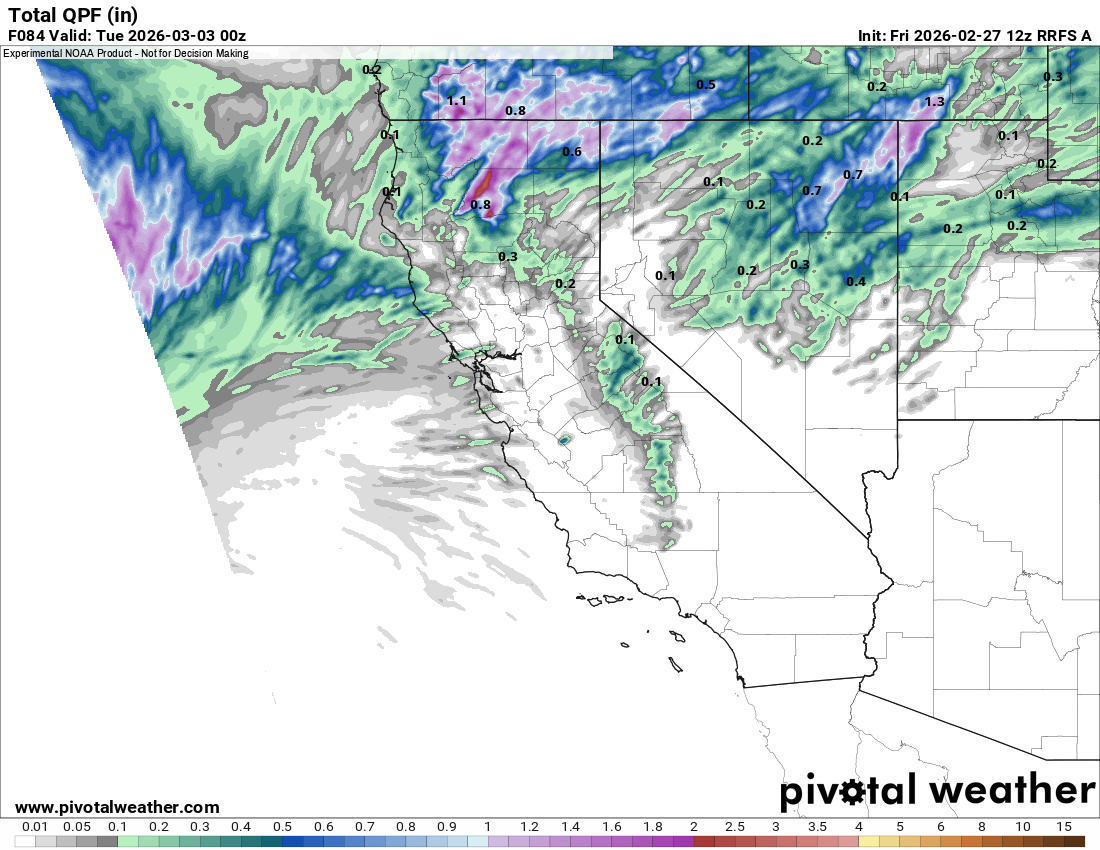
It's never a good setup when you have a weak trough forcing its way into a ridge.
Longer Range
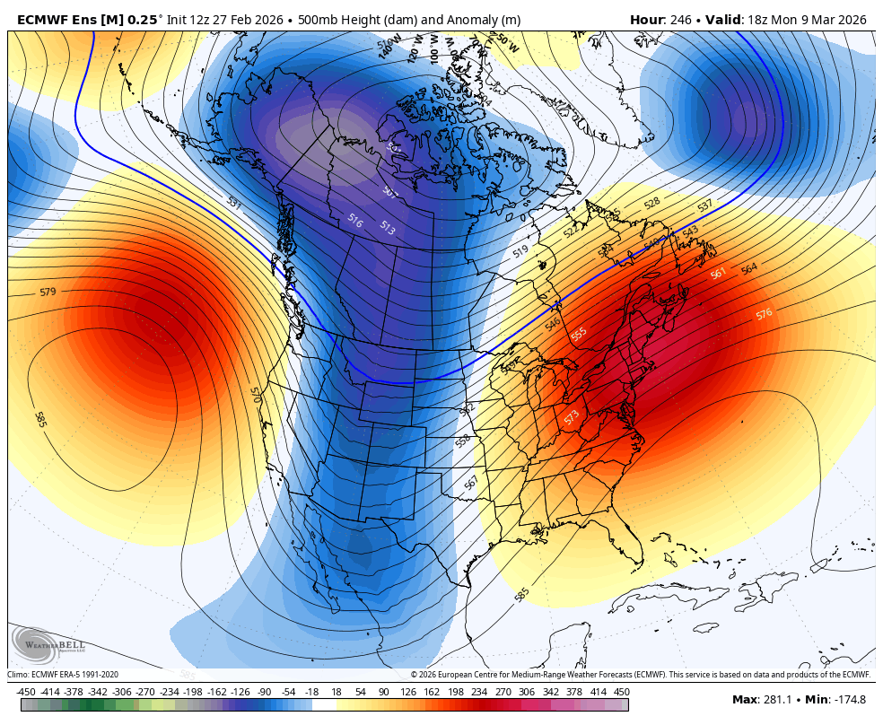
Longer range, the pattern looks pretty unfavorable for us to receive significant snowfall, although the temperatures should be more seasonably appropriate. As I mentioned yesterday, the ridge over the gulf of alaska will force an inside slider type pattern with troughs strengthening over the great basin. This is a decent setup for the interior west, which basically is begging for snow right now, but for us it mostly means we will be colder with the occasional chance at a dusting, if the troughs are able to slide far enough west. Not a good snowpack building setup though.
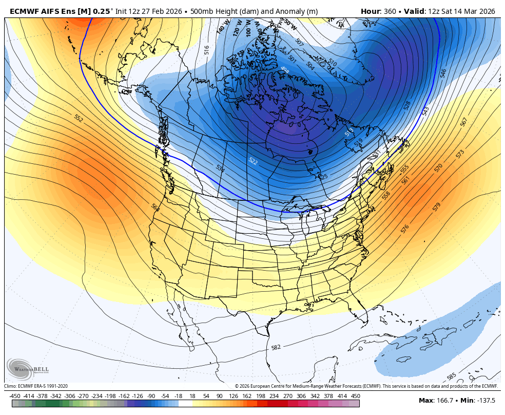
Beyond that, the ridge appears to stay cemented in the gulf of alaska into mid month. I do think we have another storm coming later in the month, but there is basically no signal for it there yet. This is not really what you want to see, because this ridge will essentially keep us from getting any significant precipitation, unless something drastically changes in the outlook.
I mentioned the Polar Vortex signal, and that is still at play. The main thing to consider with the PV signal is that it injects substantial uncertainty into weather modeling, so things can change rather quickly. But right now, there is essentially nothing big to look forward to in terms of windows of opportunity. Sad but true! Pray for snow!