Weak showers tomorrow evening and slightly cooler temps
Overview
My friends...
Today is another warm day, with chances for showers beginning tomorrow evening through Monday morning. The outlook in the long term continues to be for largley dry and slightly cooler freeze / thaw conditions. The PNW and interior west will see better snow chances as troughs dive down into the great basin over the ridge off our coast.
Temp trends
Clouds last night caused our 5th night of poor refreeze in a row. Fortunately, the snow should experience more freeze thaw conditions as we move from the warmer side of the ridge to the cooler side of the ridge.
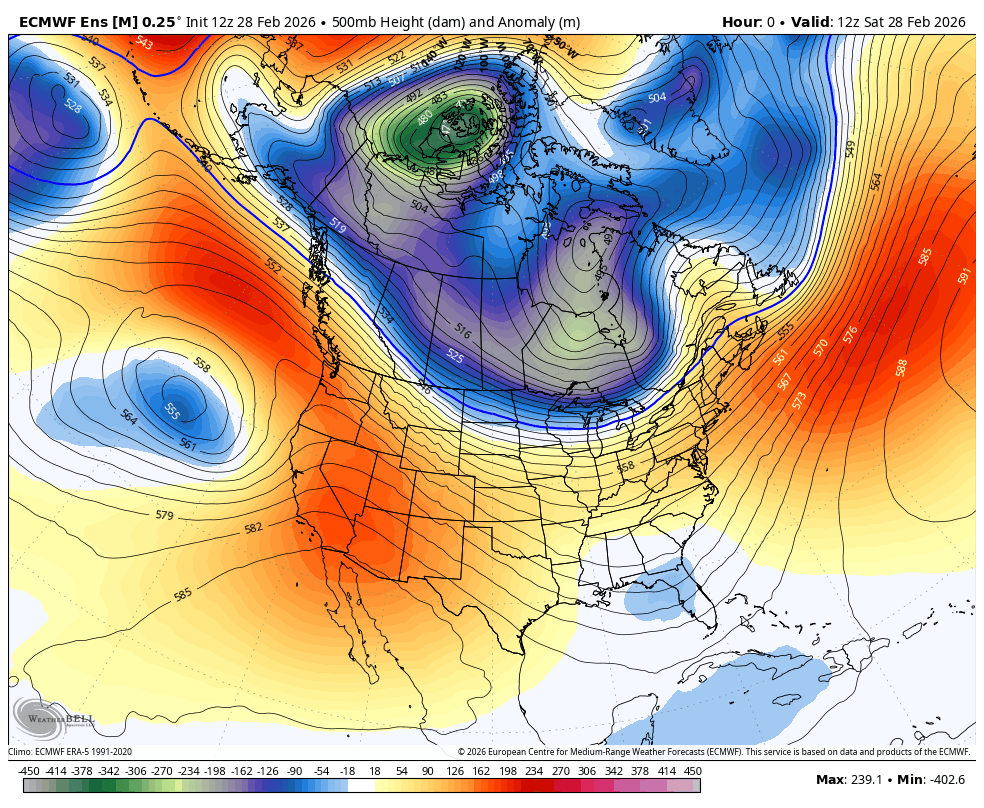
The ridge has been anchored over SoCal, causing temps of 100F yesterday in parts of SoCal! 90s all over the place too. A weak low pressure system will disintegrate is it comes on shore, bringing colder temps and scattered showers.
Beginning Wednesday, the ridge will cement itself off the west coast. Just close enough to keep everything going up and over that ridge and into the intermountain west...
Showers
My friends, I am still not convinced by the showers coming Sunday evening around 4pm through monday morning, expecting about 0-2". However, the HRRR is a notable exception showing closer to 0.3-0.4" of liquid for Mammoth Mountain... If it is correct, this could bring our totals up to a measly 3-4"...
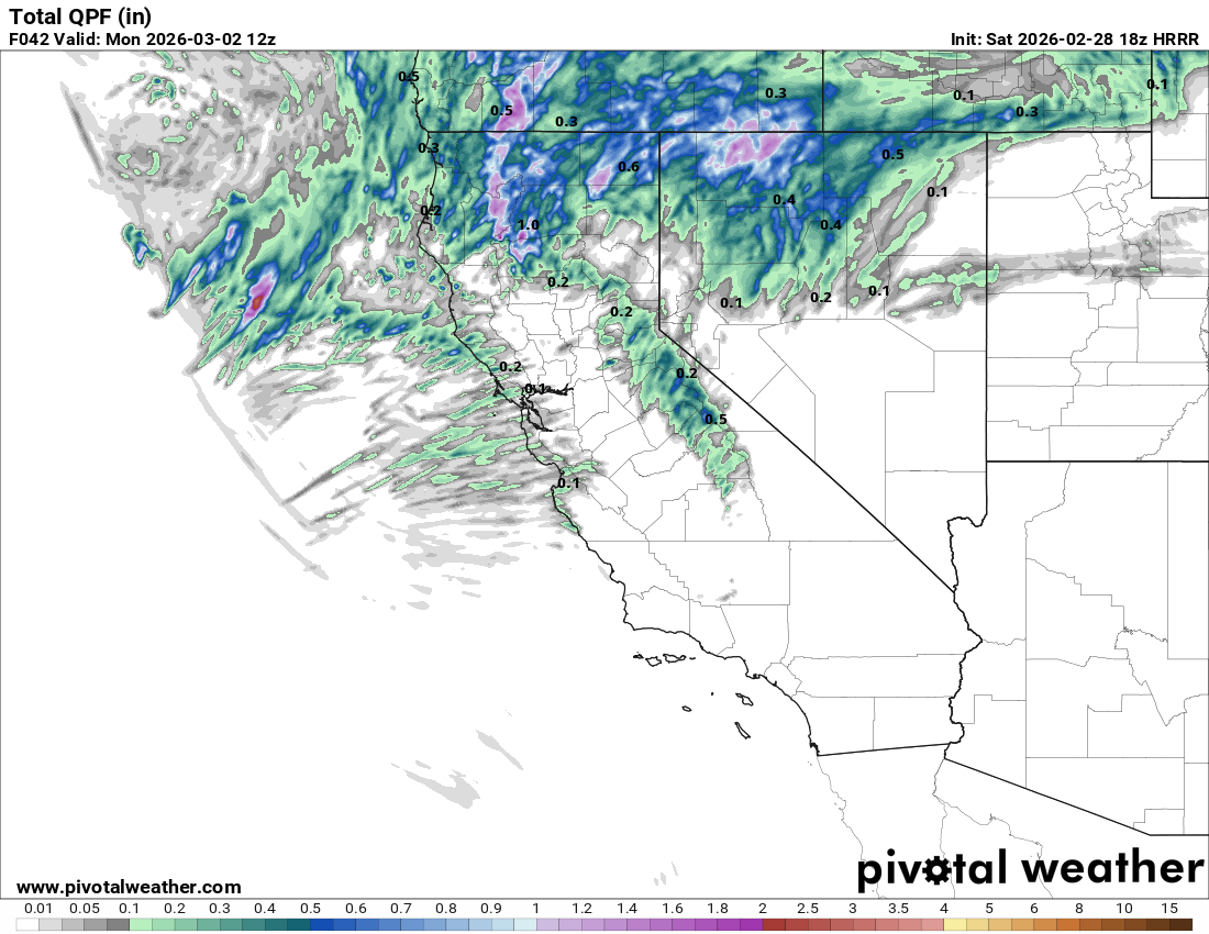
The guidance from a hi-res model like this is often more accurate for localized QPF (toal precip), however if there is convection involved, can overdo local totals by misplacing bands of convective activity. In addition, they can just outright overdo that portion, especially at 48 hours.
I'm expecting most likely a dusting, but with "higher end" totals possible if Hi-res guidance turns out to be true.
Longer Range
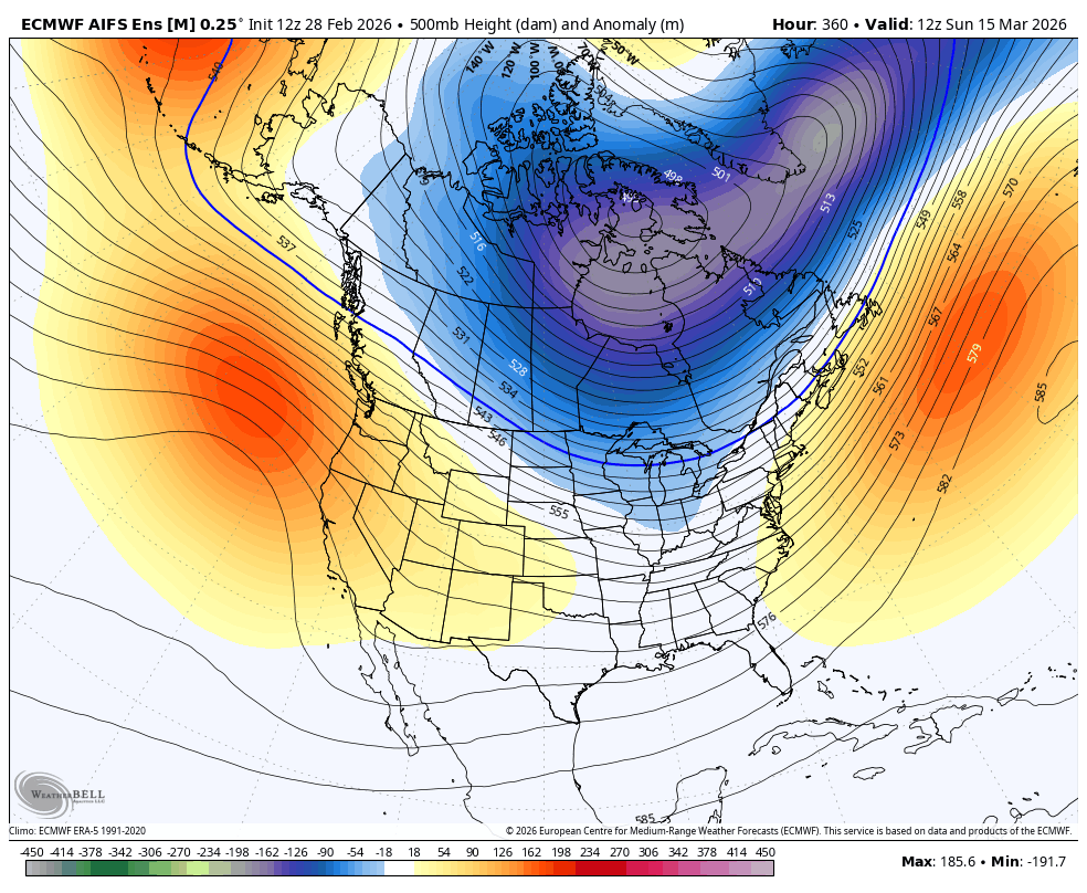
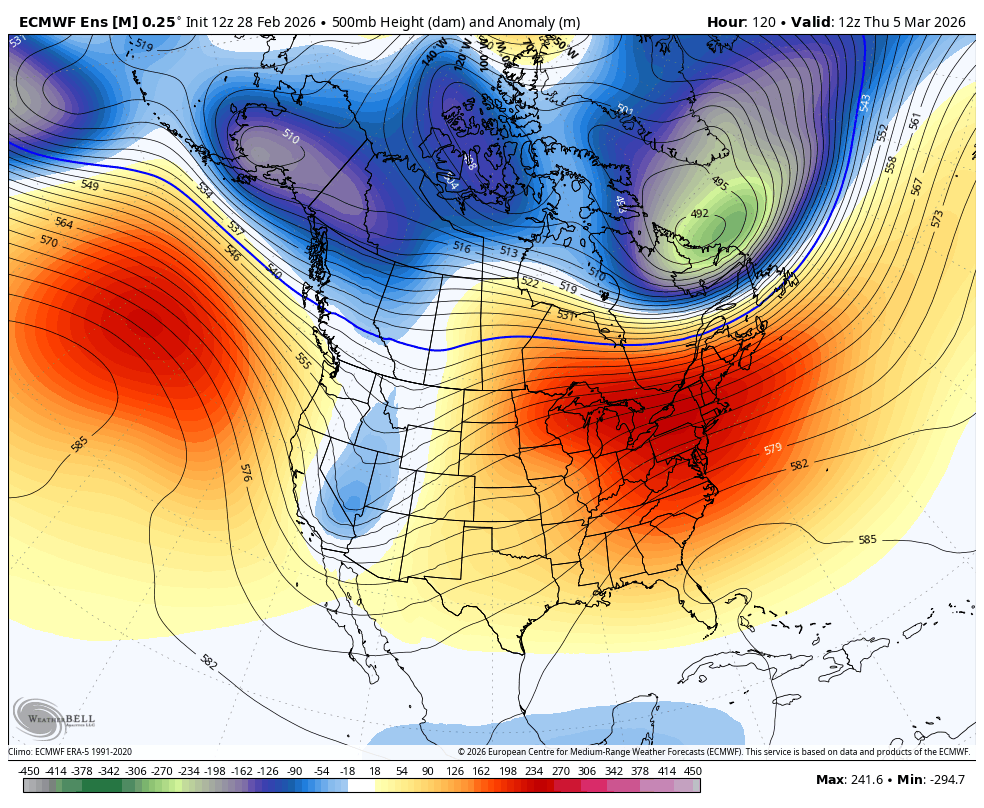
My friends... I hate to say it, but longer range, models show that problematic ridge staying planted. Under this setup, we fortunately stay cooler, and can occasionally receive a colder dusting of snow if troughs nudge just far enough west, however we do remain mostly dry.
We are going to have to hope for a major shake up to the pattern, IMO, and it could be until mid march or later at this point. I am hopeful we can see occasional shots of moisture as the wavelengths of the jet stream become more progressive in spring.
This happens because in winter time, the atmospheric circulation is driven primarily by "baroclinic" forces: I.E. multiple thousand mile temperature differences between the tropics and the poles.
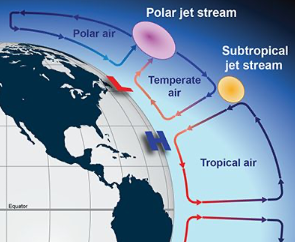
In spring time, the sun starts to hang around much longer each day, and injects a lot more thermal energy each day into the atmosphere. This causes a shift from a "baroclinic" atmosphere towards a more "barotropic" atmosphere, with shorter and more chaotic weather patterns.
The result of this is that March, while having slightly less of a high end potential than mid-winter months, can offer more consistent smaller shots of precipitation. I'm hoping for that, but time will tell!! Pray for snow my friends. Winter is losing the battle for now!