Happy First Day of Meteorological Spring!
Overview
Spring starts today with very weak showers over the Sierra and a dry outlook through the first half of march. We will stay slightly cooler than we have been recently, while the intermountain west sees a more favorable pattern for snowfall. There is no end in sight yet to our dry outlook.
Spring has sprung!
My friends...
Happy first day of meteorological spring! Funnily enough, it has felt like spring more often than not in the Sierra this winter. While March is still a wet month of transition in California, averaging ~64.5" of snowfall at Mammoth Mountain, it is typically the last month where snowpack reliabily builds. The sun angle gets higher and higher, and at our latitude it is hard to compete with.
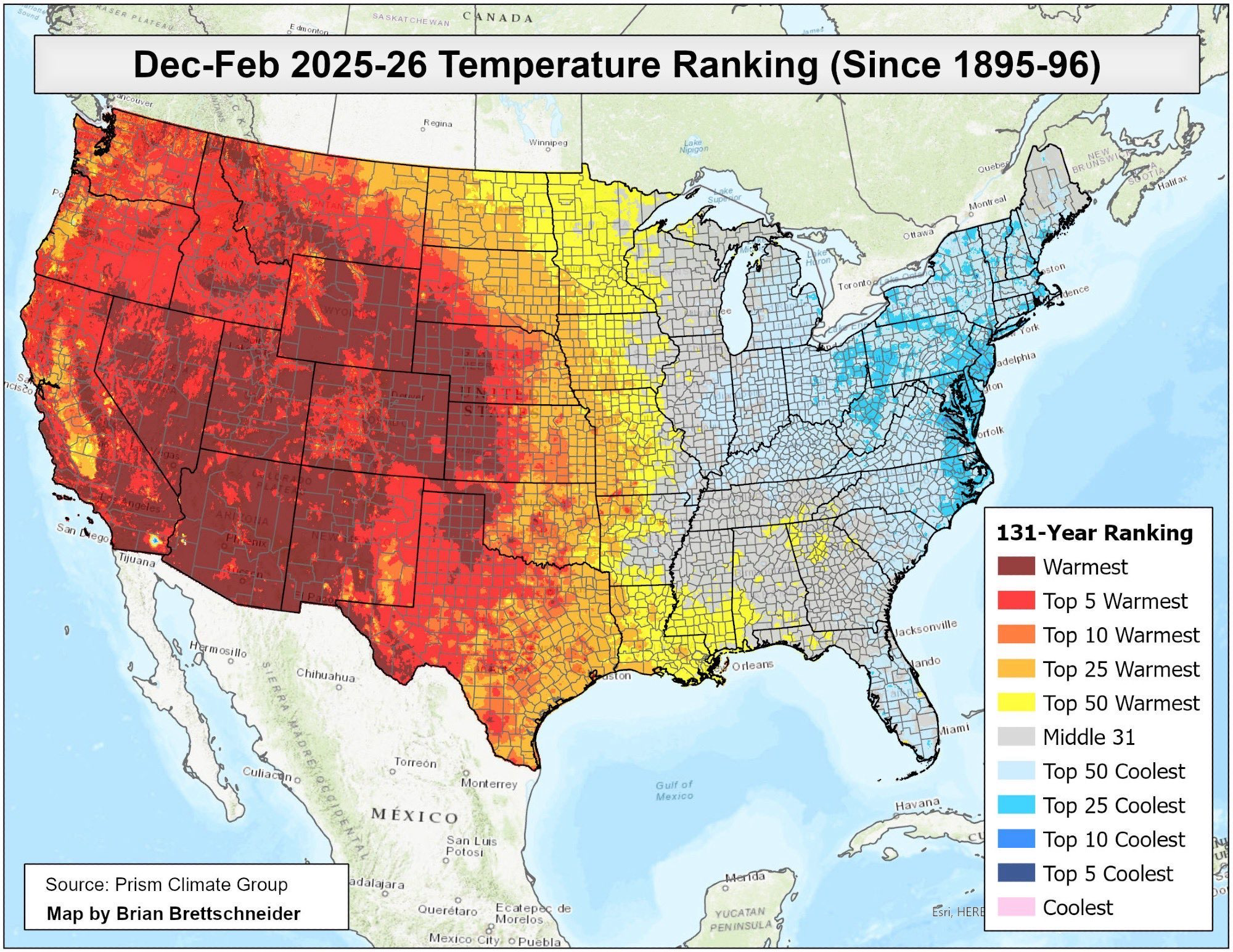
The core winter months were remarkably warm ones out west. A vast swath of the west experienced its warmest winter on record, and did take the record for warmest winter as a whole.
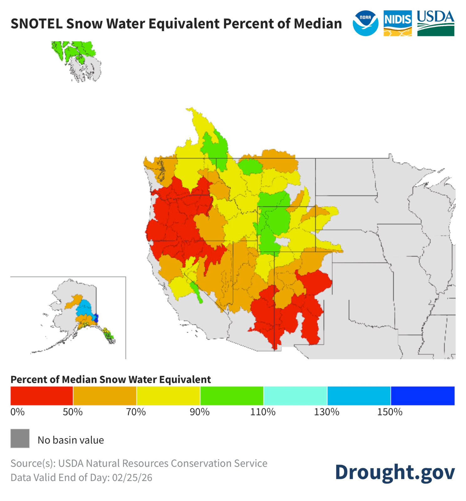
I did expect this winter to be above average in warmth, but this was truly something else. It is all thanks to the polar vortex, which has been stretching repeatedly out east, leaving the west with a massive ridge and extended dry periods as compensation. Still, our slice of the Sierra sticks out as the only near average basin around in terms of snowpack...
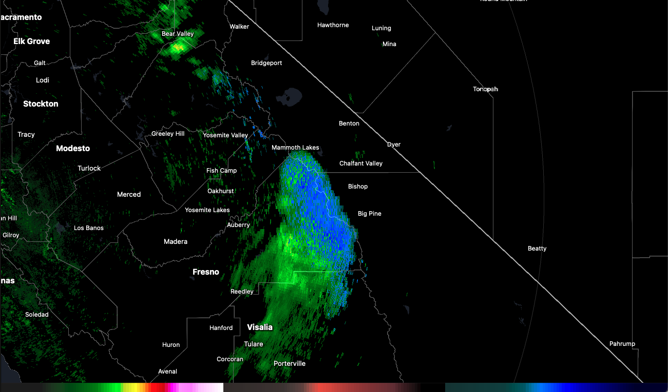
Weak Showers Today
As mentioned, some very weak showers are moving over us today, resulting in 0" in most places with up to 2" possible in localized areas through tomorrow morning.
Fortunately, this brings on a slightly cooler pattern and more consistent freezes overnight.
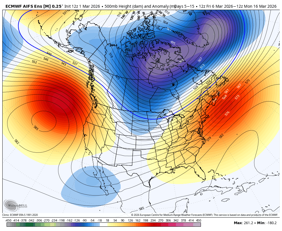
Long Range Dry
My friends, I hate to say it, but the outlook is rather bleak for us into mid march at this point. There is a potent and stubborn ridge setting up off our coast, and it doesn't look like its going anywhere for 2+ weeks. I am hopeful that the spring transition will eventually bring a more progressive pattern, but we are going to have to buckle up for a long dry pattern, again, IMO.
That's the story of the winter, I guess!
Luckily, with the ridge not placed directly over us, we do stay slightly cooler, with more consistent freeze/thaw patterns, and can occasionally receive a little inside slider-type dusting, however this is not a good luck for getting any real storms.
If this ridge backs off several hundred miles to the west, our chances might improve, or if it nudges east, we will be under the torch.
I'm not expecting much precip through mid march though.
Let's hope for something to come sooner rather than later!