Measly March
Overview
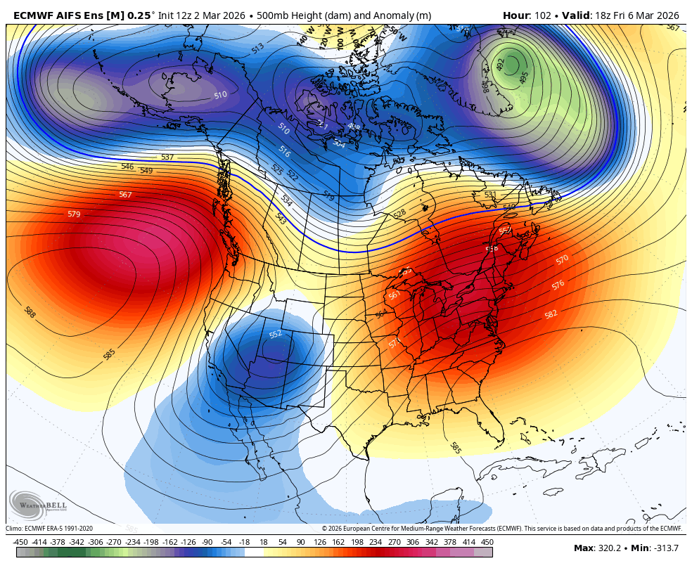
This week will be much colder as a trough amplifies into the great basin. Our outlook for march is very dry, as a majorly stubborn ridge looks to build in off our coast. Unless a shakeup happens that none of the models are seeing, it won't be til the last third of March, possibly longer, until we see precipitation chances return. At that point, the odds are stacking against us as the seasonal change wins over.
Cooler this week...
My friends...
Mammoth mtn reported 1" of snow yesterday, which was right in the middle of the 0-2" range I was expecting. Although, looking outside it looks an awful lot more like hail than snow!

On Wednesday / Thursday, a trough is expected to make its way over the massive ridge setting up off our coast and amplify as it passes over the great basin. This will bring us another chance at a dusting, but it will also bring us howling north winds and much colder temperatures. The high in Mammoth Lakes thursday will be down to 41F, with the mountain not cracking 32F. Overnight lows in the teens.
Expecting 0-1" more snow for Mammoth thru Thursday.
Bishop will be back down to the high 50s as well, but it will be short lived.
Big time block...
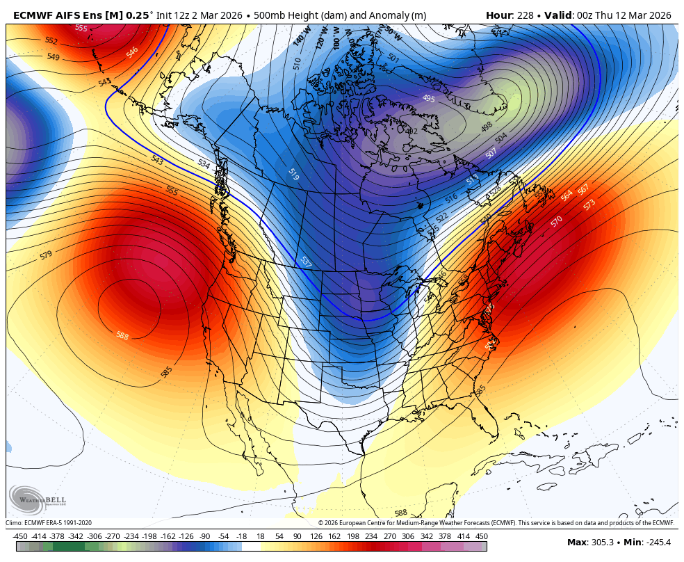
As I have mentioned... A very strong and stubborn blocking pattern is setting up just close enough to shore to ensure we basically miss out on all of the Polar Vortex fun!
This will ultimately stop us from getting nearly any precipitation through the middle of March, possibly even longer, barring a major unforeseen shakeup...
While things will remain a little cooler for us, we really ought to be cashing in on some snow before the seasonal transition takes over.
March is our last core winter month. December through March all average about 64-71" of snow. April drops off to 32.6" and then May down to 8"!... So things start to change really quickly around the end of March. While rare, April can still deliver triple digits (e.g. 118" April 2006!), but it commonly delivers at least something fun!!