Dry March!
Overview
My friends...
While a cooler pattern will persist through Saturday, warmer weather returns next week alongside continued dry weather. There is no end in sight and it could be another 10-20 days before we see chances for any measurable snowfall return.
Cool Thru Sat...
As discussed, it has been much colder the last few days with really solid refreezes and daytime temps not cracking freezing up high.
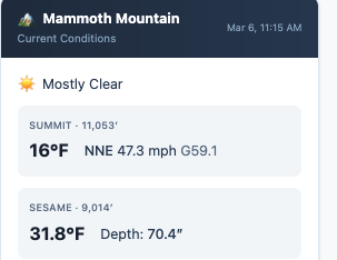
In addition, there is very strong North wind sustained at 45mph with gusts over 60mph!
We will remain cooler thru saturday when we start to warm up much more, reaching high temps of mid to high 50s by early next week in Mammoth Lakes and mid 70s in Bishop.. Low temps will still be low enough to allow a solid refreeze down to 8k.
Stubborn block!
My friends... It continues to look exceedingly bleak for our precipitation chances... Not good!
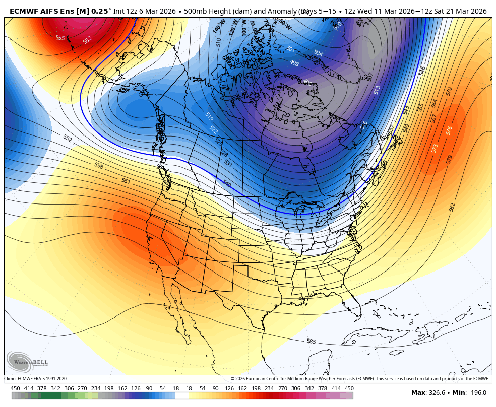
As you know from the previous blogs, this is largely due to the polar vortex stretching back out east, which causes a troughing pattern over the eastern half of US with a compensatory ridge out west. Until the polar vortex decides to play ball, we will not have any chances of precipitation, IMO. It could be until the last 10 days of the month, if not longer.
You just hate to see it! We will be getting warmer as the ridge moves more over us.
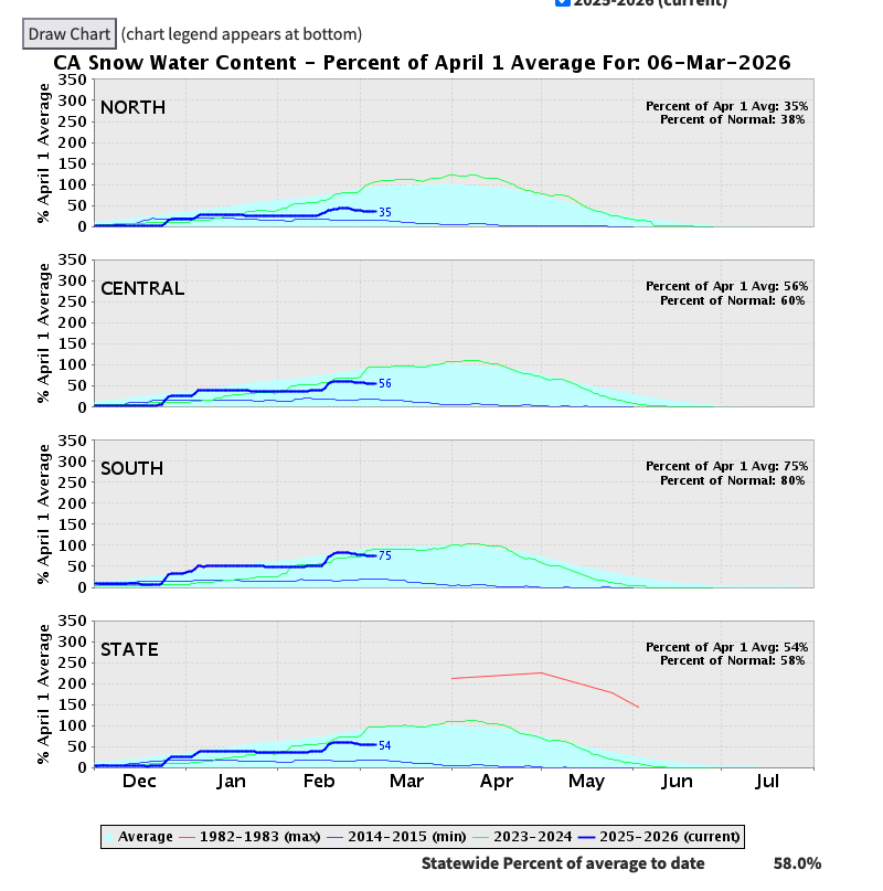
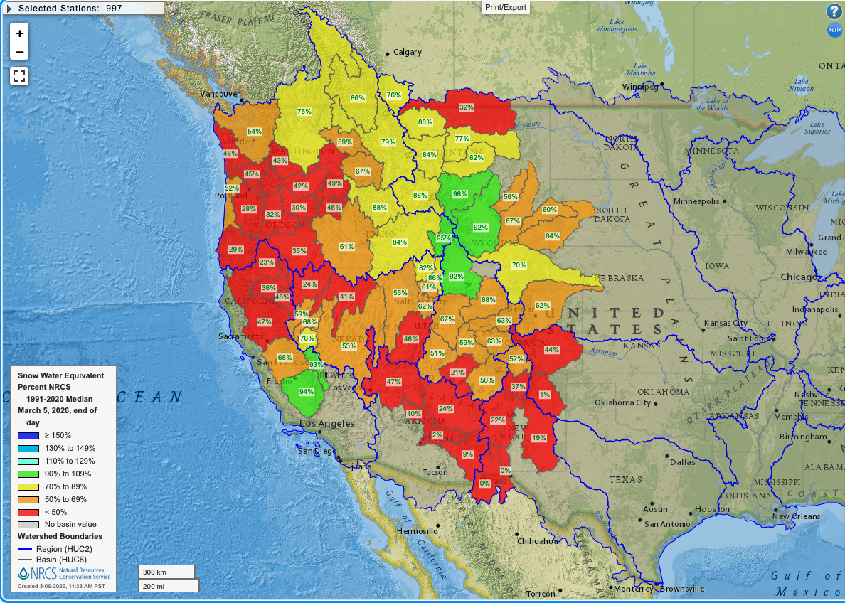
The Central and Southern Sierra did briefly reach or surpass average snow water equivalent (SWE) after those february storms, but rain, no overnight freezes for a week, and howling warm wind ate away at the snowpack. The good thing is, the eastern sierra continues to be the exception for most of the west in terms of snowpack numbers, however our solar aspects and lower elevation snow are officially torched.