Corn cycle and a waning snowpack!
Overview
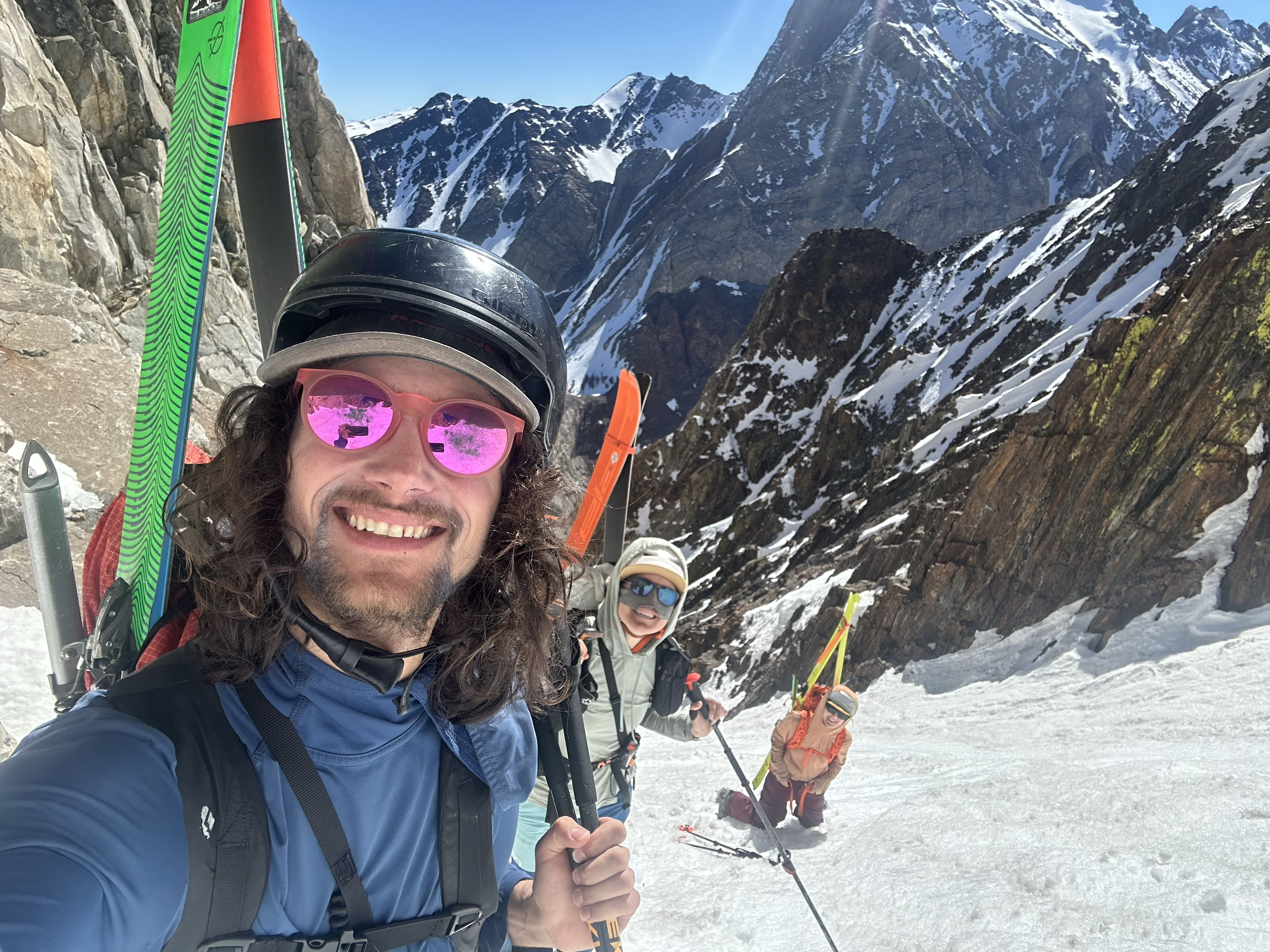
My friends...
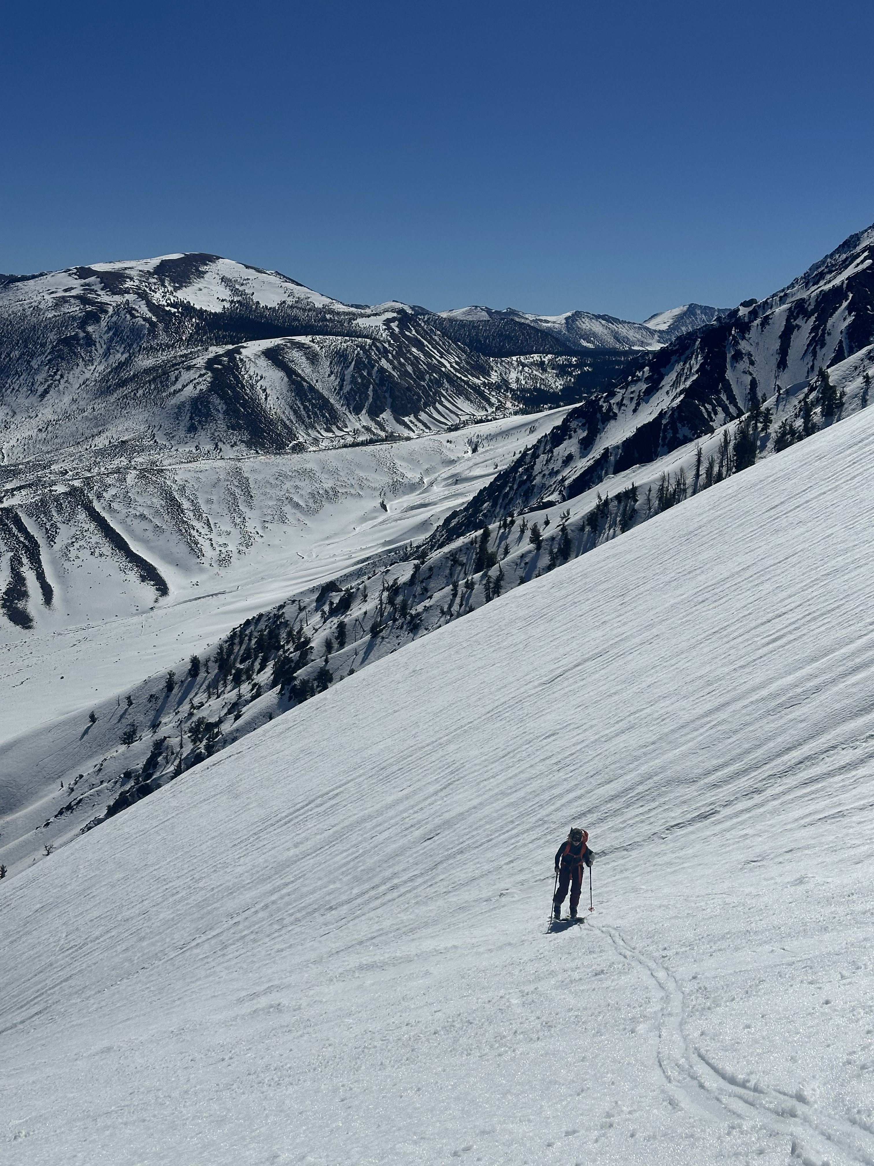
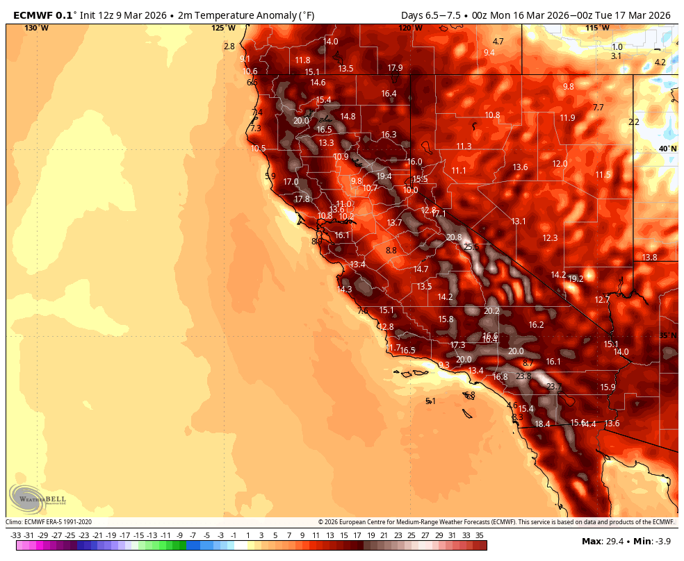
The colder weather gave way the last two days to a corn cycle. I've been having a great time skiing some solar aspects and enjoying the warmth and sunshine! The next few days will result in warmer and warmer weather, and by Friday Mammoth Lakes could be cracking 71F, with the heatwave currently looking to peak by early next week, possibly in the mid to high 70s in Mammoth. Bishop is likely to surpass 80F highs starting Friday...
There is currently no wet period on the horizon, however our chances could improve once the polar vortex begins to retract from out east towards the end of March.
Heatwave...
The temps warmed up quite a lot the last two days, resulting in a great corn cycle after some hard freezes! I've been making the most of the "boring" weather!
This week, a heatwave will steadily build to potential record breaking levels. By the end of the week, we will be in the 70s in Mammoth Lake, and possibly as high as mid 70s by early next week. Looks very hot. This will surely result in more snowpack loss. This heatwave may last for quite some time, unfortunately.
It is all being driven by a big stubborn ridge right overhead.
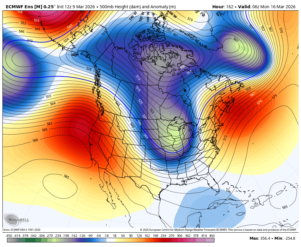
This ridge is going to take some time to dissolve, as the polar vortex continues to run the show, bringing cold weather back out east for the foreseeable future.
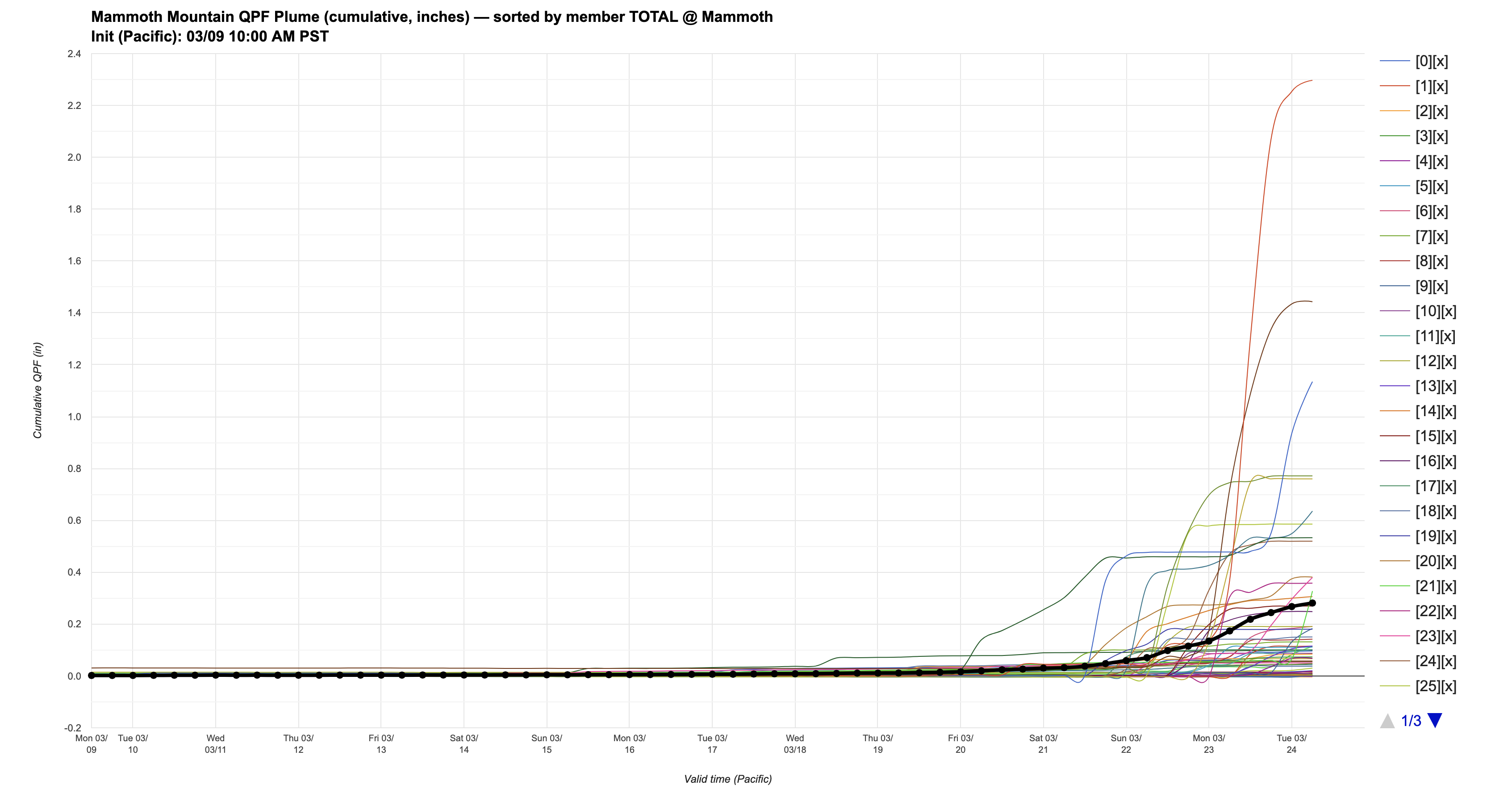
My gut feeling tells me that we will have a much better chance for active weather towards the end of the month, but there is currently not much of a convincing signal showing up for any precipitation at all for the next 15 days. Here is the latest DeepMind ensemble plume for Mammoth Mountain, with most members showing nothing, and only a few with some storms starting to show up towards the last week of March. Buckle up my friends!
Snowpack
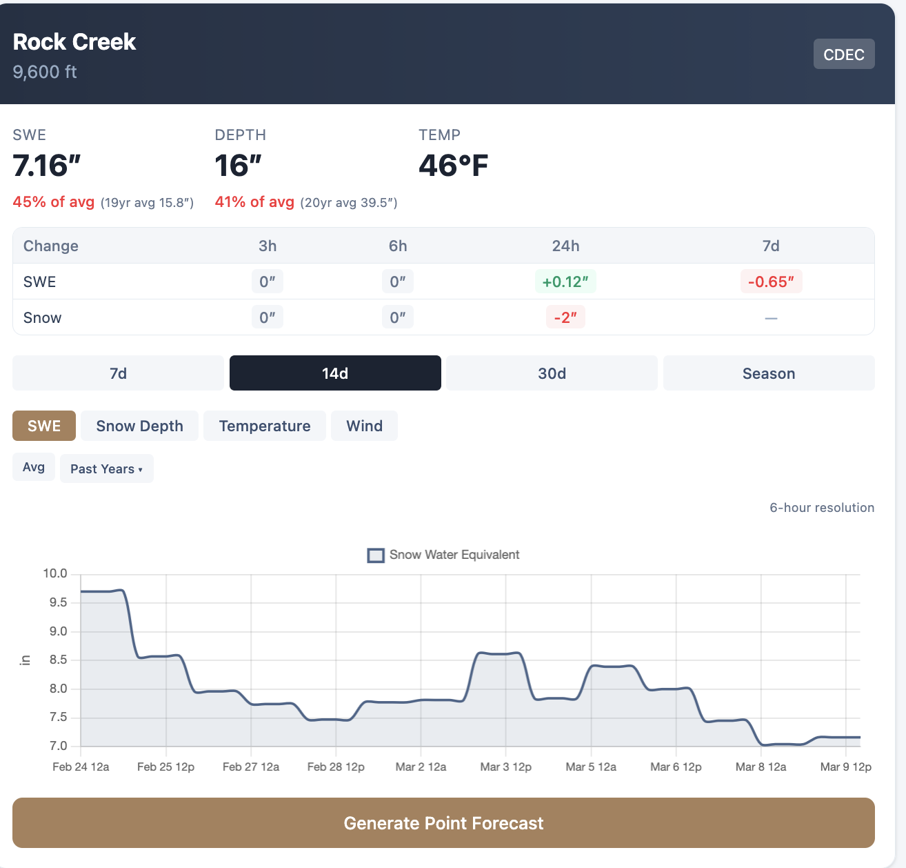
My friends... Some sites around the Eastern Sierra are holding strong for snowpack, with others, not so much. You can play around with all the sensor data on the "Weather Map" tab of this website. Rock creek is at 45% of average SWE.
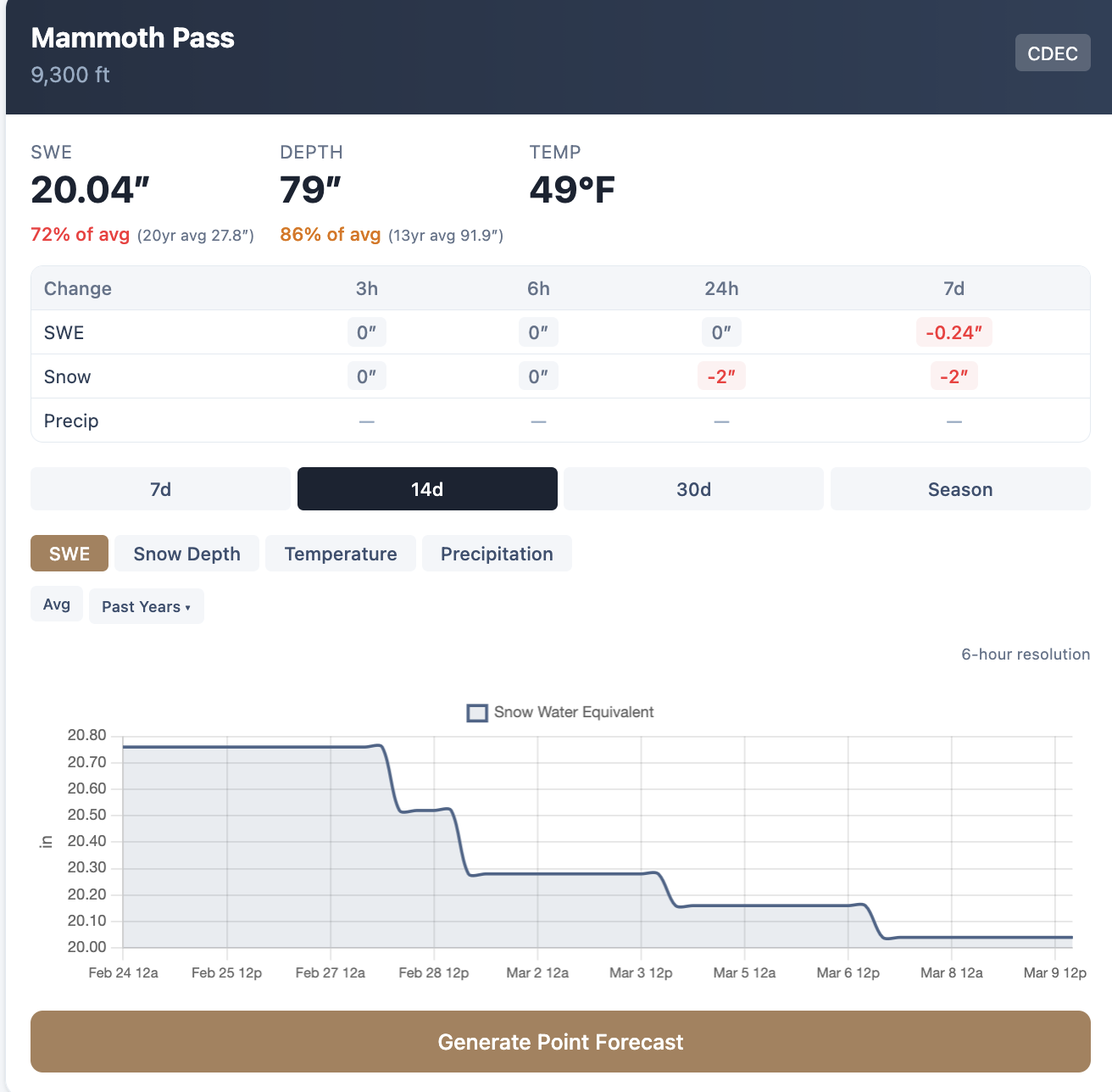
Mammoth pass is at 72% of average SWE to date.
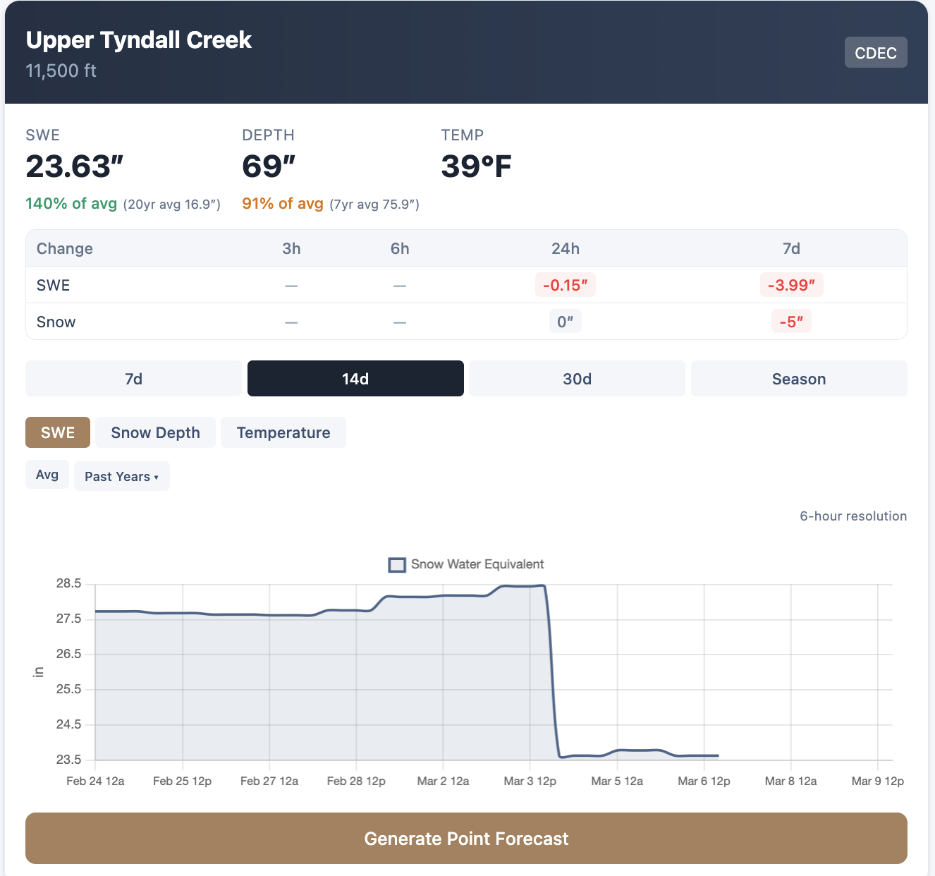
Down south, the numbers are better relative to average in most places, with Upper Tyndall Creek at 140% of average to date. Crabtree meadow is 146%.
However, with no storms on the horizon (during a time where SWE is supposed to be building), and with this major heatwave, these numbers are probably going to get a lot lower over the next two weeks.
Hope for a change in the pattern sooner than later, we need it!