A weak pair of storms coming...
Overview
My friends...
Today is the last day of very warm weather. By tomorrow, our long-hyped pattern change arrives. As of now, I'm expecting it to bring in about 4-8" of snow through Thursday to Sierra Crest areas and Mammoth Mountain. Two storms will impact the state. The first one is a shot of moisture Tuesday morning - Wednesday morning from a weak trough. This is our most impactful storm of the event. The second storm is an upper level trough impacting primarily the Tahoe area northward from Wednesday evening through Friday. It is somewhat of a nothing burger in our area, aside from very heavy winds Thursday. Details below...
Storm Tuesday - Thursday
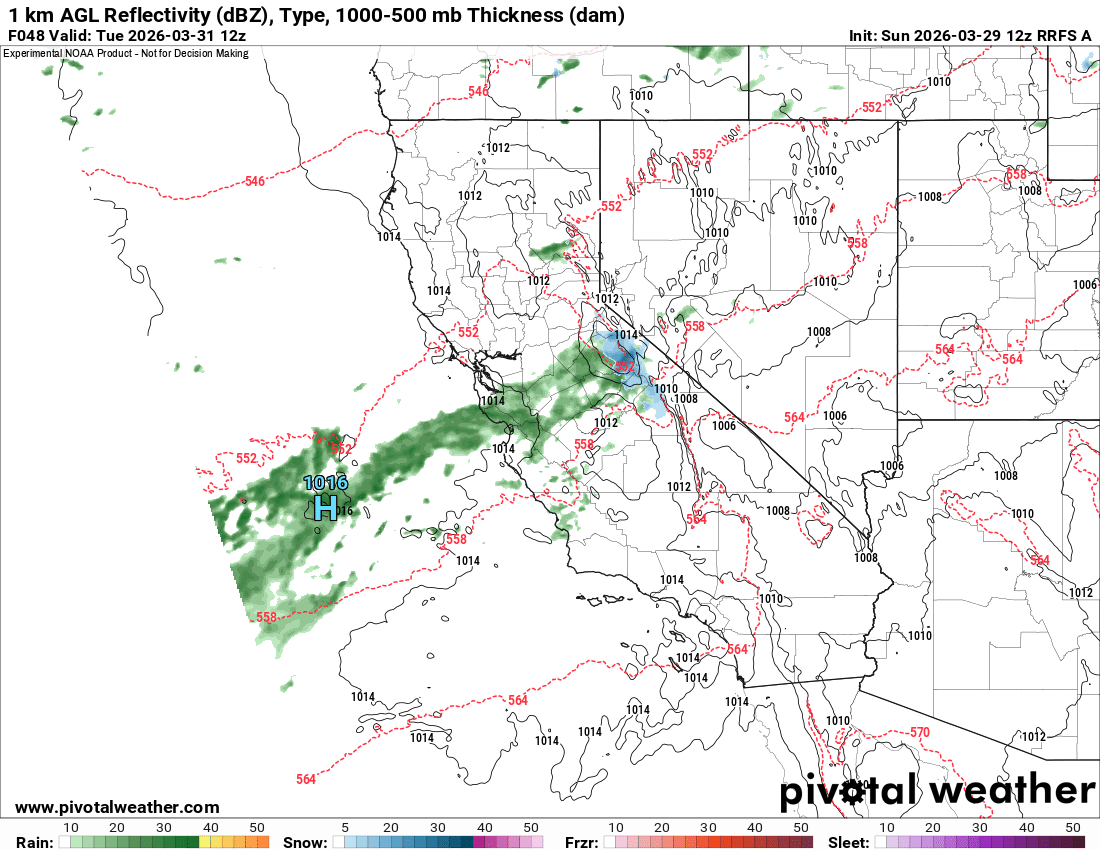
Two very weak storms will impact the area. The first of the two will arrive early Tuesday AM, and looks to be the most "impactful" for the Eastern Sierra. A relatively narrow and weak plume of moisture will bring snow showers through Wednesday AM between CA Hwy 4 and the Sierra Crest west of Lone Pine. Snow levels will fall from ~8300 down to ~7300'.
For Sierra Crest areas westward, including Mammoth Mountain, I'm expecting 4-8" of snowfall from this. Rain shadowed areas may see some spillover, but most places east of the crest can expect about 0-4".
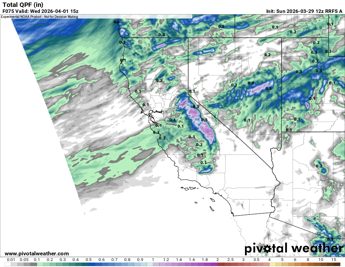
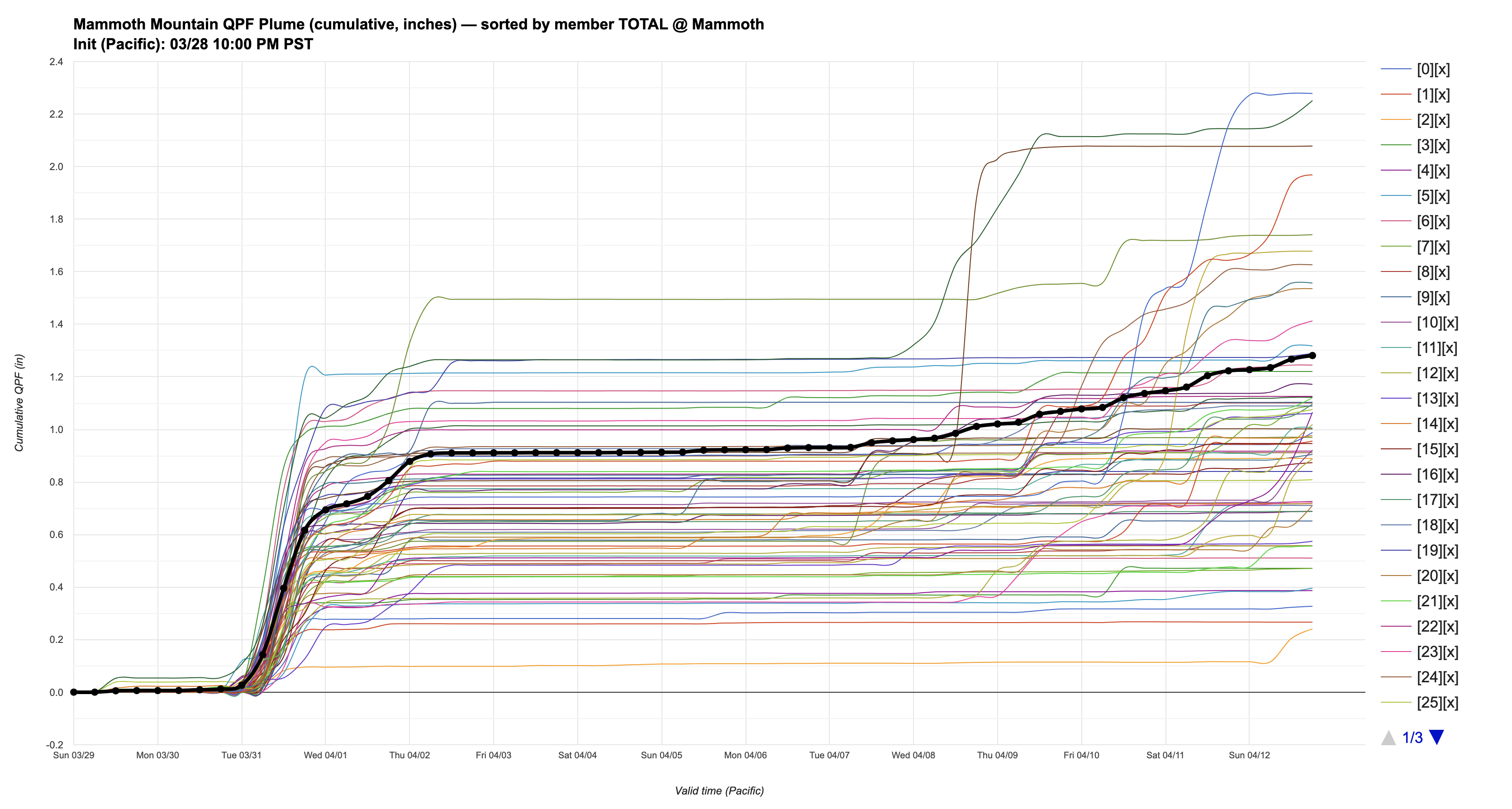
The RRFS shows 0.9" of liquid for Mammoth, whereas the Euro model shows around 0.6-0.7".
Overall, this is not a very convincing storm, with not much cold air or dynamics attached. Pretty much just a shot of moisture.
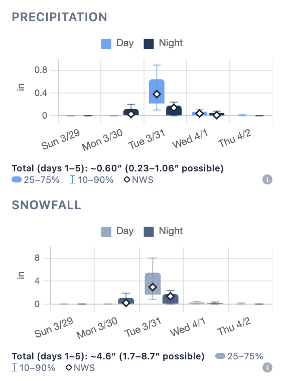
I will note, there is still a large amount of uncertainty remaining, shown through the box and whisker charts on eastsideweather.com...
Winds look to be around 30-45mph SW over ridges through Wednesday.
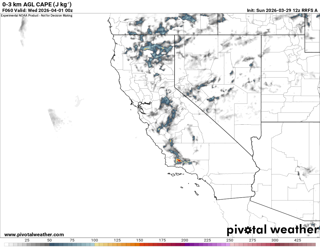
There is a little bit of convectivity behind the storm, and some weak cells with the occasional thunderstorm could start popping up Tuesday afternoon as the storm clears and the sun heats the surface.
The second upper level trough moves in shortly afterward, on Wednesday, bringing heavier showers and snowfall to Northern California and the Tahoe Area. Most models show this as somewhat of a nothing burger for us, with maybe 0-0.3" of liquid equivalent. However, the ICON model shows this much stronger in our area. We will have to wait and see.
As of now, for us, the most impactful part of this second trough looks to be the associated ridgetop winds. On Thursday, there could be as high as 70MPH SW winds in our area!
Longer Range
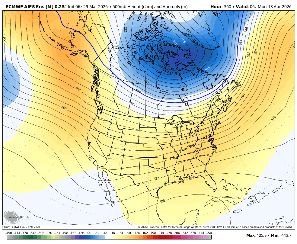
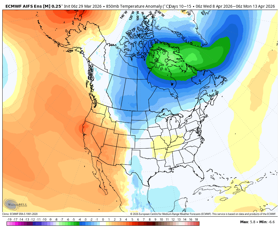
As mentioned, a there is a weak signal for Gulf of Alaska troughing in the long range. This keeps us on the cooler side of the ridge, with occasional chances for a shortwave to bust over and deliver weak scattered showers. Looking at the DeepMind plume, you can see a little bit of "noise" in the extended range, but nothing coherent or strong.
At the very least, this keeps us slightly cooler, but still above average temps wise. We should at least see a consistent freeze / thaw cycle!