A pattern change is coming. A big storm? Not so fast...
Overview
My friends...
Heat continues through the weekend, with a slight cooling trend. By Monday, a pattern change is afoot, with much colder temps on the way. By now, the hype is out of control regarding a major storm "dropping 1-3 feet" for Mammoth Mountain. People are already booking their trips to chase pow. Not so fast. If you recall my last blog post, I pointed out the vast amount of uncertainty in the ensemble guidance, and said it was too soon to hop aboard the storm train. Well, the trends have been to significantly weaken the amount of precipitation we will see in the Eastern Sierra. Model uncertainty still remains high for the upcoming window.
Last Few Days of Heat...
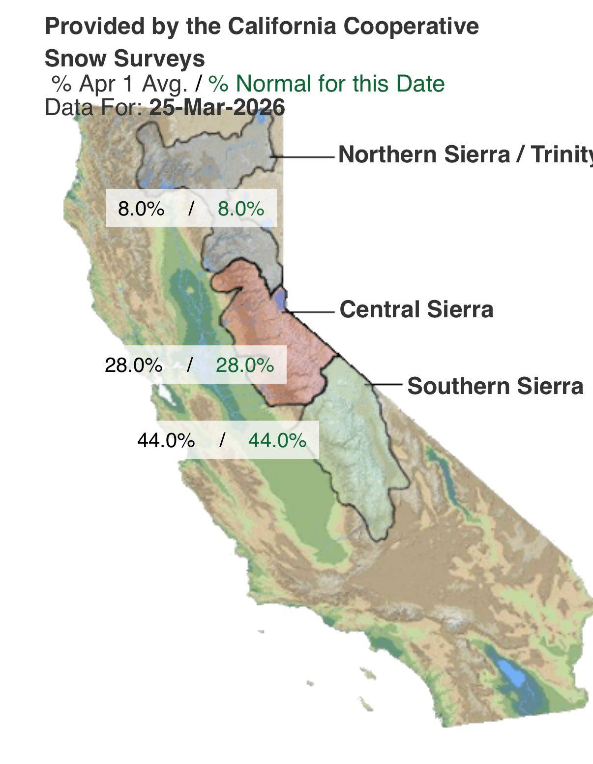
Our historic heatwave is slowly on its way out. The resulting snowpack loss has been extraordinary. The Northern Sierra is now at 8% of average for the date, with snow barely remaining at all. The Southern Sierra is around 45% of average for the date. Ouch!
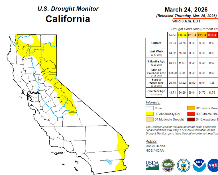
In addition to that, abnormally dry conditions have returned to the Sierra Nevada. We started the year 100% drought free, the first time in 20+ years, but it was short-lived. This heat wave hurt us badly, but luckily is on its way out over the next few days as a major pattern change is brewing.
Big Storm Coming... Not so fast, April's fools!
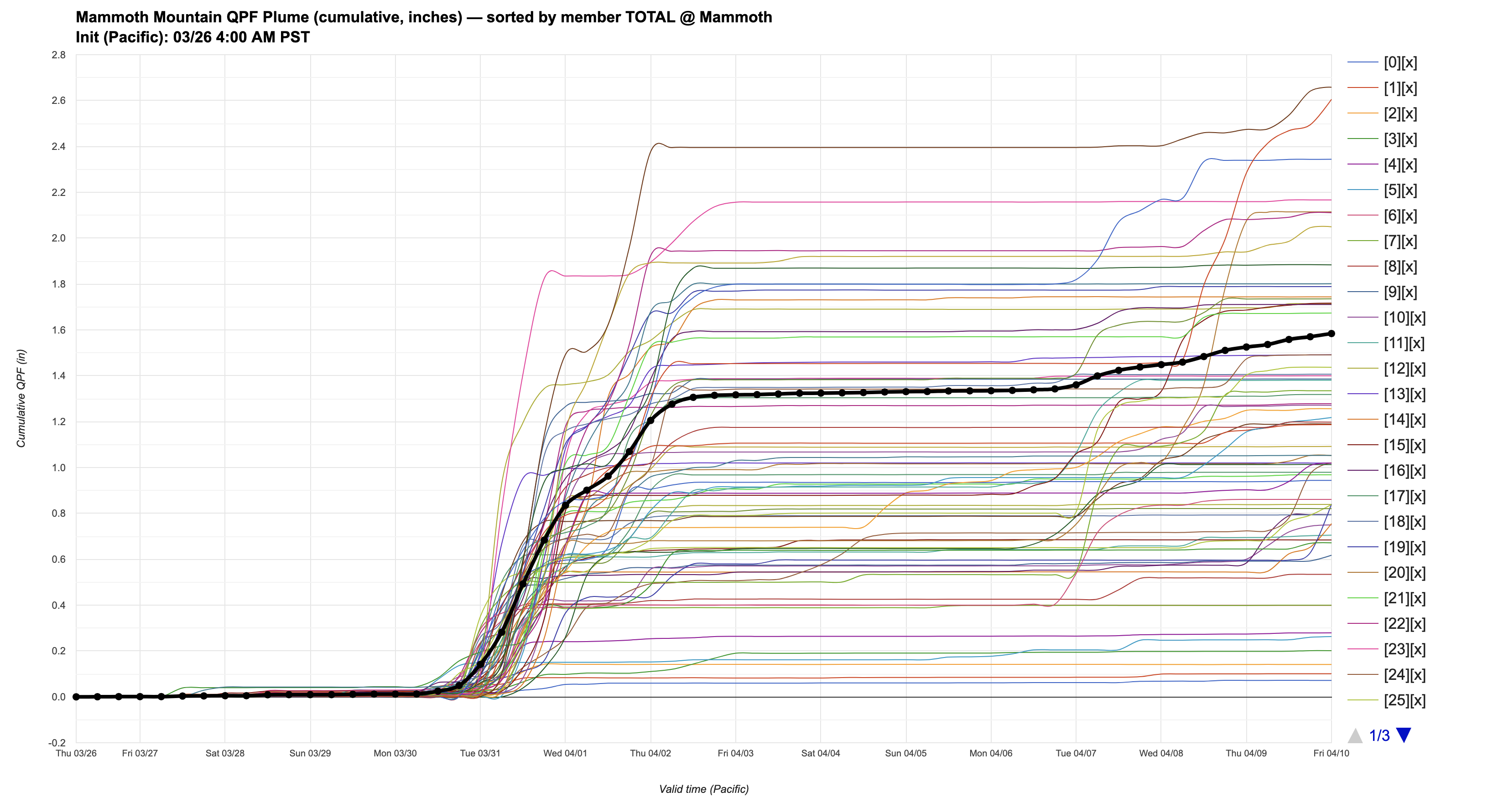
My friends... The hype has been out of control regarding the upcoming storm. The April's fools are coming out in droves, promising 1-3 Feet of snow for Mammoth Mountain, booking up hotels, etc. If you recall my last blog post, this is somewhat premature, as a significant amount of uncertainty remained around the amount of precipitation. The DeepMind plume from 03/24 showed an average of 3.5" of precip, with an enormous spread from 0.1"-6" of liquid equivalent. Well, it has come back to reality, with the drier scenarios now faring better. All of the other ensemble suites have trended down significantly as well. And to tell you the truth, if "The Trend Is Your Friend", well then I don't like the way this thing is heading at all.
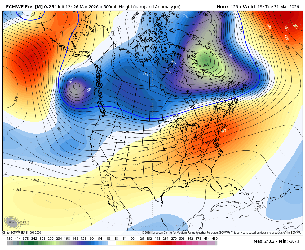
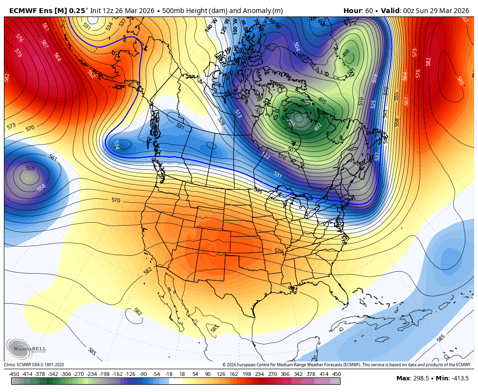
There are a few problems here. The models were previously showing two troughs impacting us, the second one stronger than the first. Well, trough #1 does still seem likely to impact us, bringing weak to moderate showers to the Sierra. This one is weaker and less convincing than it was a few days ago, and is not trending favorably for us.
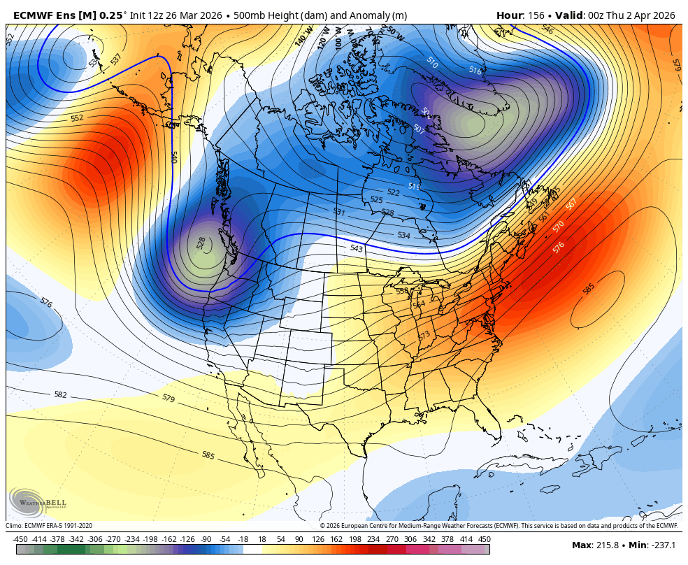
The second trough, originally shown to bring us the heaviest showers, is shifting significantly northward. It does look like the Northern Sierra will see substantial precipitation from this, but it leaves us on the drier side of a disintegrating front, and with higher snow levels.
Finally, we can take another look at the DeepMind plume, showing over 1" of liquid equivalent from this storm window, BUT, the same problem still exists. An enormous spread of outcomes, including mostly dry scenarios. So my friends, our "storm window" for next week is STILL NOT A LOCK!
Longer Range...
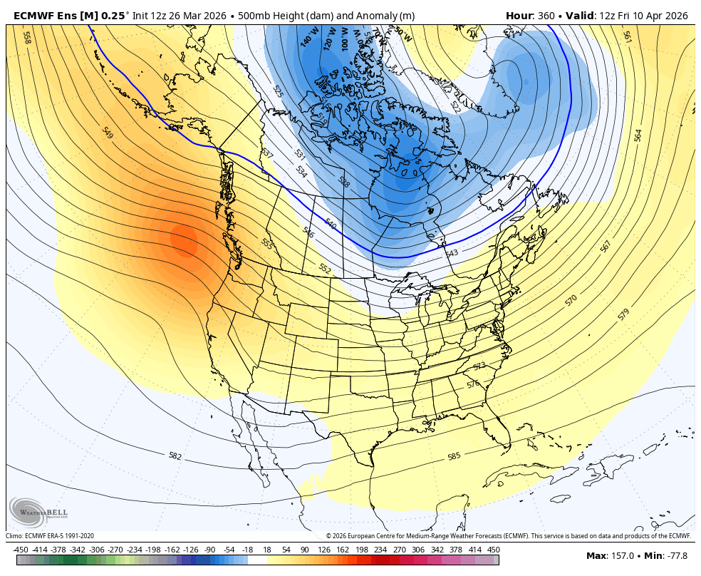
Longer range, this pattern change will bring in much cooler air and a consistent freeze thaw cycle for the first time in two weeks! Remarkably, the summit of Mammoth Mountain (11,053ft) will have gone over two weeks without dropping below 32F... Just crazy.
However, I don't really see us setting up into a sustained active pattern, and a blocking ridge of high pressure builds in over the Gulf of Alaska. This should keep us cooler than our heatwave, but doesn't really give us a good opportunity for storms to creep in.
Now, as we are heading into late March and April, keep in mind that model uncertainty is really high, so things can change fast. However, the jet stream is weakening significantly, and our chances of seeing a strong storm get lower and lower each week...