A pattern change coming? But first, more heat!!
Overview
My friends...
Today was another very hot day on the Eastside. Thankfully, today marks the beginning of a slight cooling trend over the next 5-6 days, with models hinting at a storm window from March 31st - April 3rd. This should usher in much colder temps. Models are currently split on how much precipitation we will see, hinting at anywhere from 1-3" of liquid equivalent. Temps look cold enough for this to be all snow in Mammoth Lakes, with snow levels even as low as 4-5k!
Heat Continues...
Today was another hot day, reaching 88F at the Bishop Airport. Until last Thursday, this would have been enough to beat the previous March all-time temperature record. The duration and intensity of this heat are remarkable, and historic!
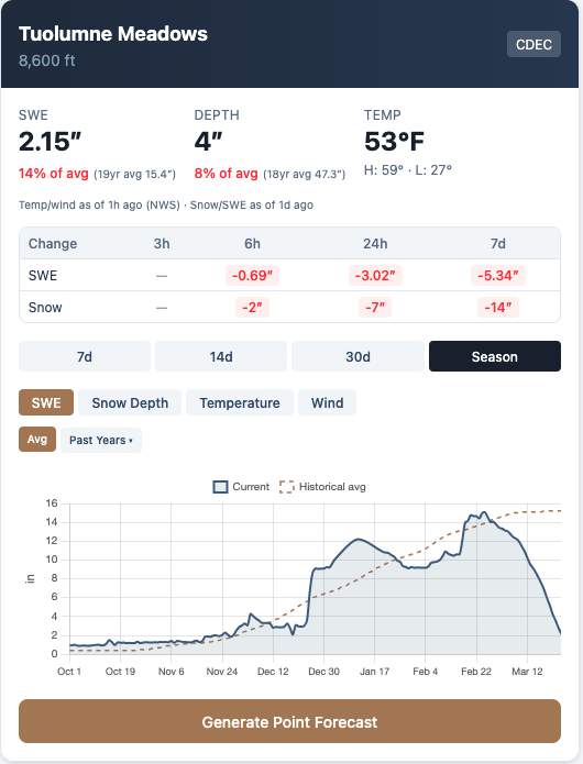
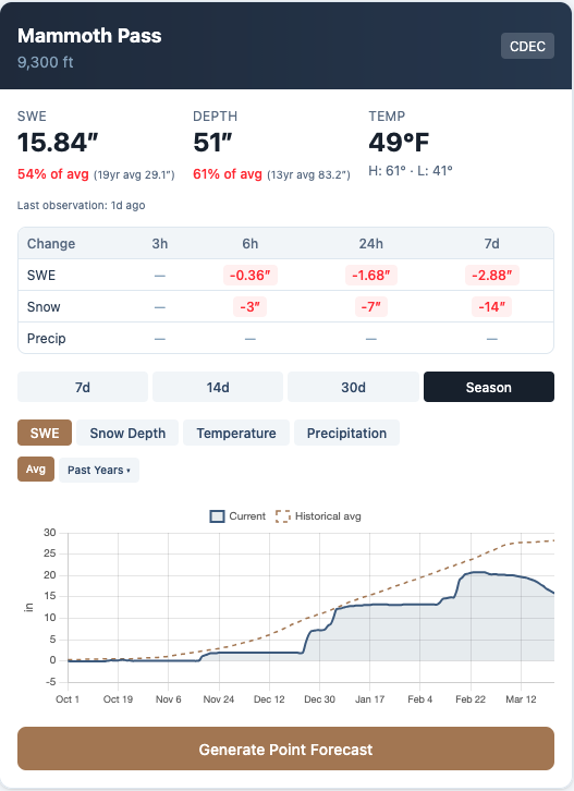
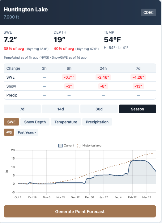
The resulting losses in snowpack, especially at mid-elevations, have been astounding. Palisades is closing a month early. Eagle is closing after this weekend, and Canyon is on limited time, IMO. It is likely the most dramatic decline in snowpack for the month of March that CA has ever seen. Here's a smattering of snow sensor stations around the range...
I can't believe it, but we still have 5-6 days of significantly above average temps to get through as the ridge takes its time dissipating.
Storm Window Mar 31st - Apr 3rd
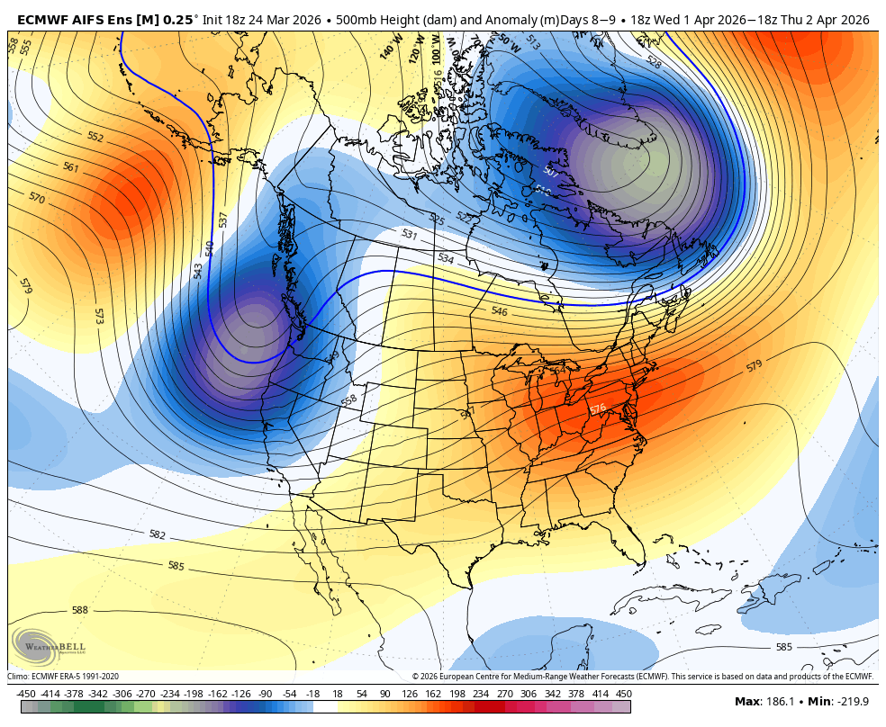
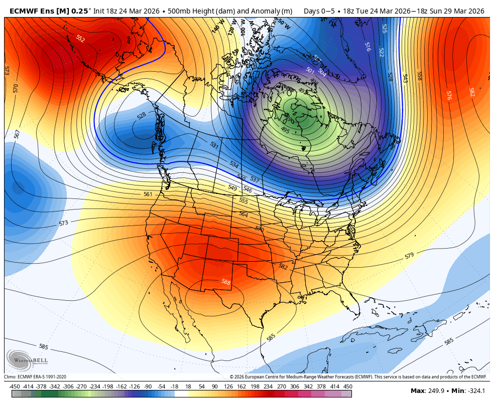
Models have been steadily amplifying the signal for a pacific trough making its way towards CA between Mar 31st and April 3rd. We are nearing a time when model skill decreases dramatically due to shortening jetstream wavelengths, however, they have been very consistent in showing this signal for several days now, and it is trending more coherent each day.
This should bring in much colder temps, and snow levels look like they could even get as low as around 5k at times in the Eastern Sierra. Talk about weather whiplash!
My friends, there is still a load of uncertainty regarding this system, and I want everyone reading to be cautiously optimistic that there is some powder coming our way within the next week. However, taking a look at the DeepMind WeatherNext2.0 ensemble spread, you can see the issue:
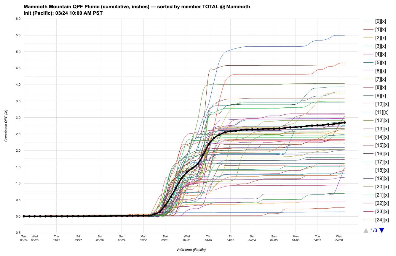
While the ensemble average is close to 3", which would be a really solid storm, there are plenty of members showing much less than that. So the signal is still pretty scattered, and we will need to wait a few days before we write home about a big-time AR coming to CA. It's just not locked in yet.
PS. this is also one of the most valuable aspects of the DeepMind WeatherNext2.0 ensemble. It is meant to be more dispersive to catch possible outlier scenarios. This also means it doesn't latch on to a pattern prematurely.
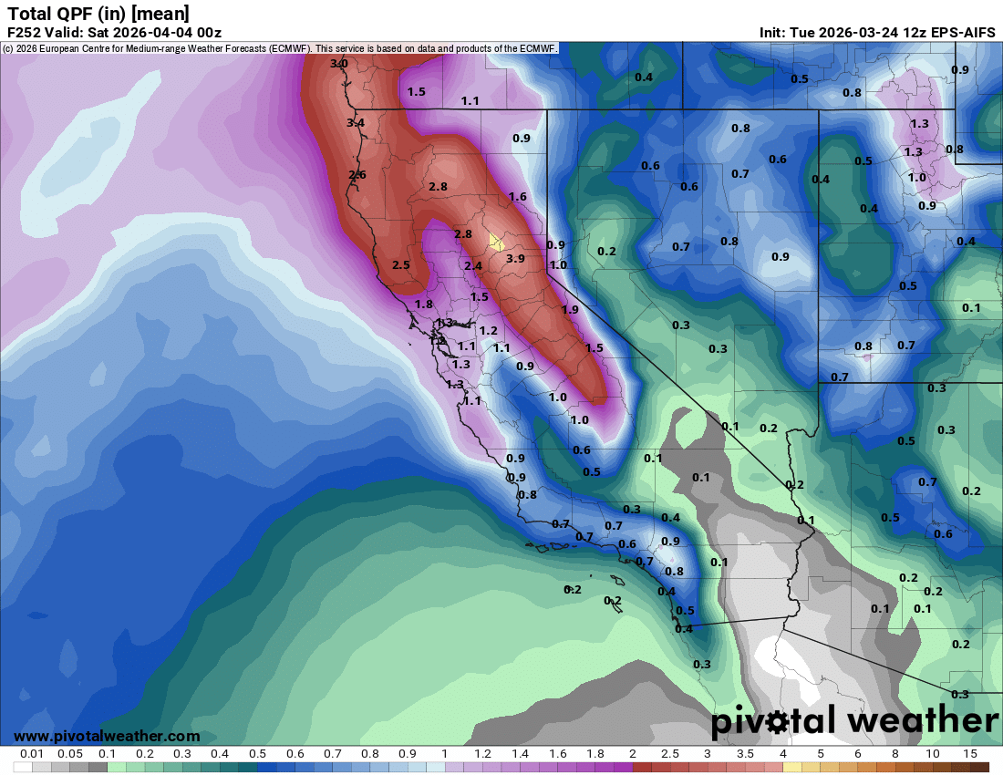
Some operational models are showing a pretty hefty storm coming our way, like the Euro below:
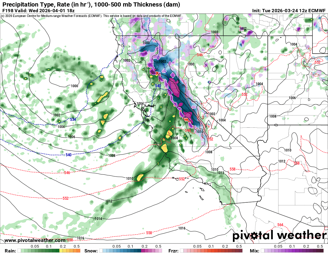
However, until more ensemble members hop on board and we get this thing within 5 days, anything could happen!
At the very least, it looks like we will see some active weather, as well as much cooler temps, and the ensemble averages are very promising to look at!