More Heat this Week and a Possible Pattern Change...?
Overview
My friends...
Our intense heatwave shattered many records across the nation, including all-time March high temperature records at both the Mammoth and Bishop airports. A paltry cooldown this weekend resulted in slightly lower temperatures, but unfortunately the high pressure ridge is rebuilding for another peak in heat this Tuesday, lasting through this next week.
By the beginning of April, a pattern change appears to be afoot, with ensemble guidance showing a pretty cohesive signal for a Pacific trough to impact CA. Right now, it is not clear whether it will be a small or a moderate storm, but it does not currently look like a stronger storm.
A slew of records!
The heatwave has been truly remarkable. I will soon write a blog about the magnitude of the event, and discuss how climate change significantly increases the frequency and magnitude of events like this one. Stations were shattering all-time heat records for March for multiple days in a row, and even surpassing April records at times.
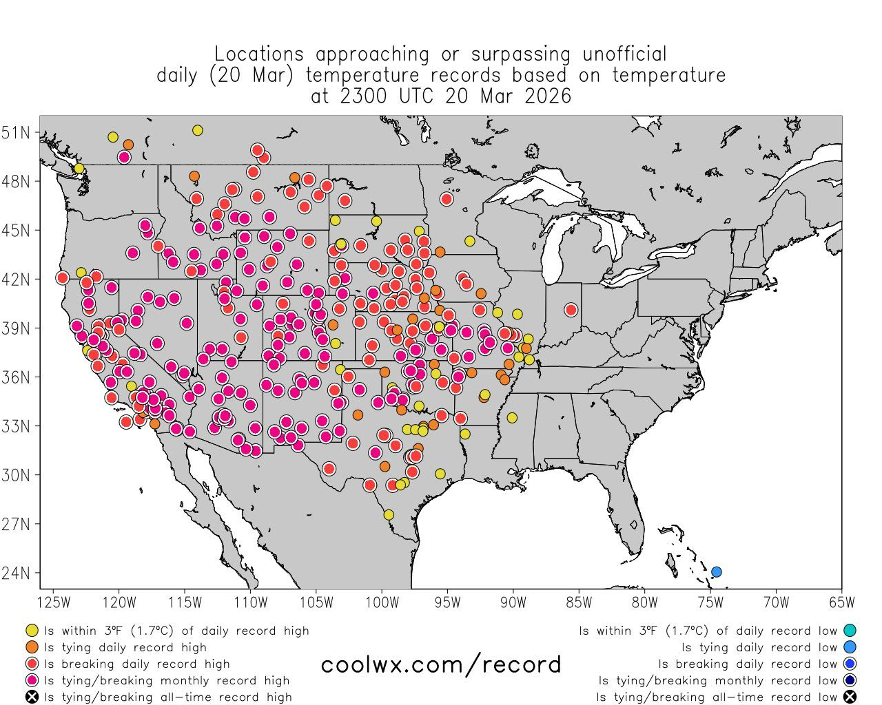
The last few days, the intense heat has moved across the country, bringing record-breaking heat to the plains and southeast as well.
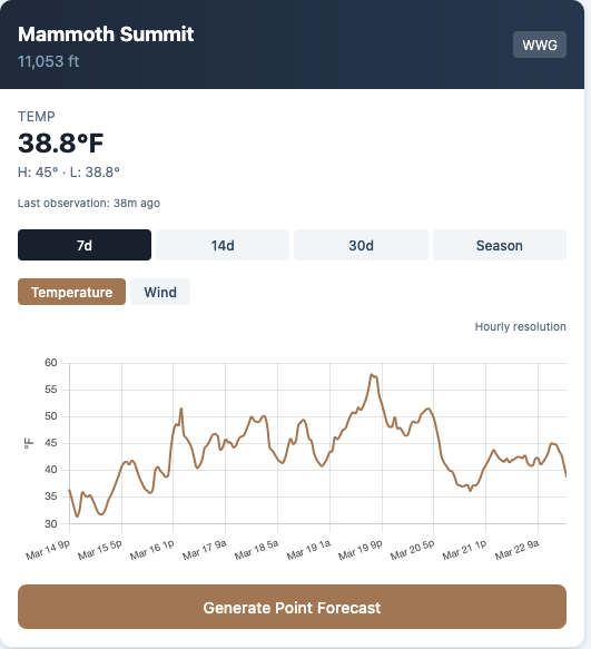
Locally here in Mammoth, the presence of strong overnight inversions has left us without a refreeze on the summit of Mammoth Mountain (11,053ft) in... 7 days!!! In March!
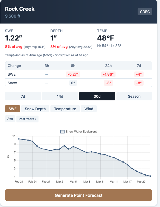
These poor overnight refreezes have not allowed our snow to reset, and places have hemorrhaged snowpack. Rock Creek has 1" of snow left on the ground, and it will probably not survive the next few days.
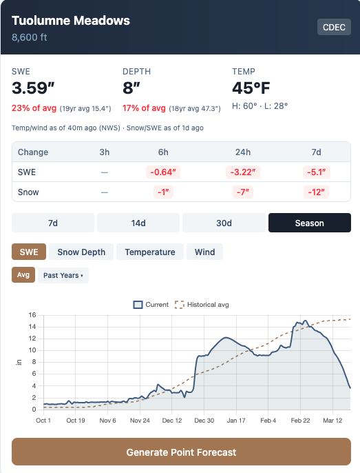
This graph of seasonal snowpack from Tuolumne Meadows shows the drama clearly, especially when compared to the average line, which increases steadily until April. It had seemed several times this season that monstrous storms had salvaged our snowpack. Each time, a relentless ridge set up in response to a downstream Polar Vortex stretch, and our snowpack declined heavily between storms. What has happened since February has been truly historic, and one of the worst March declines in snowpack for the Sierra Nevada ever.
High Pressure Rebuilds
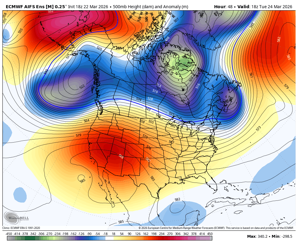
High pressure rebuilds this week for a brief peak in heat on Tuesday, and above average temps through next week. Relentless! It should cool off gradually towards next weekend, but remain above average.
A Storm Window?
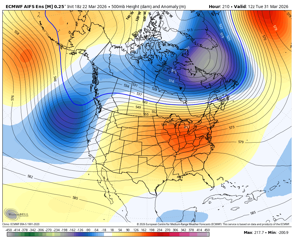
Models now show a much more coherent signal for a storm window between March 31st and April 3rd. A decent pacific trough will make its way towards us, but how impactful it is remains to be seen.
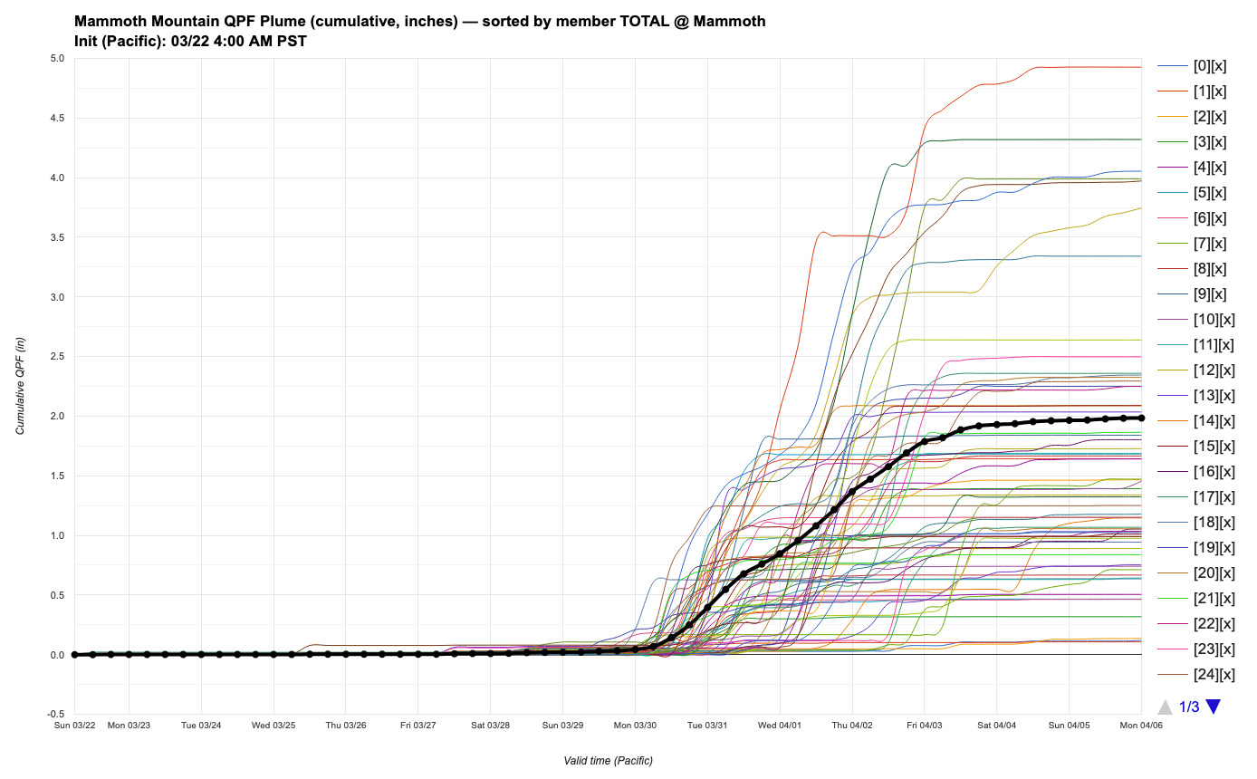
The latest DeepMind ensemble plume shows the vast range of outcomes that are possible, with an average of 2" of liquid for Mammoth Mountain. That could potentially be a moderately impactful winter storm for us, but there is still a lot of time for things to change. Lots of heat to get through before then too!