New Record in Bishop, Heat Reloading Next Week...
Overview
My friends...
After an all-time March high temp record was broken yesterday in Bishop, today will be an even hotter day. The ridge causing our heat will relax slightly this weekend, which will enable a small cool-down of a few degrees. But by Tuesday, it will reform right overhead driving another spike in intensity. While it does look like we will be on a slight cooling trend after Tuesday, unfortunately the anomalous heat looks like it will remain through next week.
We have no precipitation coming until the last day of March, when a strengthening signal in ensembles suggests we may have a chance at some active weather. Confidence remains low at this time.
New Record!
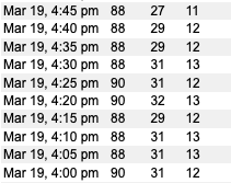
The Bishop airport broke a record for all-time March high-temperature yesterday. While the old record was 87F (March 31, 1966), yesterday it reached 90F briefly.
The heatwave reaches its ultimate strength today, and that record could be broken a second time!
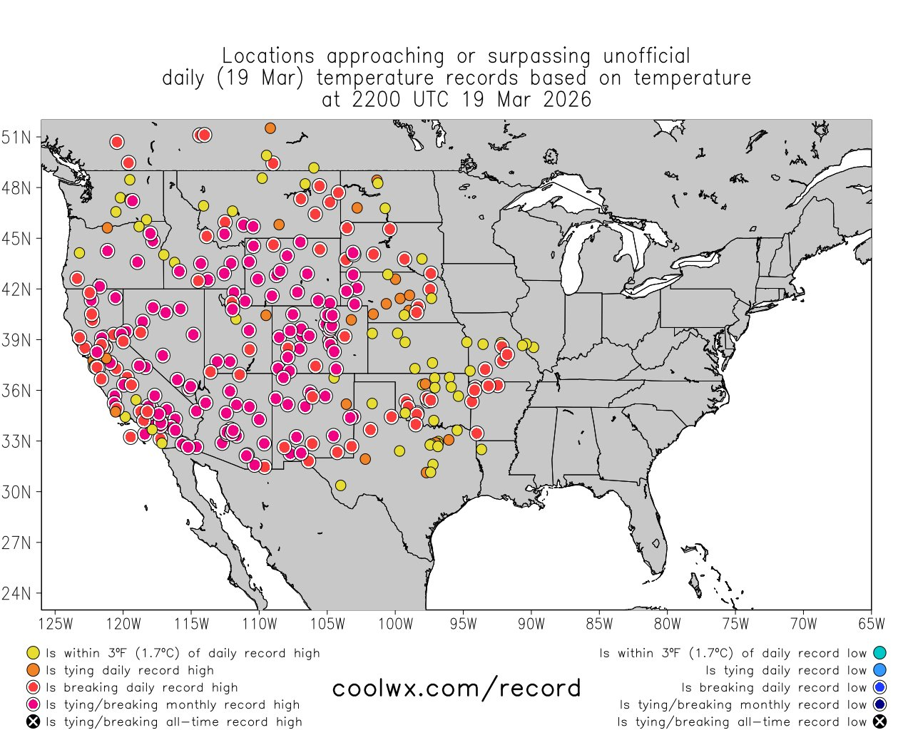
The slew of records going down across the country in recent days is astonishing. For example, Phoenix reached 106F degrees, shattering the previous March record and surpassing the April record of 105F. Here is a graphic showing all the records broken yesterday...
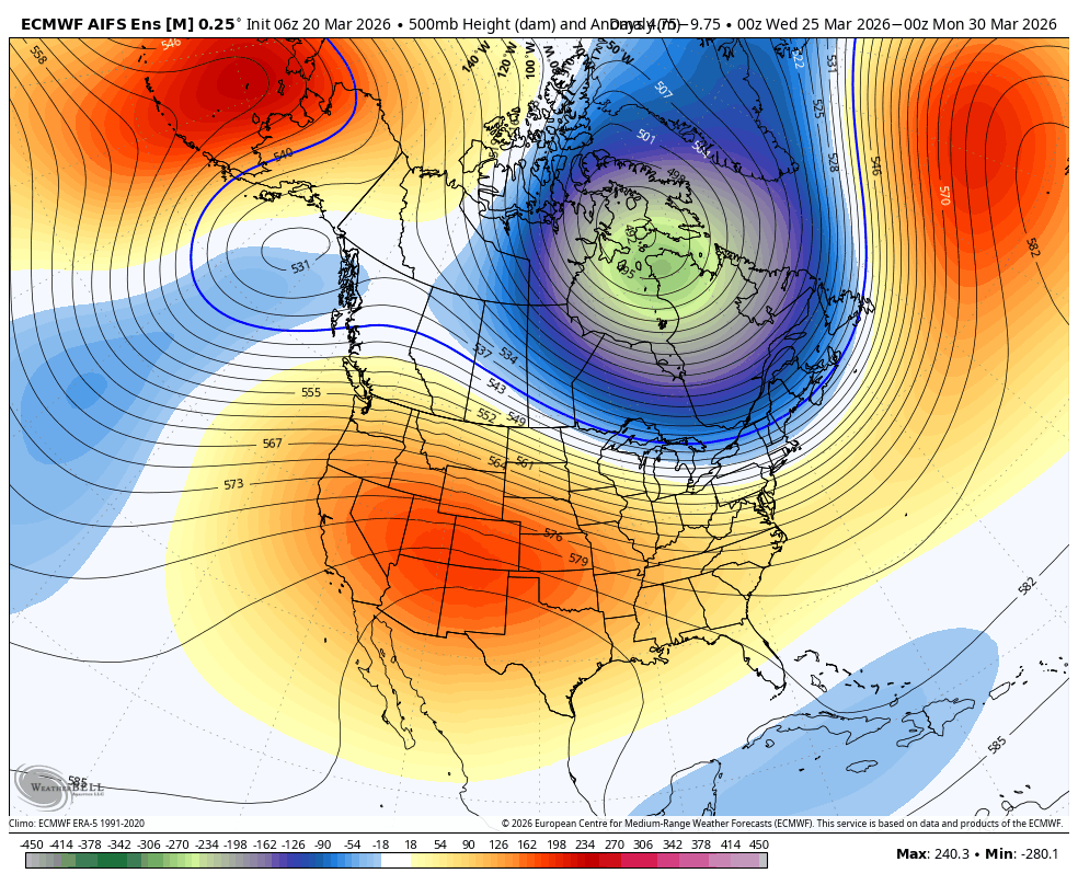
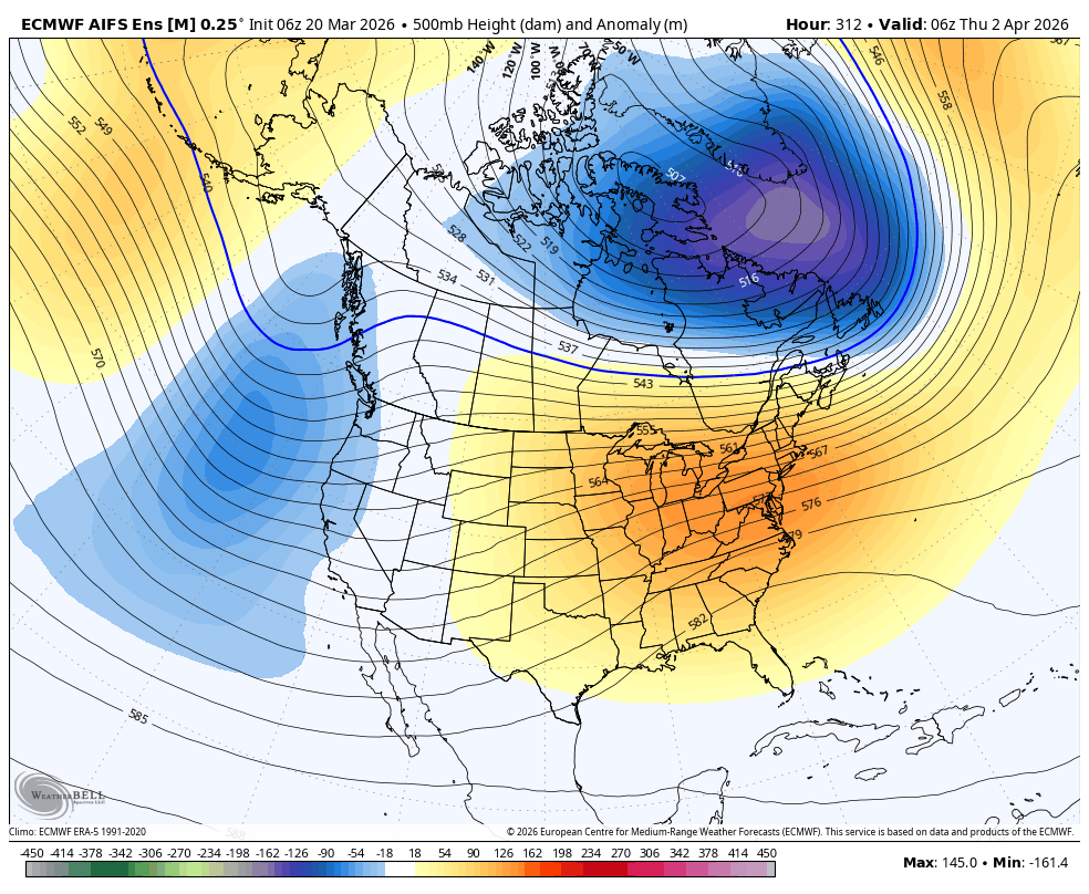
While the heatwave very slightly backs off due to a flattening ridge, it reloads again on Tuesday as the ridge builds in over us...
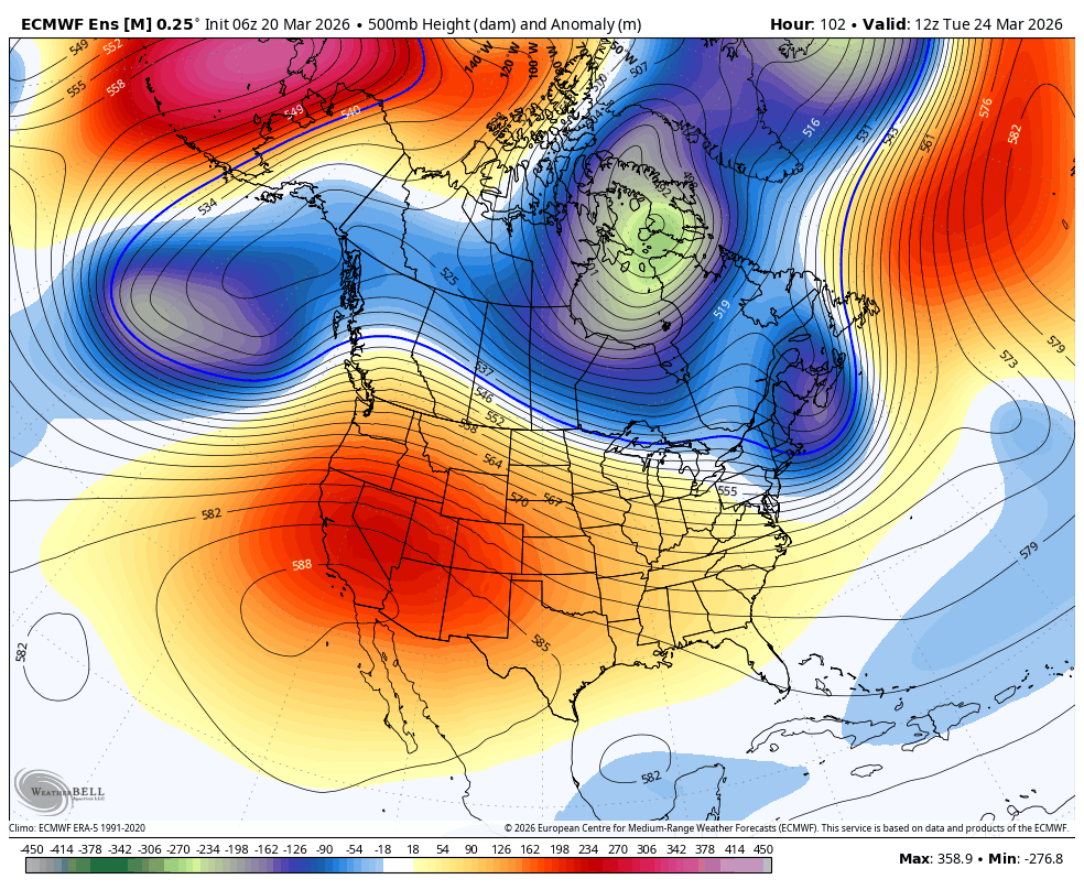
And, unfortunately, high pressure remains entrenched over the west until the last day or so of March. That means above average temps for another 10 days... Yikes! Extraordinary doesn't even begin to sum it up.
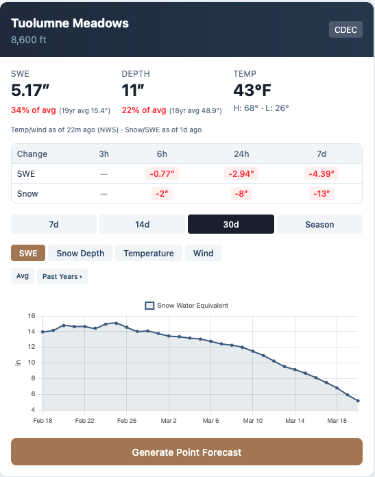
Sadly, the melt from this has been and will continue to be prolific. Just over two weeks ago, Tuolumne Meadows had around 15" of SWE, and is now down to 5"..
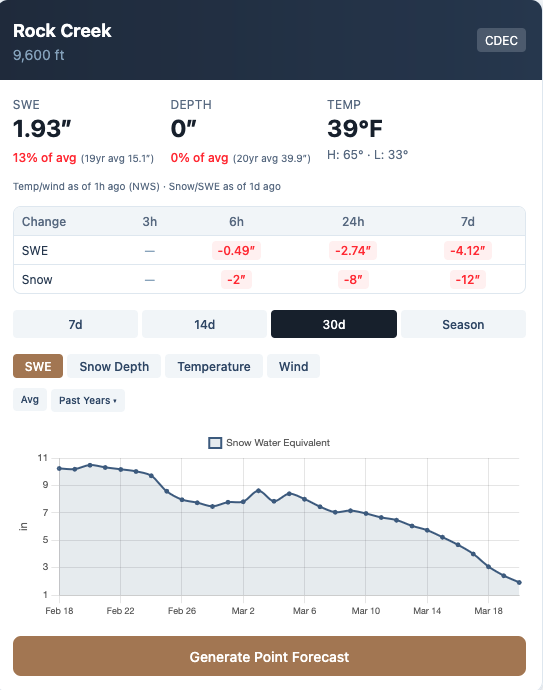
The Rock Creek station is on its last leg at under 2" of SWE.
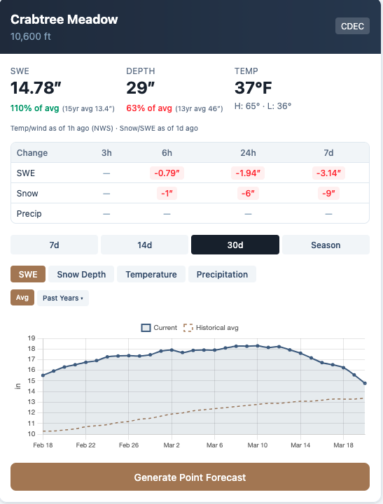
Only some of the highest and more southern stations are still holding strong relative to average, and even these are taking quite a hit right now. To think that the melt started on Feb 20th this year, pretty much 5 weeks early, is astonishing.
Active Weather...?
Let me start by saying that I am not bought into any of the current trends on the models yet. I'll need to see this signal show up for a few more days before I get my hopes up. BUT...
Remember that incredibly diffuse signal for a West Coast trough at the end of the month? Well, it is ever so slightly less diffuse now. But still not a coherent strong signal.
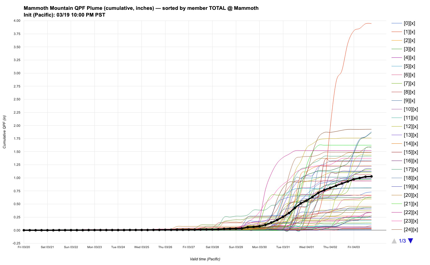
The result on ensembles is about half of them show a weak or moderate storm impacting California in the March 31st - April 3rd time range... Here's the latest DeepMind ensemble plume. Definitely not no signal, but the ensemble suite is definitely pretty split between the moderate storm and no storm.
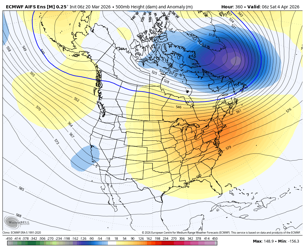
At the 15-day range, the ensemble signal essentially flattens out completely, and confidence on any pattern out west is 0. But there is a slight signal towards East coast ridging and finally a warm up for the Northeast. This also makes me feel better about the polar vortex signal and stubborn East Coast troughing regime finally disappearing...
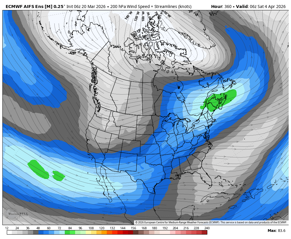
In addition, the Southern jet stream is waking up, which could drive active weather across the plains and midwest. In addition to that, it could start a more zonal spring-time pattern, and could even undercut the ridge with occasional chances for moisture into April. These are all big ifs, but all we have to look at right now!
Westerly Wind Bursts and what it means for our possible developing El Niño!
My friends, as I discussed on the 3/15 blog, we are on the cusp of an El Niño, and potentially a strong full-basin El Niño per seasonal modeling. I mentioned how there are "Westerly Wind Bursts", which have occured frequently this winter and help push warm subsurface water eastward via downwelling Kelvin waves, from the Maritime Continent into the ENSO region. They are driven largely by MJO forcing.
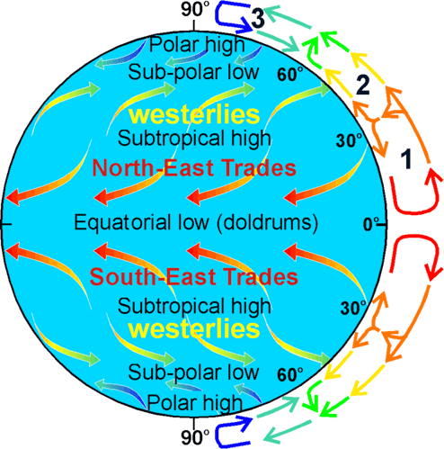
Typically, the winds in the tropics blow from east to west (the prevailing easterlies). This helps maintain the pool of warm water in the western Pacific and suppresses warming in the eastern Pacific. However, in a Westerly Wind Burst (WWB), the winds reverse, sometimes dramatically. This process can deepen the eastern/central Pacific "thermocline" via downwelling Kelvin waves and promote surface warming farther east.
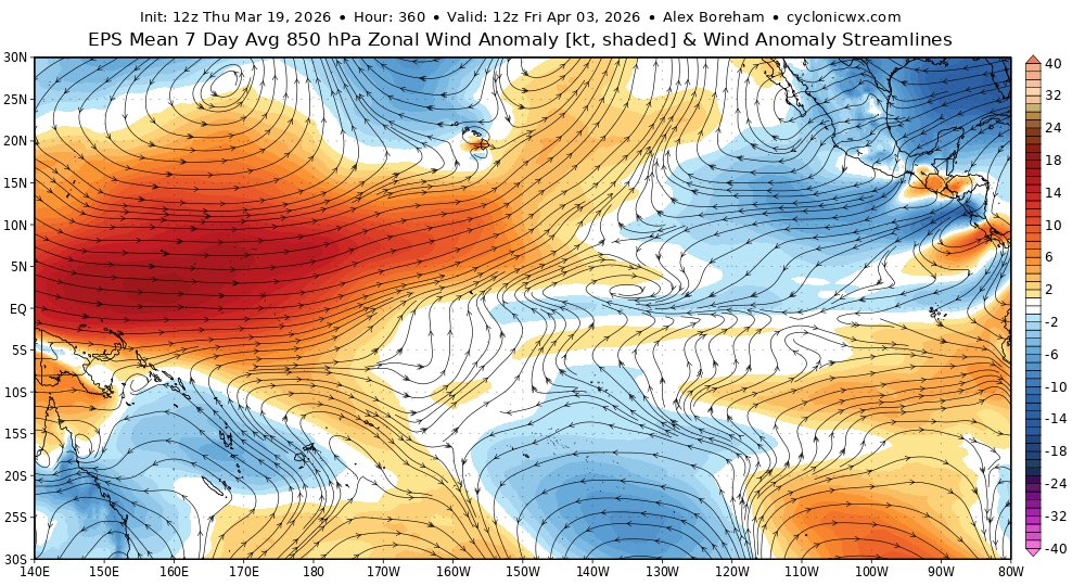
Well, models are currently showing a very strong, potentially record breaking WWB occuring over the maritime continent in response to MJO forcing. There has been a lot of chatter about how this ups the high-end potential of our developing El Niño by quite a lot. Time will tell!
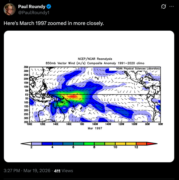
As a part of the interesting discussion surrounding this, @PaulRoundy1 drew a parallel to a WWB event from March 1997, which preceded one of the strongest El Niños in recorded history.