Dog days... of winter?
Overview
My friends...
Record breaking heat is ramping up across the west, bringing with it prolific snowpack loss, as well as many all-time monthly heat records. The heatwave will reach its peak Thu/Fri over the Eastern Sierra, with all-time monthly records in jeopardy for Bishop and Mammoth Lakes. This intensity will slowly back off into next week, while above average temperatures remain. There is currently no stormy period on the horizon, with a bit of noise for something at the end of the month, but it is not very convincing...
Unprecedented Heat
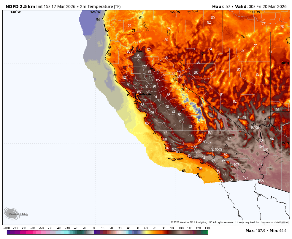
Starting today, hi-temps in Mammoth will surpass 70F until the end of the week, and hi-temps in Bishop will surpass 85F as well. On Friday, it looks like the all-time March hi-temp record in Bishop (87F, March 31st, 1966) could go down. It is currently forecast to be as high as 91F. By Monday and Tuesday, temps start coming down but remain well above seasonal norms.
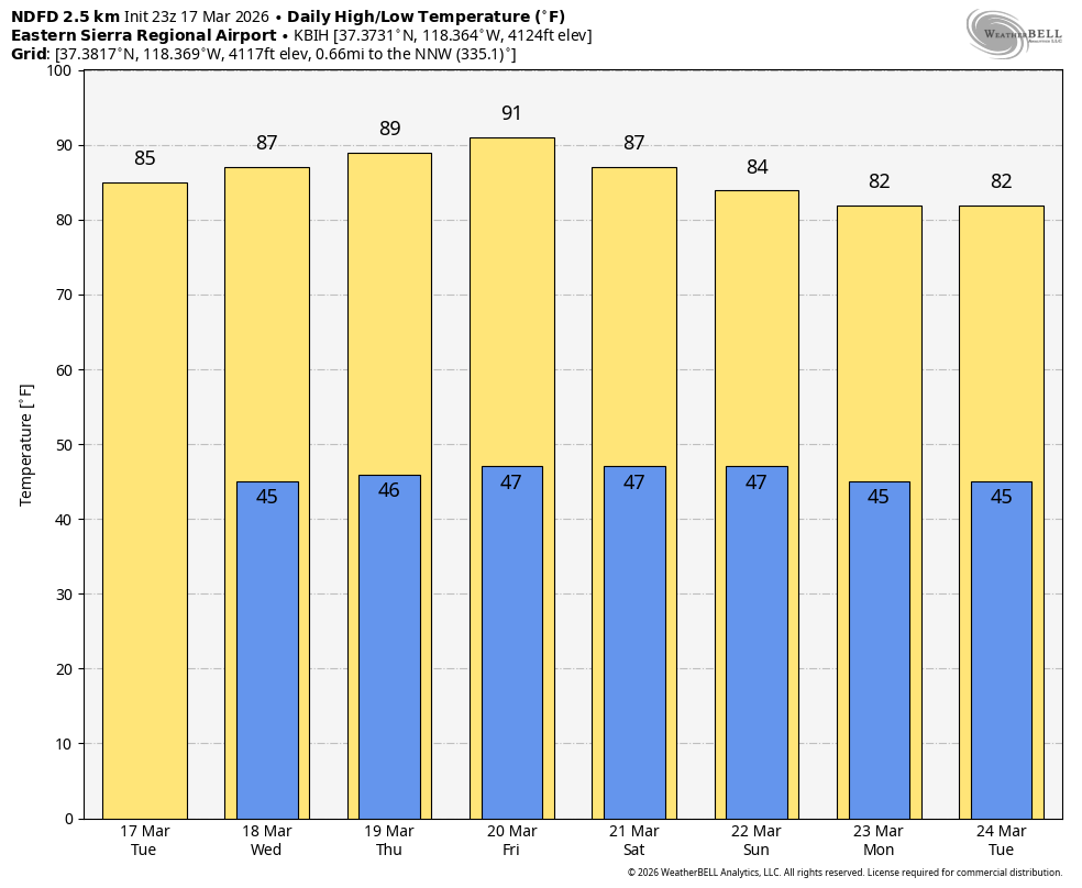
While high-pressure may weaken from its record breaking levels, it does not look like above average temps are going anywhere at day 10+. Ensemble guidance now shows weaker high pressure to our east...
Of particular note and concern with this heatwave is the warm air aloft and presence of overnight inversions due to high subsidence. Last night, the low temperature on the summit of Mammoth Mountain (11,053ft) was 43.2F. Unreal. It means that even under clear skies, the snowpack is unable to cool sufficiently overnight due to warm air aloft and strong inversions, limiting radiative cooling and preventing a convincing refreeze. As a result, avalanche danger will be on the rise throughout the week, as I don't see a convincing refreeze until at least the weekend. Please head to esavalanche.org for avy information.
Noise End of Month
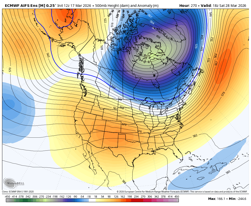
Some operational models have been showing storms making their way into CA towards the end of March. The truth is, this signal is very diffuse, and not shown consistently across ensemble members. The vast majority of ensemble members still show CA as completely dry through the end of the month, with a broad, low amplitude signal being shown for a west coast trough by the EC-AI ensemble.
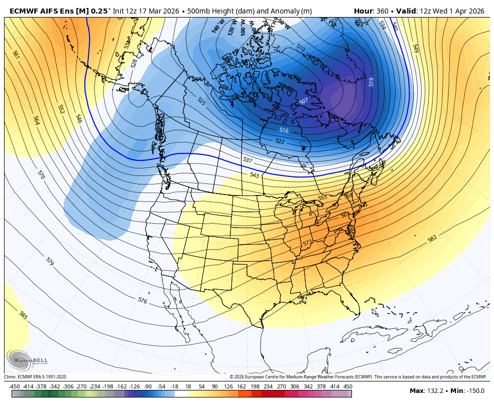
This is an incredibly diffuse signal, and at 15 days, is subject to change.
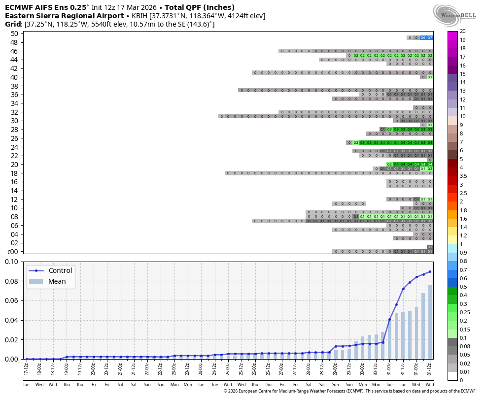
The above graphic is known as a meteogram, and it shows the output for each ensemble member in the Euro AI ensemble suite. Almost all of them show no precip, and the ones that do show any show very little. Sad but true!
Snowpack
Sadly, I believe this to be the knockout blow for much of our Sierra Nevada snowpack, especially at low and mid elevations.
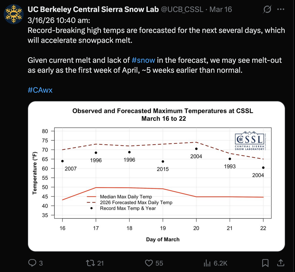
Yesterday, an individual at the UCB Central Sierra Snow Lab speculated that the melt out would be complete by the first week of April at the lab, which is 5 weeks earlier than average.
A west which is badly starved for snow all winter will see prolific melt, and with no cooler temps or storms on the horizon, we are cooked. Good game, my friends, and may we find better luck with our snowpack next season. I briefly discuss a developing El Niño in the last blog post if you want to check it out.
There could very likely be more storms coming, but it doesn't look good as far as we can see using model guidance.