Record breaking heatwave... Winter is Over.
Overview
My friends...
It is hard to overstate the enormity of the heatwave that lies ahead. A truly monstrous March heat wave will bring a mid-summer feel to most of the west. Elevations of 8-9k will be in the mid 70s across the west, and parts of SoCal will reach over 110 degrees. This incredible heatwave will persist until at least 3/20, with early ensemble guidance hinting it could reload beyond that point.
Major Heatwave
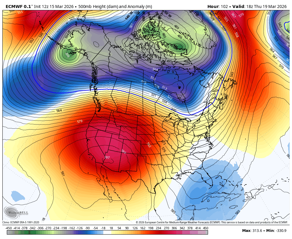
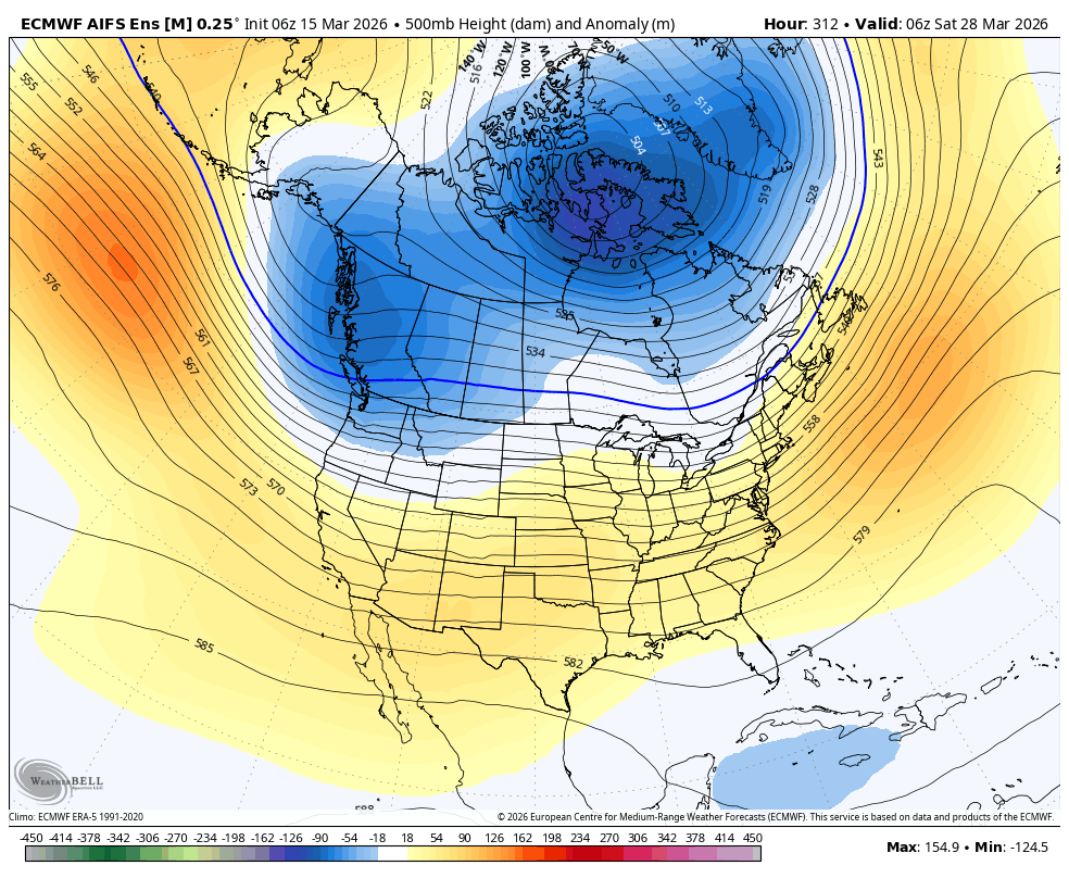
Today is the last "cooler" day, before an extreme "heatdome" builds in, lasting until at least next weekend. It is truly set to be a historic early heatwave, rivaling midsummer temperatures. The word unprecedented gets thrown around a lot in weather discussions, but this is that. For starters, models are showing a ridge at a height of 600dam, which would break the record for highest pressure ever observed over that area (IN MARCH!). If this occurred in early July, all-time global temperature records would likely fall, but the shorter March days limit the absolute heating potential.
The list of records that could fall is astonishing.
Locally here, the all-time March high temp record in Bishop is 87F on Mar 31st, 1966.
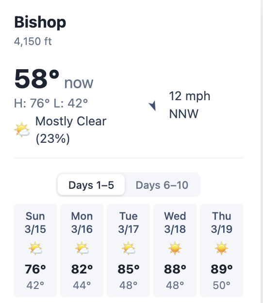
Well, it currently looks like Bishop will have 2 days at a high of 89 and one at a high of 88, so several chances to break that record.
Los Angeles has a March high temp of 99F, and could achieve 102F next week. Elsewhere, the town of Thermal, CA looks likely to achieve a high temp of 110-113, breaking the April record and shattering the March record by 7-10F. It is not normal to break all-time monthly records by such a wide margin...
A vast swath of the Southwest is expected to challenge and exceed their all-time March temp records.
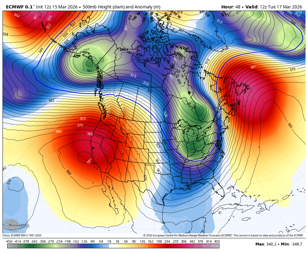
Again, my friends, this is all being driven by the polar vortex, which is helping create a highly amplified and stationary pattern. We call this type of setup a meridional flow pattern, where the jet stream develops large north–south swings rather than flowing straight west to east.
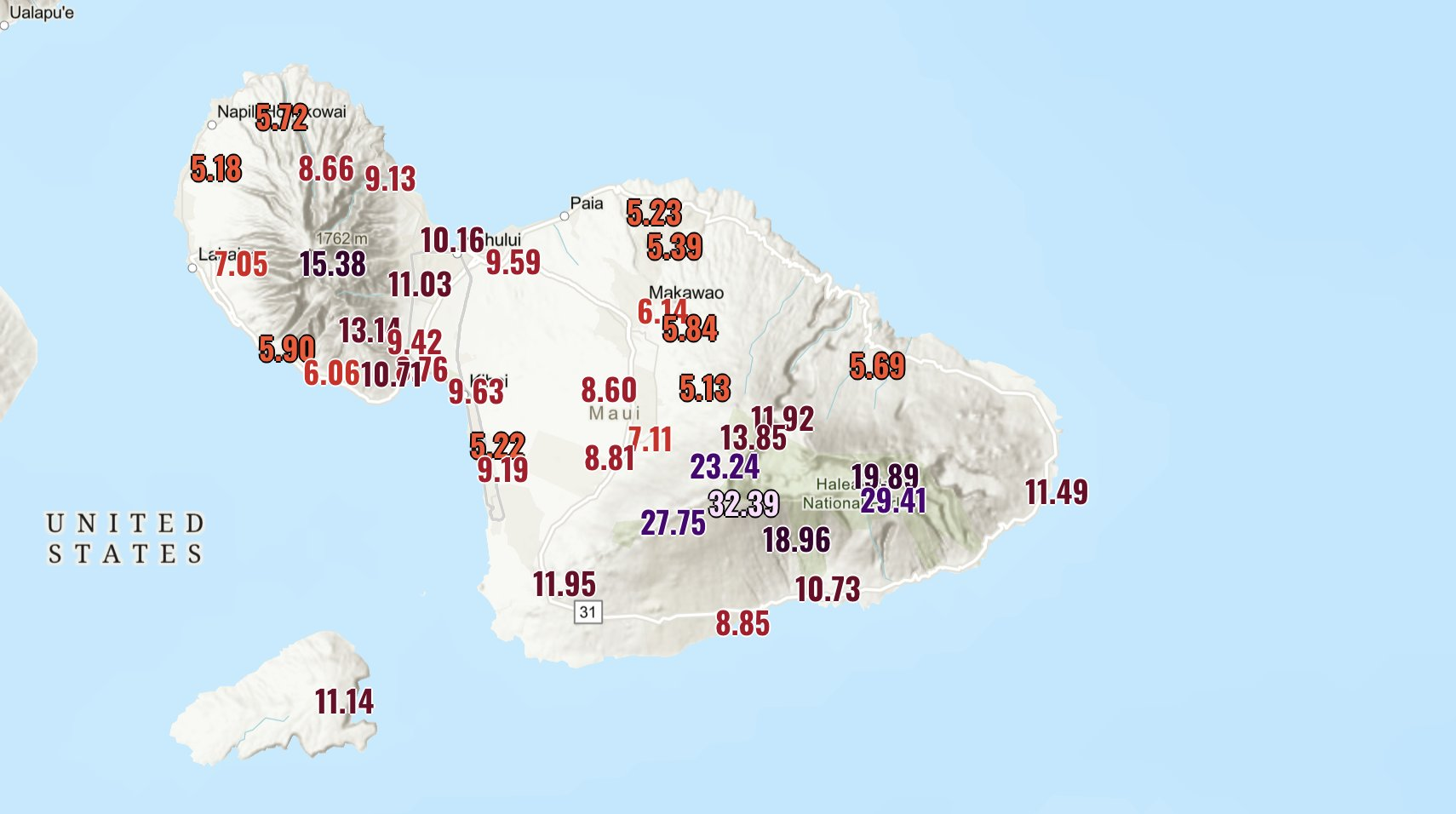
This same stationary pattern is responsible for stalling a long duration atmospheric river over Hawaii, bringing historic amounts of rainfall (32 inches in 24 hours in Haleakala...!!!), and much more on the way. This has already resulted in significant flooding and will lead to more as it continues to stall.
Winter's End
My friends... I am always slow to admit it, but it seems winter has reached its end out west. I'm calling it.
With the record breaking heatwave, and no precip on the menu until at least the end of March, it's over for us. That doesn't mean we won't get another storm, potentially an impactful one, but at this point we are done building snowpack.
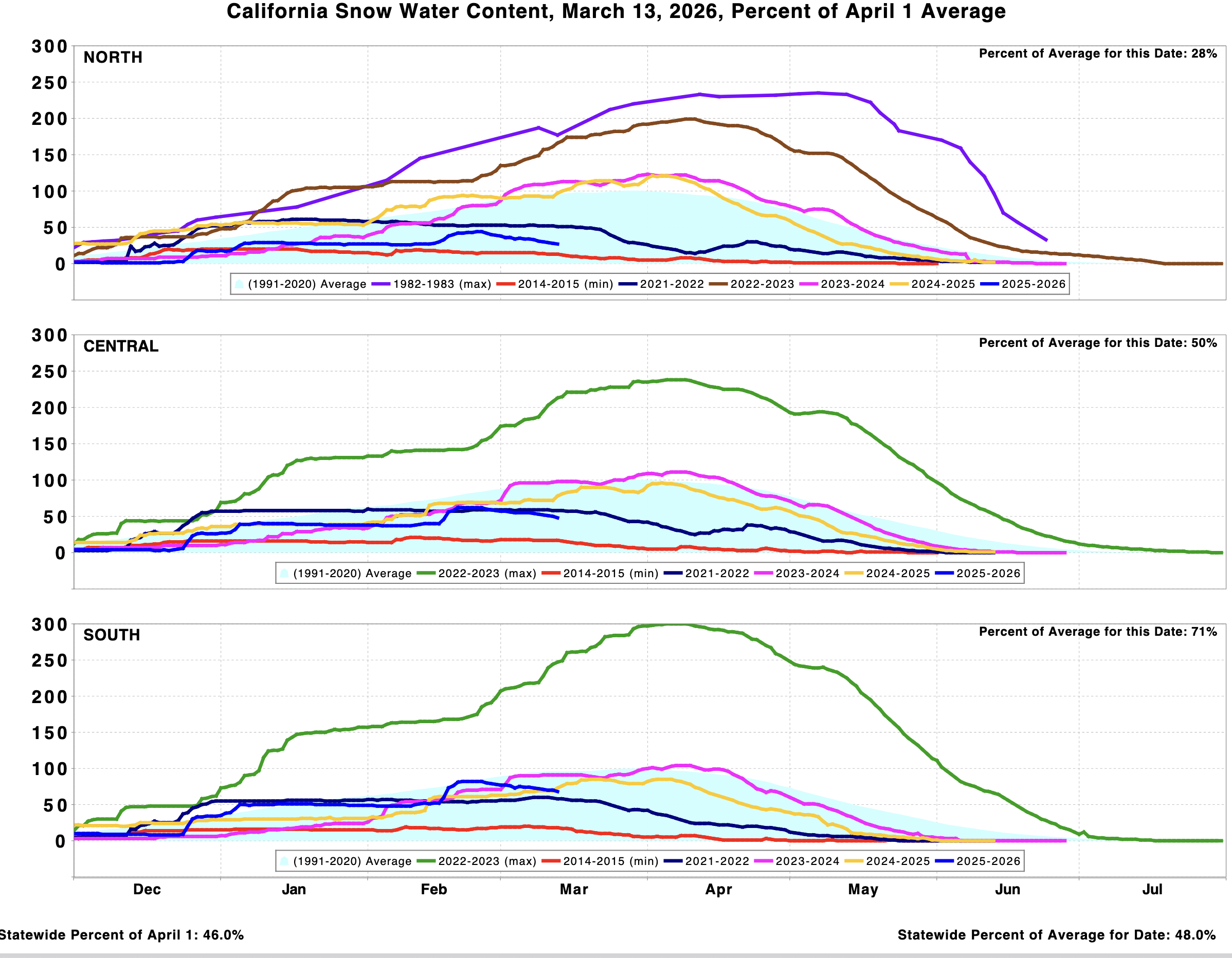
The melt has just started relative to what next week will bring, but we are already well below our season peak snowpack which occurred on Feb 20th this season. April 1st is typically considered the maximum, when the snow survey happens, but this year it is going to reveal a dire situation in my opinion.
We don't really build snowpack after that point, even with a big storm. Snow that falls on what is now dry ground will be on a limited time-supply.
While there are some indications a -PNA pattern could build in towards the end of March, it looks northerly based and not likely to bring any sustained winter weather.
The latest DeepMind ensemble shows a very small chance of weak to moderate storms, with the majority of members still showing virtually no precipitation.
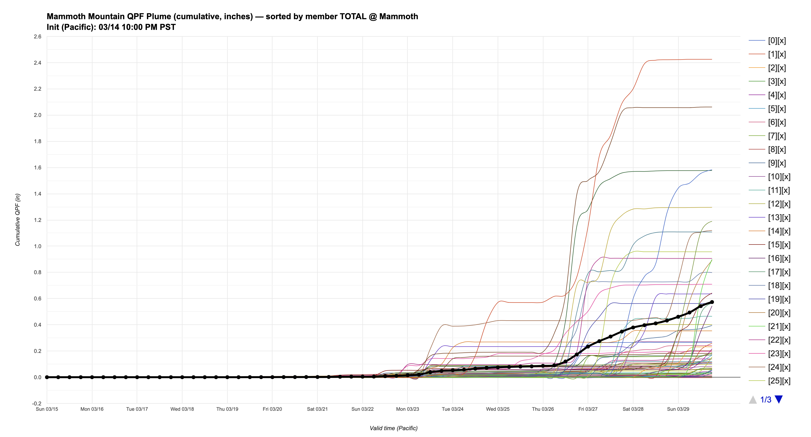
While April can and often does deliver a decent storm, I'm not really currently seeing any indicators of a prolonged stormy pattern setting up.
So for all of those reasons, I'm officially declaring winter in the west as over.
Super El Niño?
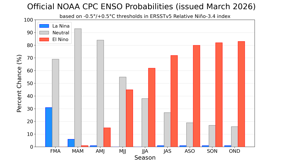
There has been a lot of chatter and hype about a developing El Niño this summer, with a strong or very strong El Niño possible.
If you've been following for a while, you know that I think the ENSO impact is often overplayed for snow seasons. There are a few exceptions to my belief, and one of those is a strong El Niño, which has such a strong impact on tropical forcing that it tends to override the atmosphere with a much stronger subtropical jetstream.
The result of this out west can be a much more active and zonal subtropical jetstream, and can often deliver, but does not guarantee, a wetter than average winter in CA.
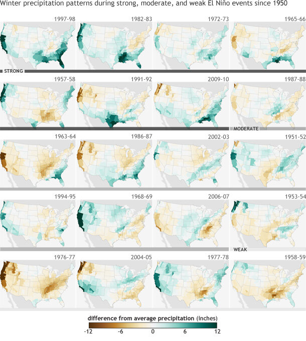
The above graphic shows a much stronger correlation for positive precipitation anomalies for a stronger El Niño. All indicators currently point to a very strong El Niño, as tropical westerly wind bursts send all the incredible warmth spilling out of the indian ocean and into the ENSO region.
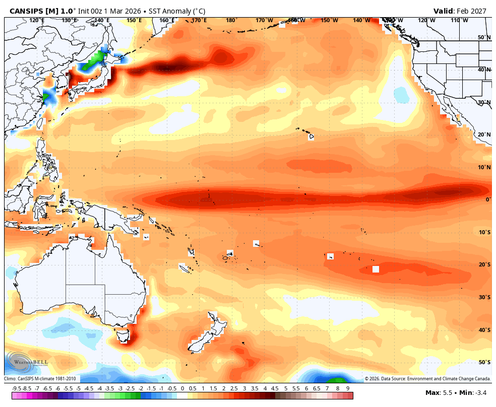
By next winter, this is looking like it could be a very strong Niño, rivaling 97-98!
Only time will tell how strong it gets, but strong El Niño events are one of the most globally impactful factors in weather. The summers that follow them (in this case, summer 2027), tend to be the hottest years on record globally.
Interesting times ahead, but I'm hoping there is more forecasting excitement for me next season than there has been this season, with storms only coming every 35 days...