Very windy with a side of snow
Overview
My friends...
Yesterday's storm shifted north at the last minute, with moisture and convection all training into the Tahoe region. Totals decreased southward, with Mammoth slightly underperforming at 5" of snowfall. Today is a very windy day with very mild scattered convective-driven showers.
Longer range, we dry out and warm up slightly above seasonal norms.
Storm Track Shifted North
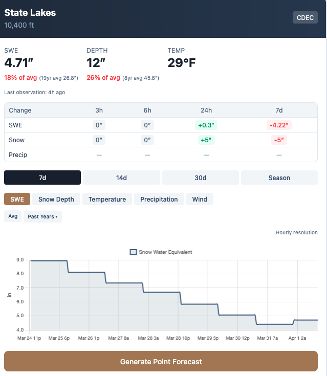
Watching the radar yesterday, it was clear that all the moisture was training to our north. Showers barely had the energy to carry over the Sierra crest and into Mammoth. As a result, Mammoth snow sensors reported 5" of snow yesterday, which was on the lower end of what I thought was possible. Showers in town were weak all day, and with warm surfaces, hardly any stuck.
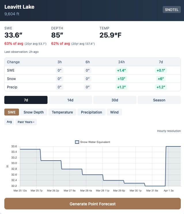
Taking a look at some snow sensor station data, it seems like all the action was up north. As per usual, Leavitt Lake, very orographically favored, was the winner at 13" of new snow!
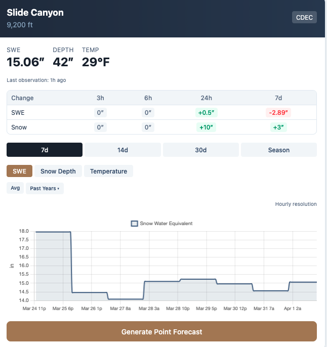
Slide Canyon in northern Yosemite National Park was another winner, with 10" of snow.
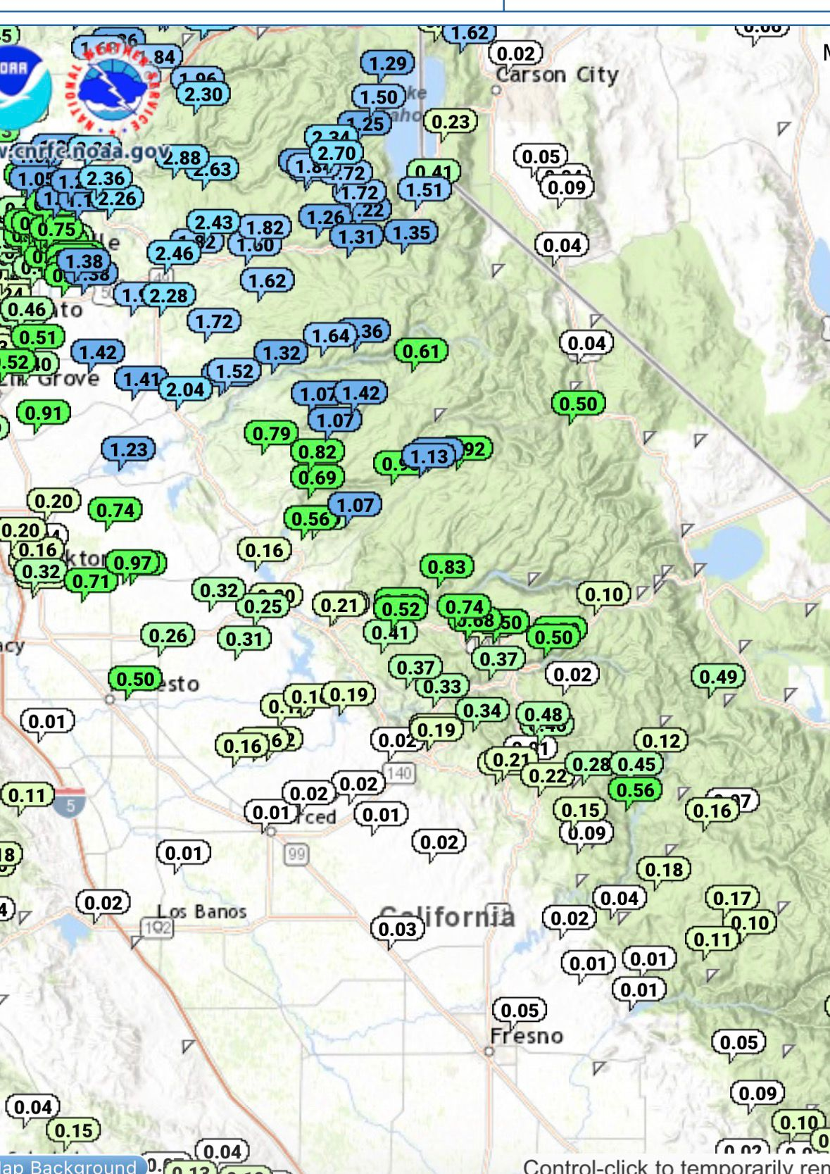
Down south, it seems like only places West of the crest picked up any snow, from 0-5".
This was quite different from what was modeled. Models showed most of the moisture training into the areas HWY 4 southward, in addition to the afternoon convection also being focused there. However, taking a look at observed totals, the bulk of the moisture shifted significantly north from what was forecast! Both the initial moisture plume and convective activity ended up much farther north than modeling suggested. So it goes! Convective showers are notoriously difficult to pin down in the mountains.
Weak Showers This Evening...
Very heavy winds over ridgetops will be accompanied today by very weak convective driven showers. Again, these are hard to pin down and amounts can vary widely locally. Model guidance currently hints at around 0.2-0.4" of liquid equivalent, resulting in about 2-4" of heavily rimed snowfall, mostly confined to Sierra Crest areas. These are scraps compared to the heavier snowfall farther north in Tahoe.
Longer Range
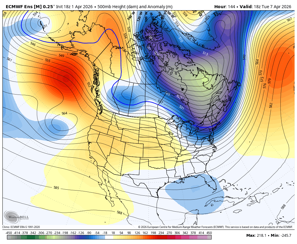
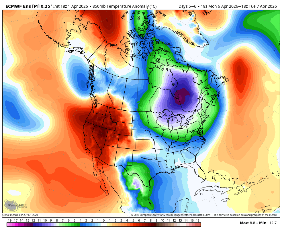
While we stay slightly cooler for the next few days and begin warming up into the weekend, high pressure will soon build in over the Gulf of Alaska leading to a stronger warmup above seasonal norms. I don't really see any active weather, although we may end up with an occasional clipper producing weak showers.
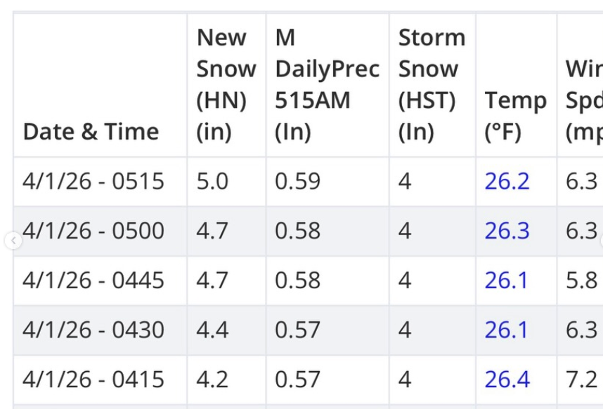
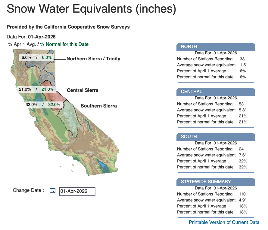
This will continue our melt, and continue our drying out as well. Today is April 1st, a milestone date in the range where snowpack typically reaches its peak. The snowpack numbers from this date are an important indicator for water resources, fire risk, and more. Well, today, our statewide snowpack sits at a dismal 18% of average, which is the second lowest ever recorded.
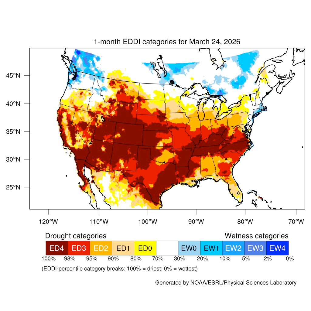
In addition to that, surfaces and fuels have dried substantially over the month of March. Here is a plot of the Evaporative Demand Drought Index (EDDI) for the month of March. This is basically a measure of how readily moisture evaporates into the atmosphere. This indicates fuels will begin to cure a lot earlier than usual. At this time, I'm admittedly a bit worried about a difficult summer from a wildfire perspective.