Warming up, possible undercutting systems later next week?
Overview
My friends...
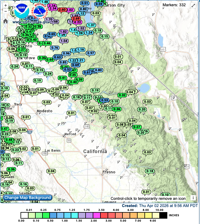
Mammoth Mountain has surprisingly reported 5" of snow from yesterday's showers. This appears to be a localized maximum, as precipitation gauges in the area generally indicate less liquid equivalent than that. The general trend yesterday was for precipitation disparities across nearby localized regions. They are now reporting a "storm total" of 9".
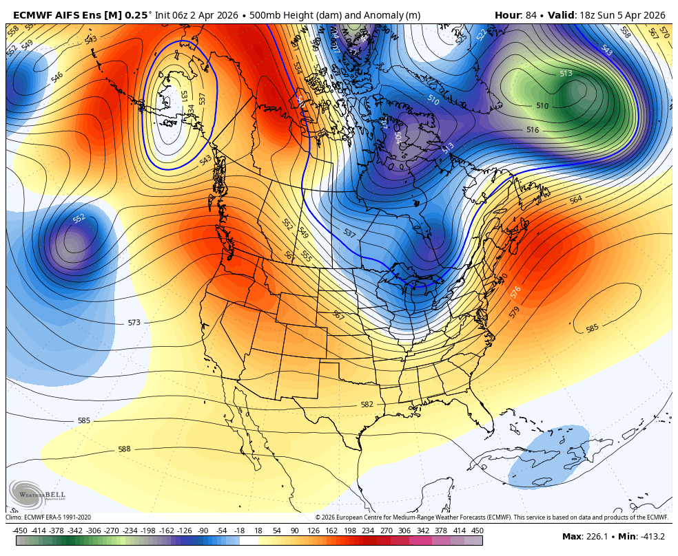
We will begin on a warming trend over the next few days, reaching temps a bit above seasonal norms by the end of the weekend. The longer-range outlook is generally low confidence, but a low-amplitude signal for systems undercutting the Gulf of Alaska ridge has begun to emerge. Models now hint at another storm window around April 9th-10th. My personal feeling is we need to wait and watch a bit longer before jumping on the train.
Showers Leaving
As mentioned, Mammoth reported 5" of snow from yesterday's snow showers. While possible, some aspects of this seem off. Firstly, the radar hardly showed any meaningful precipitation yesterday. Secondly, nearby precipitation gauges, like at Devil's Postpile, come closer to corroborating the liquid equivalent reported yesterday by the Sesame plot (0.19"), rather than the snowfall amount. Either way, I'm not complaining, and gauges hint at a lot of small local variations yesterday. Here's the last 24 hours of liquid equivalent nearby.
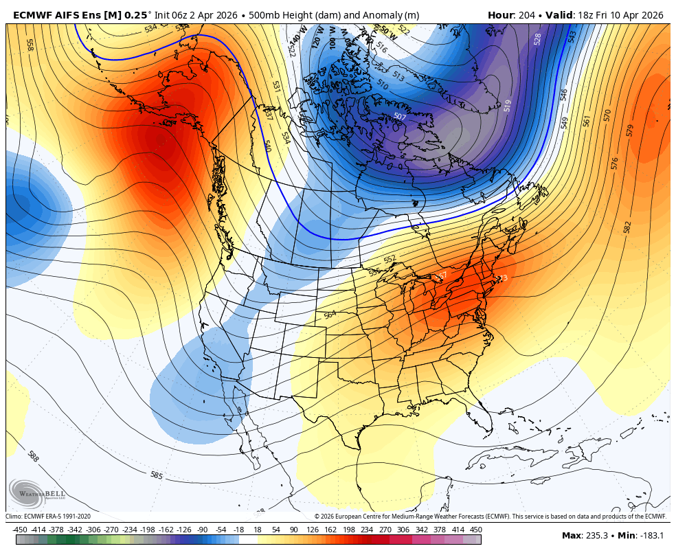
High pressure will now build in, first centered over the PNW, and then retrograding North West into the Gulf of Alaska. Above average temps will return by the end of this weekend.
Undercutting the ridge?
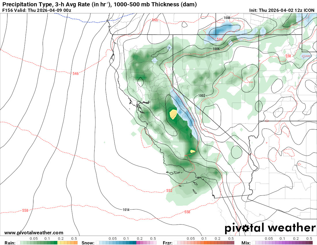
In the last day, there has been a small but notable change with our forecasted ridging pattern. I alluded cryptically to the possibility of the occasional shortwave in yesterday's blog post. Ensemble guidance now hints that the GoA ridge will nudge far enough northward for weak shortwave troughs to briefly undercut, beginning as soon as April 8th-10th. This may bring weak to moderate showers back to the Sierra, as soon as a week out. But I should stress that this is early, and a low-confidence signal. Personally, I need another day or two before I buy into this.
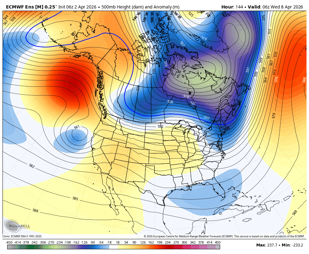
As a result, models like the ICON, Euro, and Euro AI are once again showing showers.
And ensemble guidance like the DeepMind plume shows a diffuse signal, but with many members showing increasing QPF around this time as well...
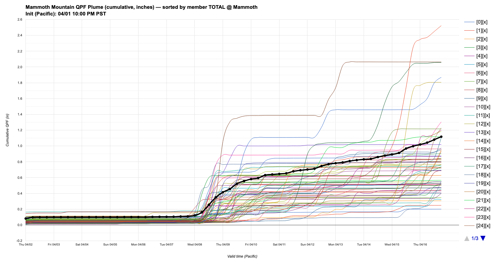
This is supposedly accompanied by a more persistent undercutting trough, but once again, a weak and low confidence signal from the ensembles. Time will tell!