May Ends With Snow?
Overview
My friends...
Winter is never far away in the mountains. After a nice few weeks of mostly warmer weather punctuated by occasional thunderstorms, a brief change in the pattern is coming. A cutoff low pressure system will bring several days of cooler and unsettled weather back to our region, first in the form of snow showers and then several days of thunderstorms. Longer range, the pattern looks mostly dry and warmer, with occasional mountain thunderstorms remaining possible.
Cutoff Low
A low pressure system will sweep down from the PNW, becoming cutoff as it nears California. This will result in the system stalling over CA for several days, resulting in convectively driven snow showers on Wednesday and Thursday.
As of now, snow levels look roughly 7-8k on Wednesday, and closer to 8.5k on Thursday. Because of the convective nature of these showers, totals will vary across our region. Most of the Sierra Crest can expect to see 3-7" of snowfall, with isolated higher pockets possibly seeing more than that.
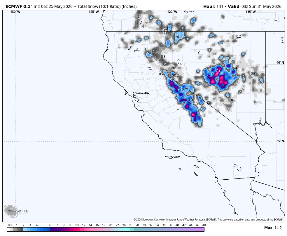
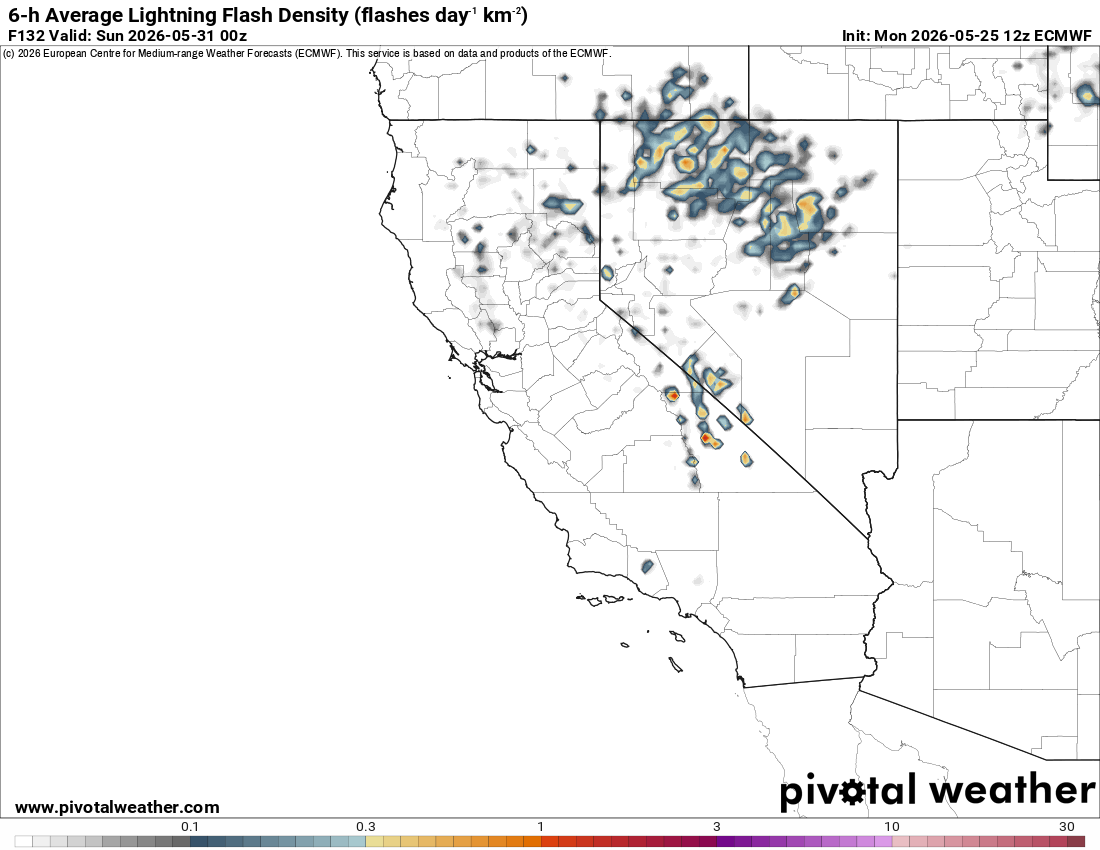
On Friday, the colder air moves out as the cutoff low falls apart and heads eastward. However, afternoon thunderstorms will be possible through at least next Sunday as elevated moisture remains alongside a possible weaker shortwave moving through the area next weekend.
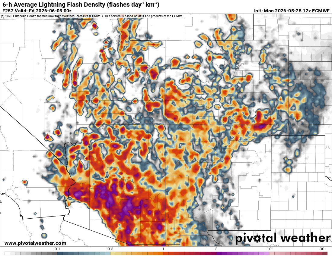
Next week, our temps will trend warmer and back above seasonal norms, as a monsoonal outbreak over the four corners region is trending likelier:
Longer Range
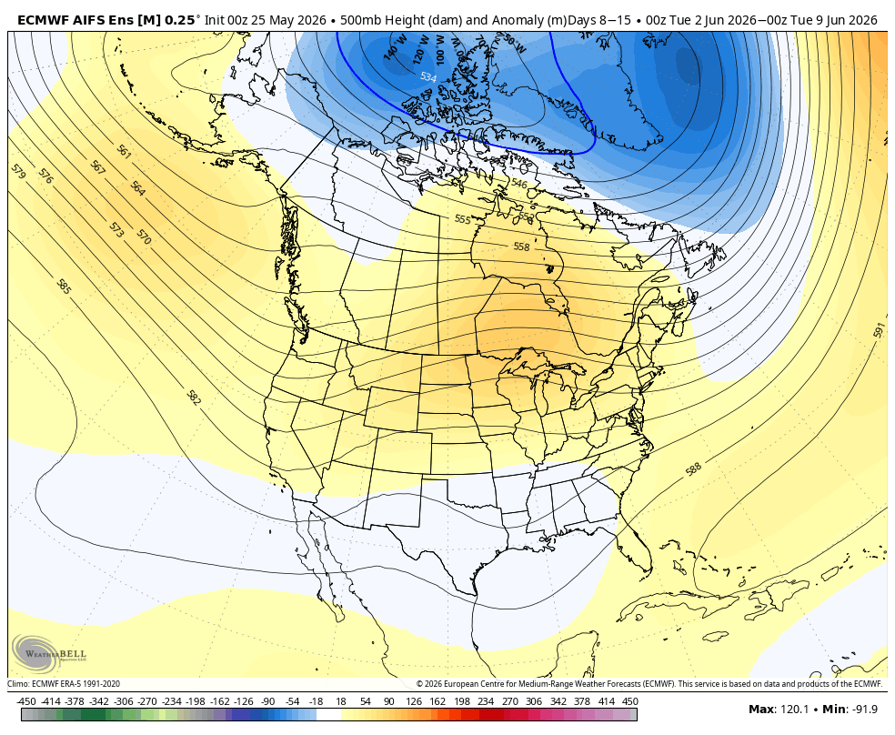
Longer range, the southern jet stream remains active over the Baja peninsula. This should drive active weather over the Gulf of Mexico region, while keeping the four corners region in play for monsoonal activity. For us in the Eastern Sierra, this will lead to mostly warm weather with occasional thunderstorm outbreaks over the mountains.