Monsoon Reloading!
Overview
My friends...
The monsoon has delivered several days of thunderstorm activity, with Saturday featuring especially intense and widespread downpours over parts of the Sierra Nevada. A flash flood warning was issued near Bridgeport due to slow-moving thunderstorms that stalled over the area for quite a while.
Today and yesterday have primarily featured thunderstorms popping up east of the Sierra Crest. Tomorrow, activity begins ramping up again, lasting through Friday.
After that, a brief retraction of the monsoon appears likely, with uncertainty in the extended range. Here's a video of today's storm development from the top of Mammoth Mountain:
Monsoon Reloaded!
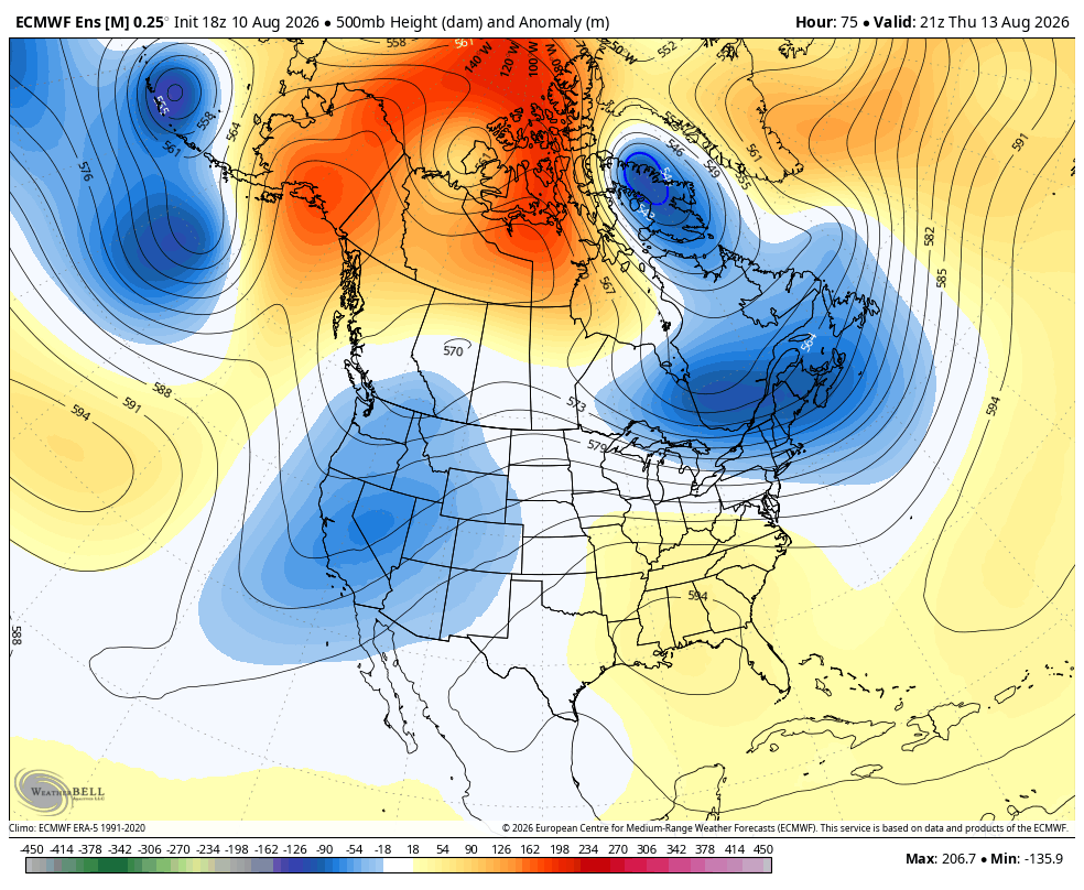
A more intense surge of moisture is arriving in our region. This will coincide with a West Coast trough acting as a trigger for some more widespread showers and lower temperatures than we have been experiencing for quite some time.
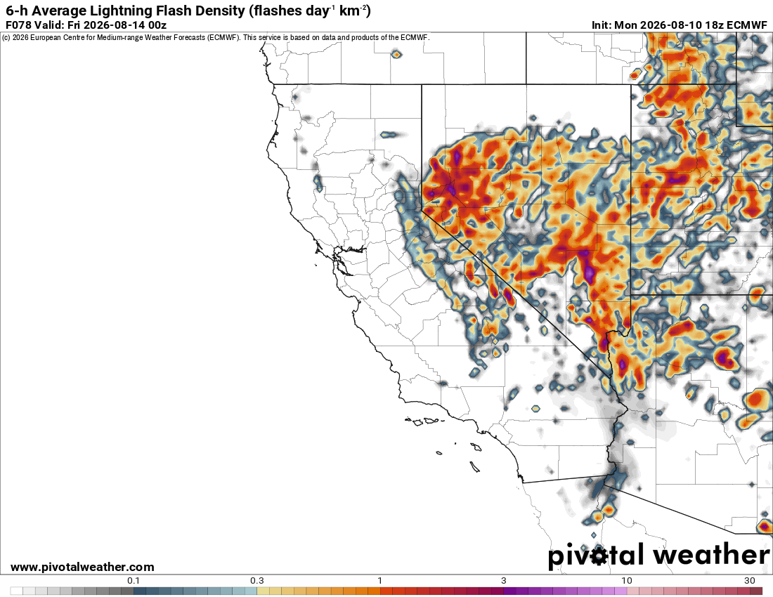
As of now, Tuesday, Wednesday, and Thursday all look quite active over the Sierra Nevada, with widespread lightning likely, especially Wednesday and Thursday.
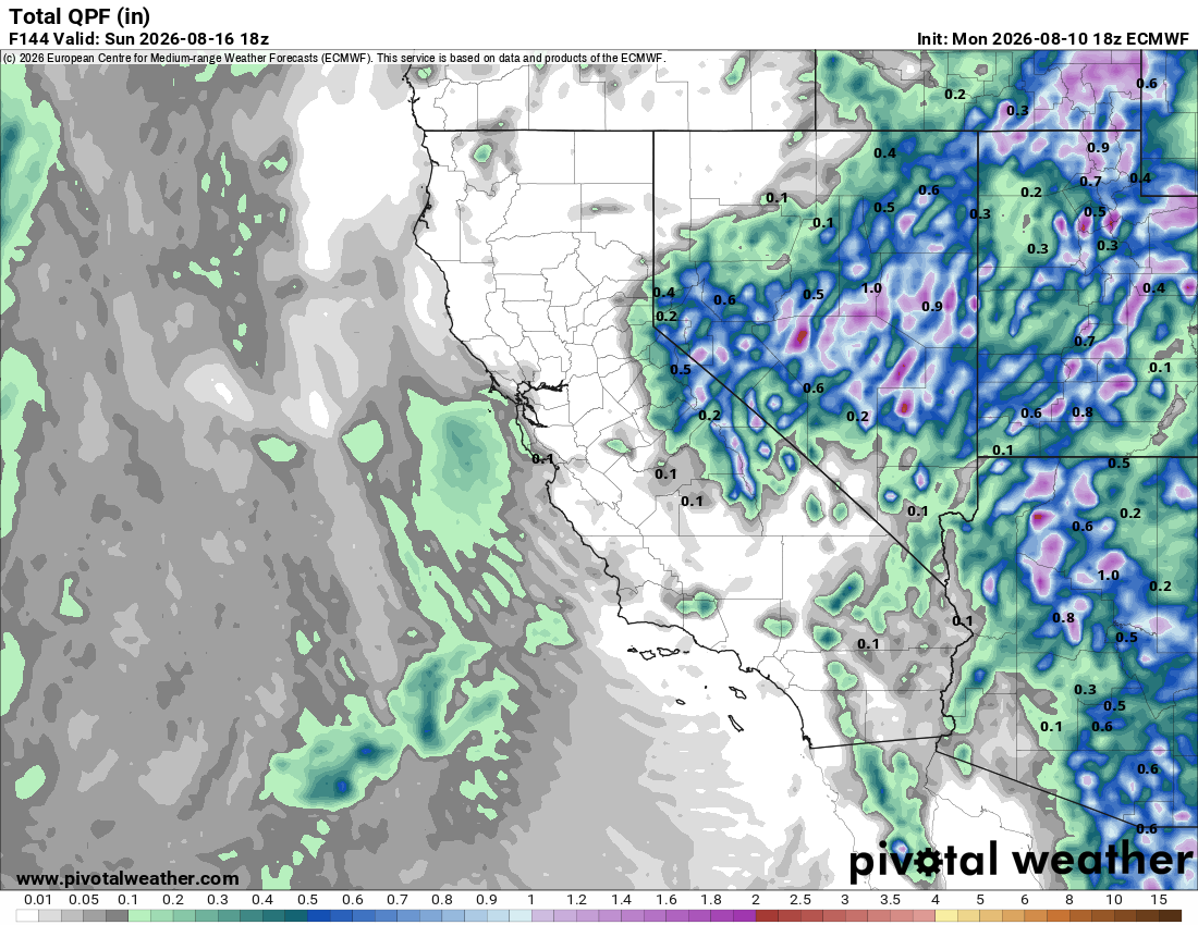
The precipitation totals shown by the European model are also indicative of heavier activity, with many areas along the Sierra Crest shown totaling over 1" of rainfall... However, there will not be nearly as much rain over coastal and Sierra foothills areas, which also have a risk for lightning. We'll have to watch this pattern carefully for any potential wildfire starts, because some areas may see dry lightning strikes.
These thunderstorms will occur primarily in the afternoons and evenings. However, on Wednesday night, as the trough develops, thunderstorms could remain active overnight.
While exact totals for any one region will be difficult to predict due to the scattered nature of these storms, this pattern comes with the usual risks: heavy downpours, thunder and lightning, gusty outflow winds, hail, and localized flash flooding. Hikers, climbers, and other outdoor enthusiasts are advised to watch the sky and be prepared to descend to lower ground before thunder roars!
Longer Range
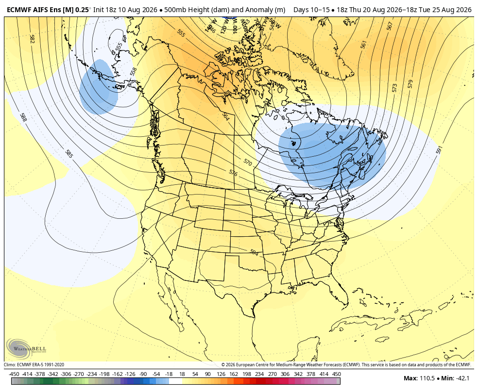
Immediately following this pattern, we look likely to see a period of calmer weather as the monsoon retracts back to the Desert Southwest. Longer range, there is less certainty, but there are early indications that the monsoon will remain more active with occasional moisture intrusions into the Sierra, as a broad flow pattern favorable for moisture transport appears to remain established.
The ensemble mean also depicts a weak West Coast troughing pattern lingering, which could help steer moisture into the Sierra Nevada and keep temps cooler, but uncertainty is quite high around the pattern 10-15 days out.