Trick or Treat? A Halloween Snowstorm Is Coming!
Overview
My friends...
Forecasting this storm has felt a bit like this:
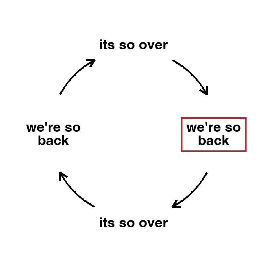
As of today, the models have gotten their act together, and we're in the "we're so back" phase... For now! The models are now converging on a storm actually coming through the area. There's still plenty of time for "it's so over" to make a comeback, but this is the most confident I've been in this one so far.
After this storm, there's a slight chance of some very weak storms next week, before a Gulf of Alaska trough sets up, possibly favoring a wetter storm track into mid month.
Two systems merging
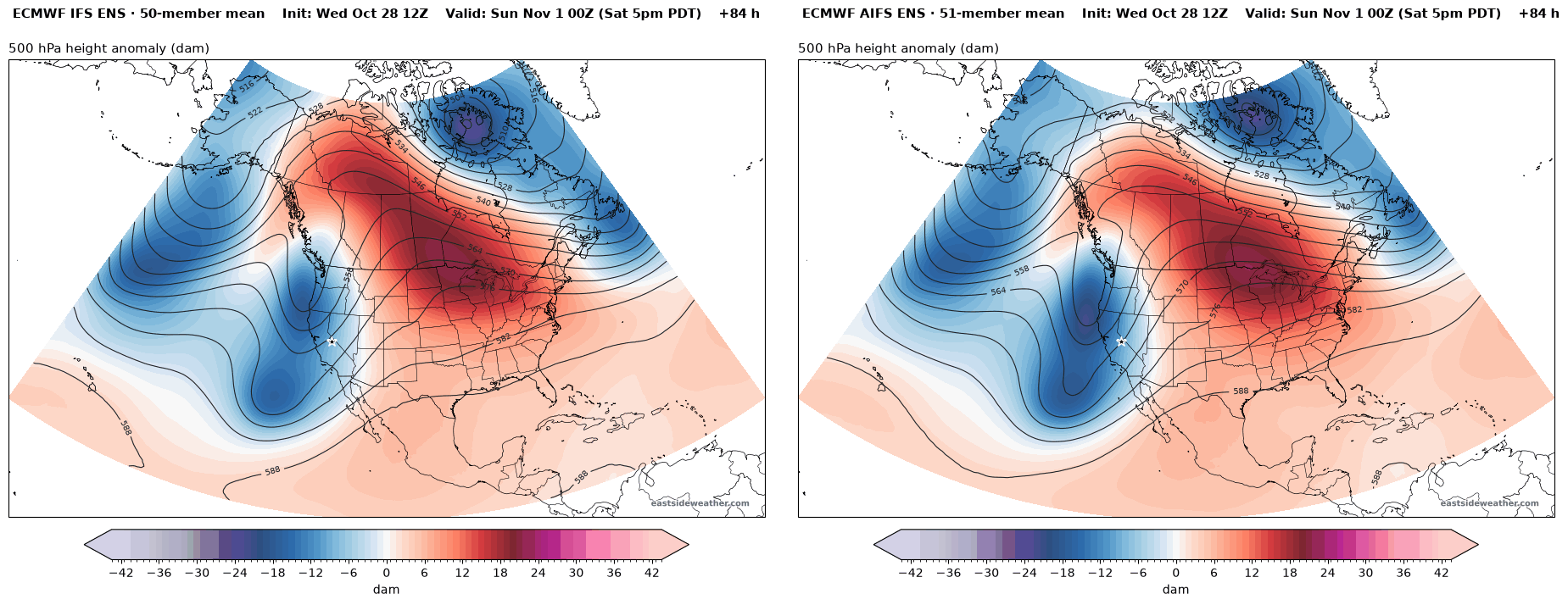
The reason this has been such a tricky forecast is because it involves two low pressure systems merging. An upper level low drops in from the north, while a secondary disturbance is riding the southern jetstream. Slight variations in the track of one ends up being make or break for whether or not we see snow.
Below is the general pattern of the jet stream. Watch the northern low dive down the coast and the southern jet streak lift into California, with the two phasing over the state on Saturday... Two moving parts always results in a tenuous forecast!
By Saturday evening, the ensembles are now showing precipitation ramping up over the Sierra Nevada.
Snow levels and timing
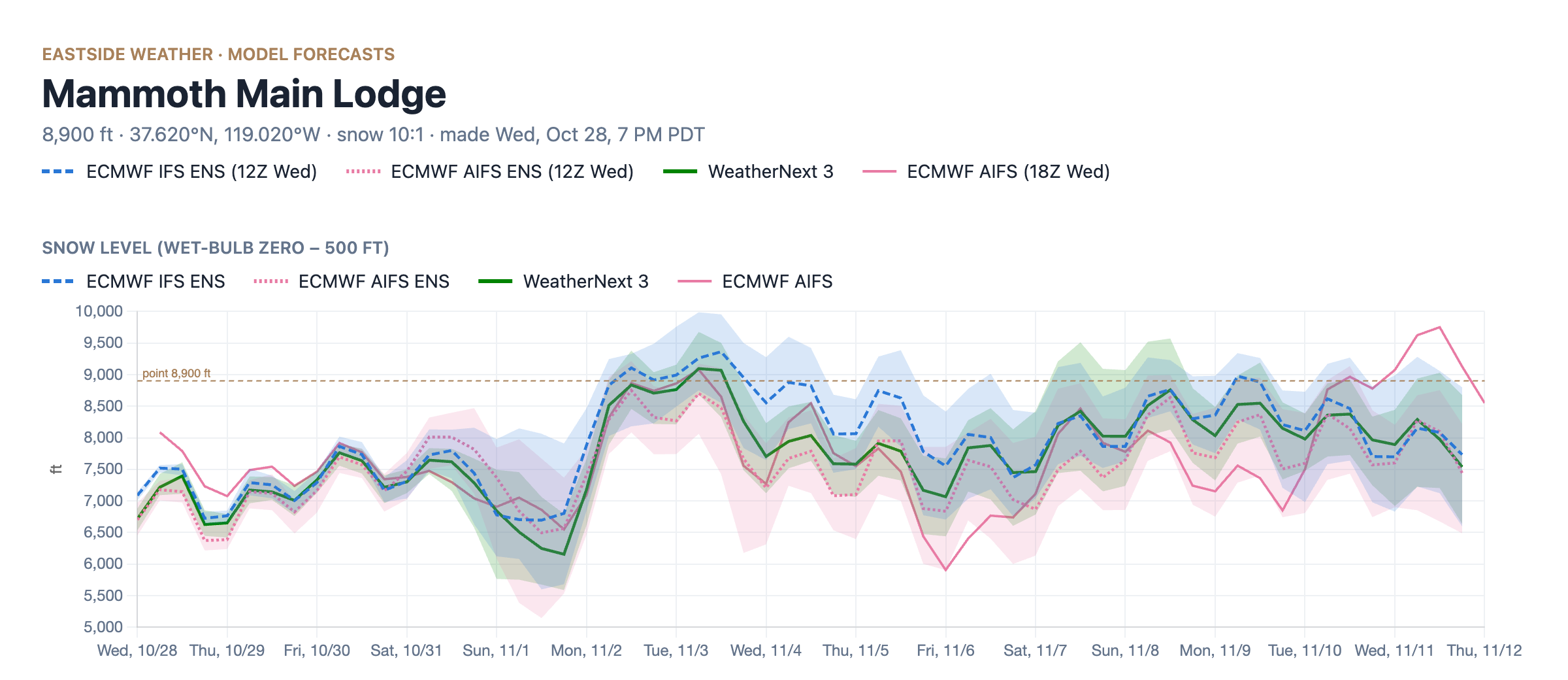
A few showers could precede the main storm, starting as early as late Thursday night or Friday morning. These could bring a dusting up to an inch of snow, with snow levels right around the town of Mammoth Lakes.
The main event moves in later on Saturday. Snow levels start out around 7,000 to 8,000 feet Saturday, then fall to around 6,000 to 6,500 feet Saturday night into Sunday as the colder air arrives. This should be mostly a snow event for the town of Mammoth Lakes, with some mixing possible at the start.
How much?
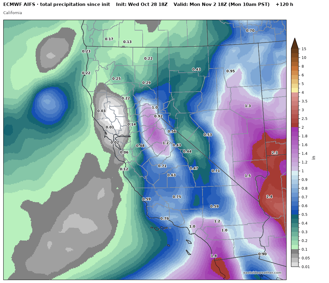
Here's the total precipitation from the Euro AI model through Monday morning. It spreads precipitation across most of the state, with the heaviest totals in the central Sierra and Southern California.
For liquid through Sunday at Main Lodge, the medians are roughly 0.9" in the Euro AI model, 0.8" in the Euro model, and 0.6" in WeatherNext 3. The 25th to 75th percentile range across all three runs from about 0.4" up to 1.3".
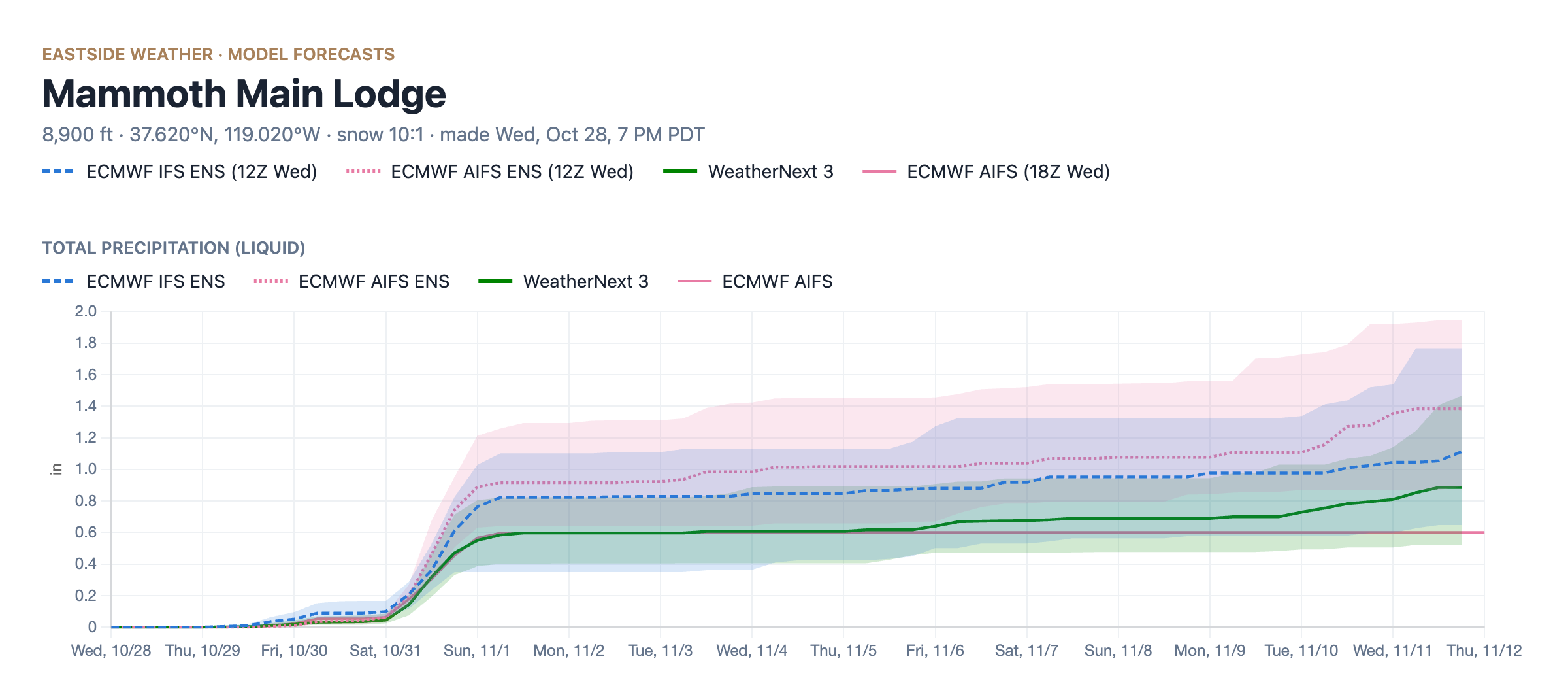
At a 10:1 ratio, that works out to a median of around 5-9" at Main Lodge, with a 25th to 75th percentile range of roughly 4-12". For the town of Mammoth Lakes, I'm thinking roughly 1-4", and for Mammoth Mountain about 5-9".
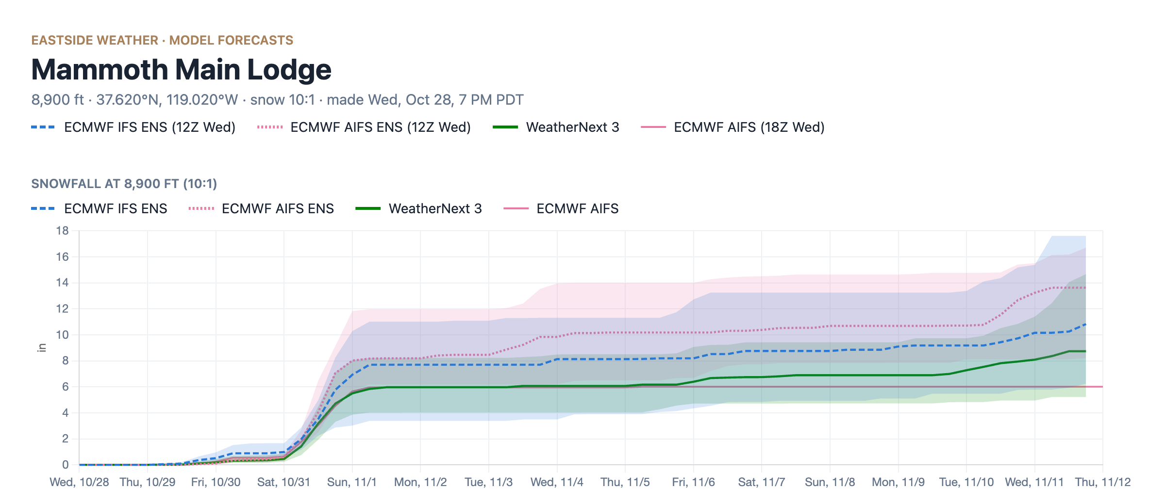
WeatherNext 3: © 2024-6 Google LLC, whose machine learning models were used to create the experimental data made available under the following licence terms https://storage.googleapis.com/weathernext-public/terms-of-use.pdf. This data is intended for experimental modelling only and is not intended, validated, or approved for real world use.
This is still an inherently tricky forecast, so expect these numbers to shift over the next couple of days. The mountain has officially started snowmaking operations, and the colder air behind this storm should help with that, which is great news. We are still waiting on that first big base builder though.
A Gulf of Alaska trough to our north
After the storm, the storm window retracts for a few days while a deep trough sets up in the Gulf of Alaska. By the end of next week, both the Euro (IFS ENS) and Euro AI (AIFS ENS) show it parked off the coast of British Columbia.
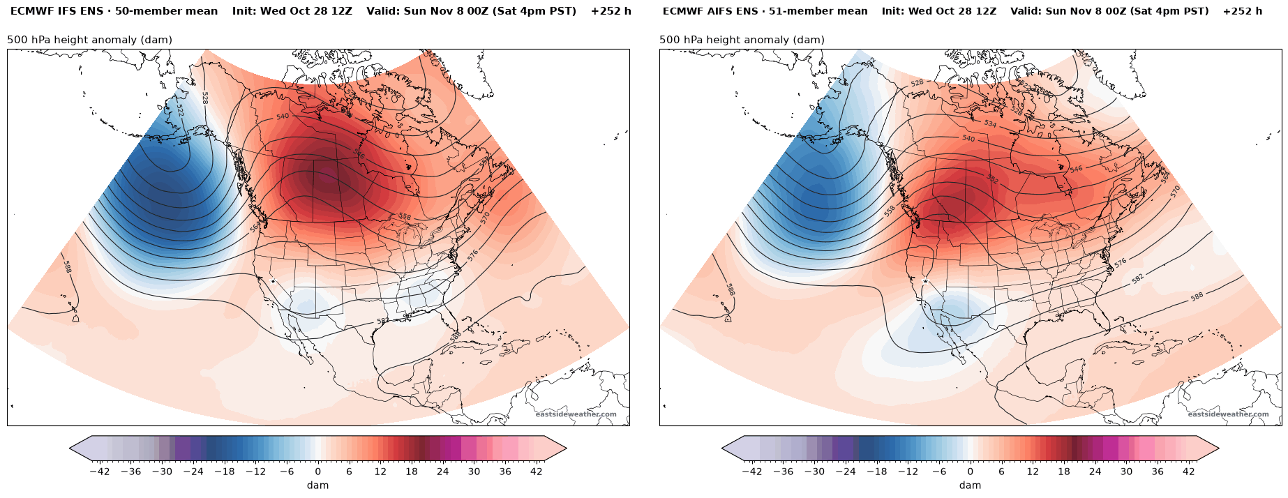
This troughing pattern will favor the Pacific Northwest at first. Even so, it can still bring a storm to us, since with all of that wave energy just to our west, we sit right downstream of the storm track. The catch is snow levels. With the parent low pressure system sitting so far north, storms that reach us can pull up milder air from the southwest, and snow levels can be an issue depending on where that low sets up. You can already see this in the snow level chart above, with snow levels jumping back up to around 8,500 to 9,000 feet next week.
Later on in the month, the low pressure does appear to be nudging southward, which is a better look for us. WeatherNext 3 shows the trough digging further south along the West Coast by November 11.
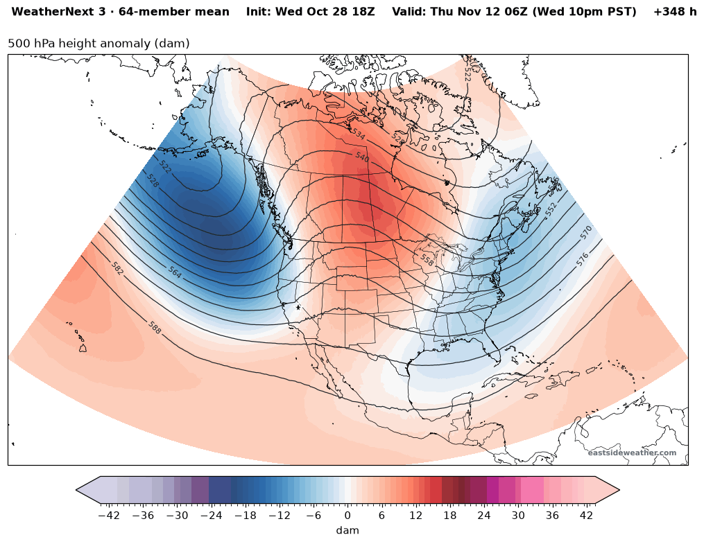
This will take time though. Climatology favors the Pacific Northwest this time of year. November is actually their wettest month, while ours isn't really until January and February, which is also when the El Niño response is really forecast to arrive in full. Here's a fun map showing that gradual southward migration of the storm track through the winter:
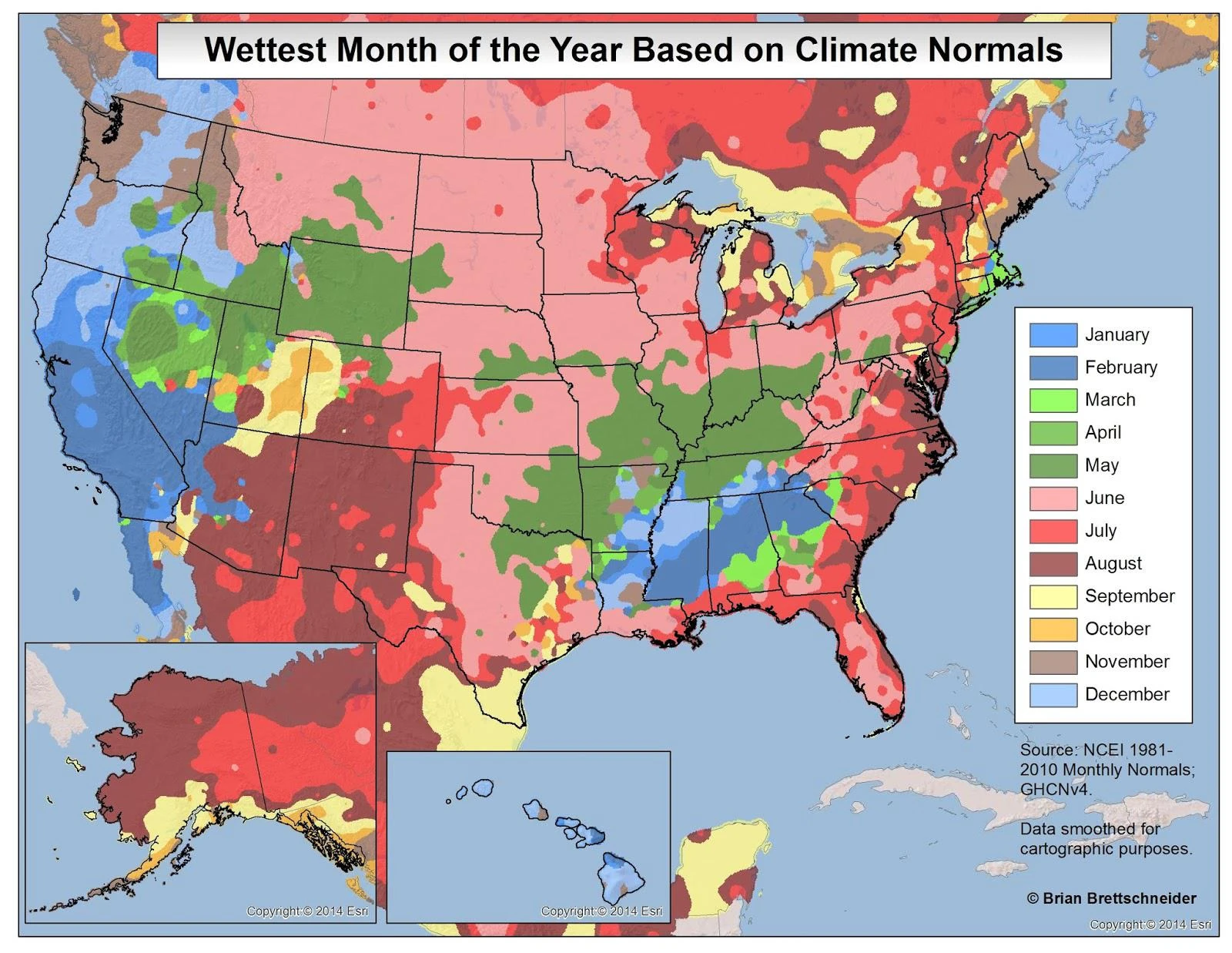
Image: © Brian Brettschneider, NCEI 1981-2010 Monthly Normals.
So for now, let's enjoy a Halloween treat... Let it snow!
Enjoying the forecasts?
Eastside Weather is a passion project, but keeping it running comes with steady monthly costs: hosting, data feeds and the servers that crunch the model runs. Right now the site costs more than it brings in. Whatever you chip in goes straight back into keeping it going and building new tools.