Auspicious April: Storm Tuesday, More Chances to Round Out the Month!
Overview
My friends...
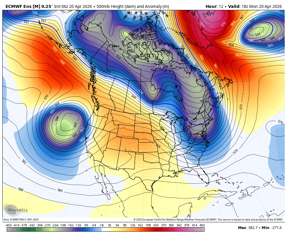
April is turning out to be quite auspicious for us here in the Sierra Nevada. A moderate storm will impact California today through Wednesday, bringing solid rainfall totals to NorCal and heavy snowfall to the Sierra, with totals decreasing southward. By Wednesday, we clear out and remain on the cooler side as a troughing pattern continues to undercut the west coast ridge. By next weekend, storm chances are ramping up again as a result of this undercutting pattern, fueled by an active southern jetstream.
Storm Tuesday!
The storm for this Tuesday has been trending up with each successive day.
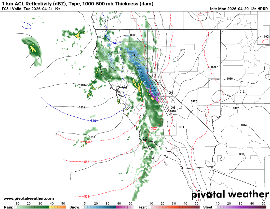
A relatively strong and slow moving closed low pressure system is moving towards California today. By tomorrow morning, it will push far enough inland to spin up a period of heavy snowfall over the Sierra Nevada.
Fueled by an active subtropical jetstream, this storm is packing solid frontal dynamics and is a winter-like event. The HRRR model shows the frontal passage beginning over the Eastern Sierra around 12pm Tuesday, with the heaviest snowfall rates between 1pm and 10pm. Convection will follow the main front, and will lead to intermittent strong bursts of precipitation, with showers lasting into Wednesday AM. These showers may be accompanied by lightning and thunder.
Models have steadily trended upward with precipitation totals. They now show a range of 1.2-1.8" of liquid equivalent for the Sierra Crest near Mammoth Mountain. The cold front will bring temperatures and snow levels crashing, with snow levels beginning around 7.5k' but lowering to around 6.5k'. As a result, I am now expecting 10-16" of snow for the Sierra Crest near Mammoth. Isolated areas on the highest peaks could see 20". Parts of the 395 corridor will see 0-5". This system does have a bit of a southerly flow component, which is why I'm not going with a higher range like 12-18". Under southerly flow Mammoth ends up less orographically favored than is typical with a winter storm. We'll see what that does for us!
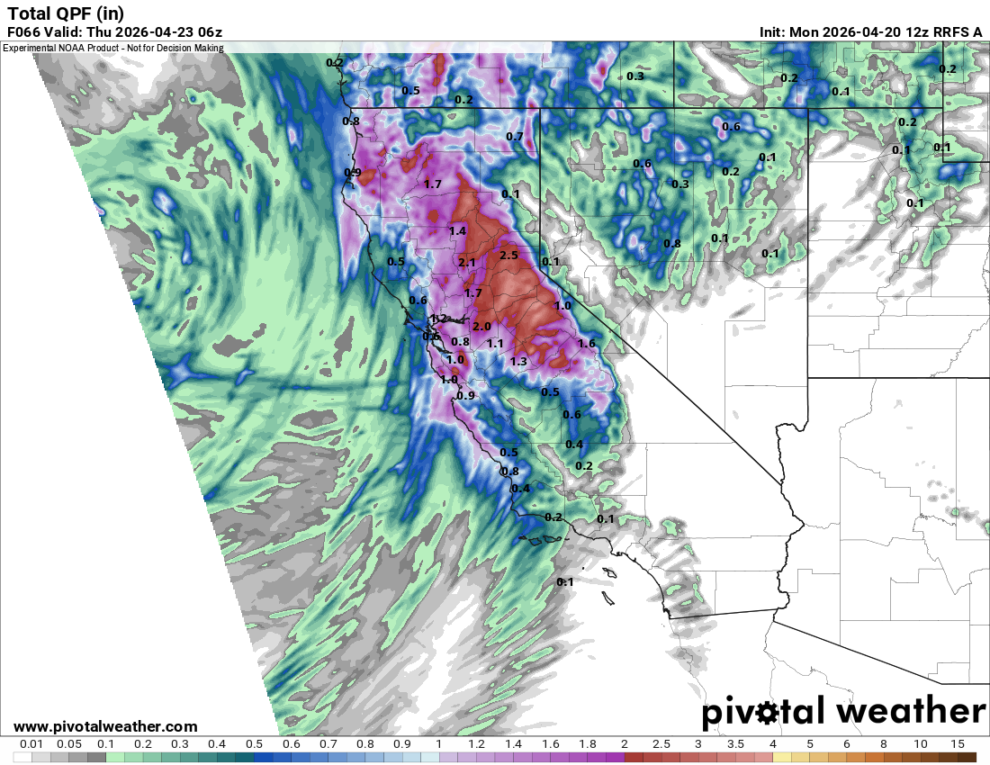
The highest precipitation totals will end up over the Tahoe region, with multiple feet possible along the highest peaks there.
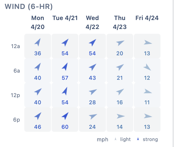
With the increasing intensity of this system, there also now looks to be much stronger winds than previously forecast... Winds will be in the 50-60mph range over ridges Tuesday during the storm. These winds may also couple down to the surface, with strong winds possible along the 395 corridor as well.
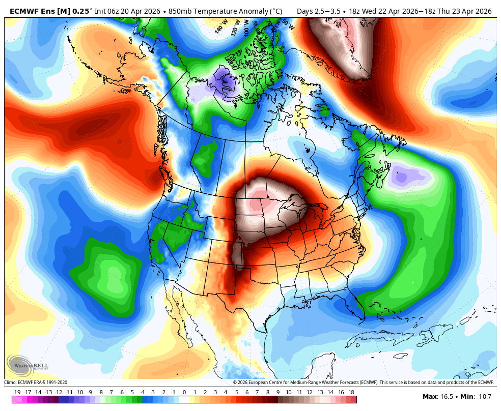
Once the storm clears out, we are in for mild weather with below average temps:
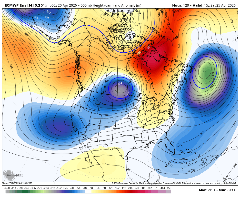
Active April continues...?
I can't believe it, but the models are now showing yet another period of activity for us next weekend. As mentioned, a pattern of troughing will continue to undercut the West Coast ridge, driven by a particularly active subtropical jet stream:
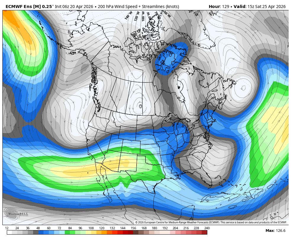
In my opinion, this will keep the West unsettled for quite some time. It is possible that we see more snow falling next weekend! Keep it coming!
This pattern looks likely to linger towards the end of the month. But for now, we have a really solid April storm to get through! Nice one!