Merry Fishmas! The Prophecy Comes True! Plus, Is It Time To Drink The El Niño Kool-aid?
Overview
My friends...
The last storm delivered beautifully. I was expecting a range of 10-16", and Mammoth reported 12" of delectable April pow. Auspicious April prevails. At 46" of snow, Mammoth is above the monthly average of 32", and the accumulations aren't finished yet! A weak showery storm this Saturday - Sunday AM will deliver variable accumulations to the Sierra, mostly south of Tahoe.
Longer range, there is no denying that summer is creeping closer each day, however showers will remain possible into early May as the southern jet continues to stay active!
Beyond that, the El Niño hype is off the charts. But what exactly does it mean for our summer and next winter?
Weekend Storm
I can't remember a fishmas where we didn't have unsettled weather. This year will be no exception.
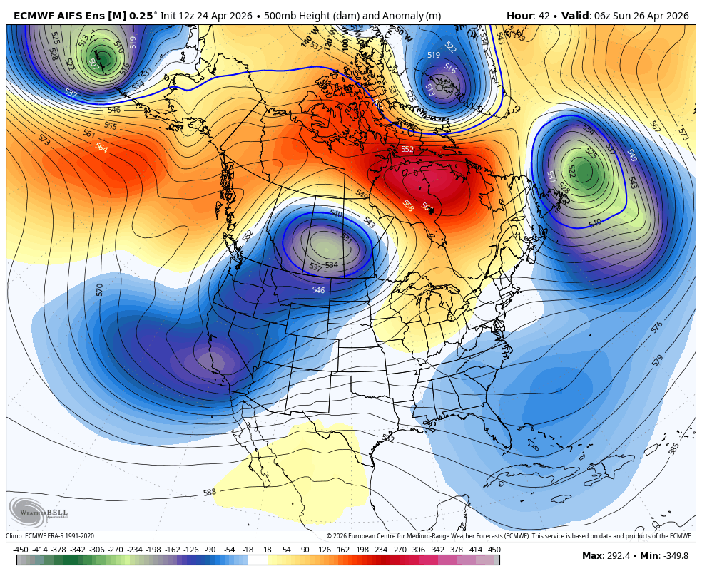
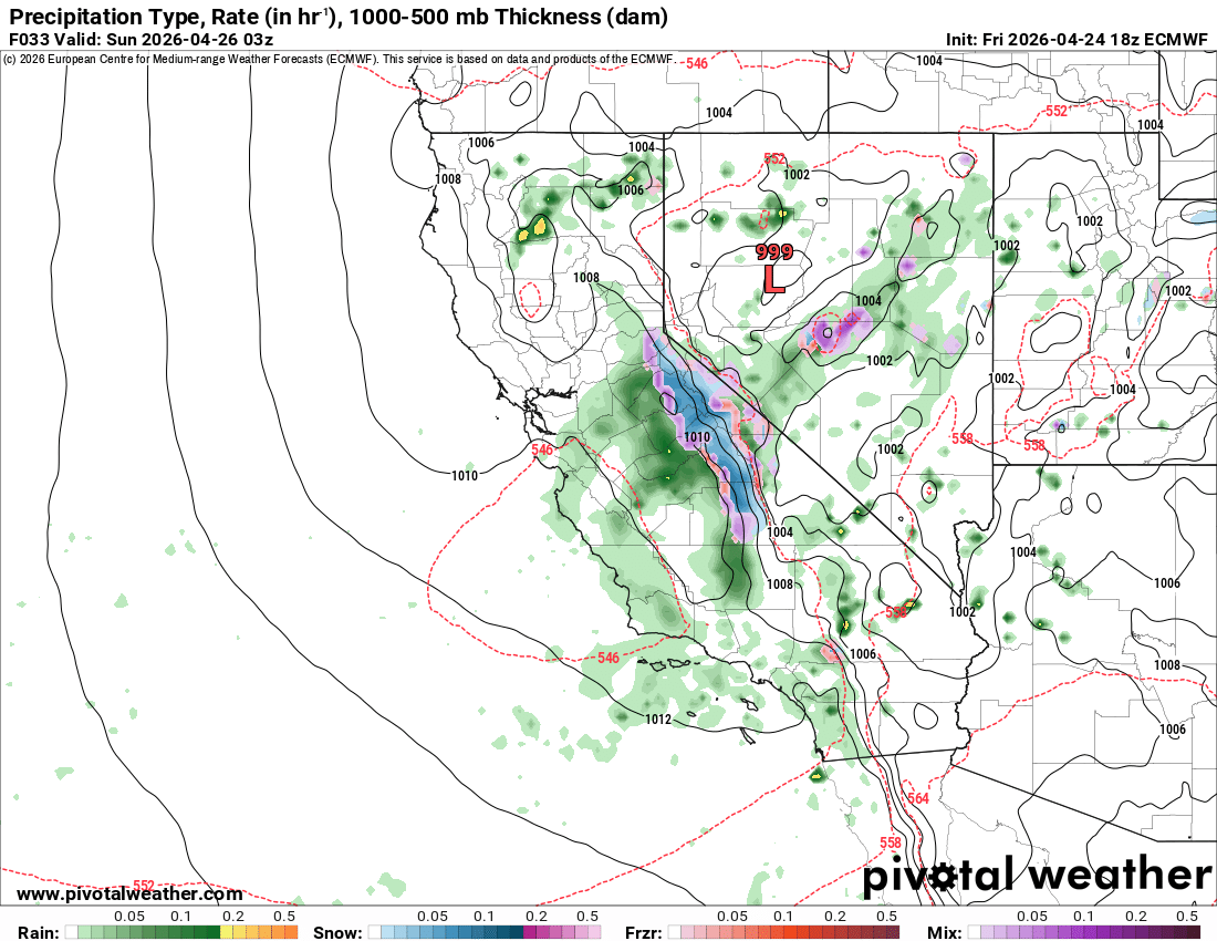
Another low pressure system, fueled by an active southern jet stream, moves onshore tomorrow. By mid day Saturday, scattered showers will be possible, with more widespread activity picking up into the evening. Showers will linger into Sunday AM. Much of the activity looks concentrated west of the Sierra Crest, but modest accumulations will be possible along and east of the crest. There is much uncertainty around where the heaviest bands of precipitation fall, so a range of 1-6" is expected for most of the region.
Snow levels look around 7.5k to start, lowering to around 6.5k as night falls.
Longer Range
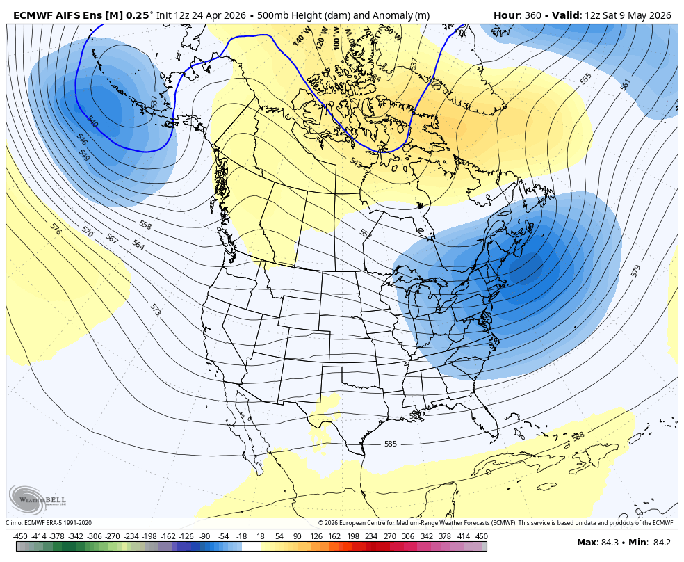
Longer range, uncertainty is high regarding the West Coast pattern. Ensembles show an incredibly diffuse signal, which means that they aren't sure what to do with it:
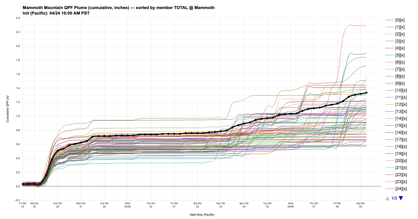
Looking at our old friend the DeepMind WeatherNext2.0 ensemble plume for Mammoth Mountain, we can see a return to dry weather to start next week, however by the first week of May, a moderate number of ensemble members show us returning to a showery pattern, while an almost equal number of members show no precip. Split signal...
However, there is no denying that winter weather is on borrowed time and summer is on its way in.
A Developing El Niño... What does it mean?
My friends... At this point, you have probably caught on to some of the hype around a developing El Niño, with some models even hinting at the possibility of a super El Niño event. Here is where our Sea Surface Temperature Anomalies are as of today. I should note that the development of El Niño remains uncertain as long as we are behind the "Spring Predictability Barrier".
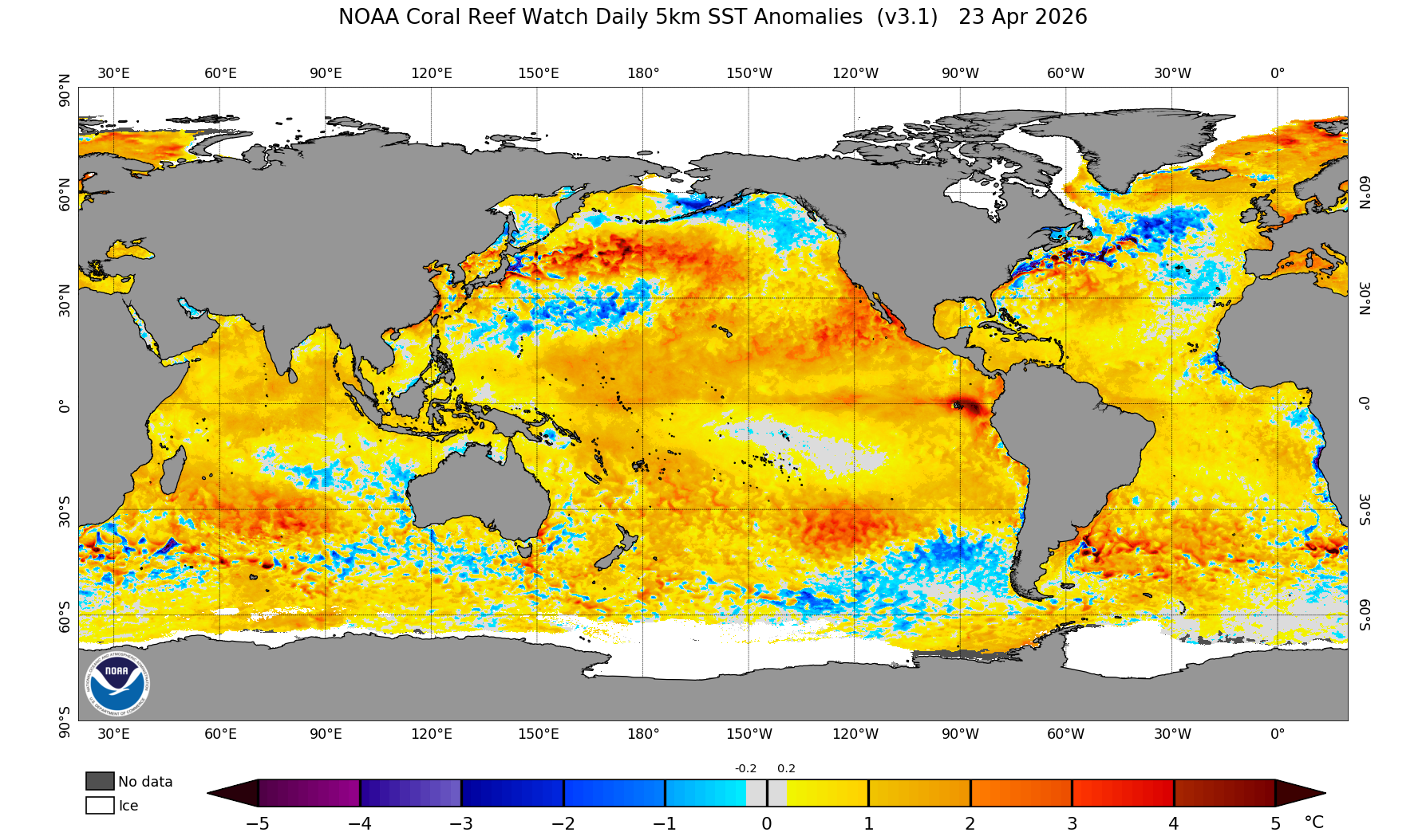
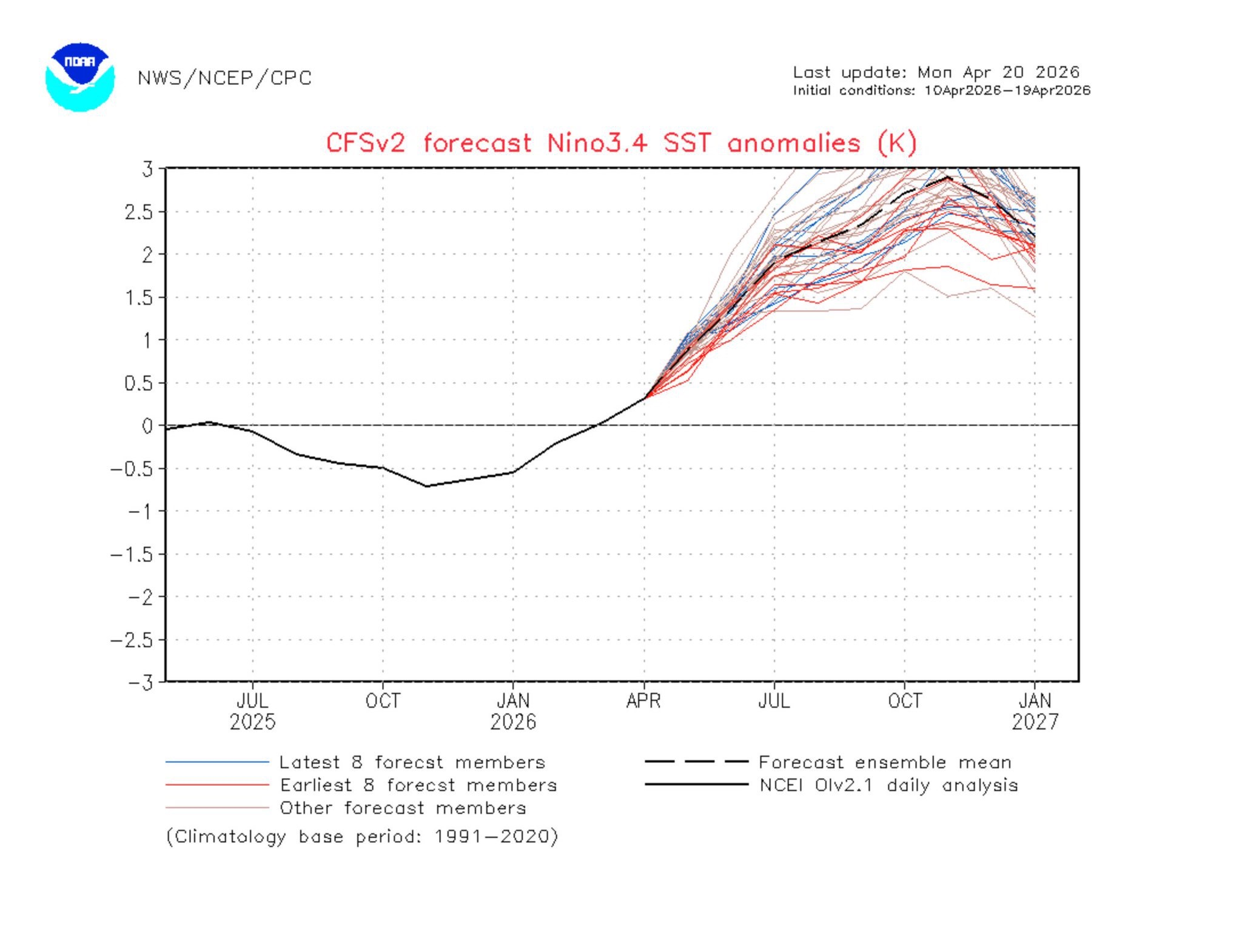
El Niño is certainly beginning to take shape from both ends of the Pacific Basin. Westerly Wind Bursts have been unrelenting, leading to an impressive warmup in the Western Pacific. Meanwhile, the Niño 3.4 region has steadily grown warmer, and is expected to continue doing so. Models are currently hinting at a strong El Niño developing over the next few months, and it is not expected to peak until October - December. Some models even show a potential super El Niño developing. The CFSv2 model does not even have a Y-axis large enough to account for the forecast it is putting out:
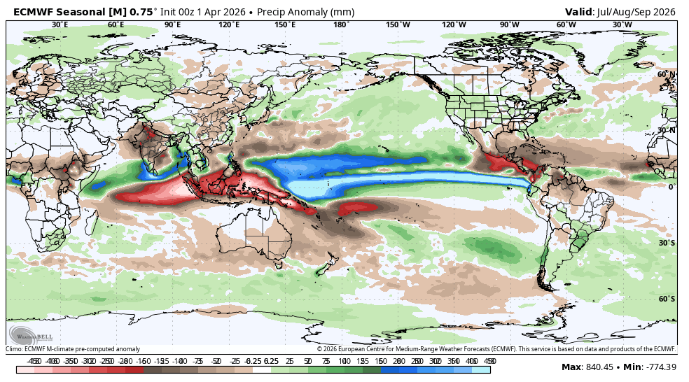
In the summer, this has a number of "expected" impacts. The first of these is that it results in significantly more shear over the Atlantic Basin, and tends to hamper the Atlantic hurricane season. This is expected to lead to worsening drought over the American SE, which sees much of its summer precip from tropical systems.
By contrast, the Eastern Pacific is expected to be much more favorable to tropical storm development as a result of the anomalous SSTs over the region. These systems may transport a bit of extra moisture over the American Southwest, leading to a more active monsoon with occasional outbreaks into the Sierra. Here are both of those signals reflected in seasonal modeling.
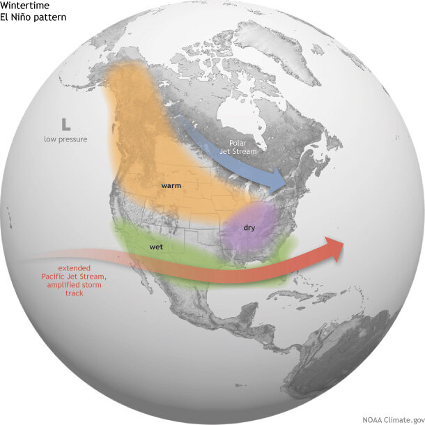
Now what does this mean for our winter? If you know me, you know I don't buy into the textbook ENSO thinking. One exception is that strong and super El Niños do actually impact the atmospheric circulation substantially on their own, and therefore I do buy into the impacts of these specific events a bit more. Here is the expected atmospheric response, especially to strong or super EL Niños. Essentially, the Walker Circulation is weakened and shifted Eastward. Combined with significant heat release and convection over the equatorial Pacific, this can often extend the Subtropical Pacific Jet Stream and support a more active storm track into Southern California.
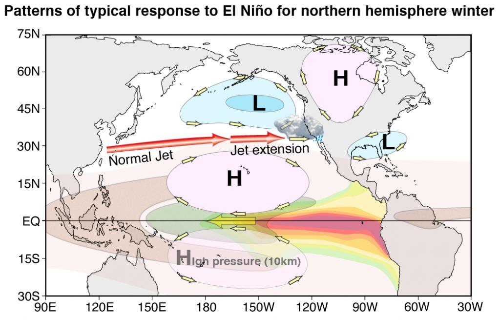
However, even Super El Niños can go wrong, like the winter of 2015-16, which was "meh" in California, and much wetter up north, which diverges from "textbook" thinking:
So I would say I am expecting a slightly wetter than average summer in the Sierra Nevada due to more tropical remnants and monsoonal intrusions. The winter is more uncertain, but if a super El Niño develops, I would say it slightly tilts the odds in favor of a more southern storm track into the West Coast, favoring Southern California and the Southern Sierra. But it is way too soon to count on that!
Finally, El Niño tends to release a lot of heat into the atmosphere. As a result, the summers that follow strong El Niño events can often be some of the hottest years. I am expecting the summer of 2027 to be globally very hot as a result of this...