May Day! Snow Showers to Start the Month, With a Warmer and Drier Long Term Outlook
Overview
My friends...
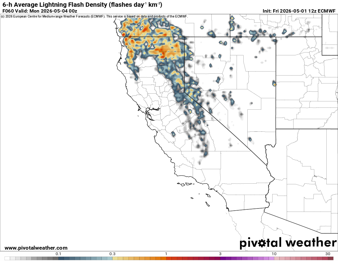
Isolated showers have continued to pop up over the Sierra Nevada these last few days. Anecdotally, it was raining pretty hard up on Sonora Pass yesterday evening.
A showery pattern moves in this weekend, with several days of rain and high level snow over the Sierra Nevada as a trough stalls off the coast. As it ejects eastward on Tuesday, the Bay Area as well as coast mountains of Southern California will see increasing precipitation chances.
Longer term, models still show a much drier and warmer pattern ahead, with occasional mountain showers possible.
Weekend Showers
Tomorrow, an offshore trough builds in and stalls for several days.
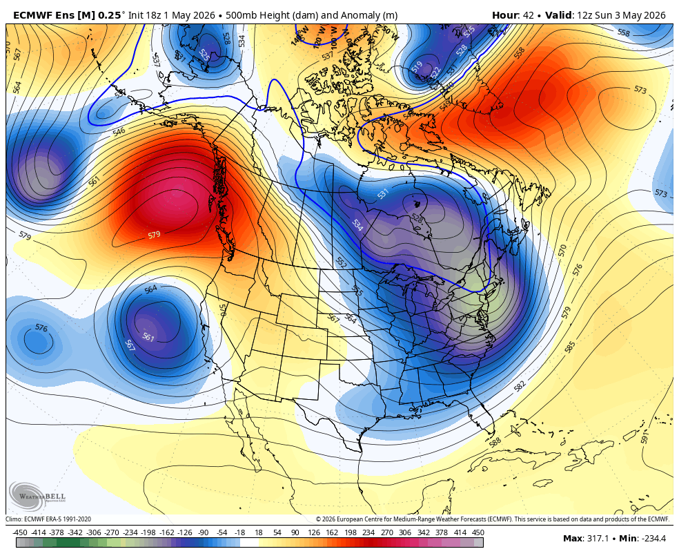
This will bring several days of unsettled weather back to the area. Some showers will start to ramp up tomorrow, while Sunday currently looks most favored for stronger thunderstorms, with snow showers ramping up into early Monday.
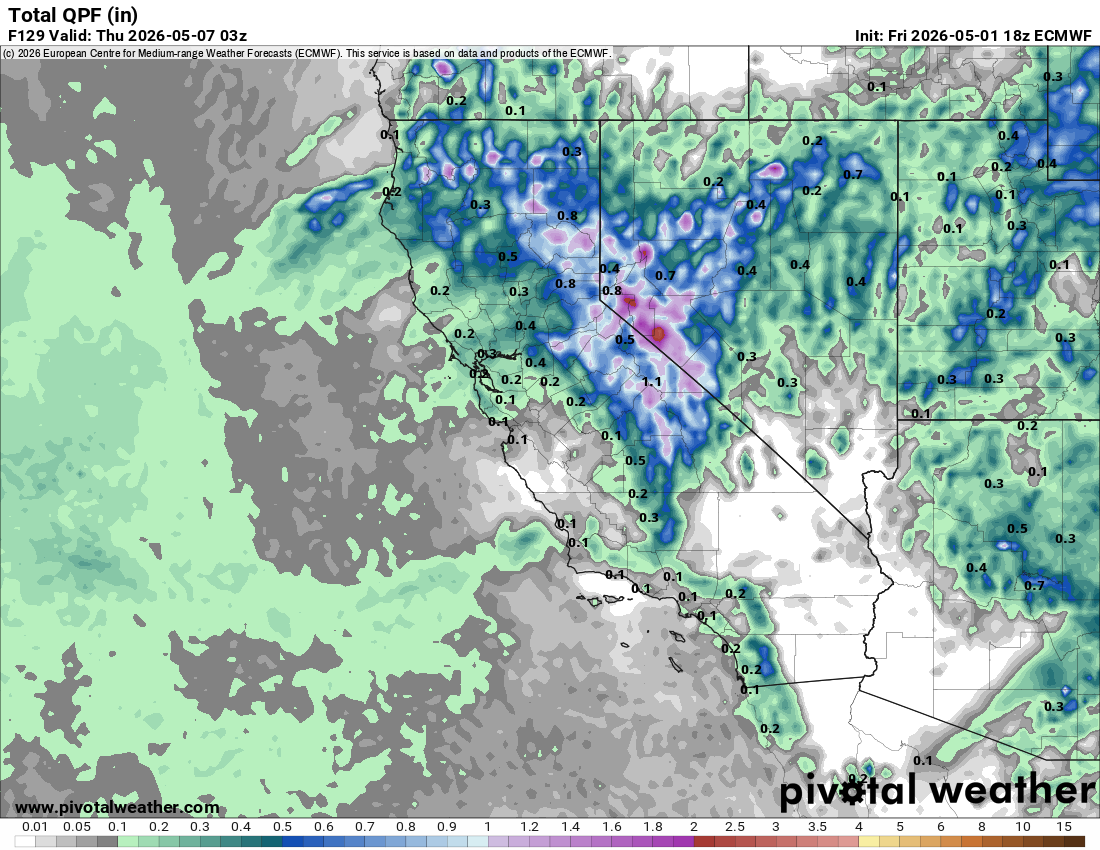
As of now, models show anywhere from 0.7-1.5" of liquid equivalent through Wednesday, with the bulk of the precipitation falling Monday into Tuesday. Snow levels will vary day to day and with precipitation intensity, but the general trends are for snow levels to start around 10k Saturday, lower to 9k Sunday, lower further to 8k Monday, and then rise again to near 9k Tuesday... Fun!
As a result, I'm currently expecting favored areas above 9k' to receive 6-10" of snow thru Wednesday, while less favored areas will receive 1-6" above 9k'. Parts of the White Mountains also look poised to receive over a foot of snow, especially along the northern part of the range above 10,000'...
Because these showers have convective energy behind them, totals will vary widely and could differ on a drainage to drainage scale.
Longer Range
At the 7-12 day range, the models are clearly leaning towards building a ridge over the West Coast, which will bring temperatures above average...
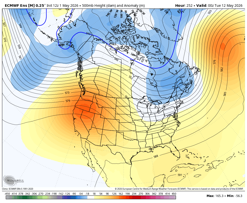
Confidence starts to break down quite a lot more at the 15 day range, with models currently showing a continued diffuse ridging pattern over the West Coast:
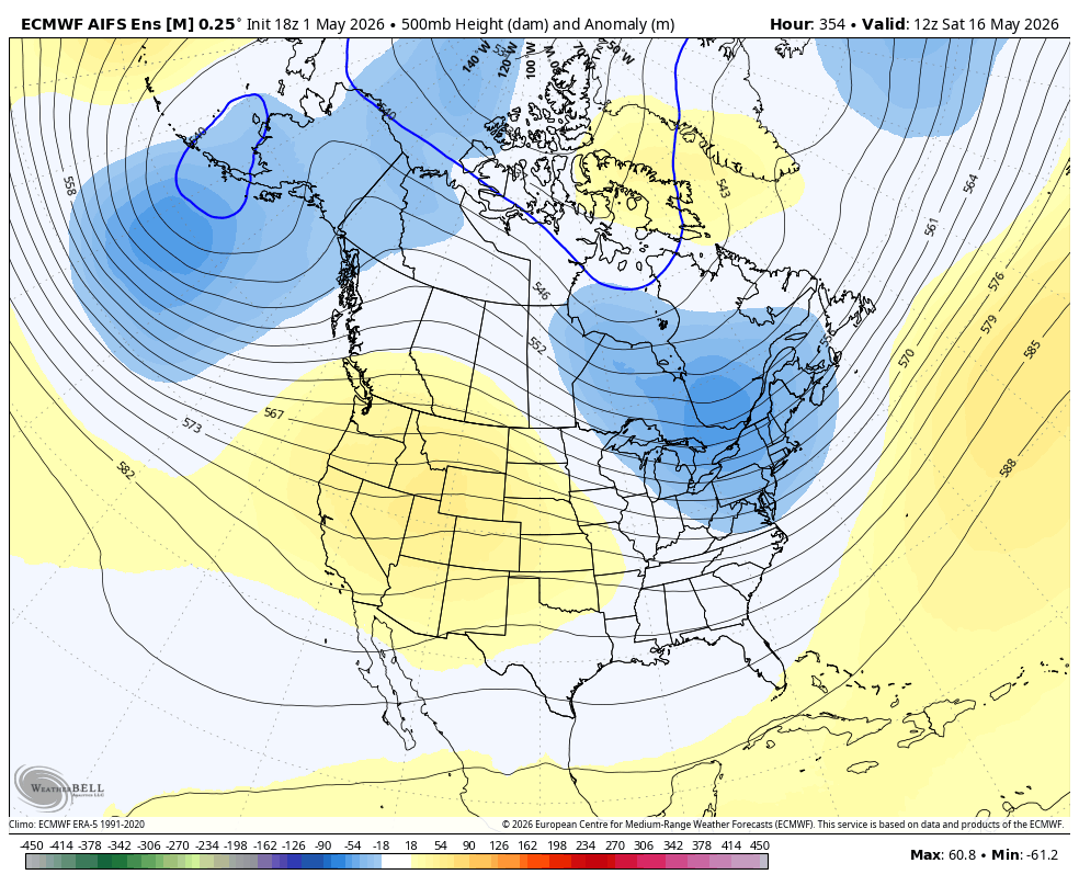
However, not all ensemble members are sold, and some try to keep the pattern progressive with weak short waves approaching California. This could lead to continued mountain showers. IMO, we are due for a warmup and more sustained dryout, however, it doesn't take much to pop off an occasional mountain shower here or there... Time will tell.