A Storm Window This Weekend, And The Door Stays Open
Overview
My friends...
Clear weather will stick around for the next few days, with highs near 60 in Mammoth and near 70 in the Owens Valley. Then, we are still approaching a promising extended window of opportunity for storms.
Modeling around this window has been pretty volatile. The latest trend has been to push back any more substantial precipitation to the end of this weekend, and the first storm looks like it will have a tough time getting here in one piece. But the bigger picture remains largely the same: the Gulf of Alaska trough I've been talking about is setting up, more chances are showing up the week after, and that trough doesn't appear to be going anywhere in the medium range.
It's still too uncertain of a pattern to forecast any potential storm, but we are closing in on another potential storm window we've been tracking for a while.
This weekend: a storm slams into the ridge
The first storm that makes its way towards California under this Gulf of Alaska trough setup is going to be slamming into a ridge on the West Coast. As it does so, it ends up with split flow, sending most of the moisture north into the Pacific Northwest, with a weaker cutoff low fizzling out to the south.
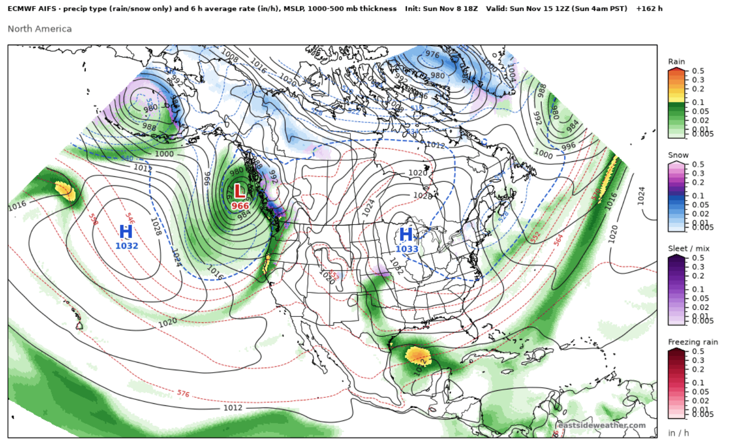
Here is the Euro AI model (AIFS) early Sunday morning. You can see the deep low off Washington, with the front dragging down into Northern California and losing steam as it does.
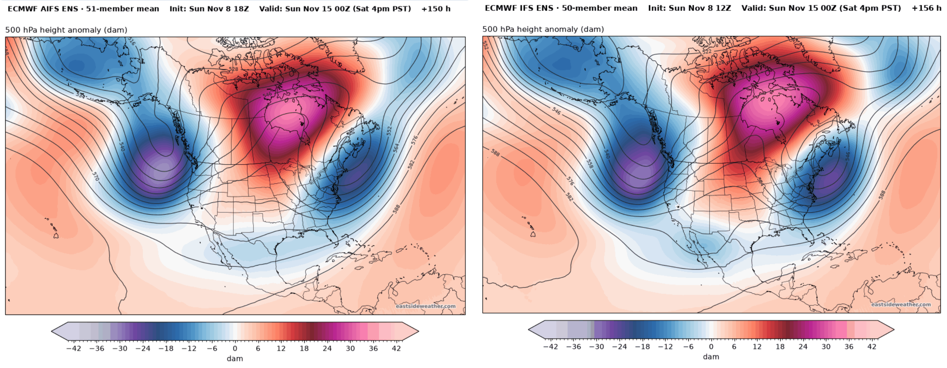
The ensembles agree on the overall setup. Here are the Euro AI ensemble (AIFS ENS, left) and the Euro ensemble (IFS ENS, right) on Saturday afternoon. Both place a pretty deep trough off the Pacific Northwest, with a western ridge holding it back.
What the model trends show
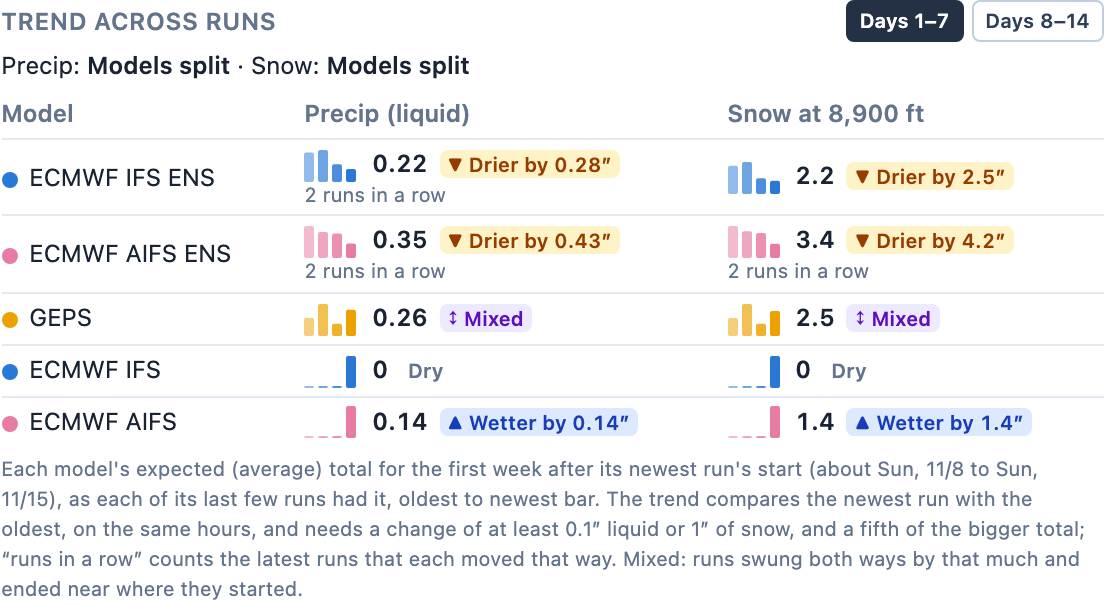
This is where our new model trends feature can be quite helpful for tracking which way a system is heading. It tracks how each model's forecast for Mammoth Main Lodge has changed over its last few runs, so we can see which way things are leaning instead of chasing every individual run.
For the next 7 days, through this weekend, both Euro ensembles have trended drier two runs in a row. That's known as split flow, and can happen when a storm is slamming into a ridge over us. And it's also why the more substantial precipitation has been getting pushed back as models show it disintegrating into two pieces. The one exception is the operational AIFS, which just turned wetter on its newest run. So this weekend is still very much up in the air!
The week after: more chances
By the end of the weekend and into next week, models show the ridge backing off a bit to the east, which could allow storms to push in a bit farther without disintegrating.
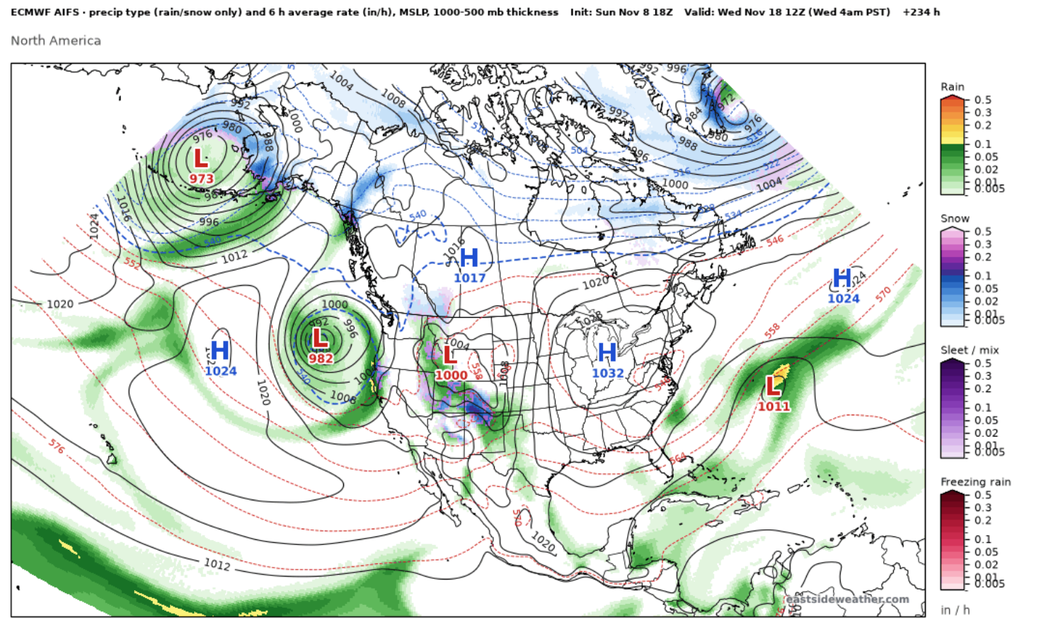
Here is the AIFS again next Wednesday morning, now with a closed low sitting right off the central California coast:
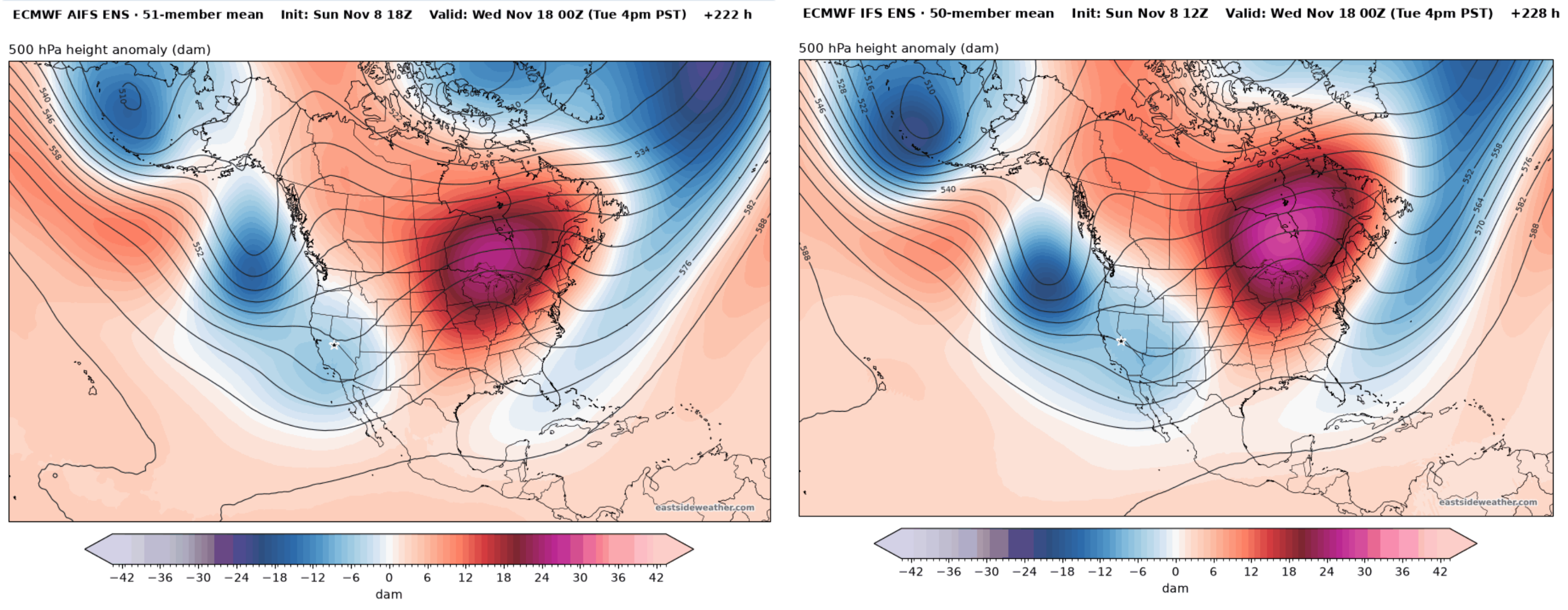
The ensemble means show the same idea, with the trough axis shifting south and lower heights spreading over California. The AIFS ENS (left) and IFS ENS (right) are in good agreement here:
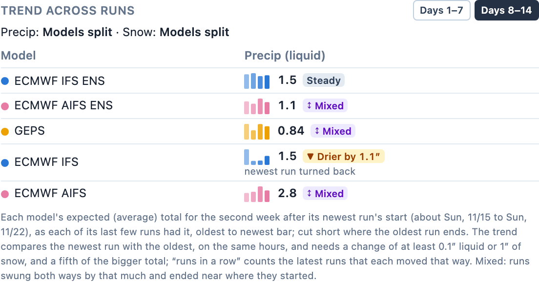
And the trends for days 8 to 14 tell a different story than the weekend. The IFS ENS is holding steady, and the AIFS ENS has bounced around a bit but ended right where it started. My tendency is usually to believe the newer AI models these days, which are holding relatively steady for moderate November precipitation and an open storm door beyond. Remember, our November average is only around 26" of snow.
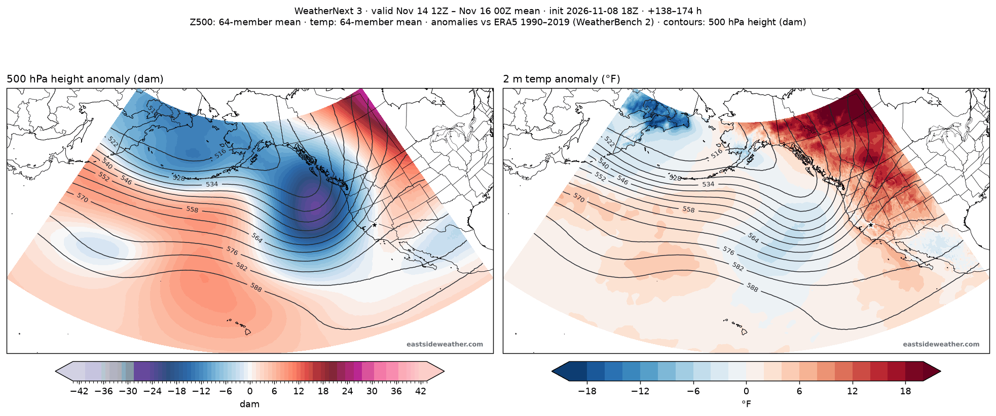
This pattern also has support from Google DeepMind's WeatherNext 3 ensemble, which is one of the best in the world.
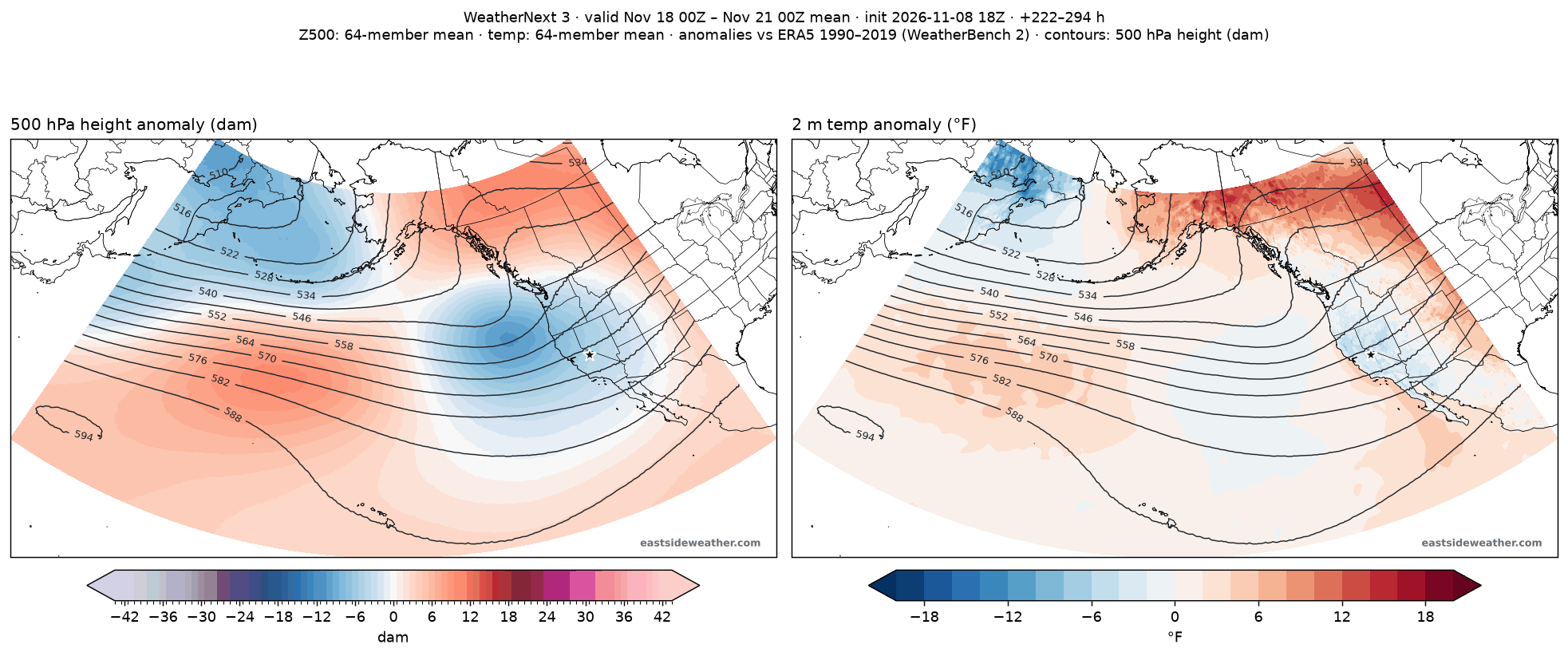
And here it is for the middle of next week (Tuesday through Friday). The trough drops south and sets up right off the California coast, with cooler than average temperatures across the state. This is another promising window of opportunity, but still far from certain.
WeatherNext 3: © 2024-6 Google LLC, whose machine learning models were used to create the experimental data made available under the following licence terms https://storage.googleapis.com/weathernext-public/terms-of-use.pdf. This data is intended for experimental modelling only and is not intended, validated, or approved for real world use.
The Gulf of Alaska trough sticks around
Looking even further out, the Gulf of Alaska trough doesn't appear to be going anywhere in the medium range. Here are the AIFS ENS (left) and IFS ENS (right) two weeks out, on Sunday, November 22. Both keep lower heights in the Gulf of Alaska and across the West, with ridging staying out in the central and eastern part of the continent.
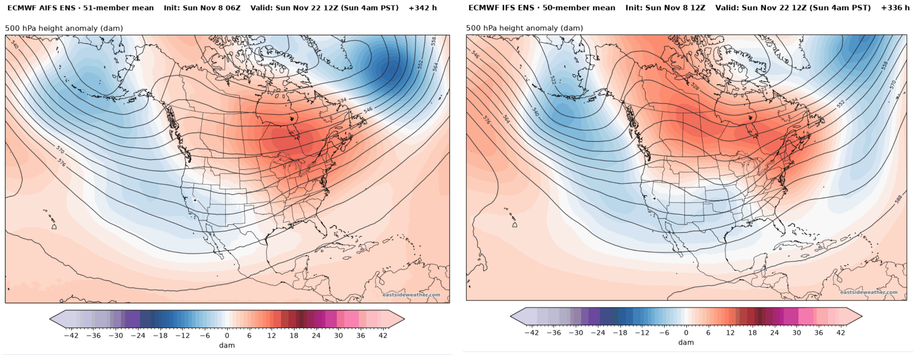
This is our long anticipated El Niño look, and its showing up early. The mid-latitude storm track is maturing very early, and I expect this trend to keep up as we head into boreal winter. But my friends, now is the time for snow dances!
Enjoying the forecasts?
Eastside Weather is a passion project, but keeping it running comes with steady monthly costs: hosting, data feeds and the servers that crunch the model runs. Right now the site costs more than it brings in. Whatever you chip in goes straight back into keeping it going and building new tools.