A Winter Storm This Friday! Chances Continue Into The Medium Range
Overview
My friends...
Happy first Winter Storm Watch of the season to all who celebrate!
Curse of the forecaster... On Sunday, I issued a blog talking about how models seemed to be heading towards a dry start to the weekend. Well, mere hours after I wrote that post, models hopped fully back on the trend of precipitation actually reaching us this Friday. I'd rather have it this way!
As of today, a moderate snowstorm is looking likely from Friday afternoon into Saturday morning, and the National Weather Service has issued a Winter Storm Watch for Mono County. Another, colder system appears to be on its heels Monday. Beyond that, ensembles show considerable support for continued activity in California. The long-awaited Gulf of Alaska trough delivers for us.
Looking further out, a brief -EPO block looks to be favored, with troughing in the Gulf of Alaska that could send undercutting systems into California. I don't really see an end in sight to this general pattern of troughing in the Gulf of Alaska... But now I'm out on a limb. One storm at a time!
For those who just want the forecast for Friday & Saturday: I'm expecting 6-10" of snow at Main Lodge as of now, subject to change.
Friday: the first storm arrives
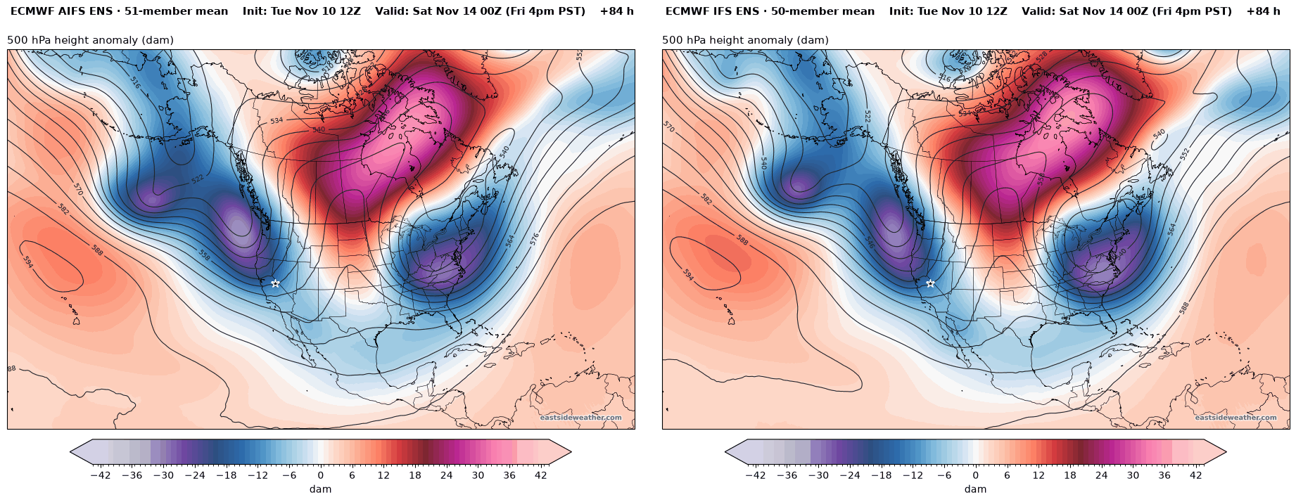
Here are the Euro AI ensemble and the Euro ensemble Friday afternoon. The ridging pattern has backed off far enough for a trough to dig into the state. There is now great agreement on that from models.
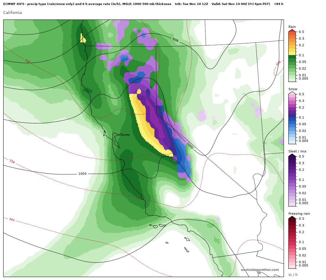
Here is the Euro AI operational model for Friday afternoon. A potent front with a narrow cold-frontal rain band will drive heavy precipitation rates occasionally reaching 2-3" of snow/hour Friday night into Saturday morning.
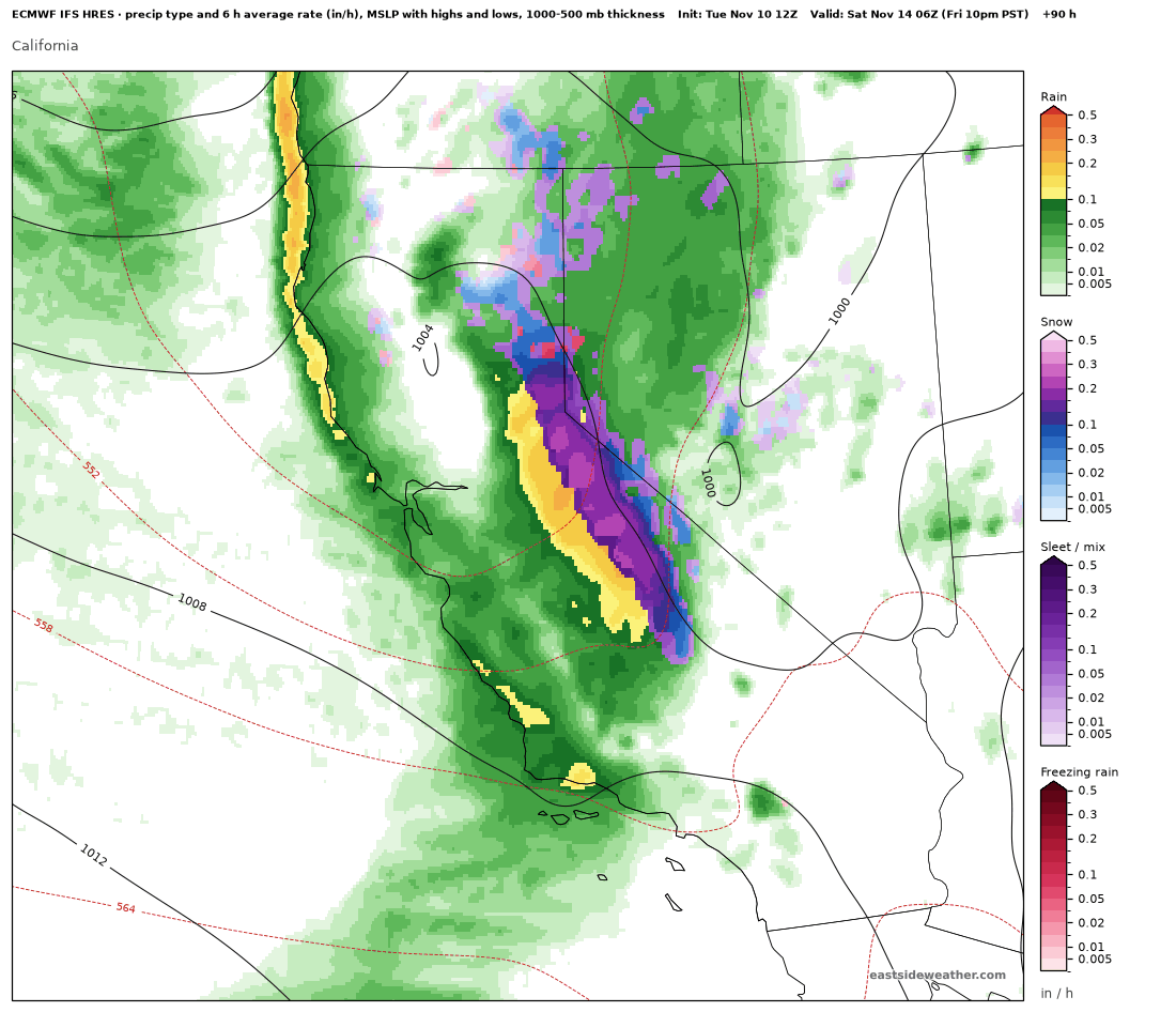
The Euro operational model is in broad agreement now, showing heavy Friday night snowfall and rain.
Our first Winter Storm Watch has been issued by the NWS, calling for up to 12 inches of snow above 7,500 feet, and 6 inches between 6,000 and 7,500 feet. Also coming along with the snow are very heavy winds. Winds could gust up to 80 mph over ridges and 40-55 mph along 395...
Snow levels
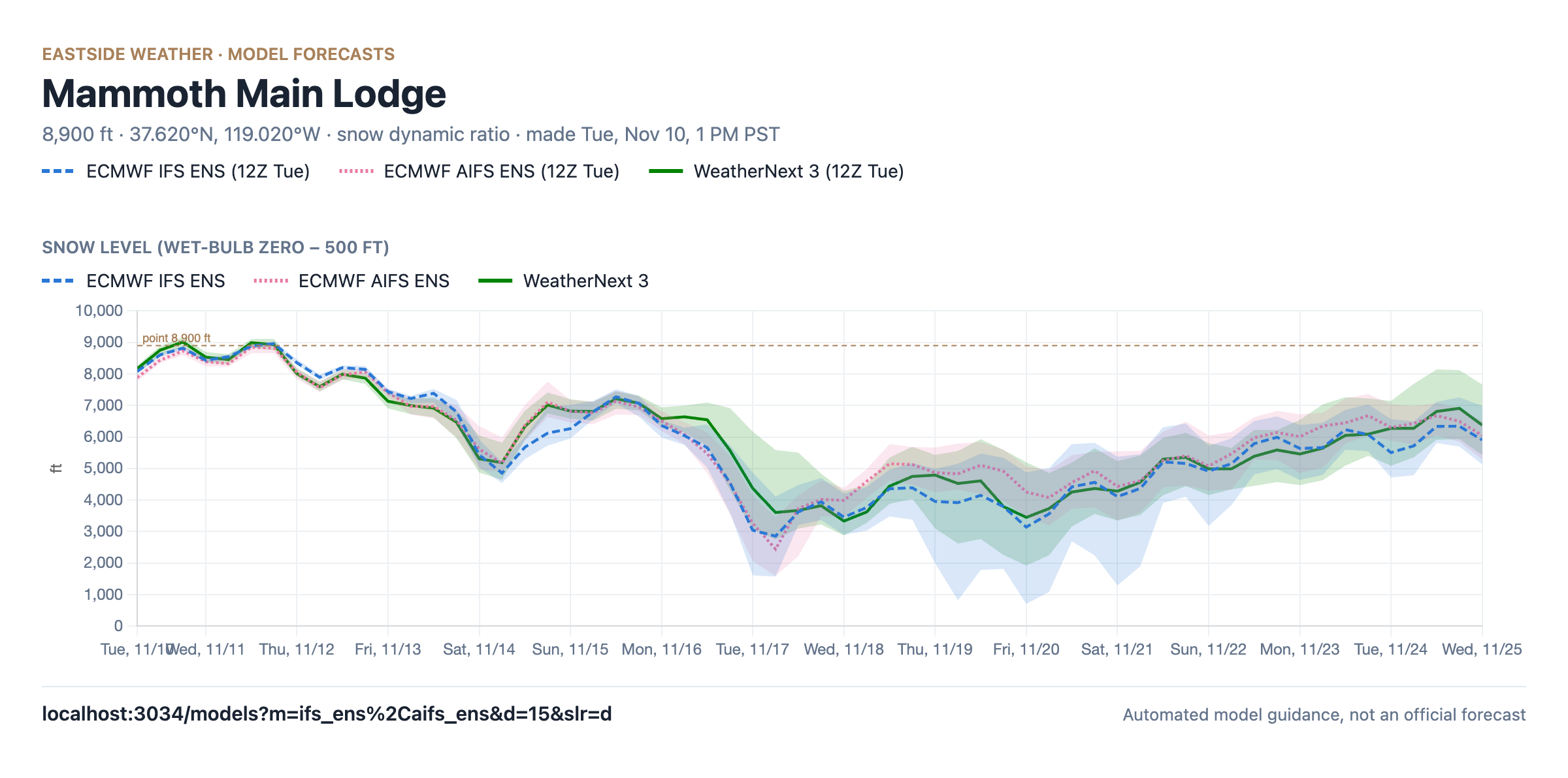
The system comes in warm, but not as warm as our Halloween storm. Snow levels start out around 7,000 to 7,500 feet on Friday with some Sierra cement. Snow levels will fall to around 5,000 to 6,000 feet by Saturday morning with colder air behind the front.
The Monday system looks like a much colder storm. Models show snow levels around 2,500 to 3,500 feet Monday night into Tuesday, so snow down in the Owens Valley and at lower elevations is certainly a possibility, but this is still too far out.
Monday: a colder storm
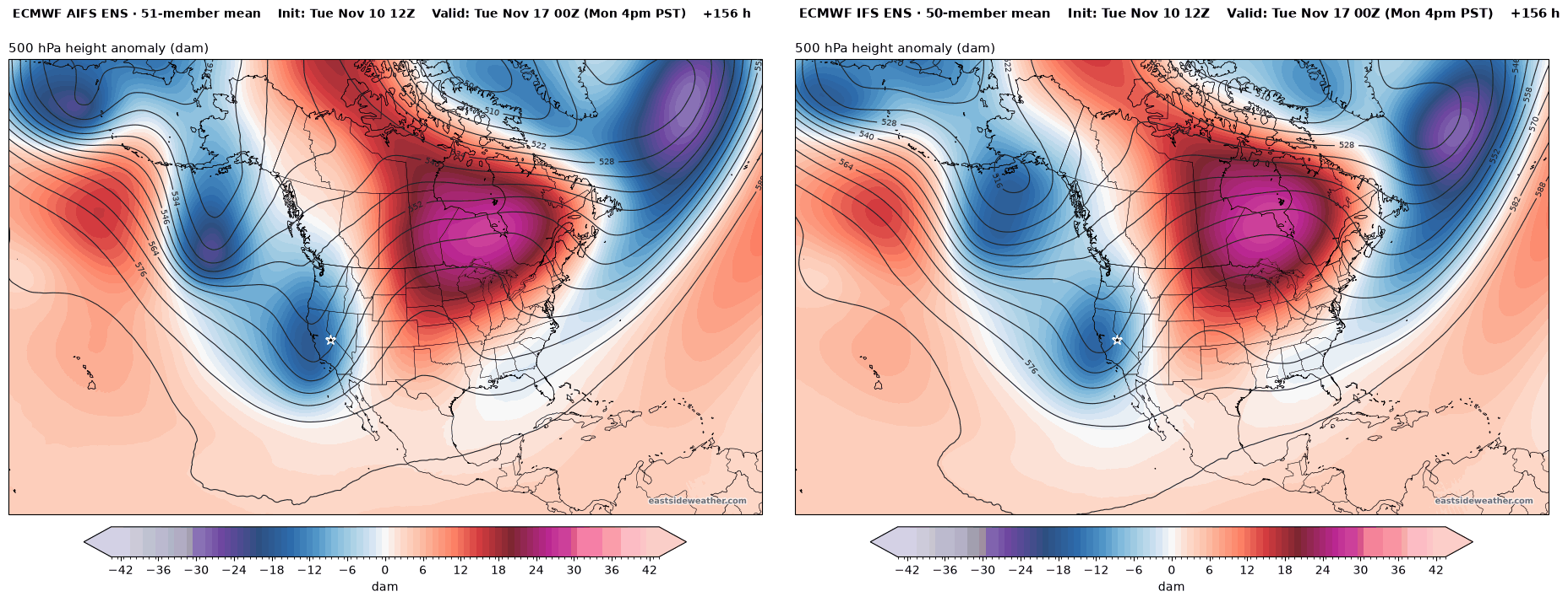
The second system drops in from the north on Monday. Here are the AIFS ENS (left) and IFS ENS (right) Monday afternoon, with a sharp trough digging down the California coast. This one has less moisture to work with, but much colder air...
How much?
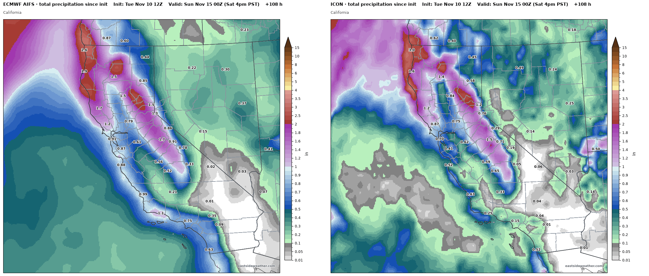
Since only Friday and Saturday are close enough, we'll only forecast for those. Through Saturday afternoon, the Euro AI and the ICON put the heaviest totals in Northern California, but still give the crest around Mammoth over 1" of liquid, with 1.5-1.7" on the west slope.
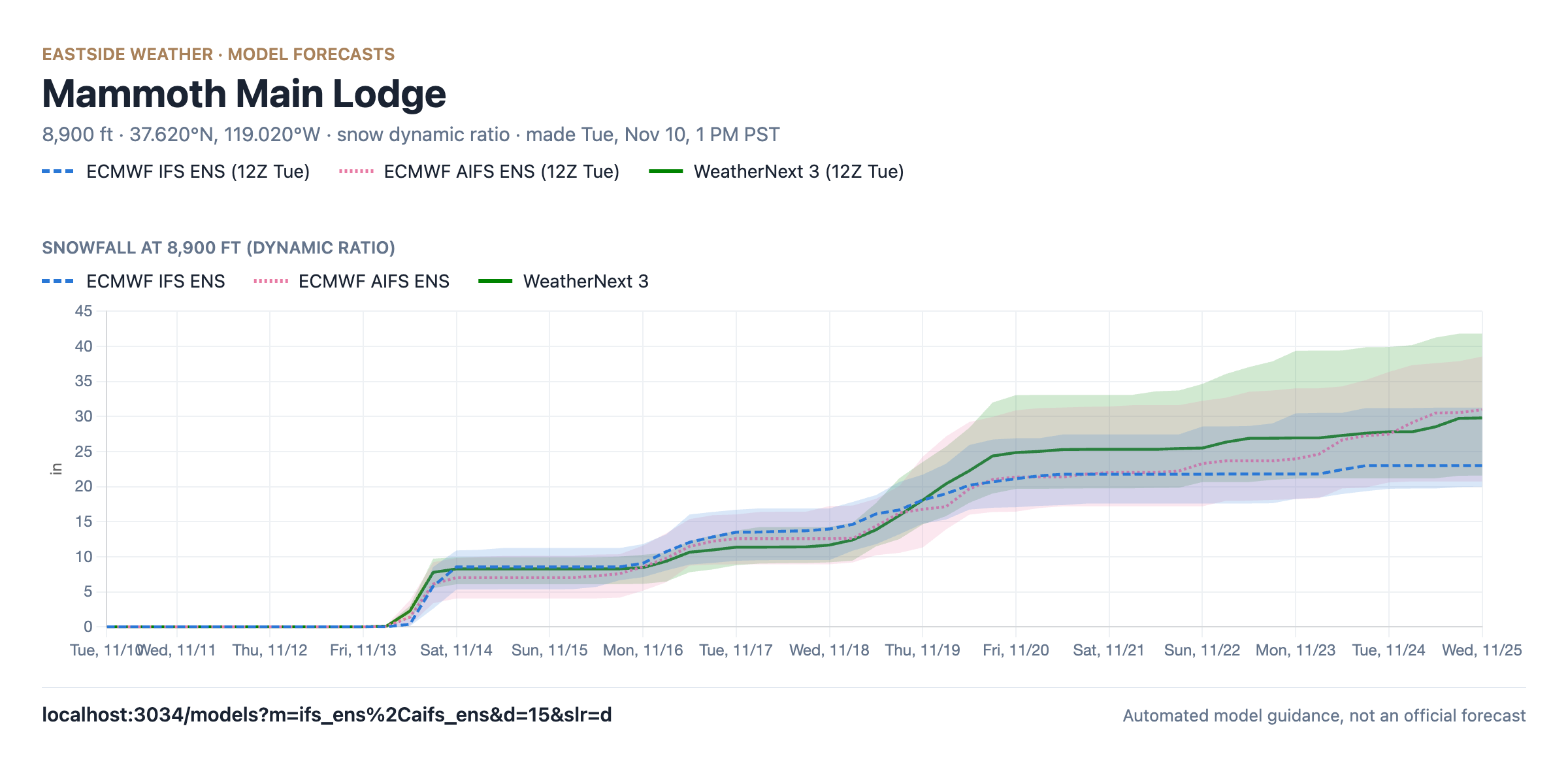
The ensembles also went wetter on this morning's 12Z runs. The Euro AI ensemble went from a median of around 0.3" at Main Lodge to around 0.9", and all three ensembles now agree on around 1-1.15" of liquid through Saturday.
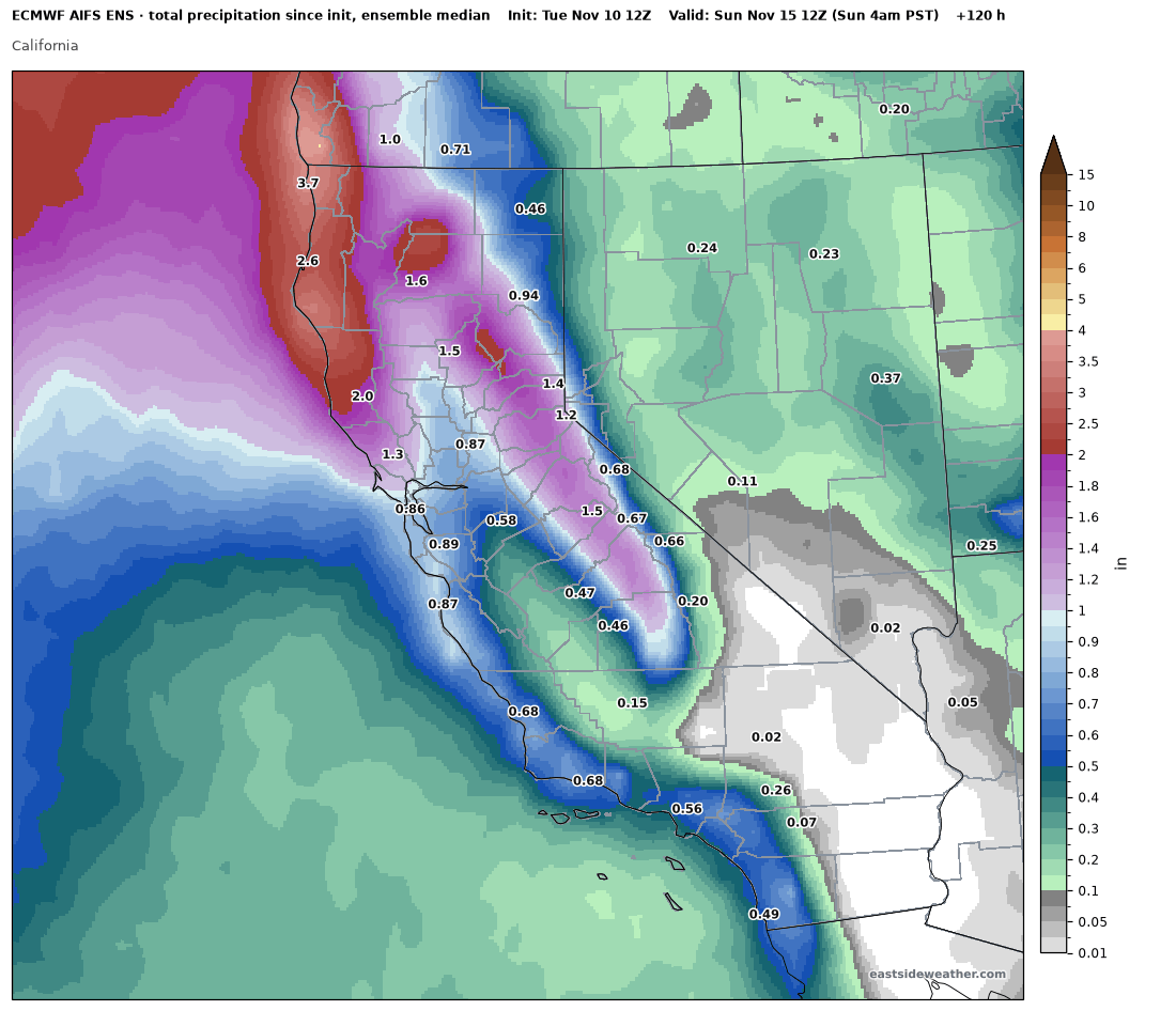
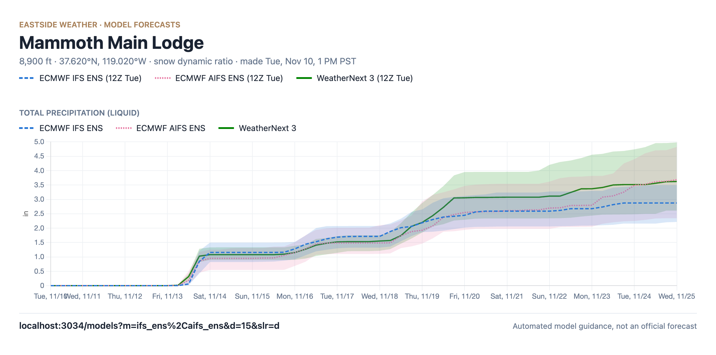
That works out to medians of around 7-8.5" of snow at Main Lodge. As a brief aside, instead of a 10:1 or Kuchera ratio, these snow numbers use our new Mammoth snow ratio, fitted to the ski patrol's hand-weighed Sesame snow board, which accounts for how strong winds pack the snow down. With warm 700 mb temps and 60-80 mph gusts on the ridges, it calculates Friday at around a 7:1 ratio.
WeatherNext 3: © 2024-6 Google LLC, whose machine learning models were used to create the experimental data made available under the following licence terms https://storage.googleapis.com/weathernext-public/terms-of-use.pdf. This data is intended for experimental modelling only and is not intended, validated, or approved for real world use.
Putting it all together, between Fri & Sat, I'm thinking roughly 6-10" of snow at Main Lodge, 8-14" at the summit, and 3-7" in the town of Mammoth Lakes (warm surfaces will hinder accumulation at first).
After Saturday, the ensembles keep climbing, with the AI models reaching multiple inches of liquid at Main Lodge over the next two weeks. That is still too far out to put numbers on, so one storm at a time!
The medium range: a brief -EPO block
After Monday, models keep the storm door open, with another shot of precipitation trending likelier for the middle of next week. Beyond that, a possible -EPO block develops with an Alaskan ridge and a trough in the Gulf of Alaska.
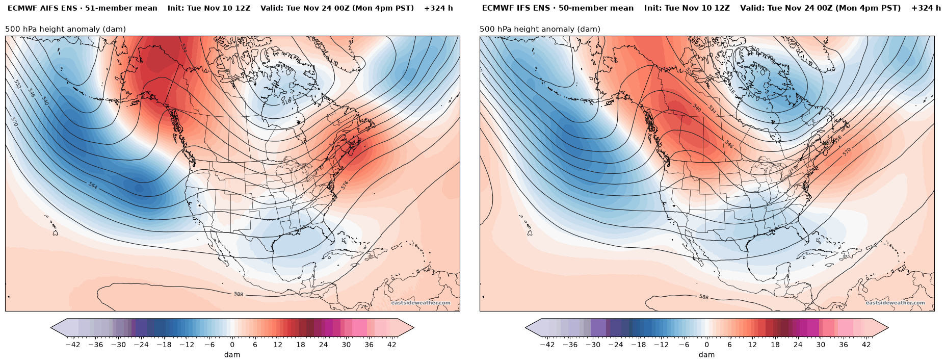
WeatherNext 3 shows the same idea at the same time. For what it's worth, it doesn't show that Gulf of Alaska trough going anywhere in the medium range.
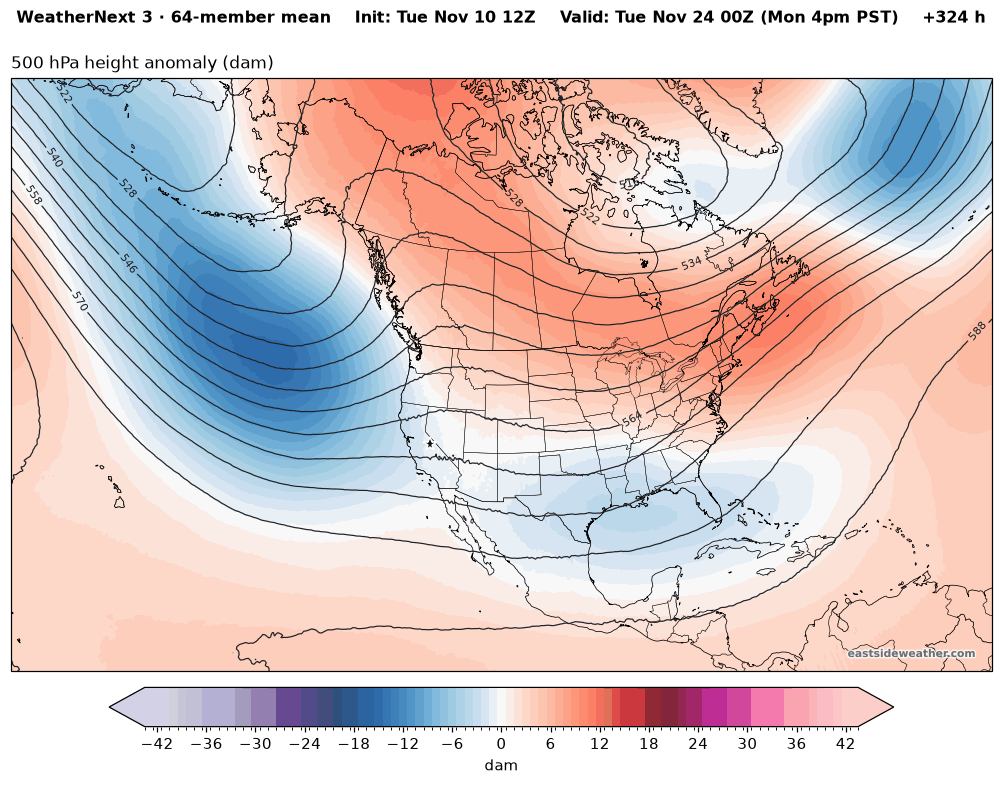
With this configuration, storms could potentially undercut the ridge to our north into California. And ensembles generally show that possibility, with precipitation trending up at that window. Far out, but time will tell!
How long will this last?
This pattern is undoubtedly being driven by our historic El Niño. It is a textbook look, and it's showing up on the early side for El Niños. At this point, I'm starting to believe this will be the dominant pattern this winter.
Seasonal models show a nearly identical look to what the medium range shows above.
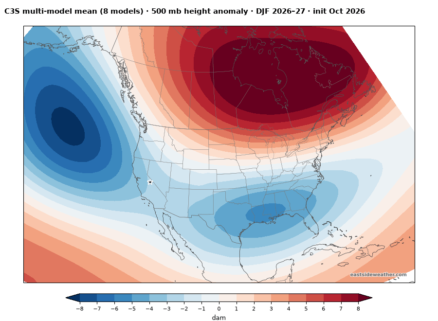
Of course, there will be breaks in the pattern, but I'm buying into an active winter in California. An in-depth discussion on that coming shortly...
So for now, my friends... Let it snow!
Enjoying the forecasts?
Eastside Weather is a passion project, but keeping it running comes with steady monthly costs: hosting, data feeds and the servers that crunch the model runs. Right now the site costs more than it brings in. Whatever you chip in goes straight back into keeping it going and building new tools.