A Close Call With Some Tropical Remnants, a Retreating Monsoon, and a Large Brush Fire Near Aberdeen!
Overview
My friends...
The past few days have featured increasing thunderstorm activity as remnants from a tropical system pass northward off our coast. Today will feature the most widespread thunderstorm activity across the Eastern Sierra Nevada and eastern California. After this, monsoonal moisture appears to weaken and retreat to the Desert Southwest for the foreseeable future.
A large brush fire broke out near Aberdeen yesterday and is currently at 2,500 acres with 5% containment. Evacuation orders are in place near the fire.
Thunderstorms and the Monsoon
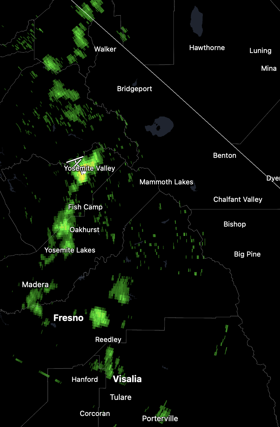
Several days of increasing thunderstorm activity will peak today with the most widespread activity yet. Radar currently shows some cells tracking northward west of the Sierra Crest this morning:
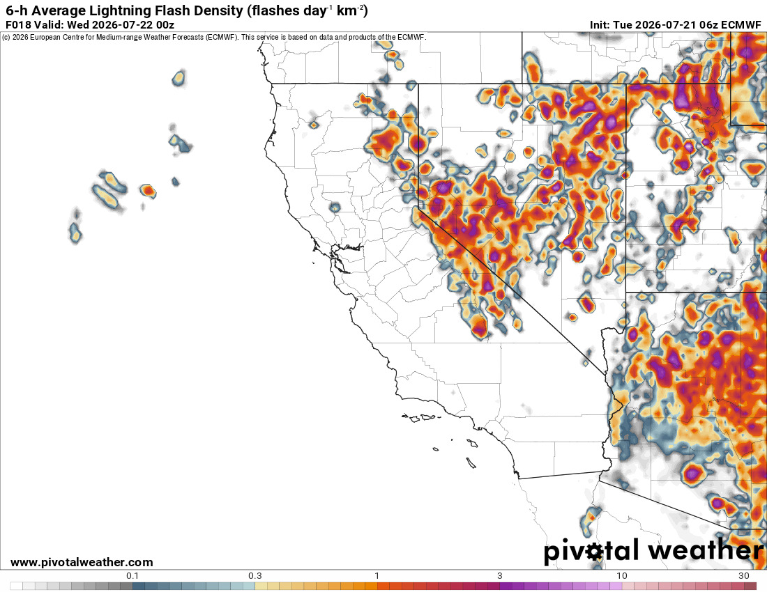
Today, there will be widespread thunderstorm activity, with strong downpours, lightning, gusty outflow winds, and hail possible. Here is the Euro showing lightning activity for this afternoon:
This is bringing substantial moisture into the mid-levels of the atmosphere, while moisture remains less impressive near the surface in some lower-elevation valleys. Stronger storm cores can still produce heavy downpours, but the drier subcloud layer may lead to more evaporation beneath weaker cells and a lightning risk outside the main rain cores.
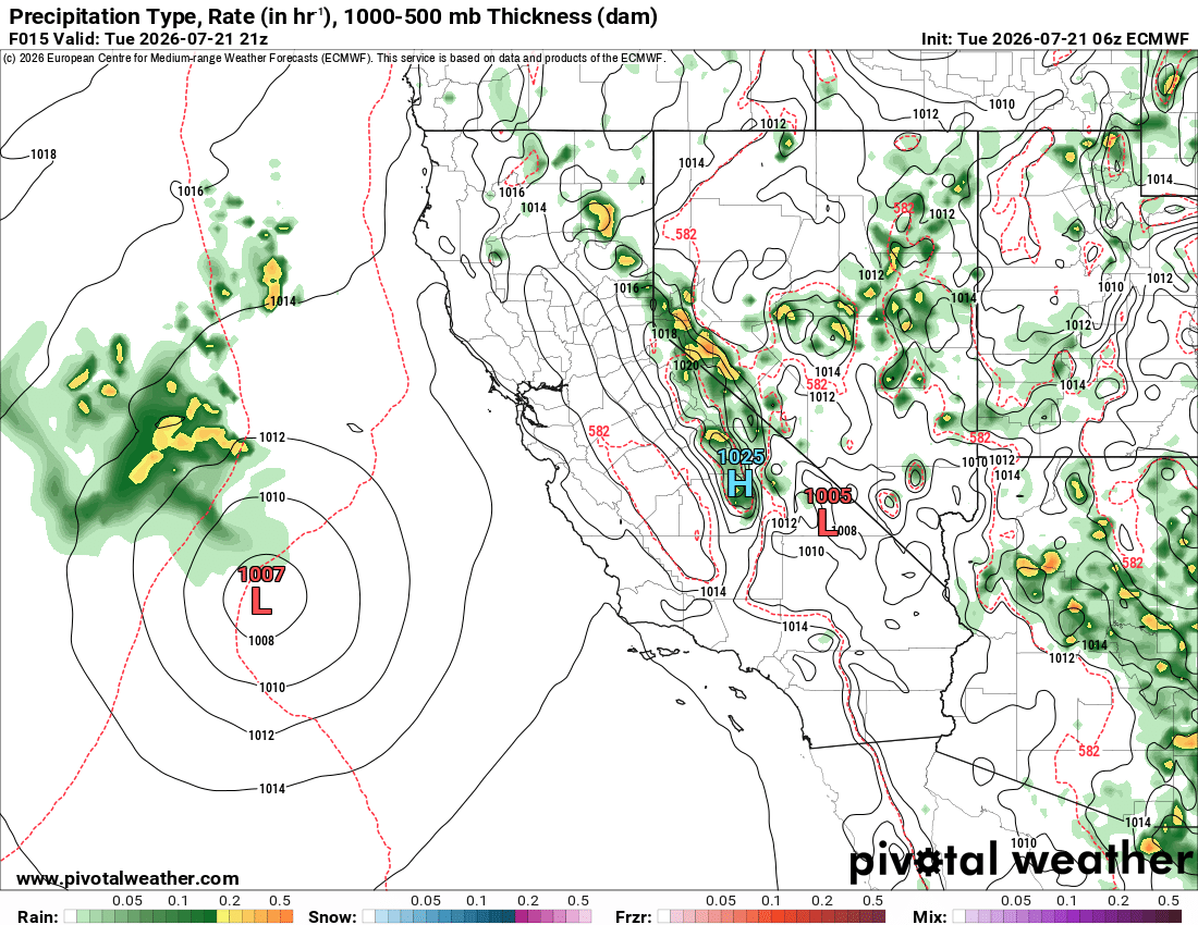
The above graphic shows a relatively close call with some tropical remnants tracking north. This is bringing a lot of moisture into the mid-levels of the atmosphere:
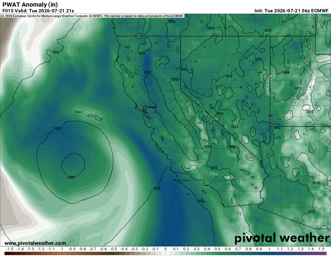
With less moisture at lower levels:
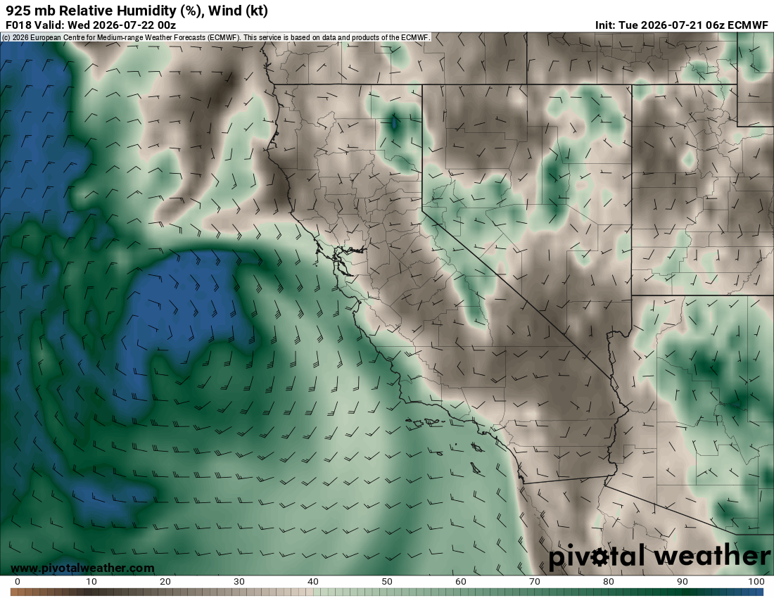
While this is a noteworthy event for the Sierra Nevada, most of the state will only see high clouds. However, if this system tracked a bit farther east, it would have been quite the story! As a reminder, this type of moisture connection will become more plausible later this summer, as the Eastern Pacific hurricane season is expected to be more active, in part due to our developing El Niño, and the monsoon is generally better established.
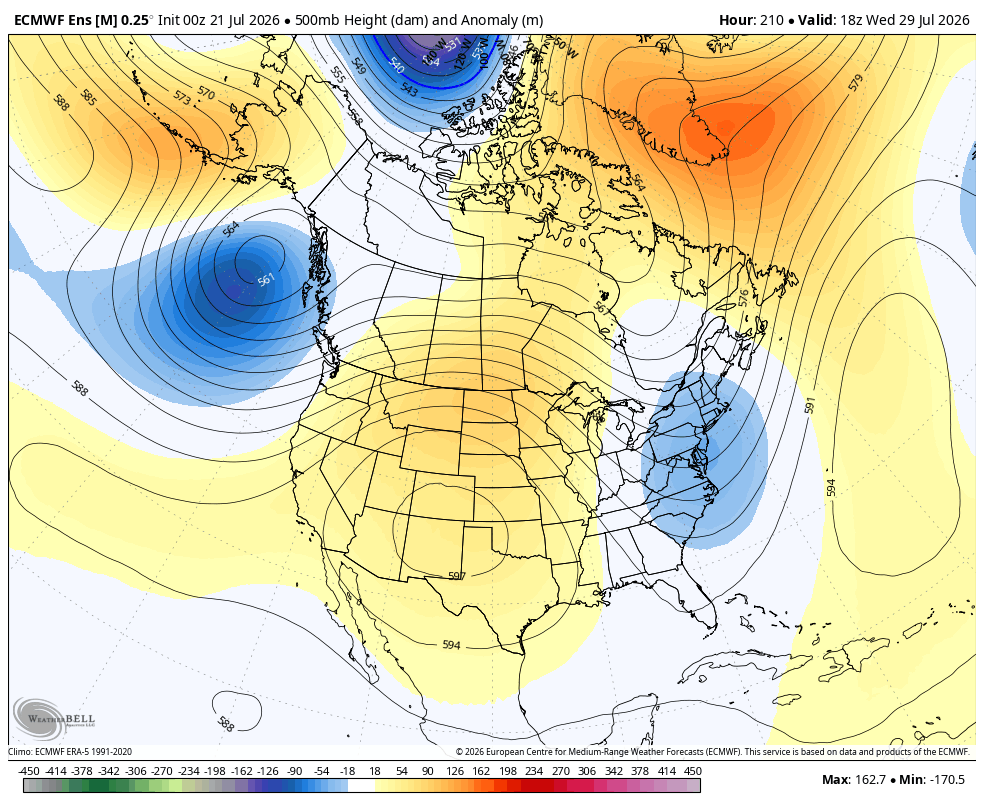
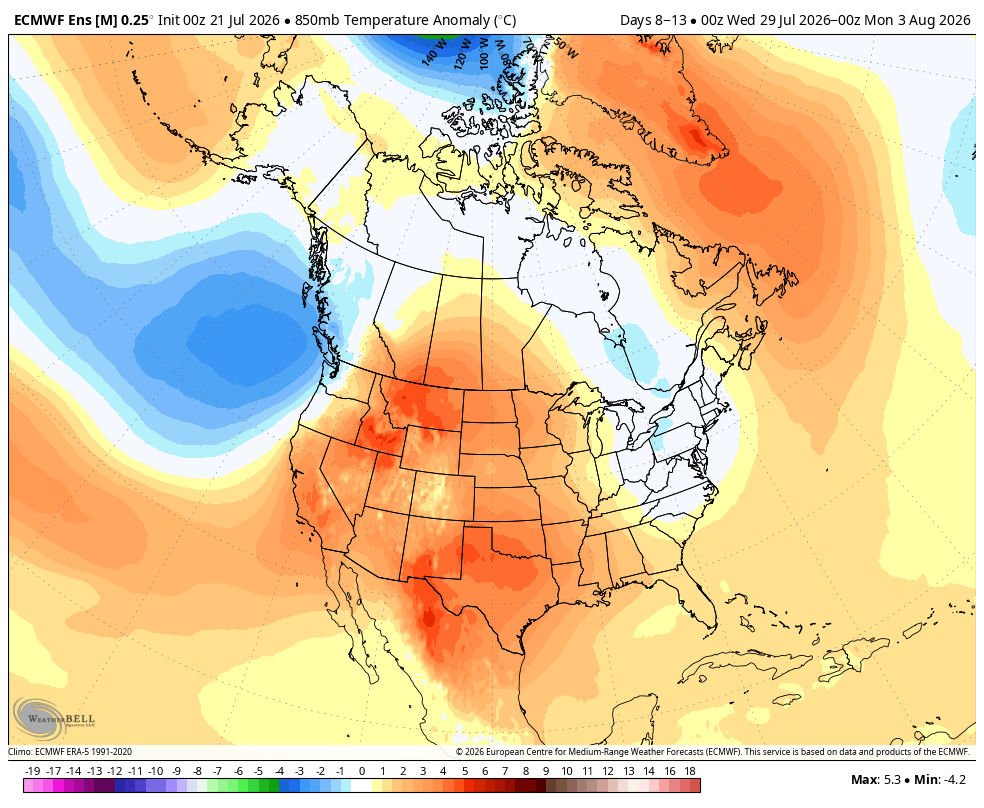
After this, monsoonal moisture gradually retreats to the Desert Southwest and weakens, with no significant moisture intrusions currently expected over the next 10 to 15 days. Confidence is naturally lower toward the end of that period.
This will coincide with a ridge centered near the Four Corners region and a heatwave across the Southwest, with above-average temperatures expected.
Fire in Aberdeen
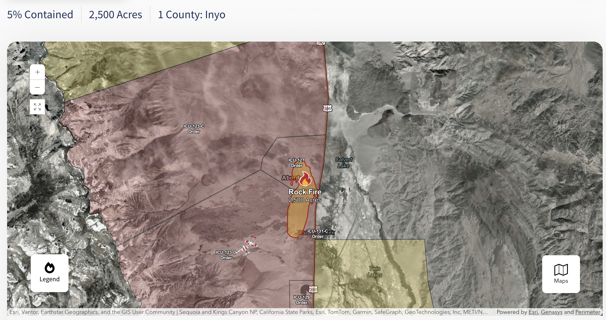
Yesterday, a brush fire broke out near Aberdeen and grew quite rapidly. It is believed to have started around 4:50 p.m. on 7/20, and the cause is still under investigation. The fire has been named the Rock Fire.
It is currently at 2,500 acres and 5% containment as of 9:27 a.m. on July 21, with continued growth expected throughout the day. These types of brush fires can spread very quickly, although their evolution depends heavily on winds, fuels, terrain, and suppression efforts. Let's hope for good news as crews work to contain the fire! As of now, smoke impacts appear to be relatively minimal outside of the immediate area.
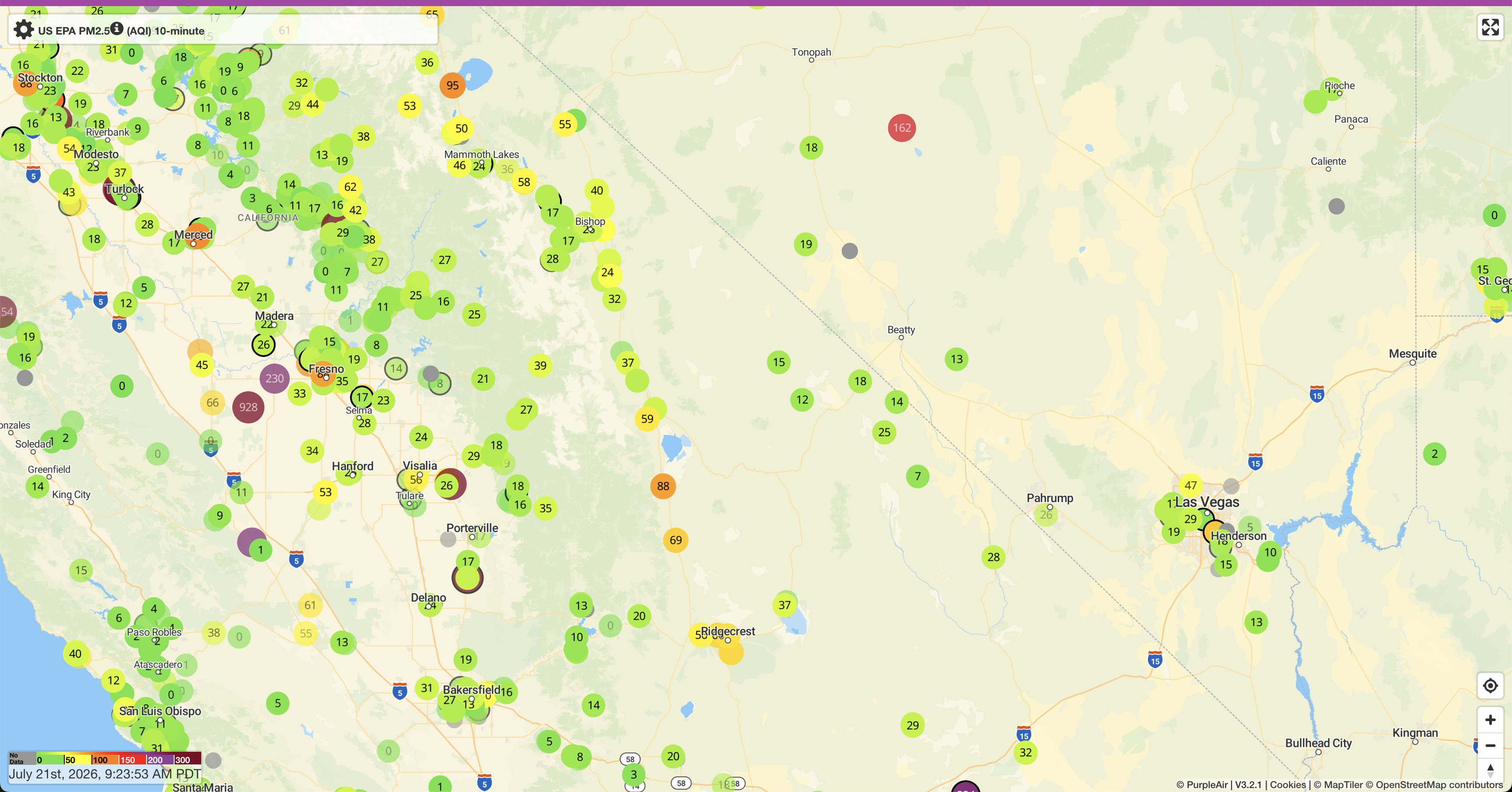
The HRRR does show a decent near-surface plume of smoke heading south down the Owens Valley later today:
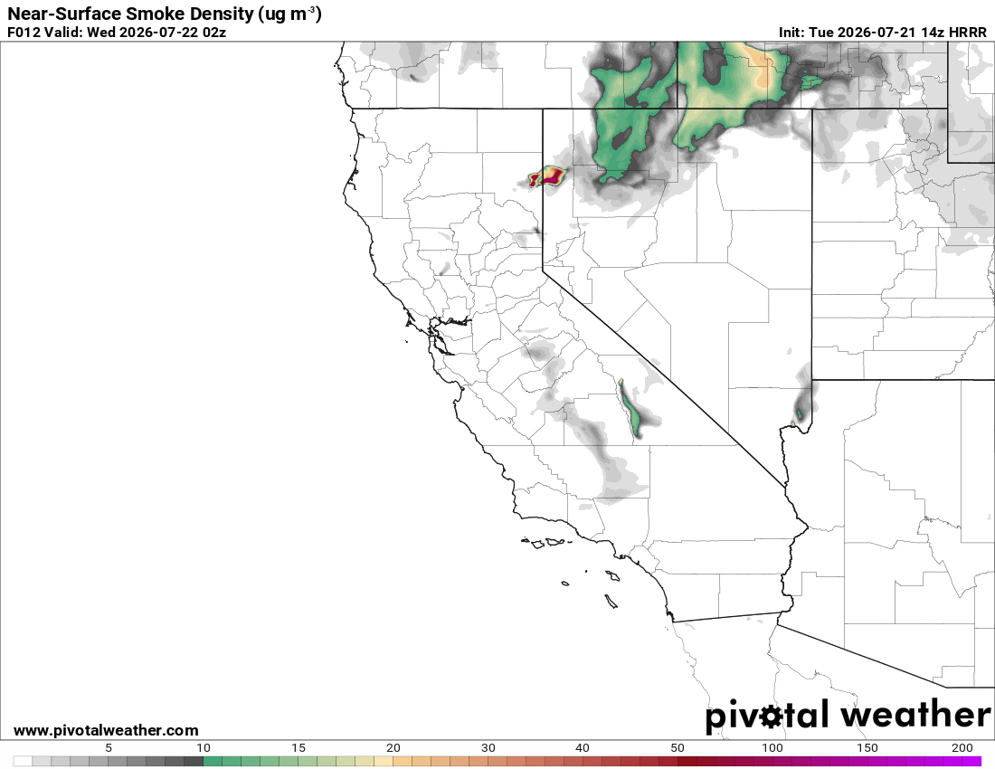
However, it also shows the plume clearing relatively quickly into tomorrow.
Enjoying the forecasts?
Eastside Weather is a passion project, but keeping it running comes with steady monthly costs: hosting, data feeds and the servers that crunch the model runs. Right now the site costs more than it brings in. Whatever you chip in goes straight back into keeping it going and building new tools.