Tropical Moisture Coming? Burners Beware!
Overview
My friends...
If you have been following my discussions, you'll know that I've been talking about the possibility of remnant tropical moisture making its way to California by the end of August. This now appears quite likely, with all models showing moderate rainfall totals over the Sierra Nevada as remnant moisture from Tropical Storm Iselle phases with an upper-level low (ULL) approaching California this Friday.
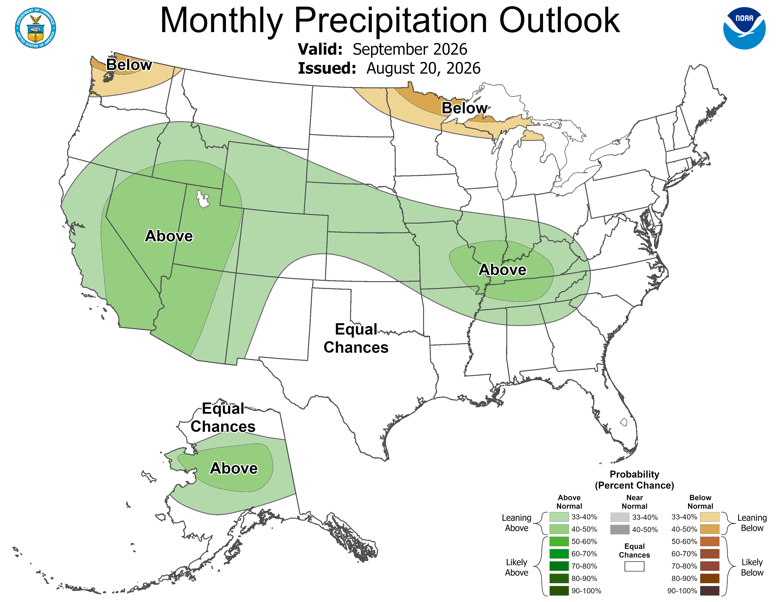
Beyond this, continued activity in the Eastern Pacific Basin looks likely, which could bring more opportunities for remnant moisture into September. This is reflected in long-term model and CPC guidance.
Tropical Moisture in the Sierra!
As of now, models indicate that the heaviest moisture will arrive Friday AM and last into Saturday AM, with convectively driven showers possible through the weekend. The Euro AI model shows the heaviest plume arriving north of Mammoth and spilling over into the Black Rock Desert, which is unfortunate timing for Burning Man, whose gate opens this weekend...
Friday should feature rain and significant moisture over the Sierra Nevada, with clearing out likely over the weekend. Lingering moisture may allow for afternoon thunderstorms to develop this weekend, so climbers and hikers should be aware that clear skies in the morning are not an indication of a clear forecast. By Sunday, most of the convective activity appears likely to diminish.
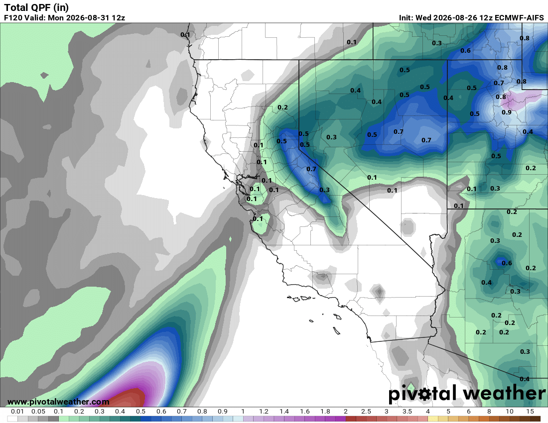
Unfortunately, Burning Man is increasingly in peril with the expansion of the North American Monsoon and increasing hurricane activity...
Model guidance and predictability have been especially poor lately, in part due to numerous tropical systems across the Pacific injecting uncertainty into the pattern as they recurve to midlatitudes. This poor predictability is likely to continue for the remainder of the Pacific hurricane season, as it typically reaches its peak around this time of year.
Longer Range... More Chances?
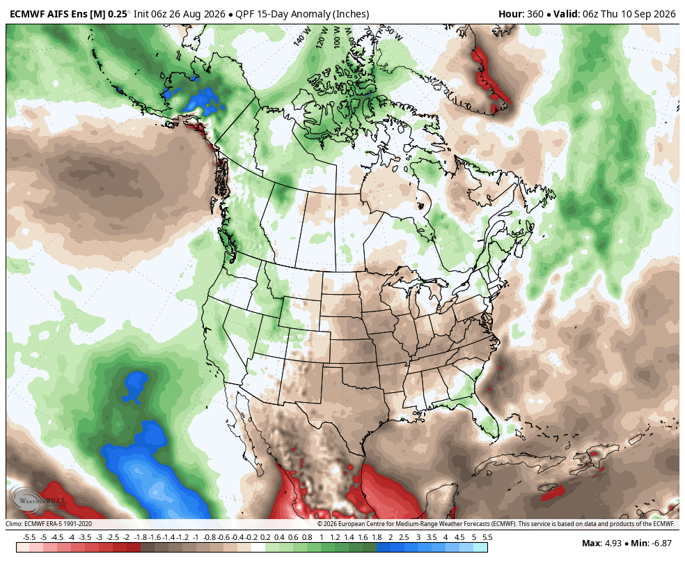
Because model predictability is very poor right now, it will be hard to speak with any measure of confidence regarding future opportunities for tropical moisture into the Southwest. However, with more activity expected to continue in the Eastern Pacific, the ingredients are certainly there for more of these events, which is also shown in ensemble guidance:
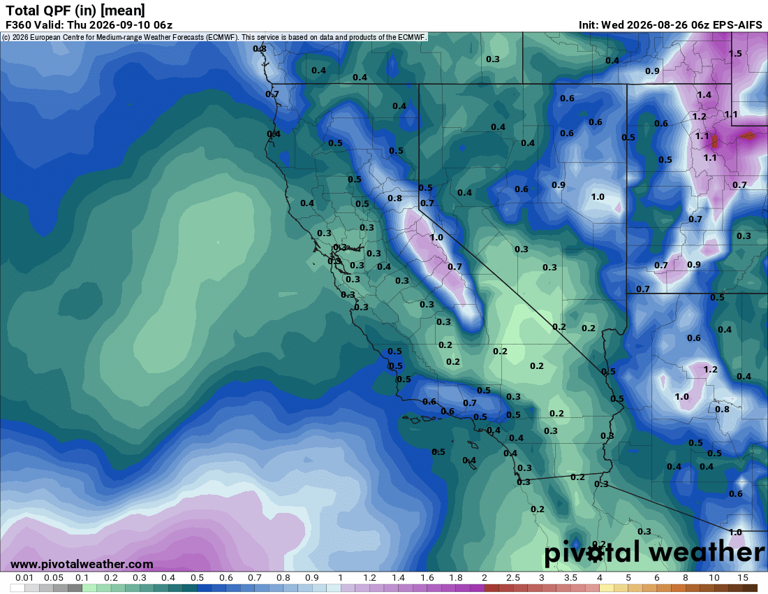
If this were midwinter, we would hardly bat an eye at these numbers; however, this is typically a time of year when the average precipitation is near zero for much of California, so seeing widespread precipitation in ensemble modeling is certainly worth paying attention to.
Getting true remnants of a tropical system into California requires a very favorable and unlikely setup to occur; however, with an active outlook in the Eastern Pacific expected, there will be more opportunities than usual to at least see some remnant moisture coming our way...
The CPC guidance for the long range also reflects this possibility: