Cool and Dry Fall Weather is Favored. What Does It Mean For Our Foliage?
Overview
My friends...
Dry and cooler-than-average weather will persist for the foreseeable future as weak troughing hangs around out west. This pattern should favor continued fall color development, with plenty of cool nights and mostly dry weather ahead.
Anecdotally, parts of the Eastern Sierra such as Rock Creek are already beginning to see significant fall color, with a pretty noticeable increase compared to just one week ago. Please check out the Mono County Fall Foliage Report for weekly updates on the progression. As of writing this blog on Monday, Sept 14th, the report is 5 days old and indicates color is "just getting started" at a majority of locations on the Eastside.
It is still a little early to say that the entire fall color season is running ahead of schedule, but what I saw at Rock Creek this weekend has me thinking a few of our higher elevations might. More on that below.
Longer range, there are some early indications that we may see precipitation chances increase slightly 10-15 days out as continued troughing appears favored in ensemble guidance.
Cool Fall Weather
Models show a string of weak troughs moving over California during the next 10-15 days. This will keep us mostly dry while also bringing cooler-than-average temperatures, with some particularly chilly nights expected.
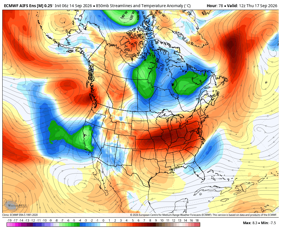
In particular, Wednesday night and Thursday morning look rather cold as a trough moves over us.
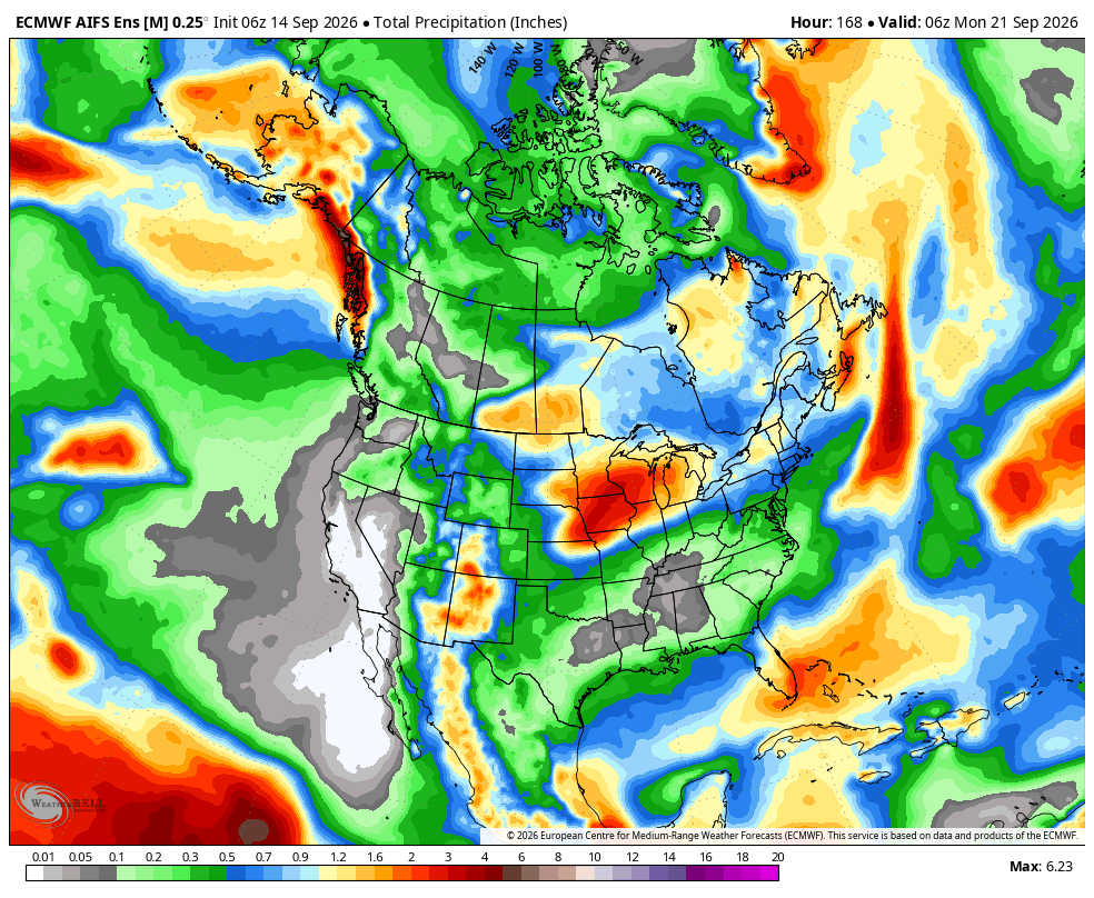
Models show us remaining mostly quite dry over the next 7-10 days. However, toward the end of the forecast window, around days 10-15, some models indicate increasing chances for moisture to return to the Sierra. Nothing particularly impressive at the moment:
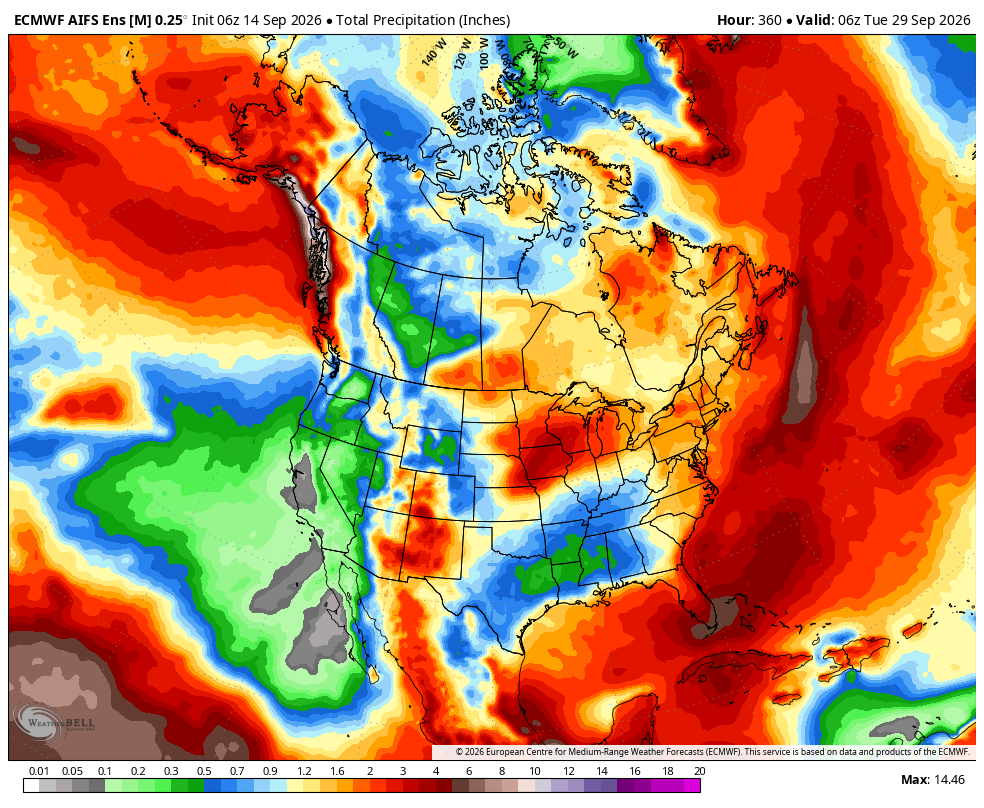
Worth keeping in mind: if one of these troughs digs deeply enough, things can flip from cold, dry, and gusty to an actual precipitation event rather quickly. That is really what the day 10-15 signal is, a few ensemble members digging a trough far enough south to tap some moisture. I will be watching whether that cluster grows over the next few runs.
For fall color, the upcoming weather is generally favorable. Cool nights and sunny or mostly dry days can help produce rich fall colors once trees have begun their seasonal transition.
The main caveat is that there is such a thing as too cold. The colors we are after come from pigments the leaf builds up while it is slowly shutting down, so a hard freeze that kills the leaf outright skips that step entirely and it just browns. Strong winds can also strip colorful leaves from trees once they have transitioned.
As of now, this week appears to feature some gusty afternoons, but nothing looks strong enough to worry much about widespread leaf stripping, especially considering that most of the larger trees are only just beginning to transition.
Fall Foliage Report and Forecast
The Mono County Fall Foliage Report indicates that locations above 8,000 feet are beginning their brilliant displays of fall colors, although most locations are still well before peak.
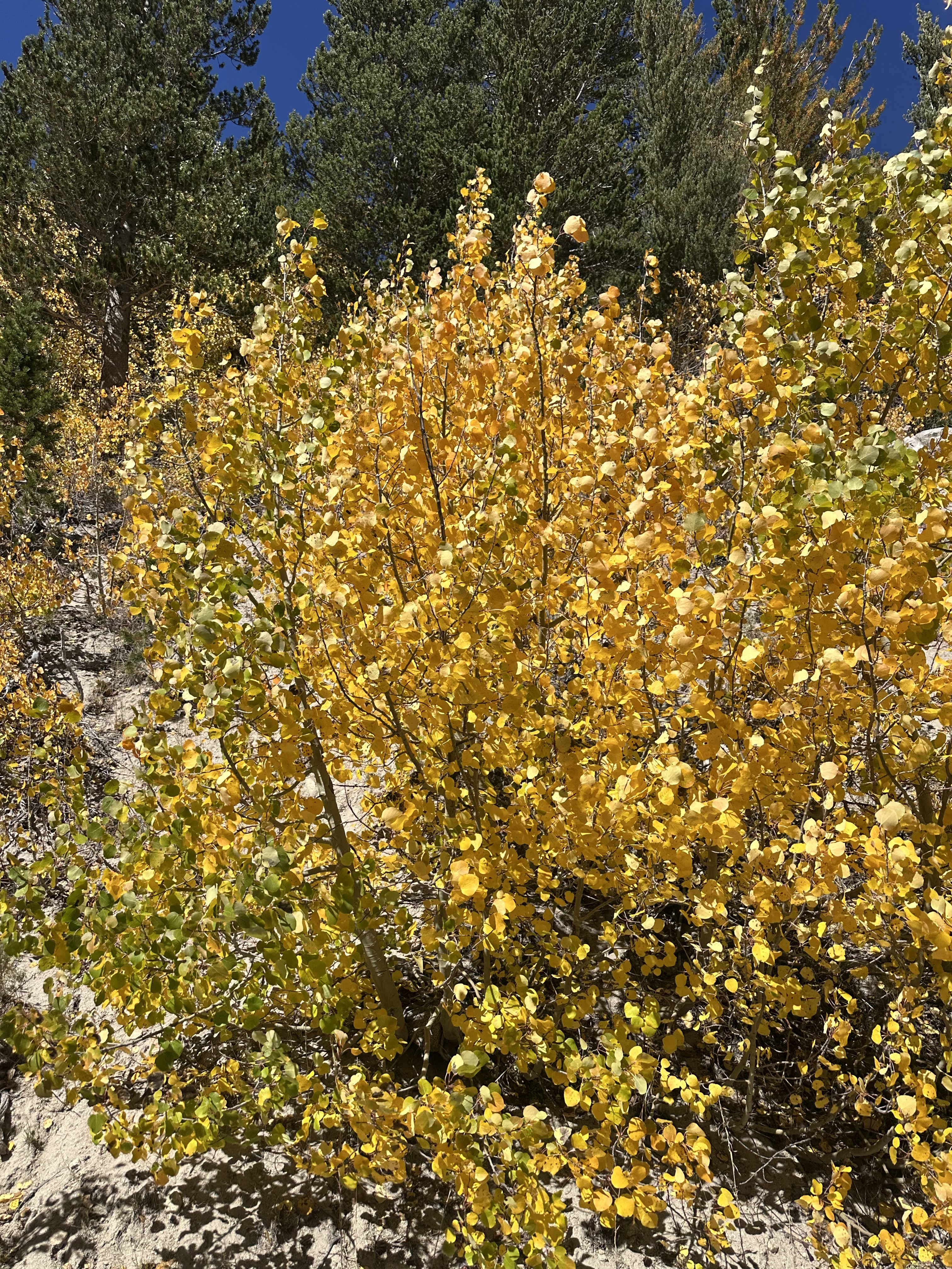
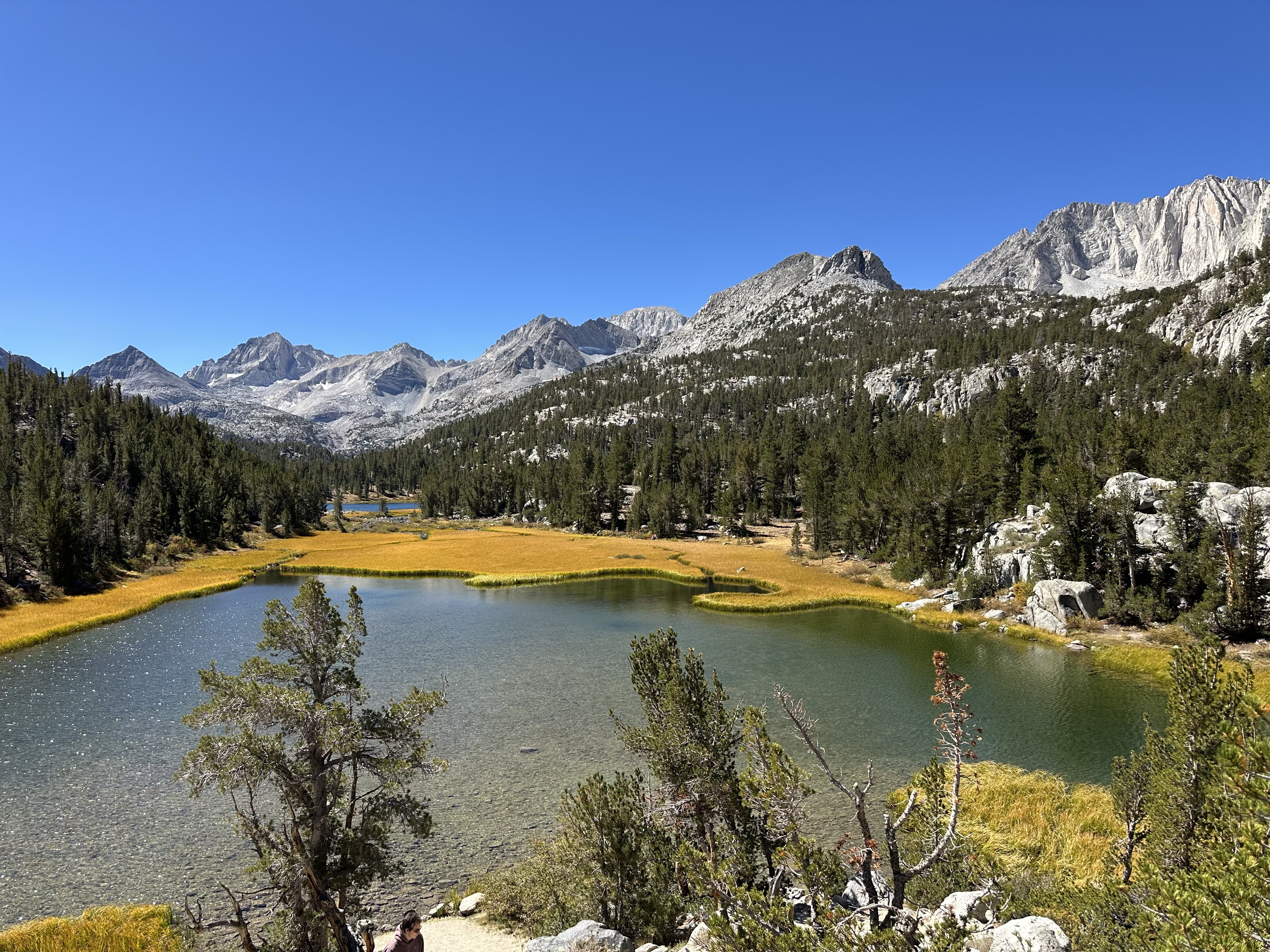
Rock Creek (9,600') has started to transition fairly rapidly, and some groves of aspens and willows are already displaying full color. As of now, the larger aspen trees are still holding onto mostly green leaves, with the tops of some trees beginning to turn. A lot of the most impressive color right now is still coming from small to medium aspens, willows, and alpine grasses.
Here are some pictures I snapped from Rock Creek yesterday:
Certain groves are already nearing full color:
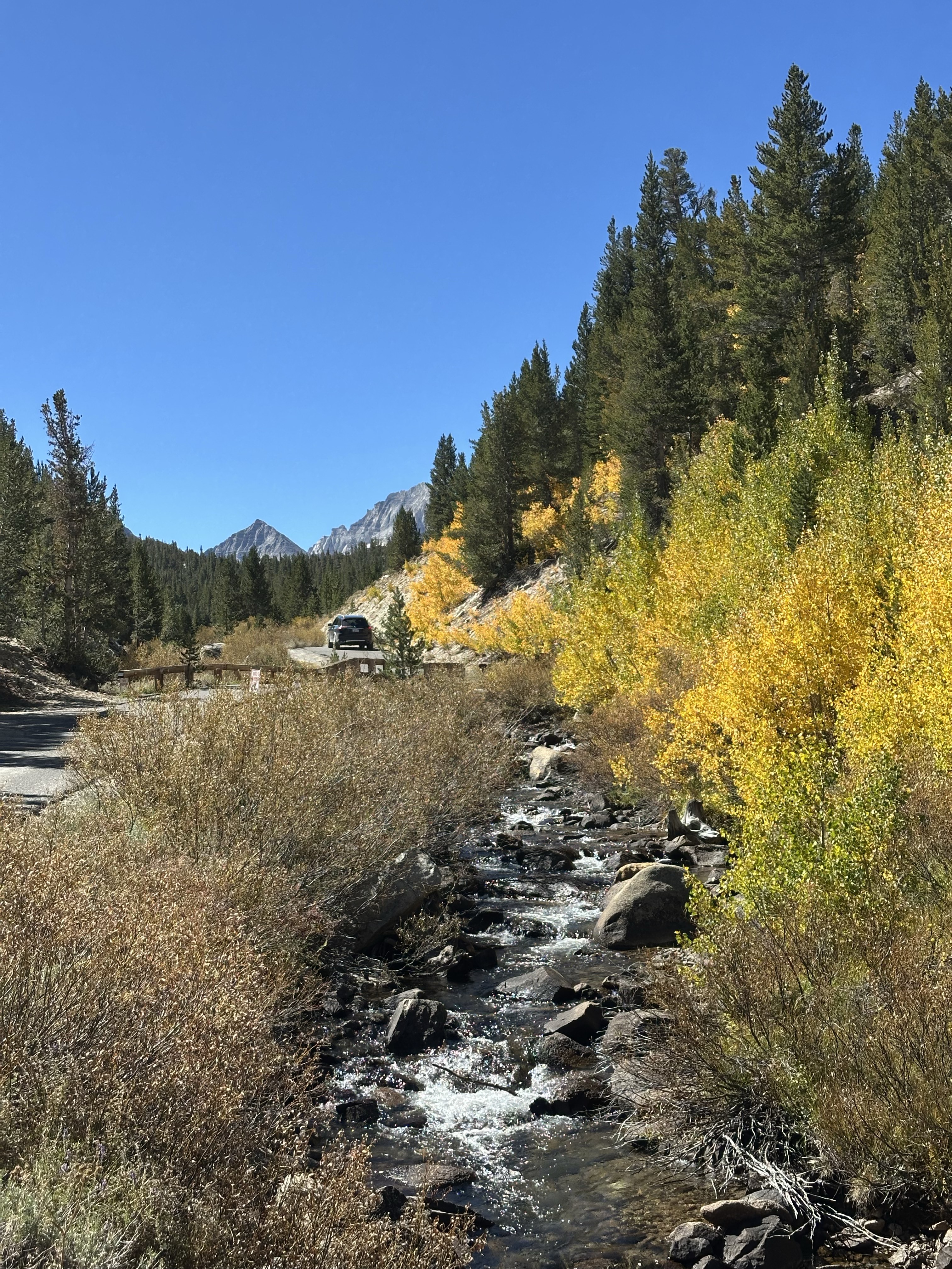
With smaller trees peaking soonest:
And alpine grasses displaying brilliant color:
As of now, the broader fall foliage forecast shows a fairly typical progression across the Eastern Sierra. Higher-elevation locations such as Rock Creek usually peak first, often during the latter half of September, while many mid and lower-elevation locations peak later into October.
Here is what the current forecast shows:
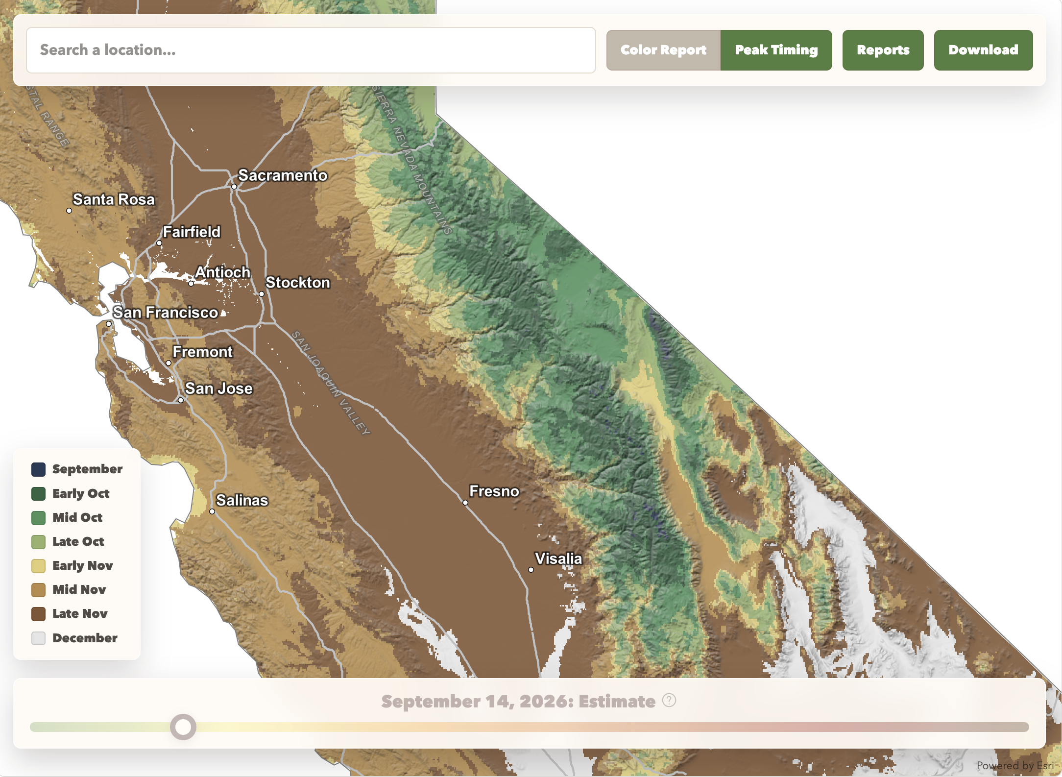
I think our highest-elevation stands run slightly ahead of this. Rock Creek is already transitioning fast in some groves, and the cool nights ahead should keep pushing it, so I wouldn't be surprised to see those stands approaching peak in the latter half of September with lower elevations lagging 2-3 weeks behind. The map looks to be built largely off the typical seasonal progression, so I will be watching over the next week to see whether observations start pulling ahead of it.