Dome Fire Ignites in Yosemite National Park... Showers Next Week?
Overview
My friends...
The next few days will feature cool and gusty weather as a weak trough moves over California. On Monday, there is a chance for mountain showers as another weak shortwave trough makes its way over the state.
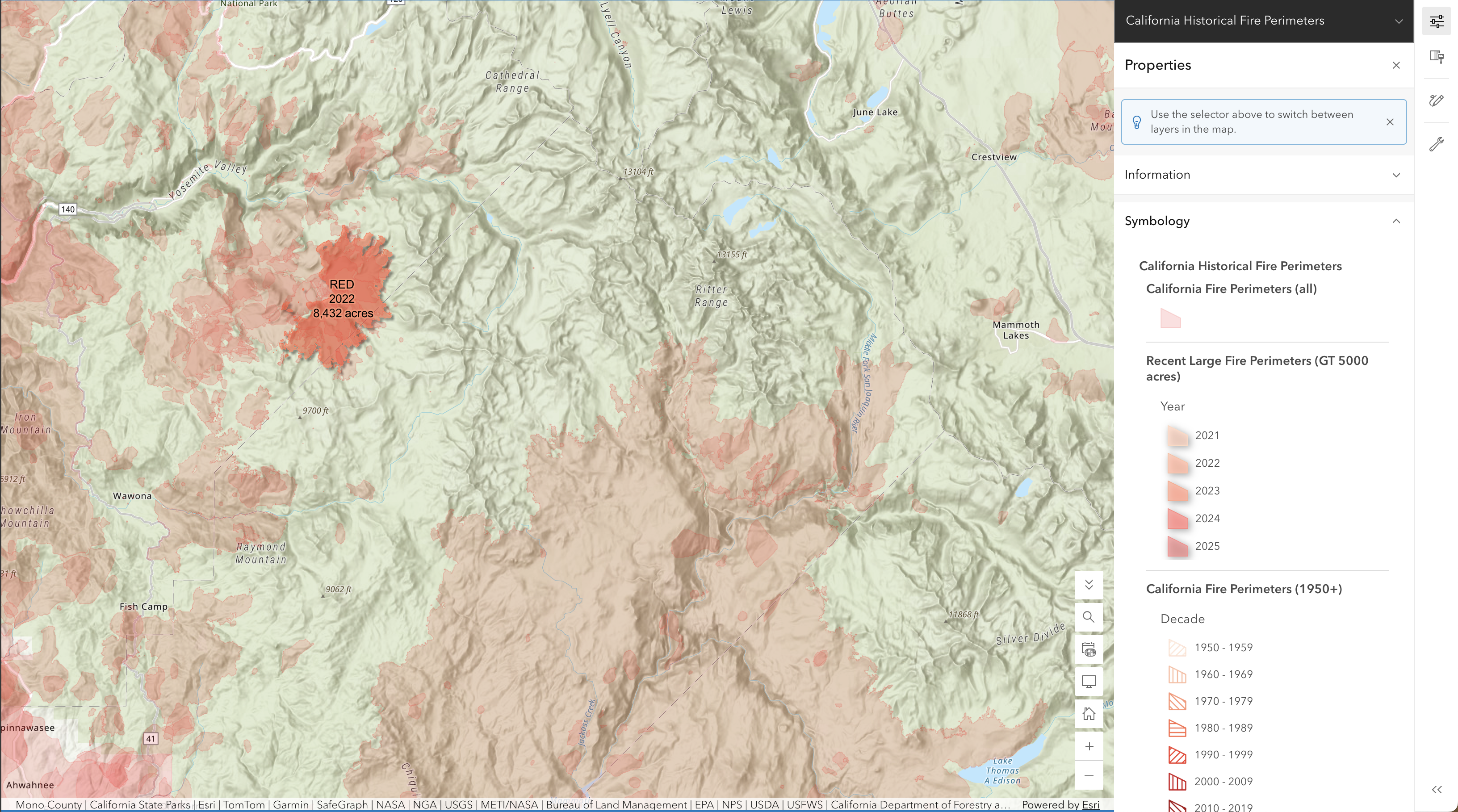
The Dome Fire, which started yesterday, has grown rapidly to over 1,100 acres and is burning in remote and rugged terrain. Much of the fire is bordered to the south, east, and west by areas that have burned within the last decade, although a sizable pocket of unburned terrain remains available for potential growth. Crews are attempting to suppress the fire, but limited access and rugged terrain are making suppression difficult at the current moment. Gusty conditions over the next few days could prove problematic for the fire's spread, with smoke impacts possible along the Eastern Sierra, particularly near Bridgeport, which is downstream of the upcoming winds.
Dome Fire
The Dome Fire ignited yesterday north of Wawona Dome near Chilnaulna Falls and has shown rapid spread. As of this writing at 3:30PM on Wednesday, September 16th, the fire is reported to be at 1,177 acres, burning roughly 30 miles west of Mammoth Lakes.
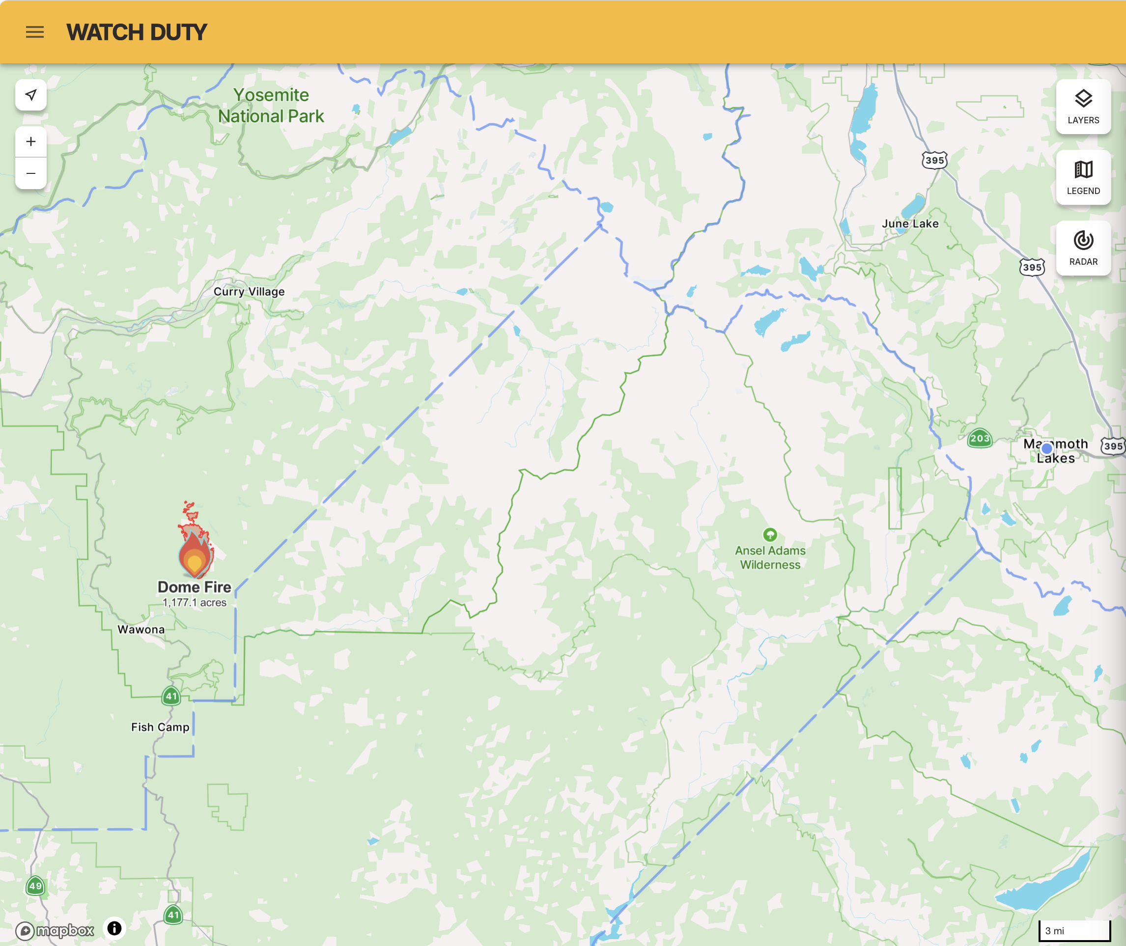
Strong winds out of the southwest could prove to be problematic over the next two days. The fire is burning within a sizable pocket of relatively recent unburned vegetation, surrounded on several sides by older burn scars. In the below map, the new Dome Fire is burning just northeast of Wawona, with a good amount of room to grow...
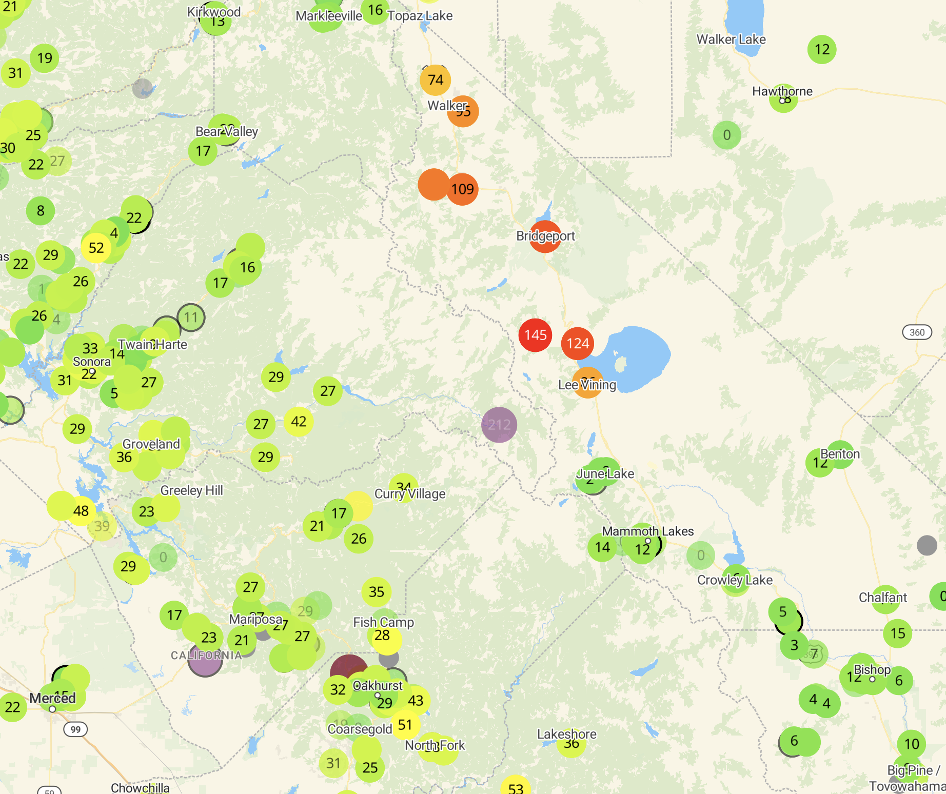
As of now, the fire poses no immediate threat to any infrastructure, but could produce substantial smoke at times for portions of the Eastside, depending on fire activity and wind direction. Today, the smoke has been primarily impacting Bridgeport, which is downstream with the current wind direction.
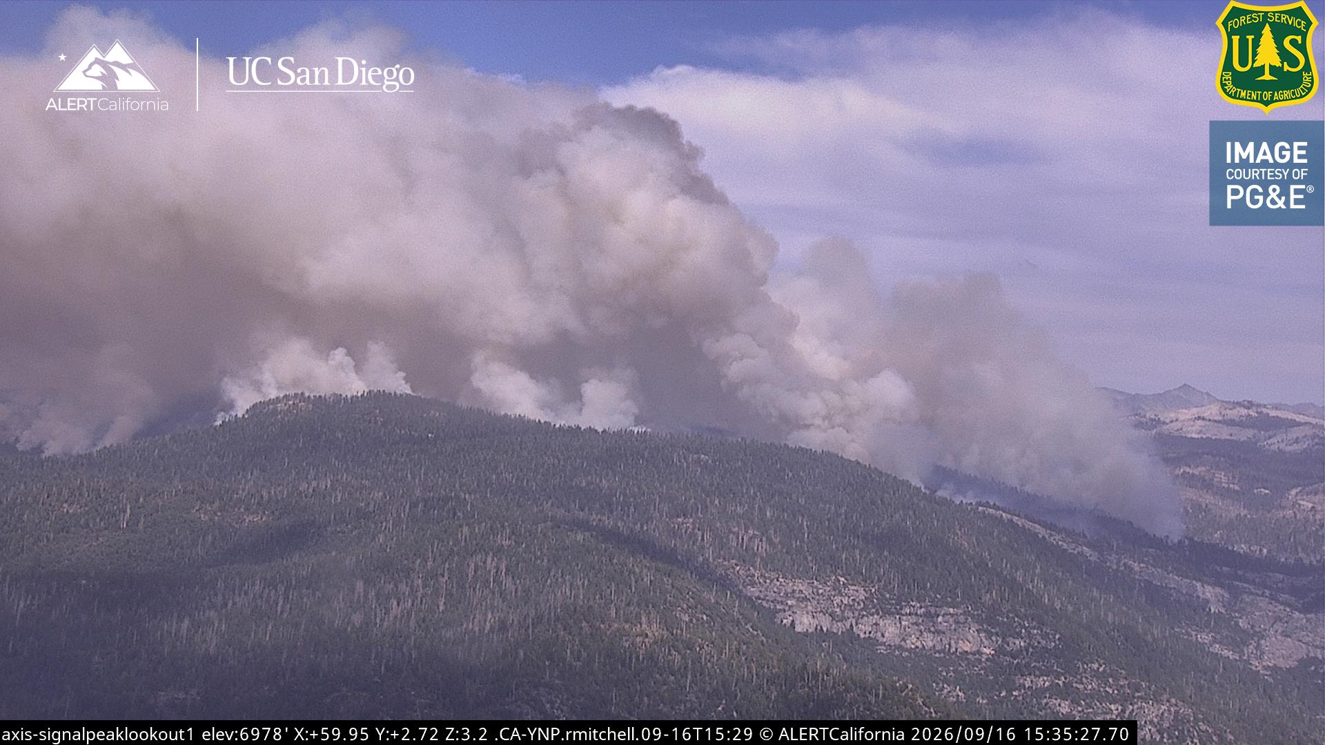
Let's hope for good news with the fire, and that we can avoid much of the worst of the smoke out here.
Cool and Gusty Weather... Showers next week?
A weak shortwave trough is currently moving over California, bringing cooler than average temperatures, as well as gusty conditions and high clouds.
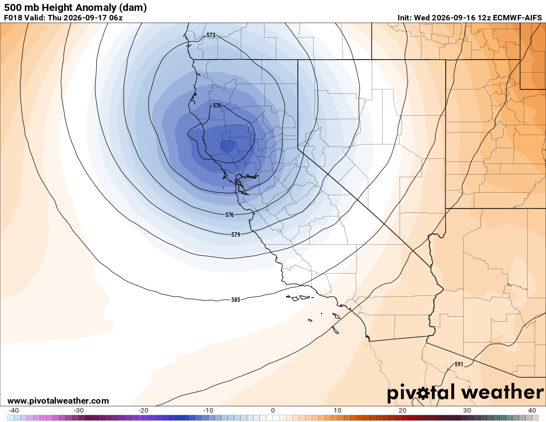
By next week, many models are showing another shortwave trough digging into California, potentially bringing very light precipitation to the Sierra Nevada in the form of scattered showers:
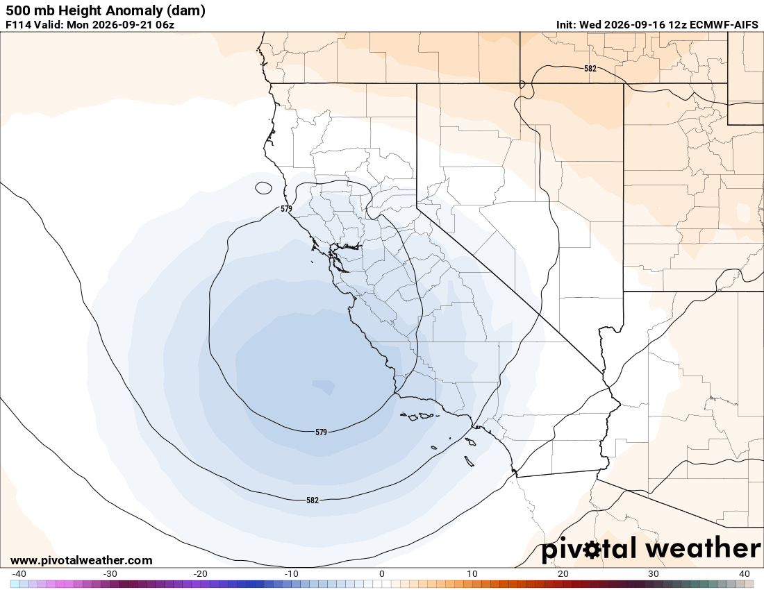
This looks like a pretty weak event, and appears likely to bring only light precipitation and blustery conditions to the Sierra.
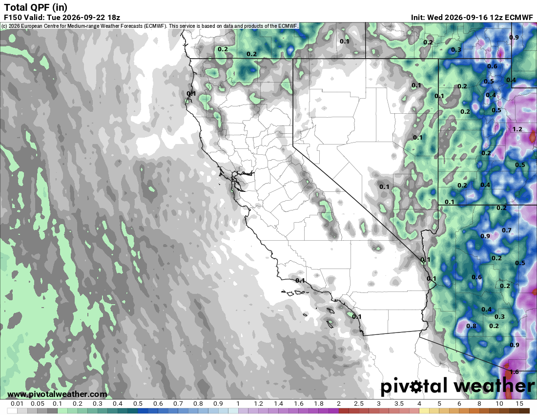
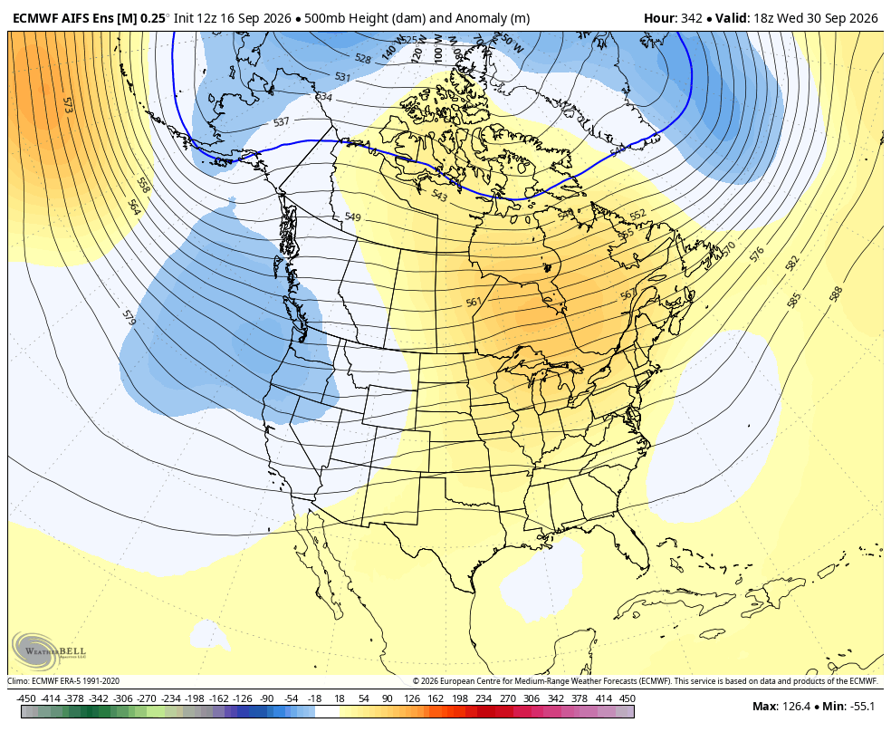
Longer range, more troughing activity may continue across the West, which could help to keep temperatures down while bringing occasional chances for weak mountain showers.