More September Snow in the Sierra? And, Will Trailfest Be Spared From the Dome Fire's Smoke?
Overview
My friends...
Patterns have a tendency to repeat themselves, and that's the story this week. What was initially advertised by models as warm and clear weather is giving way to a string of weak shortwave troughs. The first, a trough passing to our north this Friday, will usher in cooler temps and gusty conditions. Then, a trough this Sunday into Monday appears likely to interact with some remnant tropical moisture from the Eastern Pacific and may bring us light snow showers above 9,000-10,000 feet.
As Trailfest gets underway this weekend, we're watching closely to see what happens with the plume of smoke from the Dome Fire, which is burning roughly 30 miles west of Mammoth Lakes, and is 4,133 acres and 16% contained as of this writing on Thu, Sep 24th at 10:37PM.
More September Snow?
Last week's showers brought an early taste of winter to the alpine, with many high peaks being dusted with snow, and several thunderstorms at lower elevations. The Bishop Airport reported 0.27" of rain!
This week, the pattern reloads, as another shortwave trough makes its way over California:
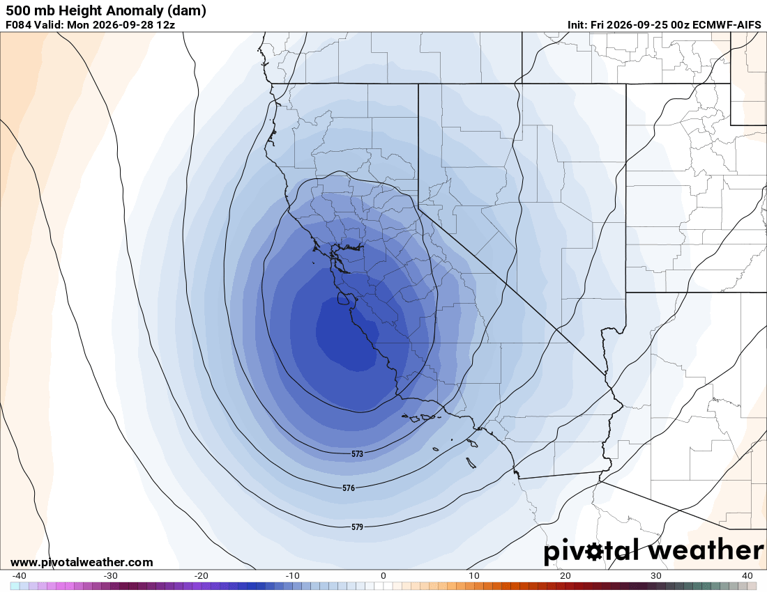
This could bring precipitation and snowfall, with snow levels currently trending around 9-10k'. Right now, showers appear to be starting up around Monday AM, but it is still early with time to change.
There is still uncertainty in the models over where the remnant moisture from the Eastern Pacific ultimately ends up. Some guidance, particularly the ICON, brings substantially more moisture farther north, but right now that appears to be an outlier compared with the broader model suite. Most guidance shows more modest precipitation totals, generally under 0.5" of liquid along the Sierra Nevada. Here's the AIFS precipitation forecast:
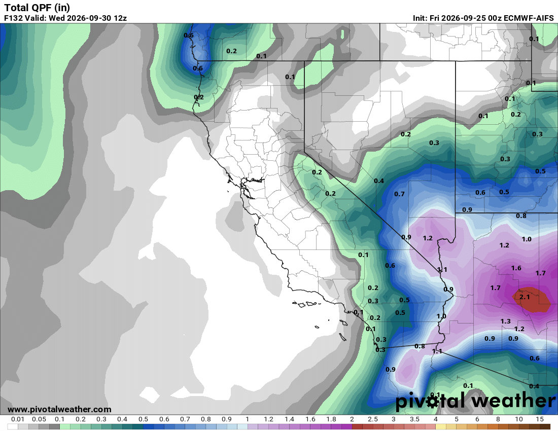
As you can see, this keeps the bulk of the moisture well to our south and east, but still brings in a dusting to an inch or two of snow across much of the Sierra above 9k-10k.
Fall in the Sierra often works this way. We get teased with dusting after dusting before it comes all at once. I'm still expecting it to be quite a while before any substantial accumulations.
Trailfest Weather, Will There Be Smoke?
The Dome Fire continues to burn in Yosemite National Park, reaching over 4,100 acres and 16% containment. Troughing activity will help to mitigate its spread, but it will continue to burn and produce smoke until the area receives more substantial precipitation.
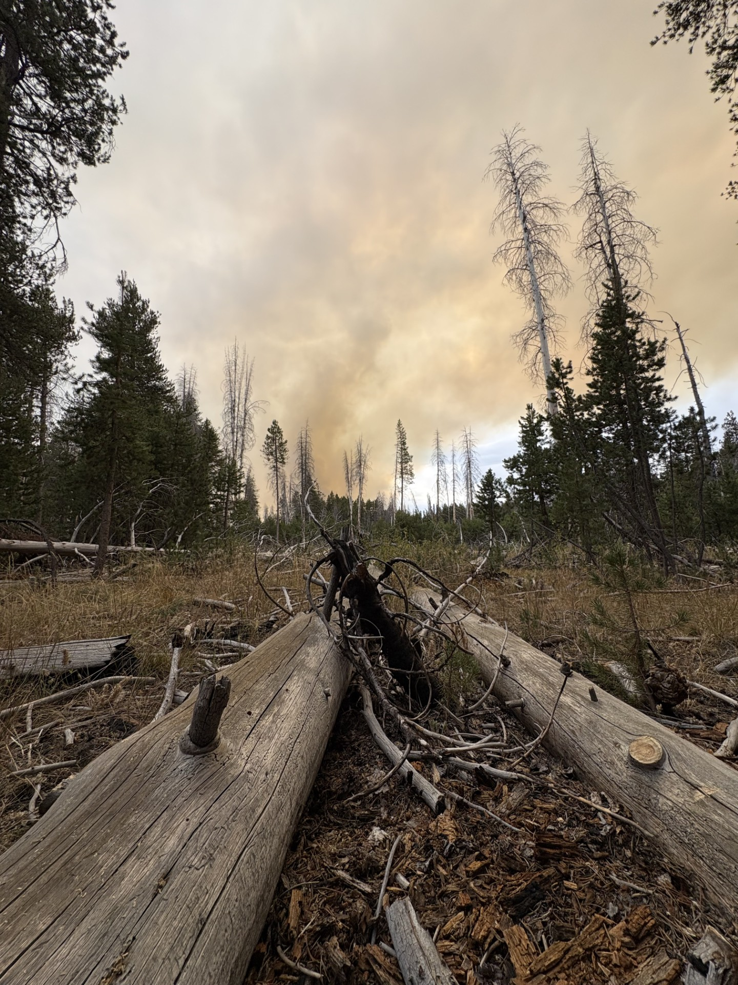
Naturally, many are probably wondering about smoke impacts this weekend as Trailfest is ramping up.
Fortunately, the flow appears to be turning southerly and southwesterly this weekend, and the heaviest smoke should be lifted north of Mammoth. Here's the latest HRRR smoke forecast through Saturday afternoon, showing this general flow direction:
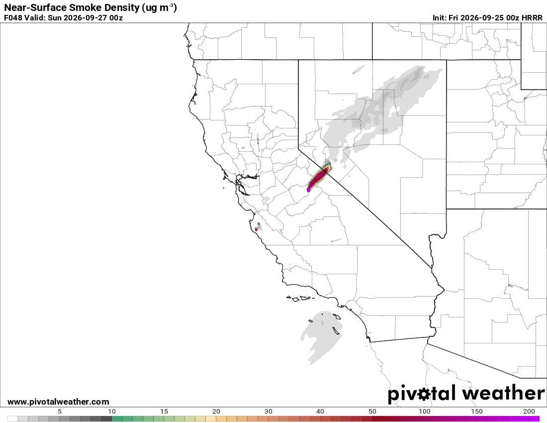
The prevailing flow direction appears to remain similar into Sunday, so Trailfest should largely be spared from the heavier smoke if that pattern holds.
This weekend, the weather in Mammoth Lakes:
Friday and Saturday will be mostly sunny with highs in the upper 60s, but with gusty southwest winds both days. Sunday turns cooler, with a high near 62 and an overnight low in the upper 30s. By Monday, highs fall into the upper 50s, with a slight chance of rain and high-elevation snow showers.
Mammoth Mountain will run 5-15 degrees cooler and be gusty, with winds out of the southwest up to 30+ MPH.
To all those running, have a great run!