Hurricane Rachel and a Possible Cutoff Low: Will the Sierra Get In On It?
Overview
My friends...
Today is another stunner of a day on the Eastside! The next few days should stay warm and dry. Then, early next week, a delicate forecast is in store as several ingredients come together. I've been working on my own tools for interpreting uncertainty in forecasts, and this is the perfect opportunity to put them to work!
Two complex factors are at play on Sunday going into Monday. The first of those is a trough diving down from the north, bringing in some cooler air. It's not certain how far south it will dig or if it closes into a cut-off low. The second ingredient is Hurricane Rachel, which is recurving and will send its remnant moisture very near to the coast of Southern California.
The most likely outcome is that this moisture impacts parts of Southern California and the Desert Southwest, bringing snow to the high terrain of Utah and the Great Basin. There's currently a lower chance that some moisture wraps up into this trough, impacting the Sierra. IF this did happen, it could bring us modest rain and some snow. As of now, this is just something to keep an eye on!
A Trough Approaches!
By Sunday, all the models are now indicating a trough will dive down from the north. This pattern was sleuthed out by WeatherNext3 a fair bit earlier than the other models... Here's a side by side comparison showing the current spread, using my own visualizations, which you too can view on my site, for free!
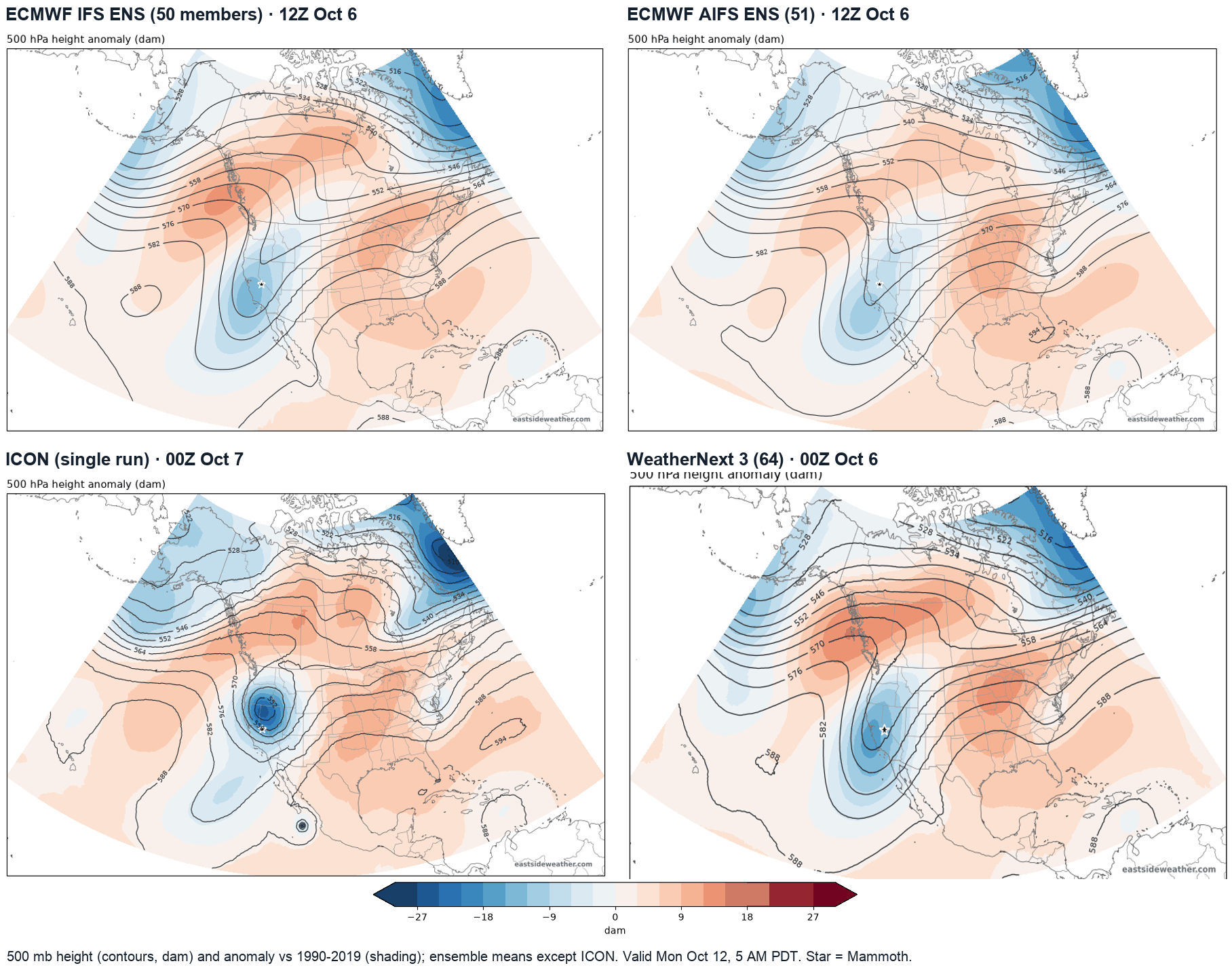
The single ICON run and WeatherNext 3 show a sharper, more closed-off low. Where exactly that low sits, and how long it lingers, is what decides who gets the moisture.
Following Rachel's Moisture
Taking a look at the Atmospheric River parameter, IVT (Integrated Vapor Transport), we can see the interaction between storms spinning up a sharp looking AR into the SW. On Sunday, both the ECMWF IFS and the latest ICON stream Rachel's remnant moisture north from off the coast of Mexico, across Baja and into Arizona, Nevada and Utah. The AIFS ensemble puts its highest odds of a moisture plume in the same place:
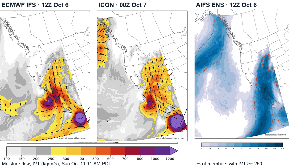
As you can see, the Sierra sits on the western edge of the plume. Slight variations in the depth of the trough and its timing will be the difference between a dry and wet outcome here in the Sierra Nevada...
Visualizing Ensemble Uncertainty...
I mentioned that I have been building my own model tools on the site, designed specifically to visualize ensemble spread. Please use them on the Models page. I am genuinely psyched to have an event so soon after publishing them to put them to work on! My approach to forecasting has always been to consider the spread of possibilities.
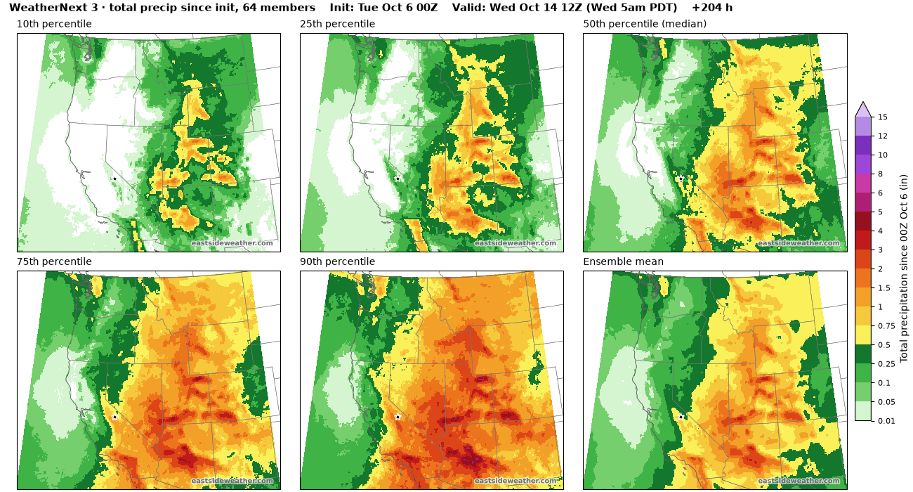
Below we can visualize the different percentiles that exist in the ensembles. The 10th percentile is the drier end of its 50 members, and the 90th is the wetter end:
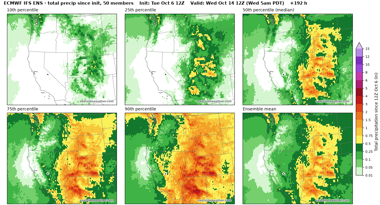
Ensembles are pretty certain that SoCal, Utah, Arizona and the Great Basin see some moisture... However, the Sierra only gets into meaningful totals toward the wetter end of the range.
The AIFS and WN3 are more sold on SoCal seeing moisture across the board, and I'm inclined to believe them:
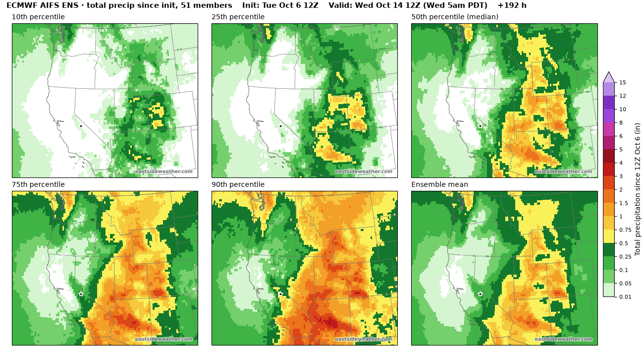
Utah looks likely to score rain and snow. At Alta, every AIFS member brings some precipitation, the median is about 1.4 inches of liquid, and about 60% of members bring an inch or more. That points toward a good chance of snow for the Wasatch and the higher Great Basin ranges.
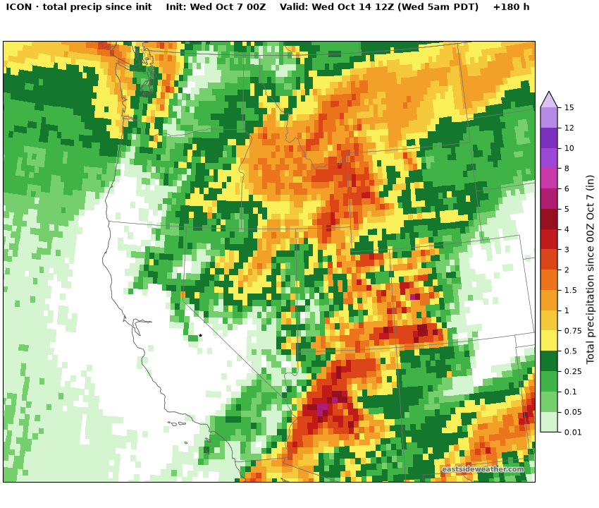
The ICON shows a similar story, with its heaviest totals over Southern California's mountains, Arizona and Utah, and lighter amounts along the Sierra:
Snow on the Eastside? Maybe, but probably not!
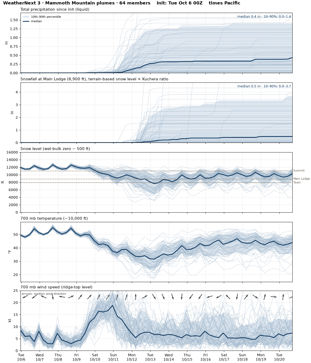
In Mammoth, the odds generally favor a no or low precipitation outcome, but there is a slight chance for some moisture...
For Mammoth Main Lodge at 8,900 feet, the ECMWF IFS ensemble gives about a 1 in 4 chance of an inch of snow or more through Wednesday morning, and about a 1 in 8 chance of 3 inches or more. The AIFS ensemble is drier, at roughly 1 in 16 for an inch.
WeatherNext 3 is generally more bullish for the Sierra, which catches my attention! While its still not screaming wet, its 50th percentile members get to a respectable event for October... But most of the precip is still to our east, and the bottom 50 percent keeps us mostly dry...
Below you can see the WeatherNext plumes for Mammoth, which show high snow levels and a spread of outcomes...
WeatherNext 3 data accessed through Google Cloud Storage. © 2024-6 Google LLC, whose machine learning models were used to create the experimental data made available under the following licence terms https://storage.googleapis.com/weathernext-public/terms-of-use.pdf. This data is intended for experimental modelling only and is not intended, validated, or approved for real world use.
Fall in the Sierra can change really quickly, so we need to keep watching for our first real storm. My gut tells me its not yet.
Longer Range...
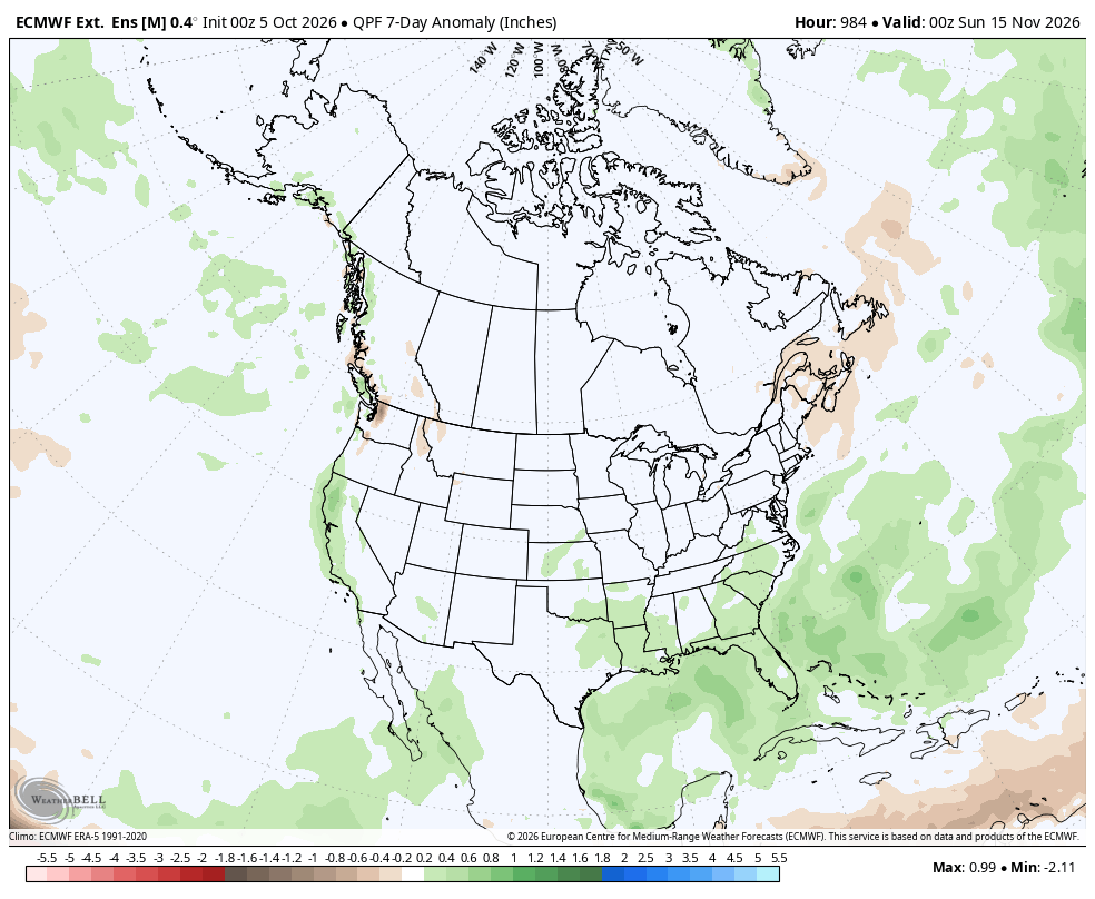
Longer range, we appear to return to a ridging pattern:
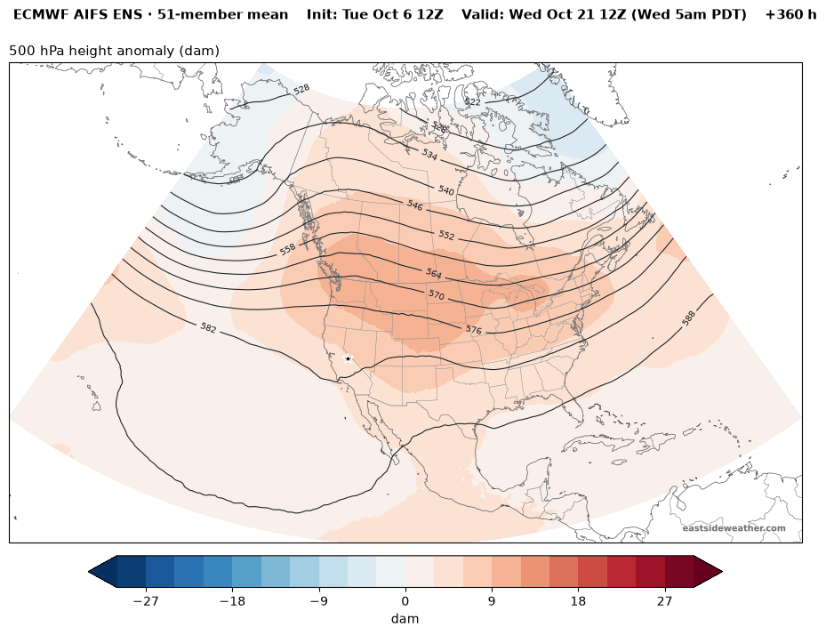
But when will the jet stream wake up and undercut any ridging... The Euro Weeklies are now starting to show some signal for mid-November. Something to watch, but still a hugeeee way out!